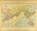
Category:1894 maps of Canada
Jump to navigation
Jump to search
Subcategories
This category has the following 2 subcategories, out of 2 total.
O
Q
- 1894 maps of Quebec (2 F)
Media in category "1894 maps of Canada"
The following 6 files are in this category, out of 6 total.
-
Map of Eastern Canada.jpg 3,479 × 2,928; 2.41 MB
-
Map of the Maritimes.jpg 3,482 × 2,923; 2.33 MB
-
Map of Western Canada.jpg 3,505 × 2,928; 2.84 MB
-
SaintJohn1894.jpg 1,169 × 792; 318 KB
-
SouthToronto1894.jpg 458 × 344; 68 KB
-
St John New Brunswick map 1894.jpg 1,169 × 792; 242 KB


