Category:1891 maps of Vermont
Jump to navigation
Jump to search
States of the United States: California · Connecticut · Delaware · Florida · Idaho · Illinois · Iowa · Kansas · Kentucky · Louisiana · Maine · Maryland · Massachusetts · Michigan · Minnesota · Missouri · Montana · New Hampshire · New Jersey · New York · North Carolina · Ohio · Oklahoma · Oregon · Pennsylvania · Rhode Island · South Dakota · Tennessee · Texas · Utah · Vermont · Virginia · Washington · Wisconsin · Wyoming – Washington, D.C.
| ← 1890 1891 1892 1894 1895 1897 1898 1899 → |
Media in category "1891 maps of Vermont"
The following 6 files are in this category, out of 6 total.
-
 Barre, Vt. (the Granite City) 1891. LOC 75696617.jpg 9,856 × 6,096; 11.46 MB
-
 Barre, Vt. (the Granite City) 1891. LOC 75696617.tif 9,856 × 6,096; 171.9 MB
-
 Barre, Vt. (The granite city) LCCN2003674168.jpg 10,460 × 6,950; 10.96 MB
-
 Barre, Vt. (The granite city) LCCN2003674168.tif 10,460 × 6,950; 208.01 MB
-
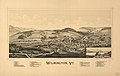 Wilmington, Vt. LOC 75696635.jpg 8,456 × 5,344; 8.75 MB
-
 Wilmington, Vt. LOC 75696635.tif 8,456 × 5,344; 129.29 MB
_1891._LOC_75696617.jpg)
_LCCN2003674168.jpg)
