Category:1891 maps of Louisiana
Jump to navigation
Jump to search
States of the United States: California · Connecticut · Delaware · Florida · Idaho · Illinois · Iowa · Kansas · Kentucky · Louisiana · Maine · Maryland · Massachusetts · Michigan · Minnesota · Missouri · Montana · New Hampshire · New Jersey · New York · North Carolina · Ohio · Oklahoma · Oregon · Pennsylvania · Rhode Island · South Dakota · Tennessee · Texas · Utah · Vermont · Virginia · Washington · Wisconsin · Wyoming – Washington, D.C.
| ← 1890 1891 1892 1893 1894 1895 1896 1898 1899 |
Subcategories
This category has the following 2 subcategories, out of 2 total.
Media in category "1891 maps of Louisiana"
The following 7 files are in this category, out of 7 total.
-
 Louisiana, Hahnville sheet (2674470151).jpg 1,658 × 2,000; 2.5 MB
-
 Louisiana, New Orleans sheet (2675293542).jpg 1,645 × 2,000; 2.67 MB
-
 Louisiana, Spanish Fort sheet (2675291208).jpg 1,664 × 2,000; 1.8 MB
-
 Plaquemines Parish Louisiana Map 1891 Empire Quarantine.jpg 2,309 × 3,014; 1.92 MB
-
 Plaquemines Parish Pointe à la Hache Map 1891.jpg 2,421 × 2,770; 2.17 MB
-

-
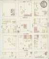 Sanborn Fire Insurance Map from Clinton, East Feliciana Parish, Louisiana. LOC sanborn03291 002.tif 6,450 × 7,650; 141.17 MB
.jpg)
.jpg)
.jpg)


