Category:1891 maps of Virginia
Jump to navigation
Jump to search
States of the United States: California · Connecticut · Delaware · Florida · Idaho · Illinois · Iowa · Kansas · Kentucky · Louisiana · Maine · Maryland · Massachusetts · Michigan · Minnesota · Missouri · Montana · New Hampshire · New Jersey · New York · North Carolina · Ohio · Oklahoma · Oregon · Pennsylvania · Rhode Island · South Dakota · Tennessee · Texas · Utah · Vermont · Virginia · Washington · Wisconsin · Wyoming – Washington, D.C.
| 1890 1891 1893 1894 1895 1896 1897 1898 1899 → |
Subcategories
This category has the following 12 subcategories, out of 12 total.
S
Media in category "1891 maps of Virginia"
The following 19 files are in this category, out of 19 total.
-
 Bird's eye view of Norfolk, Portsmouth and Berkley, Norfolk Co., Va. LOC 75696646.jpg 13,136 × 9,728; 32.69 MB
-
 Perspective map of Bedford City, Va., county seat of Bedford Co. 1891. LOC 75696637.tif 9,200 × 6,352; 167.19 MB
-
 Perspective map of Buena Vista, Va. 1891. LOC 75696639.jpg 10,512 × 6,096; 15.21 MB
-
 Perspective map of Buena Vista, Va. 1891. LOC 75696639.tif 10,512 × 6,096; 183.34 MB
-
 Perspective map of Newport News, Va., county seat of Warwick County 1891. LOC 75696642.jpg 10,736 × 6,880; 19.84 MB
-
 Perspective map of the city of Roanoke, Va. 1891. LOC 75696650.jpg 12,288 × 7,664; 23.19 MB
-
 Perspective map of the city of Roanoke, Va. 1891. LOC 75696650.tif 12,288 × 7,664; 269.44 MB
-

-

-
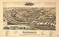
 Perspective map of the city of Waynesboro, Va. LOC 75696653.jpg 10,736 × 6,704; 16.1 MB
-
 Perspective map of the city of Waynesboro, Va. LOC 75696653.tif 10,736 × 6,704; 205.92 MB
-

-
 Sanborn Fire Insurance Map from Berryville, Clark County, Virginia. LOC sanborn08979 001.jpg 6,450 × 7,650; 3.44 MB
-
 Sanborn Fire Insurance Map from Berryville, Clark County, Virginia. LOC sanborn08979 001.tif 6,450 × 7,650; 141.17 MB
-

-

-

-

-
 Waynesboroin1891.jpg 2,684 × 1,676; 1.2 MB


,_Virginia._LOC_sanborn09003_001.jpg)
,_Virginia._LOC_sanborn09019_002.jpg)
