Category:1884 maps of the United States
Jump to navigation
Jump to search
States of the United States: California · Connecticut · Delaware · Florida · Georgia · Idaho · Iowa · Kansas · Kentucky · Louisiana · Michigan · Minnesota · Missouri · Montana · New Jersey · New York · North Carolina · North Dakota · Ohio · Oregon · Pennsylvania · South Carolina · South Dakota · Tennessee · Texas · Utah · Virginia · Washington · West Virginia · Wisconsin · Wyoming – Washington, D.C.
Subcategories
This category has the following 33 subcategories, out of 33 total.
C
D
- 1884 maps of Washington, D.C. (35 F)
F
- 1884 maps of Florida (26 F)
G
I
- 1884 maps of Idaho (7 F)
K
L
- 1884 maps of Louisiana (4 F)
M
N
- 1884 maps of North Carolina (5 F)
O
P
S
T
- 1884 maps of Texas (13 F)
U
V
- 1884 maps of Virginia (8 F)
W
- 1884 maps of Wyoming (1 F)
Media in category "1884 maps of the United States"
The following 19 files are in this category, out of 19 total.
-

-

-

-
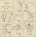 149 of 'The Campaigns of the Rebellion' (11169301295).jpg 2,830 × 2,887; 1.41 MB
-
 1884 Chicago & Alton map only.jpg 2,796 × 1,910; 1.67 MB
-

-
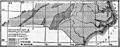 EB9 North Carolina - geological map.jpg 1,228 × 479; 183 KB
-
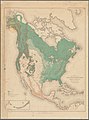
 EB9 United States.jpg 2,720 × 1,760; 1.79 MB
-

-
 Map of the Southern Express Company. LOC gm71000842.tif 8,621 × 6,213; 153.24 MB
-
 Map Presented by Confederated Missouri and Mississippi Native American Tribes - NARA - 50926148.jpg 9,312 × 13,204; 11.82 MB
-
 Nicknames of the states, 1884.jpg 9,334 × 5,232; 17.57 MB
-
-

-

-
 The Auk (1884) (20323042516).jpg 3,536 × 2,328; 1.5 MB
-
 The Auk (1884) (20355385371).jpg 3,552 × 2,172; 1.14 MB
-
 Treaty 1835, North Carolina.jpg 1,423 × 862; 239 KB
-
 Treaty of Lochaber.jpg 4,160 × 3,778; 2.43 MB
%27_(11171441165).jpg)
%27_(11167434343).jpg)
%27_(11168283805).jpg)
.jpg)


.jpg)

_(20323042516).jpg)
_(20355385371).jpg)

