Category:1874 maps
Appearance
| ← · 1870 · 1871 · 1872 · 1873 · 1874 · 1875 · 1876 · 1877 · 1878 · 1879 · → |
Deutsch: Karten mit Bezug zum Jahr 1874
English: Maps related to the year 1874
Español: Mapas relativos al año 1874
Français : Cartes concernant l’an 1874
Русский: Карты 1874 года
Subcategories
This category has the following 8 subcategories, out of 8 total.
Media in category "1874 maps"
The following 68 files are in this category, out of 68 total.
-
(Mining maps of Minas de São Domingos, Portugal). LOC 2002627754.jpg 25,939 × 9,458; 24.75 MB
-
120 of 'A Visit to Egypt in 1872. Described in four lectures, etc' (11104597164).jpg 1,476 × 1,798; 522 KB
-
(1874) The Valleys of TIROL.jpg 2,734 × 2,108; 1.75 MB
-
(1874) The UNTER-INNTAL - with Innsbruck.jpg 2,685 × 2,028; 1.22 MB
-
(1874) MAP OF WÄLSCH-TIROL.jpg 2,702 × 2,023; 1.37 MB
-
INDEBETOU(1874) p388.jpg 703 × 1,090; 590 KB
-
INDEBETOU(1874) p389.jpg 1,331 × 1,085; 1.14 MB
-
1874 Lowell and Andover Railroad map.jpg 14,482 × 4,576; 8.11 MB
-
1874 Springfield, Athol and Northeastern Railroad extension map.jpg 12,230 × 3,738; 5.62 MB
-
A.T. Chartier, Turquie d'Asia (FL36009857 2715231).jpg 11,509 × 8,421; 135.57 MB
-
Battle of Bagradas.jpg 1,455 × 865; 268 KB
-
Clyde Business Notices.; Clyde (Village); NYPL1602894.tiff 7,230 × 5,210; 107.77 MB
-
Euphrat (laender) (FL45604192 3940973).jpg 3,682 × 2,799; 3.31 MB
-
Euston Square area, Ordnance Survey map 1874.jpg 8,458 × 5,850; 16.8 MB
-
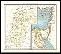
Franz Matthes, Palästina (FL37128410 3904978).jpg 3,254 × 4,218; 6.24 MB
-
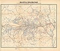
Geological map of Polissia, 1874.jpg 7,677 × 6,471; 10.1 MB
-
GreerWegefarth.jpg 1,502 × 1,001; 1.04 MB
-
Henry Lange, Palaestina und Syrien.Physikalische u Historische Karte (FL33142021 3878459).jpg 7,664 × 6,772; 70.68 MB
-
Index. NYPL1602780.tiff 5,428 × 7,230; 112.28 MB
-
Index. NYPL1602885.tiff 5,428 × 6,982; 108.43 MB
-
Kart over Nordsjøen og den Engelske kanal.png 4,413 × 2,808; 35.46 MB
-
Kart over Nordsjøen.png 4,334 × 2,852; 35.37 MB
-
Levelling map of Polissia, 1874.jpg 7,677 × 6,614; 9.69 MB
-
Map of Essex County, New Jersey - 1874 LOC 2012593675.jpg 17,959 × 19,361; 39.7 MB
-
Map of the city of Worcester (2675635192).jpg 1,534 × 2,000; 2.18 MB
-
Map of the Seaboard & Raleigh Railroad and its connections. LOC 98688800.jpg 5,022 × 2,525; 2.91 MB
-
Map of the Seaboard & Raleigh Railroad and its connections. LOC 98688800.tif 5,022 × 2,525; 36.28 MB
-
NauticalChart Yokohama 1874.jpg 1,000 × 1,392; 204 KB
-
New county and rail road map of the western states and valley of the Mississippi. LOC 98688402.jpg 10,537 × 12,667; 37.42 MB
-
Oak Hill lots LOC 2005625219.jpg 9,032 × 6,609; 7.05 MB
-
Oak Hill lots LOC 2005625219.tif 9,032 × 6,609; 170.78 MB
-
Palestine (FL37119170 3896250).jpg 3,657 × 2,779; 6.18 MB
-
Palmyra (Village) NYPL1602904.tiff 4,792 × 2,715; 37.24 MB
-
Plan de la commune de Brain-sur-l'Authion - 1874.jpg 8,240 × 7,456; 7.11 MB
-
Plymouth town of Plymouth (3887217774).jpg 857 × 2,000; 1.21 MB
-
Province of Westland (9560948380).jpg 4,477 × 17,507; 3.51 MB
-
Rahway, N.J. (2675068472).jpg 2,000 × 1,559; 2.6 MB
-
San Benedicto Island 1874 map.jpg 736 × 882; 106 KB
-
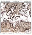
Specialkarte der Ostalpen Section Similaun.jpg 5,229 × 5,804; 11.24 MB
-
Synoptic chart 1874.png 1,563 × 1,234; 627 KB
-
Tavola Schiavoni 19 Quartiere Granili.jpg 1,024 × 696; 635 KB
-
Tavola Schiavoni 20 Barriera San Giovanni progetto01.jpg 1,024 × 719; 481 KB
-
Tavola Schiavoni 20 Barriera San Giovanni.jpg 1,024 × 710; 457 KB
-
The harbor of Annapolis - founded upon a trigonometrical survey LOC 87695538.tif 5,896 × 5,436; 91.7 MB
-
Town of Dix Business Notices.; Dix (Township) NYPL1602788.tiff 5,428 × 7,230; 112.28 MB
-
Trelawney Saunders, Jerusalem ancient & modern (FL36012648 3911771).jpg 15,250 × 11,667; 265.7 MB
-
Trelawney Saunders, Sinai and the desert of the wanderings (FL36012621 3911803).jpg 14,880 × 11,526; 259.9 MB
-
Trelawney Saunders, The Holy Land 01 (FL36012667 3911744).jpg 15,168 × 11,599; 259.17 MB
-
Trelawney Saunders, The Holy Land 02 (FL33249979 2369024).jpg 15,700 × 12,008; 274.43 MB
-
Trelawney Saunders, The Holy Land 02 (FL36012668 3911744).jpg 14,898 × 11,729; 254.76 MB
-
Trelawney Saunders, The Holy Land at Successive periods (FL36012641 3911735).jpg 15,145 × 11,617; 267.97 MB
-
Zahna Messtischblatt df dk 0010001 4042 1874.jpg 8,346 × 8,598; 8.71 MB


