Category:1873 maps
Jump to navigation
Jump to search
| ← · 1870 · 1871 · 1872 · 1873 · 1874 · 1875 · 1876 · 1877 · 1878 · 1879 · → |
Deutsch: Karten mit Bezug zum Jahr 1873
English: Maps related to the year 1873
Español: Mapas relativos al año 1873
Français : Cartes concernant l’an 1873
Русский: Карты 1873 года
Subcategories
This category has the following 9 subcategories, out of 9 total.
Media in category "1873 maps"
The following 166 files are in this category, out of 166 total.
-
 "Plan géneral des marais salants de Moirmotiers" (4623425869).jpg 3,168 × 2,699; 2.31 MB
-
-
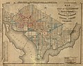
 (Map of Washington D.C. showing wood, concrete, and stone street pavements). LOC 87695618.tif 9,622 × 7,622; 209.82 MB
-
 LINDLEY(1873) Adamantia p041.jpg 3,083 × 2,421; 3.09 MB
-
 LINDLEY(1873) Adamantia p112.jpg 1,669 × 1,307; 896 KB
-
 LINDLEY(1873) Adamantia p368.jpg 1,851 × 1,229; 1.09 MB
-
 LINDLEY(1873) Adamantia p428.jpg 1,458 × 2,369; 1.28 MB
-
 LINDLEY(1873) Adamantia p434.jpg 1,309 × 1,609; 490 KB
-
 LINDLEY(1873) Adamantia p438.jpg 1,371 × 2,199; 859 KB
-
 WIEBEL(1873) p183 Die Bucht von Agostoli.jpg 2,090 × 2,160; 1.13 MB
-
 WIEBEL(1873) p183 Geologisches Profil der Halbinsel und der Bucht von Agostoli.jpg 2,071 × 1,391; 696 KB
-
 WIEBEL(1873) p183 Grundriss der Meermühle bei Agostoli.jpg 2,114 × 1,207; 583 KB
-

-
 1873 Colton Map of the Arctic or North Pole - Geographicus - PolarRegions-colton-1873.jpg 3,000 × 3,679; 3.43 MB
-
-

-
-

-
 1873 – Carte pittoresques des Environs de Paris par A.Vuillemin.jpg 10,904 × 7,568; 14.18 MB
-
 1873hogInlet.jpg 482 × 241; 27 KB
-
 Berichte der Wiener Stadtverwaltung, 1873ff, div. Pläne und Ansichten 07.jpg 2,722 × 3,866; 5.85 MB
-
 Berichte der Wiener Stadtverwaltung, 1873ff, div. Pläne und Ansichten 09.jpg 1,032 × 444; 306 KB
-
 Berichte der Wiener Stadtverwaltung, 1873ff, div. Pläne und Ansichten 13.jpg 1,031 × 550; 379 KB
-
 Berichte der Wiener Stadtverwaltung, 1873ff, div. Pläne und Ansichten 14.jpg 1,014 × 709; 454 KB
-
 Berichte der Wiener Stadtverwaltung, 1873ff, div. Pläne und Ansichten 15.jpg 1,017 × 863; 553 KB
-

-

-
 2Fi1688 Rennes église Saint-Aubin.jpg 3,399 × 4,792; 755 KB
-

-

-

-
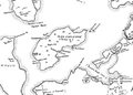
 Abaiang-Tarawa 1873 map nla obj-233983677-1 (retouched).jpg 5,000 × 7,379; 14.3 MB
-

-
 Addison (Township) NYPL1603009.tiff 5,428 × 7,230; 112.28 MB
-
 Alexander Keith Johnston, Basin of the Mediterranean (FL37663317 3370937).jpg 15,260 × 12,277; 274.71 MB
-
 Asher. Rawson, A.L. Map of Palestine and all Bible lands. 1873.jpg 1,463 × 1,718; 2.22 MB
-
 Atlantic (Township) NYPL1603075.tiff 7,052 × 5,428; 109.52 MB
-
 Baltimore 1873.jpg 8,424 × 5,905; 5.6 MB
-
 Baltimore Street Map, 1873.jpg 3,097 × 2,484; 4.15 MB
-
 Battle field of Waynesboro, Va. (2d March, 1865) LOC 99448353.jpg 7,928 × 8,005; 17.22 MB
-
 Battle field of Waynesboro, Va. (2d March, 1865) LOC 99448353.tif 7,928 × 8,005; 181.57 MB
-
 Beaufort County, South Carolina LOC 2013593120.jpg 7,525 × 9,900; 15.21 MB
-
 Beaufort County, South Carolina LOC 2013593120.tif 7,525 × 9,900; 213.14 MB
-
 Belgium 1873.jpg 7,301 × 5,177; 3.7 MB
-
 Berlin und Umgegend 1873.jpg 1,539 × 1,500; 1.7 MB
-
 Bird's eye view of the city of Denison, Texas, 1873 LOC 2013592367.jpg 8,296 × 6,593; 10.4 MB
-
 Bird's eye view of the city of Denison, Texas, 1873 LOC 2013592367.tif 8,296 × 6,593; 156.49 MB
-
 Canisteo (Township) NYPL1603020.tiff 7,230 × 5,428; 112.28 MB
-
 Cebu escondrillas.jpg 1,500 × 925; 314 KB
-

-
 China (östl. Theil), Korea und Japan im Massstabe von 1-7.500.000 LOC 2006627863.jpg 7,340 × 6,024; 8.24 MB
-
 China (östl. Theil), Korea und Japan im Massstabe von 1-7.500.000 LOC 2006627863.tif 7,340 × 6,024; 126.5 MB
-
 China LOC 2013591083.tif 9,907 × 7,014; 198.81 MB
-
 Chōsen zenzu. LOC 2006626498.jpg 6,768 × 4,835; 5.55 MB
-
 Chōsen zenzu. LOC 2006626498.tif 6,768 × 4,835; 93.62 MB
-
 Coast of Kushunkotan (1873).jpg 2,400 × 3,000; 860 KB
-
 Colton's New Mexico and Arizona. LOC 98687201.jpg 7,723 × 5,040; 7.86 MB
-
 Cornwall ore bank, map and sections. LOC 76692517.jpg 10,405 × 8,208; 12.64 MB
-
 Cornwall ore bank, map and sections. LOC 76692517.tif 10,405 × 8,208; 244.34 MB
-

-

-
 Diosgyor Vasgyar Map 1873.jpg 780 × 819; 959 KB
-
 Département de la Meuse et pays limitrophes - 1873.jpg 8,786 × 12,234; 18.36 MB
-
 Esploracion de las lagunas Negra i del Encañado 307.jpg 1,661 × 2,032; 1,019 KB
-
 Esploracion de las lagunas Negra i del Encañado 311.jpg 3,190 × 2,322; 2.38 MB
-

-
-

-

-

-

-

-
-
 FMIB 43886 Map of Abervrac'h.jpeg 861 × 878; 309 KB
-
 FMIB 43935 Ravines in the Craters of Reunion.jpeg 882 × 973; 349 KB
-
 FMIB 43957 Polders of Haarlem.jpeg 874 × 827; 241 KB
-
 FMIB 43967 Headlands of North Carolina.jpeg 1,003 × 1,601; 266 KB
-
 General Post und Strassen Karte des Herzogthums Steyermark 1873.jpg 18,155 × 13,653; 38.81 MB
-
 Gershon Henoch Leiner, זאת תהיה לכם הארץ לגבלתיה סביב (FL45611015 3948299).jpg 2,854 × 4,322; 3.37 MB
-
 Gershon Henoch Leiner, זאת תהיה לכם הארץ לגבלתיה סביב (FL6879395 2369244).jpg 2,000 × 3,146; 2.6 MB
-
 Hunt County LOC 2012592061.jpg 4,501 × 6,534; 4.78 MB
-
 Hunt County LOC 2012592061.tif 4,501 × 6,534; 84.14 MB
-
 Index. NYPL1582975.tiff 5,166 × 5,504; 81.35 MB
-
 Index. NYPL1603040.tiff 5,428 × 7,230; 112.28 MB
-
 Jerusalem. Rawson, A.L. Map of Palestine and all Bible lands. 1873.jpg 1,645 × 1,692; 2.41 MB
-
 Journal des Museum Godeffroy BHL35399146.jpg 3,128 × 4,251; 1.02 MB
-
 La Crosse, Wis. 1873. LOC 75696709.jpg 7,384 × 4,656; 6.31 MB
-
 La Crosse, Wis. 1873. LOC 75696709.tif 7,384 × 4,656; 98.36 MB
-
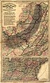
 Map of Appalachian Virginia (& parts of W. Va. & Ky.) LOC 2005625116.jpg 4,194 × 3,901; 2.18 MB
-
 Map of Appalachian Virginia (& parts of W. Va. & Ky.) LOC 2005625116.tif 4,194 × 3,901; 46.81 MB
-
 Map of Hanoi, 1873, Phạm Đình Bách.jpg 7,200 × 8,391; 12.43 MB
-
 Map of middle Virginia LOC 2005625119.jpg 2,482 × 3,353; 1.03 MB
-
 Map of middle Virginia LOC 2005625119.tif 2,482 × 3,353; 23.81 MB
-
 Map of Piedmont Virginia LOC 2005625117.jpg 3,044 × 3,810; 1.32 MB
-
 Map of Piedmont Virginia LOC 2005625117.tif 3,044 × 3,810; 33.18 MB
-
 Map of Racine & Kenosha counties, Wisconsin LOC 2012593172.jpg 14,915 × 16,847; 37.93 MB
-
 Map of Spitsbergen c. 1873.jpg 1,170 × 1,500; 940 KB
-
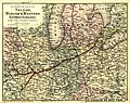
 Map of the Chesapeake and Ohio Railroad and its connections. LOC 98688617.jpg 13,055 × 4,986; 11.34 MB
-
 Map of the Chesapeake and Ohio Railroad and its connections. LOC 98688617.tif 13,055 × 4,986; 186.23 MB
-

-
-

-

-

-
-
 Map of the county of Issaquena, Mississippi LOC 2012593698.tif 12,658 × 10,936; 396.05 MB
-
 Map of the Denver and Rio Grande Railway and connections. LOC 98688649.jpg 3,488 × 7,455; 4.56 MB
-
 Map of the Denver and Rio Grande Railway and connections. LOC 98688649.tif 3,488 × 7,455; 74.4 MB
-

-

-

-

-
 Map of the surveys of the Cincinnati Railway, W.A. Gunn, Ch. Eng. LOC 98688632.jpg 5,316 × 10,070; 8.73 MB
-
 Map of the surveys of the Cincinnati Railway, W.A. Gunn, Ch. Eng. LOC 98688632.tif 5,316 × 10,070; 153.16 MB
-
 Map of the town of Newton (3720086937).jpg 924 × 1,024; 785 KB
-
 Map of the village of Claremont, New Hampshire (8347223466).jpg 766 × 800; 121 KB
-
 Map of Tide-water Virginia LOC 2005625118.jpg 2,489 × 3,421; 1.12 MB
-
 Map of Tide-water Virginia LOC 2005625118.tif 2,489 × 3,421; 24.36 MB
-
 Map of Waukesha County, Wis. LOC 2012593182.jpg 11,388 × 13,092; 25.22 MB
-
 Map of Waukesha County, Wis. LOC 2012593182.tif 11,388 × 13,092; 426.56 MB
-
 Map of Winnebago County, Wisconsin LOC 2012593183.jpg 15,045 × 17,626; 36.7 MB
-
 Map of Winnebago County, Wisconsin LOC 2012593183.tif 15,045 × 17,626; 758.7 MB
-
-

-
 Map showing the route of the Continental Railway and its connecting lines. LOC 98688643.jpg 11,741 × 6,096; 11.93 MB
-
 Map showing the route of the Continental Railway and its connecting lines. LOC 98688643.tif 11,741 × 6,096; 204.77 MB
-
 Mapa da Província de Januária.tif 6,216 × 4,737; 85.35 MB
-
 Maps showing the Atlantic & Pacific Railroad and leased lines. LOC 98688585.jpg 7,584 × 7,200; 14.42 MB
-
 Maps showing the Atlantic & Pacific Railroad and leased lines. LOC 98688585.tif 7,584 × 7,200; 156.23 MB
-

-
-

-
 Meuchen Messtischblatt df dk 0010001 4739 1873.jpg 8,383 × 8,514; 9.01 MB
-
 Moku'ume'ume.png 664 × 474; 170 KB
-
 Newport, Rhode Island (2675917740).jpg 2,000 × 746; 1.13 MB
-
 Norfolk & Portsmouth, Virginia 1873. LOC 75696645.jpg 10,832 × 7,088; 17.88 MB
-
 Old map-Austin-1873-sm.jpg 4,309 × 3,202; 5.64 MB
-
 Old map-Austin-1873.jpg 7,328 × 5,443; 10.44 MB
-
 Parts of Northern and North Western Arizona and Southern Utah. LOC 99446142.jpg 6,994 × 5,591; 6.9 MB
-
 Parts of Northern and North Western Arizona and Southern Utah. LOC 99446142.tif 6,994 × 5,591; 111.88 MB
-
-
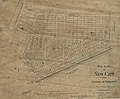
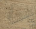 Plan of New City in the District of Columbia - half a mile from Washington LOC 88690868.tif 6,784 × 5,582; 108.34 MB
-
-

-
 Provincia do Sapucai.png 4,616 × 3,404; 18.13 MB
-
 PSM V02 D415 Weather chart.jpg 1,738 × 2,881; 1.84 MB
-
 Railroad map of the state of Texas LOC 2001622095.jpg 2,888 × 4,056; 2.54 MB
-
 Railroad map of the state of Texas LOC 2001622095.tif 2,888 × 4,056; 33.51 MB
-
 Rio Mira na Carta Nautica de 1873.png 1,796 × 728; 5 MB
-
 Ryūkyū shotō zenzu. LOC gm71005127.jpg 5,337 × 4,470; 2.87 MB
-
 Ryūkyū shotō zenzu. LOC gm71005127.tif 5,337 × 4,470; 68.25 MB
-
 Santo Domingo Map 1873.jpg 1,595 × 1,621; 1.08 MB
-
 Santo Domingo Map 1873Nu.jpg 2,484 × 2,495; 905 KB
-
 Sketch map of the Phila. and Readg. Rail Road and its branches, May, 1873. LOC 98688773.jpg 15,284 × 6,179; 9.41 MB
-
 Stéphan Illès, Jerusalem aus der Vogelschau (FL28928313 2368093).jpg 10,697 × 7,902; 127.02 MB
-
 Tarawa 1873 map.jpg 4,277 × 3,473; 5.41 MB
-
 Tarbat ness lighthouse OS map 25inch Rosshire XXX.7 1880.jpeg 8,050 × 5,800; 3.2 MB
-
 Tasmania 1873.jpg 2,503 × 3,271; 1.33 MB
-
 The Holy Land as allotted by Joshua 01 (FL35098840 3892748).jpg 5,658 × 7,125; 60.48 MB
-
 The Holy Land as allotted by Joshua 02 (FL35098841 3892748).jpg 5,528 × 7,133; 59.71 MB
-

-
 Tomil Bai detail, from- Journal des Museum Godeffroy BHL35399146 (cropped).jpg 1,689 × 1,278; 172 KB
-
 UBBasel Map 1873-1615 Kartenslg Schw Ml 4b.tif 8,375 × 7,133, 2 pages; 170.94 MB
-
 William H. Seward's travels around the world (1873) (14781726731).jpg 2,850 × 1,568; 655 KB
-
 Карта трехверстовка Шуберта 1873..jpg 7,320 × 5,560; 11.39 MB
-
 函館五稜郭の図 (はこだてごりょうかくのず).jpg 7,825 × 6,070; 15.15 MB
.jpg)
._LOC_87695618.jpg)
_Adamantia_p041.jpg)
_Adamantia_p112.jpg)
_Adamantia_p368.jpg)
_Adamantia_p428.jpg)
_Adamantia_p434.jpg)
_Adamantia_p438.jpg)
_p183_Die_Bucht_von_Agostoli.jpg)
_p183_Geologisches_Profil_der_Halbinsel_und_der_Bucht_von_Agostoli.jpg)
_p183_Grundriss_der_Meerm%C3%BChle_bei_Agostoli.jpg)


.jpg)

.jpg)

.jpg)

.jpg)


_LOC_99448353.jpg)


,_Korea_und_Japan_im_Massstabe_von_1-7.500.000_LOC_2006627863.jpg)

.jpg)


._LOC_98688644.jpg)


.jpeg)


.jpg)
.jpg)


_LOC_2005625116.jpg)


.jpg)
.jpg)


.jpg)


.jpg)
.jpg)
_Textrinum_antiquorum,_and_other_authentic_(14770224651).jpg)
.jpg)
_(14781726731).jpg)

.jpg)
.jpg)