Category:1869 maps
Jump to navigation
Jump to search
| ← · 1860 · 1861 · 1862 · 1863 · 1864 · 1865 · 1866 · 1867 · 1868 · 1869 · → |
Deutsch: Karten mit Bezug zum Jahr 1869
English: Maps related to the year 1869
Español: Mapas relativos al año 1869
Français : Cartes concernant l’an 1869
Русский: Карты 1869 года
Subcategories
This category has the following 6 subcategories, out of 6 total.
Media in category "1869 maps"
The following 193 files are in this category, out of 193 total.
-

-

-
 1 Kundelfingen Wildkarte.png 960 × 720; 1.03 MB
-

-

-
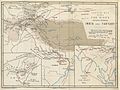 BEAL(1869) FAH-HIAN'S ROUTE THROUGH INDIA AND TARTARY.jpg 2,562 × 1,911; 2.64 MB
-
 NYC-CentralPark (1869) p018 PLAN OF THE PARK.jpg 1,241 × 2,115; 1.79 MB
-
 ROSSER(1869) p0365 SANTA CRUZ.jpg 1,703 × 1,887; 1.37 MB
-
 ROSSER(1869) p0407 SAN MIGUEL.jpg 3,925 × 1,917; 3.47 MB
-
 ROSSER(1869) p0413 PONTA DELGADA.jpg 2,798 × 1,708; 1.89 MB
-
 ROSSER(1869) p0413 S .LOURENZO BAY.jpg 2,739 × 1,697; 1.89 MB
-
 ROSSER(1869) p0413 VILLA DO PORTO.jpg 2,647 × 1,767; 1.84 MB
-
 ROSSER(1869) p0413 VILLA FRANCA.jpg 2,809 × 1,685; 1.79 MB
-
 ROSSER(1869) p0508 RIVER GIRONDE.jpg 3,525 × 2,865; 5.47 MB
-
 ROSSER(1869) p0523 RIVER DOURO.jpg 1,717 × 2,267; 2.33 MB
-
 ROSSER(1869) p0532 RIVER TAGUS.jpg 1,651 × 3,539; 3.24 MB
-
 ROSSER(1869) p0538 CADIZ.jpg 3,815 × 3,441; 6.57 MB
-
 ROSSER(1869) p0562 MOGADOR.jpg 2,842 × 2,863; 3.44 MB
-
 ROSSER(1869) p0608 SIERRA LEONE.jpg 3,997 × 2,847; 4.68 MB
-
 ROSSER(1869) p0636 LIBERIA, CAPE PALMAS.jpg 4,463 × 2,573; 5.26 MB
-
 ROSSER(1869) p0645 CAPE THREE POINTS.jpg 4,301 × 2,039; 3.76 MB
-
 ROSSER(1869) p0652 CAPE COAST CASTLE.jpg 2,955 × 2,009; 2.73 MB
-
 ROSSER(1869) p0694 TREPASSEY BAY.jpg 2,899 × 1,693; 2.53 MB
-
 ROSSER(1869) p0703 ST JOHN'S.jpg 1,663 × 1,571; 1.63 MB
-
 ROSSER(1869) p0707 HALIFAX HARBOUR.jpg 2,019 × 3,119; 3.55 MB
-
 MELLISS(1875) p027 - Map of the South Atlantic Ocean.jpg 2,437 × 1,515; 1.24 MB
-
 MELLISS(1875) p082 - Map od St.Helena (1869).jpg 1,877 × 2,686; 1.76 MB
-
 MELLISS(1875) p083 - Map od St.Helena (1869).jpg 1,999 × 2,693; 2.41 MB
-

-

-

-

-
-
 Berlin und Umgegend 1869.jpg 1,530 × 1,497; 1.97 MB
-

-
 Big Flats Subscriber's Business Directory; Big Flats (Township) NYPL1583024.tiff 5,218 × 6,252; 93.34 MB
-
 Bird's eye view of Anoka, Anoka County, Minnesota 1869. LOC 73693450.jpg 6,992 × 5,728; 6.97 MB
-
 Bird's eye view of Boscobel, Grant Co., Wisconsin 1869. LOC 73694537.jpg 7,496 × 6,552; 11.74 MB
-
 Bird's eye view of Northfield, Rice County, Minnesota 1869. LOC 73693459.jpg 7,008 × 5,680; 6.58 MB
-
 Bird's eye view of Shakopee, Scott County, Minnesota 1869. LOC 73693467.jpg 7,088 × 5,480; 6.29 MB
-
 Bird's eye view of Shakopee, Scott County, Minnesota 1869. LOC 73693467.tif 7,088 × 5,480; 111.13 MB
-

-
 Bird's eye view of the city of Faribault, Rice County, Minnesota 1869. LOC 73693452.jpg 8,944 × 6,992; 10.57 MB
-
 Bird's eye view of the city of Lawrence, Kansas 1869. LOC 73693409.jpg 8,736 × 6,816; 12.85 MB
-
 Bird's eye view of the city of Leavenworth, Kansas 1869. LOC 73693410.jpg 8,944 × 6,960; 13.76 MB
-
 Bird's eye view of the city of Rochester, Olmsted County, Minnesota 1869. LOC 73693462.jpg 7,232 × 6,400; 7.89 MB
-

-
 Bird's eye view of the city of Saint Cloud, Stearns County, Minnesota 1869. LOC 73693463.jpg 7,840 × 6,480; 11.55 MB
-
 Bird's eye view of the city of Topeka, the capital of Kansas 1869. LOC 73693411.jpg 8,480 × 6,496; 11.41 MB
-
 Bird's eye view of Wyandotte, Wyandotte Co., Kansas 1869. LOC 73693408.jpg 6,032 × 4,112; 5.91 MB
-
 Black Brook (Township); Black Brook Subscriber's Business Directory. NYPL1576108.tiff 5,234 × 5,212; 78.05 MB
-

-
 Carte sur la Guerre des Creeks.jpg 800 × 1,219; 551 KB
-

-
 Catlin Business Directory; Catlin (Township) NYPL1583021.tiff 5,250 × 6,252; 93.91 MB
-
 CavendishVermont 1869Map Beers AnnotatedPhineasGageLocations cropped.jpg 786 × 1,096; 157 KB
-
 Champlain (Township) NYPL1576102.tiff 5,138 × 4,844; 71.21 MB
-
 Charles William Wilson, Ordnance Survey of the Peninsula of Sinai (FL147391366 2366866).jpg 16,140 × 11,358; 189.61 MB
-

-
 Chepstow Place, Ordnance Survey map 1869.jpg 4,200 × 6,115; 8.48 MB
-
 China - Amoy tea districts LOC 2007627805.jpg 6,169 × 5,092; 3.52 MB
-
 China - Amoy tea districts LOC 2007627805.tif 6,169 × 5,092; 89.87 MB
-
 Cincinnati part IX embracing 11th & 19th wards. (1869).png 1,027 × 1,363; 3.05 MB
-
 City of Elmira; Elmira Subscriber's Business Directory. NYPL1583031.tiff 7,020 × 5,006; 100.54 MB
-
 City of Troy (cont.) NYPL1584718.tiff 7,164 × 4,630; 94.9 MB
-
 City of Troy (cont.) NYPL1584719.tiff 7,176 × 4,630; 95.06 MB
-

-
 City of Troy (cont.); St. Peters Church.; North Second St. M.E. Church NYPL1584722.tiff 7,212 × 4,616; 95.25 MB
-
-
 City of Troy NYPL1584717.tiff 7,114 × 4,600; 93.63 MB
-
 Colchester Business Directy.; Colchester (Township); Downsville (Village) NYPL1582964.tiff 6,002 × 5,258; 90.29 MB
-
 Colton, The Environs of Paris, 1869 - David Rumsey.jpg 6,134 × 5,080; 14.87 MB
-
-

-
 Delhi (Township); Delhi Business Directory NYPL1582960.tiff 6,018 × 5,250; 90.39 MB
-
 Delhi Business Directory; Delhi (Village) NYPL1582961.tiff 6,018 × 5,258; 90.53 MB
-
 Deposit (Village) NYPL1582956.tiff 6,002 × 5,258; 90.29 MB
-
 Dutch Gold Coast after the Anglo-Dutch forts trade (1867).jpg 640 × 453; 76 KB
-
 Egitto Palestina e Fenicia (FL36567495 3913663).jpg 2,955 × 4,061; 8.72 MB
-
 Elmira (Township); Carrs Corners (Village) NYPL1583030.tiff 6,276 × 5,242; 94.13 MB
-

-

-

-
 Erin. (Township); Erin (Village); Erin Subscriber's Business Directory. NYPL1583028.tiff 5,210 × 6,292; 93.79 MB
-
 Ermete Pierotti, Plan ancien & moderne de Jérusalem (FL6882378 2369729).jpg 1,800 × 2,863; 1.95 MB
-
 Ermete Pierotti, Plan de Jerusalem ancienne et moderne (FL6882046 2369595).jpg 2,150 × 2,847; 1.99 MB
-
 Eugène Andriveau-Goujon, Nile Delta (FL25570270 2502298).jpg 16,061 × 12,387; 268.5 MB
-

-

-
 Geological map of Tennessee LOC 90684112.tif 13,693 × 4,875; 190.98 MB
-
 Giardini pubblici mappa.jpg 2,409 × 2,404; 2.3 MB
-
 Géographie Sacrée (FL36555028 3898878).jpg 11,246 × 7,759; 126.74 MB
-
 Hancock (Village); Hancock (Township) NYPL1582963.tiff 5,192 × 6,032; 89.6 MB
-
 Horse Heads (Village); Horse Heads Subscriber's Business Directory. NYPL1583027.tiff 5,044 × 6,970; 100.59 MB
-
 Index. NYPL1576095.tiff 4,850 × 5,214; 72.35 MB
-
 Index. NYPL1583016.tiff 5,210 × 6,322; 94.24 MB
-
 Irthington Village.PNG 771 × 353; 616 KB
-
 Johnson's China and Japan. LOC 2007627525.jpg 8,009 × 5,369; 6.83 MB
-
 Johnson's China and Japan. LOC 2007627525.tif 8,009 × 5,369; 123.03 MB
-

-

-
 Johnson's Washington and Georgetown. LOC 88693480.jpg 5,302 × 4,166; 3.84 MB
-
 Johnson's Washington and Georgetown. LOC 88693480.tif 5,302 × 4,166; 63.19 MB
-
 Karte der Philippinen 1869.jpg 4,097 × 5,983; 3.28 MB
-

-

-

-
 Kortright Business Directory; Kortright (Township); Bloomville (Village) NYPL1582962.tiff 5,238 × 6,032; 90.4 MB
-
 Kroki der Flur Sommerfeld.jpg 9,739 × 11,767; 9.84 MB
-
 Lorenz Clemens Gratz, Palæstina quae nunc est unacum Libano (FL45605188 3942111).jpg 2,642 × 4,805; 6.28 MB
-
 Louisiane & floride fin 1814.gif 2,349 × 1,503; 1.27 MB
-
 Lower Egypt (FL35467274 2367019).jpg 18,881 × 13,489; 325.17 MB
-
 Ludwig Ravenstein, Palästina (FL37105210 3886662).jpg 8,831 × 11,305; 136.85 MB
-
 Map of a journey to Musardu, the capital of the Western Mandingoes LOC 96684994.jpg 4,048 × 4,656; 2.06 MB
-
 Map of a journey to Musardu, the capital of the Western Mandingoes LOC 96684994.tif 4,048 × 4,656; 53.92 MB
-
 Map of a journey to Musardu, the capital of the Western Mandingoes LOC 96684995.jpg 4,288 × 4,800; 2.68 MB
-
 Map of a journey to Musardu, the capital of the Western Mandingoes LOC 96684995.tif 4,288 × 4,800; 58.89 MB
-

-

-
 Map of the Erie Railway and its connections. LOC 98688655.jpg 17,186 × 5,386; 14.83 MB
-
 Map of the Erie Railway and its connections. LOC 98688655.tif 17,186 × 5,386; 264.83 MB
-
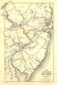
 Map of the rail roads of New Jersey, and parts of adjoining states. LOC 98688515.jpg 4,624 × 6,848; 4.68 MB
-
 Map of the rail roads of New Jersey, and parts of adjoining states. LOC 98688515.tif 4,624 × 6,848; 90.59 MB
-

-
 Map of the route of B'vt. Maj. A. Moore's scout, April 11th to June 12th 1869 LOC 2002622348.jpg 12,721 × 7,942; 10.45 MB
-
 Map of the route of B'vt. Maj. A. Moore's scout, April 11th to June 12th 1869 LOC 2002622348.tif 12,721 × 7,942; 289.05 MB
-
-

-
 Map of Virginia and West Virginia (5961390860).jpg 2,000 × 1,316; 2.39 MB
-

-

-

-

-

-

-
 Mapa del Estado de Hidalgo - 1869.jpg 5,459 × 4,000; 4.87 MB
-

-

-

-
 Outline Map of Delaware Co. New York NYPL1582951.tiff 6,010 × 5,100; 87.7 MB
-
 Overview Map of Alexander von Humboldt's Travels.jpg 5,000 × 1,926; 3.01 MB
-

-
 Plan of Rutland, Rutland County, Vermont (13383963913).jpg 1,718 × 2,000; 2.87 MB
-
-

-
 Queensland and British New Guinea prepared for Educational purposes.jpg 3,820 × 6,000; 5.71 MB
-
 Residence of Hon. Jason C. Osgood. ;City of Troy (cont.); Manufactorers Bank. NYPL1584727.tiff 7,212 × 4,670; 96.36 MB
-
-

-
 Russia (Village); Black Brook (Village); Redford (Village) NYPL1576107.tiff 5,212 × 4,882; 72.8 MB
-
 Scene on the River Delaware; Bridge Over the River Delaware; M.E. Church NYPL1582972.tiff 5,250 × 6,010; 90.27 MB
-

-
 Shinkoku higashi kaigan Amoi-kō no zu = China east coast, Amoy Harbour LOC 2002626755.jpg 5,344 × 4,233; 2.38 MB
-
 Shinkoku higashi kaigan Amoi-kō no zu = China east coast, Amoy Harbour LOC 2002626755.tif 5,344 × 4,233; 64.72 MB
-

-
 Sitio do Nobrega - 1, Acervo do Museu Paulista da USP.jpg 7,216 × 5,412; 18.25 MB
-
 Sketch of the Early History of Chemung County. NYPL1583018.tiff 5,250 × 6,252; 93.91 MB
-
 Sketch of the Early History of Clinton County. NYPL1576097.tiff 4,850 × 5,214; 72.35 MB
-

-
 Starbuck Brothers Foundery and Machine Shop, 1869.jpg 2,600 × 1,093; 319 KB
-
 Subdivision of property in the county of Washington, D.C. LOC 88693090.jpg 4,727 × 6,484; 3.66 MB
-
 Subdivision of property in the county of Washington, D.C. LOC 88693090.tif 4,727 × 6,484; 87.69 MB
-
 Subscriber's Business Directory; Horse Heads (Township) NYPL1583026.tiff 6,238 × 5,210; 92.99 MB
-
 Table of Air Line Distances for Chemung Co. N.Y. NYPL1583017.tiff 5,258 × 6,252; 94.05 MB
-
 Table of Air Line Distances for Delaware Co. New York NYPL1582948.tiff 5,986 × 5,250; 89.91 MB
-
 Table of Airline Distances for Clinton County. NYPL1576096.tiff 5,052 × 5,662; 81.84 MB
-
 Table of Contents. NYPL1582949.tiff 5,250 × 5,978; 89.79 MB
-
 Taylor Seymour and Co. Chair Manufactory, 1869.jpg 2,457 × 1,665; 533 KB
-

-

-
 Théâtre des Folies-Dramatiques (rue de Bondy) on an 1869 map of Paris.jpg 1,049 × 746; 443 KB
-
 Tongguk paryŏk sanchŏn ilt'ong chŏndo. LOC 2011591452.jpg 16,290 × 6,712; 13.47 MB
-
 Tongguk paryŏk sanchŏn ilt'ong chŏndo. LOC 2011591452.tif 16,290 × 6,712; 312.82 MB
-
 Topeka 1869.jpg 1,933 × 1,491; 585 KB
-

-

-

-
 Townsends Patent folding globe (4578741055).jpg 1,655 × 1,825; 1.79 MB
-
 Tribe of Gad.jpg 2,120 × 1,814; 1.46 MB
-
 Tribe of Judah.jpg 2,048 × 1,675; 1.9 MB
-
 Tribe of Naphtali.jpg 2,030 × 1,668; 1.49 MB
-
 Tribe of Simeon.jpg 1,597 × 1,300; 2.13 MB
-

-
 Troy University. Mount Ida.; City of Troy (cont.) NYPL1584721.tiff 7,212 × 4,616; 95.25 MB
-
 Veteran Business Directory; Veteran (Township) NYPL1583022.tiff 5,428 × 7,230; 112.28 MB
-

-
 Vuillemin and Migeon, Paris et son mur d'enceinte, 1869 - David Rumsey.jpg 4,787 × 3,814; 9.88 MB
-
 Vuillemin and Migeon, Paris in 1180, 1869 - David Rumsey.jpg 5,290 × 4,060; 11.43 MB
-
 Walton (Township); New Road P.O. (Village) NYPL1582957.tiff 5,258 × 6,024; 90.62 MB
-
 Walton Business Directy.; Walton (Village) NYPL1582958.tiff 5,250 × 6,010; 90.27 MB
-

-
 Westbourne Terrace map, Ordnance Survey 1869.png 6,228 × 9,014; 36.25 MB
-
 План Николаева 1869.jpg 3,162 × 4,723; 16.74 MB
.jpg)


.jpg)
.jpg)
_FAH-HIAN%27S_ROUTE_THROUGH_INDIA_AND_TARTARY.jpg)
_p018_PLAN_OF_THE_PARK.jpg)
_p0365_SANTA_CRUZ.jpg)
_p0407_SAN_MIGUEL.jpg)
_p0413_PONTA_DELGADA.jpg)
_p0413_S_.LOURENZO_BAY.jpg)
_p0413_VILLA_DO_PORTO.jpg)
_p0413_VILLA_FRANCA.jpg)
_p0508_RIVER_GIRONDE.jpg)
_p0523_RIVER_DOURO.jpg)
_p0532_RIVER_TAGUS.jpg)
_p0538_CADIZ.jpg)
_p0562_MOGADOR.jpg)
_p0608_SIERRA_LEONE.jpg)
_p0636_LIBERIA,_CAPE_PALMAS.jpg)
_p0645_CAPE_THREE_POINTS.jpg)
_p0652_CAPE_COAST_CASTLE.jpg)
_p0694_TREPASSEY_BAY.jpg)
_p0703_ST_JOHN%27S.jpg)
_p0707_HALIFAX_HARBOUR.jpg)
_p027_-_Map_of_the_South_Atlantic_Ocean.jpg)
_p082_-_Map_od_St.Helena_(1869).jpg)
_p083_-_Map_od_St.Helena_(1869).jpg)
_(14778299335).jpg)


_LOC_73693406.jpg)


.jpg)


.png)

.jpg)
.jpg)
.jpg)
.jpg)
.jpg)


.jpg)


.jpg)

.jpg)
.jpg)


.jpg)


_on_the_Carr%C3%A9_Marigny_of_the_Champs-%C3%89lys%C3%A9es_in_Paris_1869_-_U_Chicago.jpg)


_New_York_City_-_Geographicus_-_CentralParkSW-centralpark-1869.jpg)
.jpg)
_of_the_United_States_of_America_LOC_88693479.jpg)


_on_an_1869_map_of_Paris.jpg)


.jpg)


