Category:1874 maps of Europe
Jump to navigation
Jump to search
Temperate regions: North America · South America · Africa · Europe · Asia · – Polar regions: – Other regions:
English: 1874 maps of Europe
Español: Mapas de Europa en 1874
Suomi: Euroopan kartat vuodelta 1874
Română: Hărți ale Europei din 1874
Subcategories
This category has the following 10 subcategories, out of 10 total.
.
F
G
I
N
- 1874 maps of Norway (17 F)
R
- 1874 maps of Russia (6 F)
S
- 1874 maps of Spain (4 F)
- 1874 maps of Switzerland (9 F)
U
Media in category "1874 maps of Europe"
The following 4 files are in this category, out of 4 total.
-
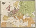
 Eisenbahn-und Dampfschiffrouten-Karte von Europa - bearbeitet von J. Franz - btv1b530326952.jpg 21,463 × 16,476; 54.4 MB
-
 Eisenbahn-und Dampfschiffrouten-Karte von Europa.jpg 21,463 × 16,476; 56.87 MB
-
 Ivalojoki 1870.jpg 5,426 × 2,314; 2.77 MB
-
 Kultala 1874.jpg 5,605 × 3,261; 1.68 MB


