Category:1861 maps of Canada
Jump to navigation
Jump to search
Countries of North America: Belize · Canada · Guatemala · Mexico · United States of America‡
‡: partly located in North America
‡: partly located in North America
| ← 1860 1861 1862 1863 1864 1866 1867 1868 1869 → |
English: Maps of Canada from 1861 or related to Canada in 1861
Français : Les cartes du Canada de 1861 ou se rapportant au Canada en 1861
Media in category "1861 maps of Canada"
The following 4 files are in this category, out of 4 total.
-
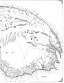
 Map of the district of Gaspe and part of the county of Rimouski - A.jpg 6,481 × 8,050; 10 MB
-
 Map of the district of Gaspe and part of the county of Rimouski - B.jpg 6,249 × 8,050; 11.48 MB
-
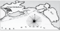 Proposed harbour of refuge, Weller's Bay, 1861.png 429 × 227; 134 KB
-
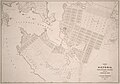 Town of Victoria, Vancouver Island from the official map.jpg 1,920 × 1,343; 341 KB


