Category:1862 maps of Canada
Jump to navigation
Jump to search
Countries of North America: Canada · Jamaica · United States of America‡
‡: partly located in North America
‡: partly located in North America
| ← 1860 1861 1862 1863 1864 1866 1867 1868 1869 → |
English: Maps of Canada from 1862 or related to Canada in 1862
Français : Les cartes du Canada de 1862 ou se rapportant au Canada en 1862
Subcategories
This category has the following 2 subcategories, out of 2 total.
O
- 1862 maps of Ontario (4 F)
Q
- 1862 maps of Quebec (1 F)
Media in category "1862 maps of Canada"
The following 8 files are in this category, out of 8 total.
-

-
 Amerique Boreale 1862.jpg 3,835 × 3,030; 2.35 MB
-
 Colton's new railroad & county map of the United States, the Canadas etc. LOC 99447074.tif 11,836 × 10,192; 345.13 MB
-
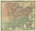
 Colton's new railroad & county map of the United States, the Canadas etc. LOC lva0000162.jpg 12,311 × 10,470; 35.34 MB
-
 Colton's new railroad & county map of the United States, the Canadas etc. LOC lva0000162.tif 12,311 × 10,470; 368.78 MB
-
 Historical sketch of the rebellion (NYPL b20643948-5686972).tiff 10,328 × 7,760, 2 pages; 229.61 MB
-
 Staaten am Atlantischen Ocean (3121047256).jpg 2,000 × 1,554; 3.5 MB
-
 Stikine Territory.png 554 × 618; 769 KB


.jpg)
