Category:1850s maps of the Russian Empire
Jump to navigation
Jump to search
Subcategories
This category has the following 14 subcategories, out of 14 total.
Media in category "1850s maps of the Russian Empire"
The following 8 files are in this category, out of 8 total.
-
 1853 - Map of the Ottoman Empire, the Black Sea and the frontiers of Russia and Persia.jpg 15,482 × 10,565; 15.87 MB
-

-
 1853 Mitchell Map of Russia - Geographicus - Russia-mitchell-1853.jpg 2,521 × 3,000; 2.45 MB
-

-
 Фрагмент карты восточного Кавказа 1855.jpg 715 × 571; 199 KB
-
 1855 map - Carte du Théâtre de la Guerre.jpg 10,800 × 7,500; 24.31 MB
-
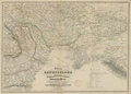 Neurussland 1855.png 2,230 × 1,592; 6.01 MB
-
 Osteuropa-Mittelasien-Aralsee.jpg 7,147 × 9,746; 15.49 MB


_-_BL.jpg)


