Category:1850s maps of the Austrian Empire
Jump to navigation
Jump to search
Subcategories
This category has the following 9 subcategories, out of 9 total.
- 1852 maps of the Austrian Empire (empty)
- 1859 maps of the Austrian Empire (empty)
'
- 1850s maps of Austria (3 F)
- 1850s maps of Croatia (4 F)
.
- 1850s maps of Czechia (4 F)
- 1850s maps of Hungary (6 F)
- 1850s maps of Montenegro (2 F)
Media in category "1850s maps of the Austrian Empire"
The following 6 files are in this category, out of 6 total.
-
 1853 Mitchell Map of Germany - Geographicus - Germany-mitchell-1850.jpg 2,389 × 3,000; 2.54 MB
-
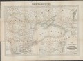 1854 Map of the frontier provinces of Turkey, Russia & Austria, the Black Sea, &c.tif 8,044 × 5,964; 137.28 MB
-
 Der Oesterreichische Kaiser-Staate.jpg 5,552 × 4,538; 9.12 MB
-
 1858 map of the Austrian Empire by John Arrowsmith.jpg 14,652 × 11,966; 39.73 MB
-
 Balina glavica 1851.jpg 1,080 × 1,154; 426 KB
-


