Category:1846 maps of the United States
Jump to navigation
Jump to search
States of the United States: California · Maryland · New Mexico · New York · Ohio · Oregon · Pennsylvania · Texas · Utah – Washington, D.C.
Subcategories
This category has the following 11 subcategories, out of 11 total.
C
- 1846 maps of California (8 F)
D
M
- 1846 maps of Maryland (2 F)
N
- 1846 maps of New Mexico (2 F)
O
- 1846 maps of Ohio (2 F)
- 1846 maps of Oregon (6 F)
P
T
- 1846 maps of Texas (10 F)
U
- 1846 maps of Utah (1 F)
Media in category "1846 maps of the United States"
The following 17 files are in this category, out of 17 total.
-
 1846 Mitchell's Map of Texas Oregon and California - Geographicus - TXORCA-mitchell-1846.jpg 5,000 × 5,420; 5.64 MB
-

-

-

-

-
 A new map of Texas, Oregon and California. LOC 00561203.tif 6,278 × 6,794; 122.03 MB
-

-

-
 Book of the Royal blue (1897) (14572618569).jpg 3,166 × 1,632; 1.35 MB
-
 Map of the United States, 1846.jpg 17,923 × 14,976; 226.68 MB
-

-

-

-
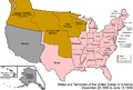
 United States 1845-12-1846-06-ar.png 1,000 × 677; 88 KB
-
 United States 1845-12-1846-06.png 1,000 × 677; 94 KB
-
 United States 1846-06-1846-12.png 1,000 × 677; 88 KB
-
 Mitchell A New Map of Texas, Oregon, and California 1846 UTA.jpg 5,412 × 5,814; 25.88 MB

%27_(11059584284).jpg)


.jpg)
.jpg)
_(14572618569).jpg)

.jpg)


