Category:1846 maps of Texas
Jump to navigation
Jump to search
States of the United States: California · Maryland · Massachusetts · New Jersey · New Mexico · New York · Ohio · Oregon · Pennsylvania · Texas · Utah – Washington, D.C.
| ← 1840 1841 1844 1845 1846 1847 1849 |
Media in category "1846 maps of Texas"
The following 12 files are in this category, out of 12 total.
-
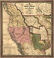
 1846 Mitchell's Map of Texas Oregon and California - Geographicus - TXORCA-mitchell-1846.jpg 5,000 × 5,420; 5.64 MB
-

-

-
 A new map of Texas, Oregon and California. LOC 00561203.jpg 6,278 × 6,794; 7.79 MB
-

-
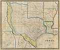 Burr The State of Texas, 1835-1845 1846 UTA.jpg 3,218 × 2,688; 1.54 MB
-
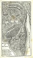 Lester Battle Ground of San Jacinto 1846 UTA.jpg 2,727 × 4,767; 8.53 MB
-
 Meyer & Radefeld Texas nach den besten Quellen 1846 UTA.jpg 4,450 × 3,779; 6.99 MB
-

-
 Texas LOC 2001627799.jpg 5,688 × 4,523; 3.51 MB
-
 Texas LOC 2001627799.tif 5,688 × 4,523; 73.61 MB
-
 Mitchell A New Map of Texas, Oregon, and California 1846 UTA.jpg 5,412 × 5,814; 25.88 MB


.jpg)


