Category:1845 maps of the United States
Jump to navigation
Jump to search
Subcategories
This category has the following 4 subcategories, out of 4 total.
Media in category "1845 maps of the United States"
The following 22 files are in this category, out of 22 total.
-

-

-

-
 A New map of the Western States. LOC 98685396.jpg 12,843 × 11,381; 28.28 MB
-
 A plan of Alfred, Maine LOC 2013593116.jpg 11,754 × 6,642; 8.06 MB
-
 American history- (1847) (14579825917).jpg 1,274 × 2,164; 827 KB
-

-

-

-

-
 Map of the United States LOC 2015591085.jpg 8,753 × 6,233; 6.33 MB
-
 Map of the United States LOC 2015591085.tif 8,753 × 6,233; 156.09 MB
-
 Map of the United States of America 1845.jpg 2,000 × 1,641; 3.02 MB
-

-

-

-

-
 Plan von Washington. LOC 88694054.jpg 5,630 × 4,602; 3.62 MB
-
 Plan von Washington. LOC 88694054.tif 5,630 × 4,602; 74.13 MB
-
 The history of Charlestown, Massachusetts (1845) (14596669860).jpg 2,560 × 1,350; 440 KB
-
 United States 1845-03-1845-12-de.png 1,000 × 677; 215 KB
-
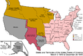 United States 1845-03-1845-12.png 1,000 × 677; 104 KB
_-_Geographicus_-_USAwall-mitchell-1844.jpg)


_(14579825917).jpg)
.jpg)
.jpg)
.jpg)


_(14596669860).jpg)

