Category:1836 maps of the United States
Jump to navigation
Jump to search
Subcategories
This category has the following 7 subcategories, out of 7 total.
F
- 1836 maps of Florida (6 F)
I
- 1836 maps of Illinois (3 F)
- 1836 maps of Indiana (2 F)
M
- 1836 maps of Massachusetts (10 F)
O
- 1836 maps of Ohio (4 F)
T
- 1836 maps of Texas (8 F)
Media in category "1836 maps of the United States"
The following 48 files are in this category, out of 48 total.
-
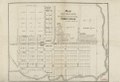
 12 of 'Atlas' (11013309386).jpg 2,724 × 3,448; 2.61 MB
-
 13 of 'Atlas' (11012139674).jpg 2,724 × 3,448; 3.17 MB
-
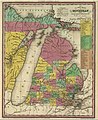 1836 Michigan.jpg 1,760 × 2,158; 3.48 MB
-
 20 of 'Atlas' (11012693753).jpg 2,724 × 3,448; 2.41 MB
-
 800-c-Reg4-B-1836b.jpg 6,958 × 5,582; 8.37 MB
-
 Carte des États-unis d'Amérique. LOC gm70002851.jpg 4,764 × 4,002; 3.32 MB
-
 Carte des États-unis d'Amérique. LOC gm70002851.tif 4,764 × 4,002; 54.55 MB
-
 Long Island 1836 map.jpg 4,000 × 2,726; 4.74 MB
-
 Map albert gallatin 1836.jpg 1,600 × 901; 464 KB
-
 Map of Dexter in Jefferson County N.Y. LOC 2007625484.jpg 8,456 × 5,808; 5.76 MB
-
 Map of Dexter in Jefferson County N.Y. LOC 2007625484.tif 8,456 × 5,808; 140.51 MB
-
 Map of Indian territory 1836.png 7,477 × 9,136; 92.32 MB
-
 Map of Irving, situated in Westchester Co., state of New-York LOC 91683241.jpg 7,387 × 5,955; 4.46 MB
-
 Map of Irving, situated in Westchester Co., state of New-York LOC 91683241.tif 7,387 × 5,955; 125.86 MB
-
-
 Map of Newark and East Newark, N.J. from the most authentic surveys. LOC gm71002268.jpg 10,906 × 8,013; 8.67 MB
-
 Map of Newark and East Newark, N.J. from the most authentic surveys. LOC gm71002268.tif 10,906 × 8,013; 250.02 MB
-
 Map of the city of New Brunswick, New Jersey LOC 2012585908.jpg 9,071 × 7,129; 9.7 MB
-
 Map of the city of New Brunswick, New Jersey LOC 2012585908.tif 9,071 × 7,129; 185.01 MB
-
 Map of the city of Perth Amboy, N.J. - February 1836 LOC 2006625921.jpg 7,153 × 10,702; 7.57 MB
-
 Map of the city of Perth Amboy, N.J. - February 1836 LOC 2006625921.tif 7,153 × 10,702; 219.02 MB
-
 Map of the village of Highgate, Franklin County, state of Vermont LOC 2008624023.jpg 10,361 × 7,286; 7.94 MB
-
 Map of the village of Highgate, Franklin County, state of Vermont LOC 2008624023.tif 10,361 × 7,286; 215.98 MB
-

-

-
 Map of Wattsburgh, Venango Township, Erie County, Pennsylvania LOC 2013589470.jpg 8,276 × 5,660; 6.79 MB
-
 Map of Wattsburgh, Venango Township, Erie County, Pennsylvania LOC 2013589470.tif 8,276 × 5,660; 134.02 MB
-

-

-

-
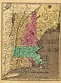 New England 1836.jpg 2,860 × 3,880; 1.84 MB
-
 New-York - by David H. Burr; engraved and printed by S. Stiles and Co., N. York. NYPL434740.tiff 5,133 × 4,590; 67.41 MB
-
 New-York. NYPL433880.tiff 4,107 × 3,735; 43.89 MB
-
 Map of the United States (NYPL b14978525-434646).jpg 10,105 × 4,715; 12.57 MB
-
 Map of the United States (NYPL b14978525-1254624).jpg 9,890 × 4,512; 12.3 MB
-
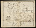
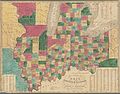 The states of Ohio, Indiana & Illinois and Michigan Territory (NYPL b20643882-5437621).jpg 8,343 × 6,560; 54.97 MB
-

-

-

-

-

-

-

-

-
 United States 1836-03-1836-06.png 1,000 × 677; 109 KB
-
 United States 1836-06-1836-07.png 1,000 × 677; 108 KB
-
 United States 1836-07-1837-01.png 1,000 × 677; 108 KB
-
 USA 1836 With Native Controlled Lands and Labels.png 1,751 × 879; 68 KB
.jpg)
.jpg)

.jpg)


.jpg)


.jpg)

.jpg)
.jpg)
.jpg)


