Category:1829 maps of the United States
Jump to navigation
Jump to search
States of the United States: Florida · Indiana · Louisiana · Massachusetts · New Jersey · New York · Pennsylvania · Rhode Island
Subcategories
This category has the following 9 subcategories, out of 9 total.
F
- 1829 maps of Florida (4 F)
I
- 1829 maps of Indiana (1 F)
L
- 1829 maps of Louisiana (1 F)
M
- 1829 maps of Massachusetts (16 F)
N
- 1829 maps of New Jersey (1 F)
P
- 1829 maps of Pennsylvania (3 F)
R
- 1829 maps of Rhode Island (2 F)
Media in category "1829 maps of the United States"
The following 21 files are in this category, out of 21 total.
-
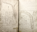
 1829 Survey of Napoleon Township.png 7,261 × 9,037; 119.56 MB
-
 Baltimore, Indiana plat.png 2,800 × 2,400; 11.43 MB
-
 Laurie Fredonia or the United States of North America 1829 UTA.jpg 5,708 × 3,832; 6.5 MB
-
 Louisiana Parishes in 1829.gif 401 × 317; 127 KB
-
 Map of Lynn and Saugus (2674579276).jpg 2,000 × 1,759; 2.52 MB
-

-

-
 Map of the United States and the Southern part of the Canadas (NYPL b20643870-5449858).jpg 9,110 × 7,352; 59.29 MB
-
 Map of the United States and the Southern part of the Canadas (NYPL b20643870-5449858).tiff 10,328 × 7,760, 2 pages; 229.61 MB
-

-
 Plan of the city of Washington - seat of government of the United States LOC 88694087.tif 5,148 × 3,833; 56.45 MB
-

-

-
 Plan of the proposed basin at the mouth of the Tiber - (Washington D.C.) LOC 88693177.tif 4,794 × 3,812; 52.28 MB
-
 Sandy-Bay, Mass. (2674589634).jpg 2,000 × 1,444; 2.34 MB
-

-

-

-
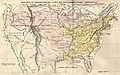
 United States 1828-1834.png 1,000 × 677; 104 KB
-
 United States of America (2675691118).jpg 2,000 × 1,568; 3.22 MB
-
 USA 1829.JPG 5,015 × 3,155; 3.21 MB


.jpg)
.jpg)
.jpg)

.jpg)
_LOC_88693177.jpg)
.jpg)
.jpg)

.jpg)
