
Category:1837 maps of the United States
Subcategories
This category has the following 2 subcategories, out of 2 total.
Media in category "1837 maps of the United States"
The following 19 files are in this category, out of 19 total.
-
 80 of 'History of Utah ... 1540-1887. (With a bibliography.)' (11293838675).jpg 1,406 × 1,203; 383 KB
-

-
 Bonneville's Map 1837 BHoU-p26.png 3,577 × 3,063; 244 KB
-

-
 Chicago ward map 1837.png 653 × 582; 11 KB
-
 Florida war 1837 - en.svg 1,153 × 1,500; 369 KB
-
 Florida war 1837 - ru.svg 1,153 × 1,500; 375 KB
-
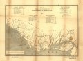
 Map exhibiting the route of communication between Philadelphia & Charleston LOC 98688345.jpg 6,885 × 5,067; 4.92 MB
-
 Map exhibiting the route of communication between Philadelphia & Charleston LOC 98688345.tif 6,885 × 5,067; 99.81 MB
-
 Map of the territory west of the Rocky Mountains LOC 2007633935.jpg 5,130 × 5,535; 4.16 MB
-
 Map of the territory west of the Rocky Mountains LOC 2007633935.tif 5,130 × 5,535; 81.24 MB
-

-
 Routes between New-York & Washington (NYPL b14951935-434652).jpg 1,776 × 6,300; 2.31 MB
-

-
 The United States. LOC 98685457.jpg 12,522 × 8,795; 16.17 MB
-
 The United States. LOC 98685457.tif 12,522 × 8,795; 315.09 MB
-
 United States 1837-01-1837-03.png 1,000 × 677; 109 KB
-
 United States 1837-03-1838.png 1,000 × 677; 108 KB
-

%27_(11293838675).jpg)
_(14802385733).jpg)


_-_DPLA_-_dd778181dda09314862a01f730b653b9.jpg)


.jpg)