Category:1750s maps of Austria
Jump to navigation
Jump to search
States of Austria:
Subcategories
This category has only the following subcategory.
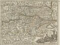
Media in category "1750s maps of Austria"
The following 5 files are in this category, out of 5 total.
-

-

-
-
 Map - Special Collections University of Amsterdam - OTM- HB-KZL 32.01.63.tif 7,331 × 6,158; 129.16 MB
-

.jpg)
.jpg)
.jpg)
.jpg)