Category:1690s maps of the Americas
Jump to navigation
Jump to search
Subcategories
This category has the following 2 subcategories, out of 2 total.
N
S
Media in category "1690s maps of the Americas"
The following 20 files are in this category, out of 20 total.
-

-
 Vincenzo Coronelli00.jpg 902 × 678; 194 KB
-
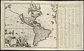
 Atlas Van der Hagen-KW1049B13 072-Novissima et Accuratissima TOTIUS AMERICAE DESCRIPTIO.jpeg 5,500 × 4,497; 3.11 MB
-
 Atlante Veneto Volume 1 048.jpg 9,619 × 6,773; 8.36 MB
-
 Atlante Veneto Volume 1 103.jpg 9,803 × 6,540; 6.14 MB
-
 Atlante Veneto Volume 1 105.jpg 9,804 × 6,650; 6.98 MB
-
 America cartouche in an Atlantic map by Blaeu.jpg 408 × 478; 47 KB
-
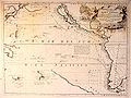
 Ca. 1695 Dutch sea chart of the Atlantic Ocean.jpg 3,045 × 2,500; 1.48 MB
-
 Novus Orbis potius Altera Continens sive Atlantis Insula.jpg 13,512 × 9,787; 27.44 MB
-

-
 Americae nova discriptio (5384787285).jpg 2,000 × 1,608; 2.93 MB
-

-
 Novissima et accuratissima totius Americae descriptio (4072628808).jpg 2,000 × 1,716; 3.4 MB
-

-
 Planisfero del mondo nuovo (8643263850).jpg 800 × 512; 119 KB
-
-

-

-

-
 Philippi Cluveri introductio in universam geographiam 1697 (139715012).jpg 7,987 × 7,353; 45.66 MB


.jpg)
.jpg)
.jpg)
.jpg)
.jpg)
.jpg)


.jpg)