Category:1650s maps of the Americas
Jump to navigation
Jump to search
Subcategories
This category has the following 3 subcategories, out of 3 total.
1
N
S
Media in category "1650s maps of the Americas"
The following 19 files are in this category, out of 19 total.
-
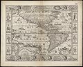 Americae nova descriptio (8343559408).jpg 800 × 648; 164 KB
-
 Americae nova tabula (8343848740).jpg 800 × 656; 150 KB
-

-

-

-

-
 Americae sive Indiae Occidentalis (2673896243).jpg 2,000 × 1,821; 2.93 MB
-

-
 North and South America, 1659 northeast.jpg 800 × 600; 128 KB
-
 North and South America, 1659 northwest.jpg 800 × 600; 119 KB
-
 North and South America, 1659 southeast.jpg 800 × 600; 131 KB
-
 North and South America, 1659 southwest.jpg 800 × 600; 118 KB
-
 North and South America, 1659.jpg 800 × 600; 130 KB
-
 Nova America descriptio LOC 2003623103.jpg 6,990 × 5,479; 4.67 MB
-
 Nova America descriptio LOC 2003623103.tif 6,990 × 5,479; 109.57 MB
-
 Novissima et accuratissima totius Americae descriptio - per N. Visscher. NYPL464998.tiff 5,547 × 4,856; 77.07 MB
-
 Americae descrip (NYPL b15262496-433854).jpg 4,557 × 4,367; 4.33 MB
-
 Americae descriptio nova (NYPL b15307676-434530).jpg 5,195 × 4,544; 5.95 MB
-
 The Most Recent and Most Accurate Description of All of America WDL172.png 1,275 × 1,024; 2.55 MB
.jpg)
.jpg)

_-_btv1b52511195b_(79_of_85)_(cropped).jpg)
_-_btv1b52511195b_(79_of_85).jpg)
.jpg)
.jpg)


.jpg)
.jpg)
