Category:17th-century maps of the Americas
Jump to navigation
Jump to search
Subcategories
This category has the following 13 subcategories, out of 13 total.
*
-
Media in category "17th-century maps of the Americas"
The following 28 files are in this category, out of 28 total.
-
Mappemonde - par Nam Hoei-Jaïn, le P. Ferdinand Verbiest, S.J. - btv1b55009590d (2 of 8).jpg 19,501 × 22,336; 76.29 MB
-
America - btv1b525051420.jpg 19,848 × 16,621; 47.7 MB
-
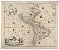
America by Nicolass Visscher.jpg 1,047 × 873; 303 KB
-
America noviter delincata - Auct Judoco Hondio - btv1b8468469k.jpg 7,270 × 5,880; 8.18 MB
-
America noviter delincata - Auct Judoco Hondio - btv1b84691337.jpg 8,122 × 6,204; 8.13 MB
-
America noviter delincata - Auct Judoco Hondio - btv1b84697050.jpg 7,738 × 6,360; 8.26 MB
-
America noviter delineata - Auct Judoco Hondio - btv1b53223497s.jpg 7,986 × 6,042; 8.85 MB
-
America noviter delineata - Auct Judoco Hondio - btv1b84684685.jpg 9,094 × 6,996; 9.76 MB
-
Americae - Hugo Allardt, excudit - btv1b84687152.jpg 10,150 × 8,100; 12.17 MB
-
Americae nova tabula - Auct Guilielmo Blaeurs - btv1b8469704k.jpg 9,490 × 7,860; 12.16 MB
-
Americae nova tabula - Auct Guilielmo Blaeurs - btv1b84699545.jpg 9,538 × 7,524; 12.64 MB
-
Amérique - btv1b84685584.jpg 8,410 × 6,660; 10.52 MB
-
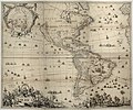
Exacta Totius Americae Tabula by Nicolaes Visscher II.jpg 18,659 × 14,386; 189.11 MB
-
Exacta totius Americæ tabula - Kungliga Biblioteket - 10398124-thumb.png 10,232 × 7,656; 291.55 MB
-
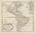
Graverad och handkolorerad karta över Amerika från 1670-1690 - Skoklosters slott - 95152.tif 3,701 × 2,977; 31.54 MB
-
Het Licht der Zee-vaert – AMERICÆ nova tabula.jpg 1,075 × 800; 298 KB
-
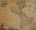
Karta över Amerika från 1600-talet, kopparbestick på papper - Skoklosters slott - 93669.tif 4,340 × 3,548; 26.82 MB
-
Recentissima novi orbis sive Americae septentrionalis et meridionalis tabula - btv1b84698149.jpg 10,318 × 8,724; 13.49 MB
-
Wit-novissima.jpg 1,500 × 1,276; 645 KB


