Category:1690s maps of North America
Jump to navigation
Jump to search
Temperate regions: North America · South America · Africa · Europe · Asia · Oceania – Polar regions: – Other regions:
Subcategories
This category has the following 15 subcategories, out of 15 total.
- 1691 maps of North America (5 F)
- 1694 maps of North America (4 F)
- 1698 maps of North America (5 F)
.
C
- 1690s maps of Cuba (empty)
M
- 1690s maps of Mexico (3 F)
U
Media in category "1690s maps of North America"
The following 5 files are in this category, out of 5 total.
-
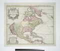 Amerique septentrionale divisée en ses principale parties. NYPL434921.tiff 5,603 × 4,776; 49.4 MB
-

-
 L'America settentrionale (14166704239).jpg 2,500 × 1,865; 1.9 MB
-
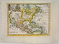
 North America (NYPL b15469124-465051).jpg 2,357 × 2,236; 1.16 MB
-
 America Borealis 1699 (NYPL b16794788-1693835).jpg 4,363 × 2,836; 4.38 MB

.jpg)
.jpg)
.jpg)