Category:1690s maps of Denmark
Jump to navigation
Jump to search
Countries of Europe: Armenia‡ · Austria · Azerbaijan‡ · Belarus · Belgium · Bulgaria · Croatia · Cyprus‡ · Denmark · France‡ · Georgia‡ · Germany · Greece · Hungary · Republic of Ireland · Italy · Lithuania · Montenegro · Netherlands‡ · Norway · Poland · Portugal‡ · Russia‡ · Spain‡ · Sweden · Switzerland · Turkey‡ · Ukraine
‡: partly located in Europe
‡: partly located in Europe
Media in category "1690s maps of Denmark"
This category contains only the following file.
-
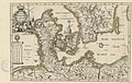 Dania, Pomerania duc. Mechleburgicus - btv1b53041190w.jpg 4,580 × 2,887; 2.43 MB
