
Category:1690s maps of Spain
Subcategories
This category has the following 3 subcategories, out of 3 total.
- 1692 maps of Spain (empty)
- 1696 maps of Spain (4 F)
Media in category "1690s maps of Spain"
The following 11 files are in this category, out of 11 total.
-
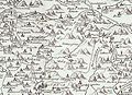 Campo de Ribatajada.jpg 918 × 662; 178 KB
-

-

-
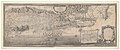
 Atlante Veneto Volume 2 025.jpg 7,362 × 10,304; 8.09 MB
-
 Atlante Veneto Volume 2 026.jpg 7,359 × 10,328; 9.59 MB
-
 Carte des Pyrénées au XVIIeme siècle.jpg 6,286 × 4,048; 10.61 MB
-

-
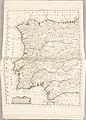
 Map - Special Collections University of Amsterdam - OTM- HB-KZL 32.23.39.tif 7,389 × 6,385; 134.98 MB
-
 Plan de la ville et citadelle de Palamos.jpg 6,391 × 5,316; 37.57 MB
-
-
 Vegueries 1694.jpg 1,037 × 837; 570 KB


