Category:1690s maps of Portugal
Jump to navigation
Jump to search
Media in category "1690s maps of Portugal"
The following 10 files are in this category, out of 10 total.
-
 0011 Planta De La Ciudad De Tavilla.jpg 8,190 × 5,789; 7.13 MB
-
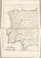
 Spain and Portugal (8343559554).jpg 800 × 656; 176 KB
-
 Atlante Veneto Volume 2 027.jpg 10,333 × 7,344; 8.38 MB
-

-
 Atlante Veneto Volume 2 025.jpg 7,362 × 10,304; 8.09 MB
-
 Atlante Veneto Volume 2 026.jpg 7,359 × 10,328; 9.59 MB
-

-

-

-
 UBBasel Map 1695-1697 Kartenslg Mappe 254-21 Portugal et Algarves.tiff 10,172 × 14,110, 2 pages; 410.66 MB

.jpg)

.jpg)


a,_geografo_del_Sereniss._Sig._Duca_di_Modena_;_Al_Emmo._e_Rmo._Prencipe_Il_Sigr._Cardinale_Fabritio_Spada_;_Antonio_Barbey_sculp._-_btv1b53057153z.jpg)

