Category:1600s maps of Germany
Jump to navigation
Jump to search
Countries of Europe: Albania · Belgium · Bosnia and Herzegovina · Croatia · Cyprus‡ · Denmark · France‡ · Georgia‡ · Germany · Greece · Republic of Ireland · Italy · Lithuania · Netherlands‡ · Norway · Portugal‡ · Romania · Russia‡ · Serbia · Spain‡ · Switzerland · Turkey‡ · Ukraine
‡: partly located in Europe
‡: partly located in Europe
Federal states of Germany:
Subcategories
This category has the following 10 subcategories, out of 10 total.
B
- 1600s maps of Baden-Württemberg (24 F)
- 1600s maps of Brandenburg (1 F)
- 1600s maps of Bremen (state) (1 F)
H
- 1600s maps of Hamburg (2 F)
- 1600s maps of Hesse (9 F)
L
M
N
T
- 1600s maps of Thuringia (2 F)
Media in category "1600s maps of Germany"
The following 10 files are in this category, out of 10 total.
-
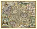
 Map of Germany NW 1600.jpg 800 × 600; 147 KB
-
 Germania (NYPL b15404146-1632159).jpg 4,761 × 3,709; 3.56 MB
-
 Bodleian Libraries, Germaniae typvs.jpg 1,000 × 675; 219 KB
-
 Germaniae Typus.jpg 12,173 × 9,564; 32.49 MB
-
 Map of Germany by Abraham Ortelius.jpeg 3,057 × 2,361; 2.76 MB
-
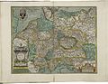
 Map of Germany NE 1600.jpg 800 × 600; 149 KB
-
 Map of Germany SE 1600.jpg 800 × 600; 153 KB
-
 Map of Germany SW 1600.jpg 800 × 600; 146 KB
-
 Map of the central Rhine (1600).jpg 800 × 600; 130 KB
-
 Map of the central Rhine northeast 1600.jpg 800 × 600; 163 KB

.jpg)


.jpg)
