Category:1600s maps of France
Jump to navigation
Jump to search
Countries of Europe: Albania · Belgium · Bosnia and Herzegovina · Croatia · Cyprus‡ · Denmark · France‡ · Georgia‡ · Germany · Greece · Republic of Ireland · Italy · Lithuania · Netherlands‡ · Norway · Portugal‡ · Romania · Russia‡ · Serbia · Spain‡ · Switzerland · Turkey‡ · Ukraine
‡: partly located in Europe
‡: partly located in Europe
Subcategories
This category has the following 4 subcategories, out of 4 total.
Media in category "1600s maps of France"
The following 16 files are in this category, out of 16 total.
-
 Map of ancient France (1600).jpg 800 × 600; 151 KB
-
 Map of France (1600).jpg 800 × 600; 119 KB
-
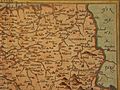 Map of France North East (1600).jpg 800 × 600; 149 KB
-
 Map of France North West (1600).jpg 800 × 600; 144 KB
-
 Map of France South East (1600).jpg 800 × 600; 152 KB
-
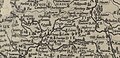
 Map of France South West (1600).jpg 800 × 600; 136 KB
-
 Gallia Nova totius Galliae geographica Hondius Jodocus.jpg 1,133 × 547; 145 KB
-
 Gerardus Mercator, Gallia (FL33133714 2583494).jpg 11,333 × 10,416; 152.79 MB
-

-
 Atlas Minor Gerardi Mercatoris 1609 (106753201).jpg 6,251 × 4,617; 5.33 MB
-
 France from Geographisch Handtbuch (north waet).jpg 800 × 600; 194 KB
-
 France from Geographisch Handtbuch (south east).jpg 800 × 600; 198 KB
-
 France from Geographisch Handtbuch (south west).jpg 800 × 600; 174 KB
-
 France from Geographisch Handtbuch north east).jpg 800 × 600; 175 KB
-
 France from Geographisch Handtbuch.jpg 800 × 600; 180 KB
-

.jpg)
.jpg)
.jpg)
.jpg)
.jpg)
.jpg)

.jpg)
_and_of_Brittany_and_Normandy_by_Abraham_Ortelius.jpeg)
.jpg)
.jpg)
.jpg)
.jpg)
.jpg)

