Category:1600s maps of Italy
Jump to navigation
Jump to search
Countries of Europe: Albania · Belgium · Bosnia and Herzegovina · Croatia · Cyprus‡ · Denmark · France‡ · Georgia‡ · Germany · Greece · Republic of Ireland · Italy · Lithuania · Netherlands‡ · Norway · Portugal‡ · Romania · Russia‡ · Serbia · Spain‡ · Switzerland · Turkey‡ · Ukraine
‡: partly located in Europe
‡: partly located in Europe
- Regions of Italy: Liguria ·
Subcategories
This category has the following 5 subcategories, out of 5 total.
- 1600 maps of Italy (5 F)
- 1606 maps of Italy (3 F)
.
Media in category "1600s maps of Italy"
The following 8 files are in this category, out of 8 total.
-
 "Theatrum orbis terrarum Abrahami Orteli". Anversa, Ioannem Moretum, 1601.png 1,145 × 807; 1.58 MB
-
-

-

-
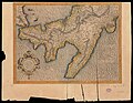
 Map of Eastern Mediterranean. HM 34. PORTOLAN ATLAS, anonymous. France (?), ca. 1600.jpg 5,358 × 4,434; 7.34 MB
-
 Map of italy North East 1600.jpg 800 × 600; 153 KB
-
 Map of italy North Wesst 1600.jpg 800 × 600; 160 KB
-


.jpg)


,_ca._1600.jpg)


