Category:1630s maps of France
Jump to navigation
Jump to search
Countries of Europe: Armenia‡ · Belgium · Cyprus‡ · Denmark · France‡ · Georgia‡ · Germany · Greece · Republic of Ireland · Italy · Lithuania · Netherlands‡ · Norway · Portugal‡ · Russia‡ · Spain‡ · Sweden · Switzerland · Turkey‡ · Ukraine
‡: partly located in Europe
‡: partly located in Europe
Former administrative regions of Metropolitan France (until end of 2015):
Alsace
Alsace
Subcategories
This category has the following 9 subcategories, out of 9 total.
- 1632 maps of France (3 F)
- 1633 maps of France (7 F)
- 1635 maps of France (6 F)
'
.
- 1630s maps of Alsace (2 F)
Media in category "1630s maps of France"
The following 24 files are in this category, out of 24 total.
-
 LASB K Hellwig 0733.jpg 3,888 × 2,528; 1.5 MB
-
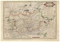
 Lotharingia Ducatus - Per Gerardum Mercatorem - btv1b8493000g (1 of 4).jpg 7,715 × 5,901; 7.33 MB
-
 LASB K Hellwig 0732.jpg 3,840 × 2,472; 1.44 MB
-
 Burgundiae Comitatus, Franche-Comté - btv1b531527458 (2 of 3).jpg 8,524 × 6,348; 9.46 MB
-
 Quercy Cadurcium (5121160756).jpg 2,000 × 1,655; 3.54 MB
-
 1634-carte du gouvernement d'Orléans.JPG 386 × 300; 15 KB
-
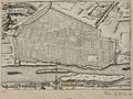 1634-Plan d'Orléans.JPG 402 × 300; 33 KB
-
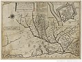
 1635 Blaeu - Carte du Bourdelois.jpg 590 × 995; 177 KB
-
 Atlas Van der Hagen-KW1049B12 033-NORMANDIA DVCATVS.jpeg 5,500 × 4,074; 3.73 MB
-
-
 Britannia Ducatus = Duché de Bretaigne (8342903270).jpg 800 × 646; 126 KB
-

-
 LASB K Hellwig 0729.jpg 3,368 × 2,456; 2.24 MB
-
 Carte du siège présidial Dax.jpg 1,387 × 1,054; 483 KB
-
 Archiepiscopatus cameracensis. Archevesché de Cambray - btv1b8592405v.jpg 8,316 × 7,171; 8.91 MB
-
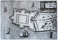 Blavet-IMG 7004.jpg 3,590 × 2,513; 3.17 MB
-
 Burgundiae comitatus (Franche Comté) - per Gerardum Mercatorem - btv1b8592600g (1 of 2).jpg 7,904 × 7,460; 10.13 MB
-
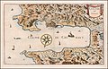 Ca. 1630 French map of the Gulf of St. Tropez.jpg 12,919 × 8,278; 21.85 MB
-
 Carte Routes de Postes-1632-Tavernier.jpg 8,608 × 6,701; 10.32 MB
-
 Cenomanorum galliae regionis typus vulgo Le Mans (5121151532).jpg 2,000 × 1,687; 3.51 MB
-

-

-
 1634-Carte du duché d'Orléans.JPG 404 × 300; 35 KB
-
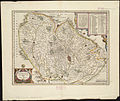
 Vermandois - btv1b8592515k.jpg 8,459 × 6,470; 8.92 MB

.jpg)

.jpg)
.jpg)


_-_Per_Gerardum_Mercator%C3%A9,_Cum_Privilegio_-_btv1b8495223s_(1_of_2).jpg)
.jpg)
_-_btv1b8592978g_(1_of_2).jpg)


_-_per_Gerardum_Mercatorem_-_btv1b8592600g_(1_of_2).jpg)


.jpg)
.jpg)


