Commons:Wiki Loves Monuments in Switzerland/Valais/A-I
Jump to navigation
Jump to search
Albinen
| Location | Upload | Photo | Object | Cat. | Coordinates | KGS-Nr | |
|---|---|---|---|---|---|---|---|
| Albinen | 
|
Pfarrkirche Hl. Bruder Klaus | B | 46°20′25″N 7°38′00″E / 46.340295796°N 7.633307868°E | 16008 | ||
| Albinen | 
|
Albinen | ISOS | 46°20′00″N 7°38′00″E / 46.333333333°N 7.633333333°E | |||
Anniviers
Ardon
| Location | Upload | Photo | Object | Cat. | Coordinates | KGS-Nr | |
|---|---|---|---|---|---|---|---|
| Ardon | 
|
église St-Jean (site archéologique), clocher et cure (avec inscriptions romaines) | B | 46°12′36″N 7°15′24″E / 46.21012°N 7.25679°E | 6593 | ||
| Ardon | 
|
Ruines du château du Crêt | B | 46°12′52″N 7°15′06″E / 46.21455°N 7.25178°E | 6594 | ||
Ausserberg
| Location | Upload | Photo | Object | Cat. | Coordinates | KGS-Nr | |
|---|---|---|---|---|---|---|---|
| Ausserberg | Kirche St. Josef (spätgotischer Flügelaltar) | Kirche St. Josef (spätgotischer Flügelaltar) | B | 46°18′51″N 7°51′04″E / 46.31428°N 7.85121°E | 6595 | ||
Ayent
| Location | Upload | Photo | Object | Cat. | Coordinates | KGS-Nr | |
|---|---|---|---|---|---|---|---|
| Ayent | 
|
Argnou, chapelle Ste-Marie-Madeleine | B | 46°15′56″N 7°23′56″E / 46.26569°N 7.39885°E | 6598 | ||
| Ayent | 
|
Botyre, chapelle St-Martin | B | 46°16′34″N 7°24′16″E / 46.27624°N 7.40444°E | 6599 | ||
| Ayent | 
|
Botyre, maison peinte | B | 46°16′34″N 7°24′17″E / 46.276°N 7.40468°E | 6600 | ||
| Ayent | 
|
église St-Romain avec clocher et voisinage | B | 46°16′58″N 7°24′46″E / 46.28273°N 7.41275°E | 6601 | ||
Bagnes
Bellwald
| Location | Upload | Photo | Object | Cat. | Coordinates | KGS-Nr | |
|---|---|---|---|---|---|---|---|
| Bellwald | 
|
Pfarrkirche Bellwald | B | 46°25′25″N 8°09′36″E / 46.4236°N 8.16005°E | 6622 | ||
| Bellwald | 
|
Fürgangen, Kapelle (Altar) | B | 46°24′45″N 8°09′07″E / 46.41239°N 8.15183°E | 6621 | ||
| Bellwald | 
|
Ried, Muttergotteskapelle | B | 46°25′51″N 8°09′21″E / 46.43097°N 8.15585°E | 6623 | ||
| Bellwald | 
|
Bodma | ISOS | 46°18′51″N 7°55′35″E / 46.3142°N 7.9264°E | |||
Bettmeralp
| Location | Upload | Photo | Object | Cat. | Coordinates | KGS-Nr | |
|---|---|---|---|---|---|---|---|
| Bettmeralp | 
|
Bettmeralp, Kapelle Maria zum Schnee | B | 46°23′18″N 8°03′37″E / 46.38843°N 8.06024°E | 6624 | ||
| Bettmeralp | 
|
Eggen | ISOS | ||||
Binn
| Location | Upload | Photo | Object | Cat. | Coordinates | KGS-Nr | |
|---|---|---|---|---|---|---|---|
| Binn | 
|
Fäld | ISOS | 46°22′14″N 8°12′45″E / 46.370428°N 8.212624°E | |||
| Binn | 
|
Schmidighischere | ISOS | 46°22′00″N 8°11′00″E / 46.366663°N 8.183325°E | |||
| Binn | 
|
Regionalmuseum Binn | B | 46°21′52″N 8°11′07″E / 46.36439°N 8.18527°E | 6635 | ||
| Binn | 
|
Bogenbrücke mit Kapelle St. Anton | A | 46°21′50″N 8°11′03″E / 46.36392°N 8.18409°E | 6629 | ||
| Binn | 
|
Eisenzeitliches Gräberfeld beim Hotel Ofenhorn | B | 46°21′52″N 8°11′05″E / 46.36446°N 8.18474°E | 6632 | ||
| Binn | 
|
Heiligkreuz, Wallfahrtskapelle und Wirtshaus | B | 46°20′29″N 8°10′30″E / 46.34145°N 8.17495°E | 6633 | ||
| Binn | 
|
Kalkbrennofen | B | 46°21′58″N 8°11′31″E / 46.36603°N 8.19207°E | 6634 | ||
| Binn | 
|
Kapelle St. Martin | B | 46°22′15″N 8°12′46″E / 46.3708°N 8.2128°E | 14104 | ||
| Binn | 
|
Willern, Kirche St. Michael und altes Pfarrhaus | B | 46°21′46″N 8°10′52″E / 46.3629°N 8.18099°E | 6630 | ||
Bitsch
| Location | Upload | Photo | Object | Cat. | Coordinates | KGS-Nr | |
|---|---|---|---|---|---|---|---|
| Bitsch | 
|
Wasen | ISOS | 46°20′19″N 8°00′36″E / 46.33859°N 8.01012°E | |||
Blatten
| Location | Upload | Photo | Object | Cat. | Coordinates | KGS-Nr | |
|---|---|---|---|---|---|---|---|
| Blatten | 
|
Fafleralp, Kapelle | B | 46°26′06″N 7°51′33″E / 46.43496°N 7.85903°E | 6641 | ||
| Blatten | 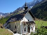
|
Kühmatt, Kapelle Mariä Heimsuchung | B | 46°25′44″N 7°50′36″E / 46.42899°N 7.84333°E | 6642 | ||
Bourg-Saint-Pierre
| Location | Upload | Photo | Object | Cat. | Coordinates | KGS-Nr | |
|---|---|---|---|---|---|---|---|
| Bourg-Saint-Pierre | 
|
Musée de l'Hospice | A | 45°52′08″N 7°10′14″E / 45.86886°N 7.17065°E | 8719 | ||
| Bourg-Saint-Pierre | 
|
Bibliothèque dl'hospice du Grand-Saint-Bernard | A | 45°52′08″N 7°10′13″E / 45.86894°N 7.17037°E | 9315 | ||
| Bourg-Saint-Pierre | 
|
Hospice du Grand-St-Bernard, Archives | A | 45°52′08″N 7°10′14″E / 45.86891°N 7.17046°E | 8828 | ||
| Bourg-Saint-Pierre | 
|
Ancien hôpital | B | 45°56′56″N 7°12′31″E / 45.94875°N 7.20858°E | 6651 | ||
| Bourg-Saint-Pierre | 
|
Ancien prieuré | B | 45°56′56″N 7°12′29″E / 45.94893°N 7.20808°E | 6652 | ||
| Bourg-Saint-Pierre | 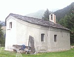
|
chapelle Notre-Dame de Lorette | B | 45°57′31″N 7°12′35″E / 45.95855°N 7.20973°E | 6654 | ||
| Bourg-Saint-Pierre | 
|
Les 2 maisons dites de Challant | B | 45°56′59″N 7°12′28″E / 45.94964°N 7.2078°E | 6655 | ||
| Bourg-Saint-Pierre | 
|
Moulin sur le torrent de Valsorey | B | 45°56′50″N 7°12′32″E / 45.9473°N 7.20898°E | 6656 | ||
| Bourg-Saint-Pierre | 
|
église Saint-Pierre | A | 45°56′57″N 7°12′29″E / 45.94917°N 7.2081°E | 6648 | ||
| Bourg-Saint-Pierre | 
|
hospice du Grand-Saint-Bernard | A | 45°52′08″N 7°10′14″E / 45.868888888°N 7.170555555°E | 6649 | ||
| Bourg-Saint-Pierre | 
|
col du Grand-Saint-Bernard | ISOS | 45°52′08″N 7°10′14″E / 45.868888888°N 7.170555555°E | |||
| Bourg-Saint-Pierre | 
|
Bourg-Saint-Pierre | ISOS | 45°57′N 7°12′E / 45.95°N 7.2°E | |||
Brig-Glis
| Location | Upload | Photo | Object | Cat. | Coordinates | KGS-Nr | |
|---|---|---|---|---|---|---|---|
| Brig-Glis | 
|
Brigue-Glis | ISOS | 46°18′57″N 7°59′15″E / 46.315916666°N 7.987619444°E | |||
| Brig-Glis | 
|
Museum Stockalperschloss | B | 46°18′55″N 7°59′26″E / 46.31526°N 7.99065°E | 13912 | ||
| Brig-Glis | 
|
Stockalperarchiv Brig und Archiv des Geschichtsforschenden Vereins Oberwallis | B | 46°18′55″N 7°59′26″E / 46.31523°N 7.99061°E | 10598 | ||
| Brig-Glis | 
|
Gamsenmauer, Talsperre | A | 46°18′08″N 7°56′53″E / 46.30225°N 7.94795°E | 6659 | ||
| Brig-Glis | 
|
Kirche Mariä Himmelfahrt mit Beinhaus | A | 46°18′38″N 7°58′41″E / 46.31066°N 7.97803°E | 6660 | ||
| Brig-Glis | Bahnhof (1906) | Bahnhof (1906) | B | 46°19′09″N 7°59′18″E / 46.31925°N 7.98825°E | 6663 | ||
| Brig-Glis | 
|
Grundbiel, jungsteinzeitliches Gräberfeld | B | 46°18′34″N 7°57′52″E / 46.30938°N 7.96437°E | 6666 | ||
| Brig-Glis | 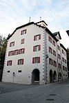
|
Haus Fernanda von Stockalper (1727) | B | 46°18′55″N 7°59′28″E / 46.31538°N 7.99109°E | 6667 | ||
| Brig-Glis | 
|
Kapelle St. Antonius Eremita | B | 46°18′52″N 7°59′31″E / 46.31447°N 7.99203°E | 6668 | ||
| Brig-Glis | 
|
Kapelle St. Sebastian | B | 46°18′59″N 7°59′16″E / 46.31627°N 7.98791°E | 6669 | ||
| Brig-Glis | 
|
Kollegiumskirche Spiritus Sanctus mit altem Kollegium | B | 46°18′56″N 7°59′32″E / 46.31546°N 7.99234°E | 6670 | ||
| Brig-Glis | 
|
Ringmauer und «Scheune« | B | 46°18′57″N 7°59′37″E / 46.31578°N 7.99374°E | 6671 | ||
| Brig-Glis | 
|
Sammlung Arnold Perren (Ethnographie) | B | 46°19′00″N 7°59′17″E / 46.31656°N 7.98794°E | 6672 | ||
| Brig-Glis | 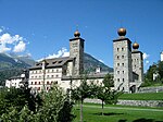
|
château de Stockalper | A | 46°18′54″N 7°59′27″E / 46.315°N 7.990833333°E | 6661 | ||
| Brig-Glis | 
|
passo del Sempione | ISOS | 46°15′06″N 8°02′00″E / 46.251666666°N 8.033333333°E | |||
Bürchen
| Location | Upload | Photo | Object | Cat. | Coordinates | KGS-Nr | |
|---|---|---|---|---|---|---|---|
| Bürchen | 
|
Hochastler, eisenzeitliche Höhensiedlung | B | 46°17′27″N 7°48′42″E / 46.29091°N 7.81158°E | 6673 | ||
| Bürchen | 
|
Ibrich, Muttergotteskapelle (Ende 17. Jh.) | B | 46°16′46″N 7°49′05″E / 46.27956°N 7.8181°E | 6674 | ||
| Bürchen | 
|
Mauracker, Kapelle | B | 46°17′00″N 7°48′49″E / 46.28344°N 7.81353°E | 6675 | ||
| Bürchen | 
|
Wandfluh, Wallfahrtskapelle der Schmerzhaften Muttergottes mit Kapellenweg (Originalfiguren in der Taufkapelle) | B | 46°18′01″N 7°48′07″E / 46.30024°N 7.80191°E | 6676 | ||
Chalais
| Location | Upload | Photo | Object | Cat. | Coordinates | KGS-Nr | |
|---|---|---|---|---|---|---|---|
| Chalais | 
|
Ancien chalet et chapelle de Chastonay | B | 46°15′26″N 7°31′46″E / 46.25722°N 7.52954°E | 6680 | ||
| Chalais | 
|
Clocher et choeur de l'ancienne église | B | 46°15′27″N 7°31′59″E / 46.25746°N 7.53312°E | 6681 | ||
| Chalais | 
|
Les Granges | B | 46°15′54″N 7°30′31″E / 46.26506°N 7.50867°E | 6677 | ||
| Chalais | 
|
Réchy, maison Siegen | B | 46°15′41″N 7°29′45″E / 46.26147°N 7.49596°E | 6678 | ||
Chamoson
| Location | Upload | Photo | Object | Cat. | Coordinates | KGS-Nr | |
|---|---|---|---|---|---|---|---|
| Chamoson | 
|
église St-André et cure | B | 46°12′07″N 7°13′31″E / 46.20199°N 7.22532°E | 6683 | ||
| Chamoson | 
|
Saint-Pierre-de-Clages | A+ISOS | 46°11′32″N 7°14′13″E / 46.192111111°N 7.237044444°E | 6682 | ||
Champéry
| Location | Upload | Photo | Object | Cat. | Coordinates | KGS-Nr | |
|---|---|---|---|---|---|---|---|
| Champéry | [[File:|150x150px|Clocher (1725) de l'église St-Théodule avec maison dite la cure]] | Clocher (1725) de l'église St-Théodule avec maison dite la cure | B | 46°10′41″N 6°52′11″E / 46.17814°N 6.86983°E | 6687 | ||
Chippis
| Location | Upload | Photo | Object | Cat. | Coordinates | KGS-Nr | |
|---|---|---|---|---|---|---|---|
| Chippis | 
|
église St-Urbain et école | B | 46°16′50″N 7°32′25″E / 46.28049°N 7.54017°E | 6691 | ||
| Chippis | 
|
Pont de fer sur le Rhône | B | 46°16′56″N 7°32′26″E / 46.28228°N 7.5406°E | 6692 | ||
| Chippis | 
|
Site industriel d'Alusuisse, rive gauche, avec usine hydroélectrique | B | 46°16′51″N 7°32′47″E / 46.28086°N 7.54631°E | 13913 | ||
Collombey-Muraz
| Location | Upload | Photo | Object | Cat. | Coordinates | KGS-Nr | |
|---|---|---|---|---|---|---|---|
| Collombey-Muraz | 
|
Collombey, Château d'Arbignon (monastère) | B | 46°16′03″N 6°56′41″E / 46.26742°N 6.94483°E | 6695 | ||
| Collombey-Muraz | 
|
Collombey, Maison de commune | B | 46°16′09″N 6°56′46″E / 46.26908°N 6.9461°E | 6696 | ||
| Collombey-Muraz | 
|
Collombey, Manoir de Lavallaz (Châtillon-Larringes) | B | 46°16′02″N 6°56′47″E / 46.26723°N 6.94637°E | 6697 | ||
| Collombey-Muraz | 
|
La Barmaz et Châble-Croix, sites préhistoriques | B | 46°16′26″N 6°56′21″E / 46.27396°N 6.93918°E | 6694 | ||
| Collombey-Muraz | [[File:|150x150px|Muraz, Eglise St-André, vieux clocher (1657), villa romaine et cure (1768)]] | Muraz, Eglise St-André, vieux clocher (1657), villa romaine et cure (1768) | B | 46°16′48″N 6°55′33″E / 46.28011°N 6.92576°E | 6698 | ||
Collonges
| Location | Upload | Photo | Object | Cat. | Coordinates | KGS-Nr | |
|---|---|---|---|---|---|---|---|
| Collonges | 
|
Verdant (site archéologique) | B | 46°10′52″N 7°01′27″E / 46.18121°N 7.02422°E | 6699 | ||
Conthey
| Location | Upload | Photo | Object | Cat. | Coordinates | KGS-Nr | |
|---|---|---|---|---|---|---|---|
| Conthey | 
|
Bourg, chapelle Ste-Pétronille | B | 46°13′56″N 7°18′06″E / 46.23222°N 7.30157°E | 6701 | ||
| Conthey | 
|
église St-Séverin et groupe de vieilles maisons | B | 46°14′02″N 7°18′01″E / 46.23392°N 7.30029°E | 6702 | ||
| Conthey | 
|
Maison d'habitation / Villa Suter | B | 46°13′40″N 7°17′58″E / 46.22789°N 7.29955°E | 10615 | ||
Crans-Montana
| Location | Upload | Photo | Object | Cat. | Coordinates | KGS-Nr | |
|---|---|---|---|---|---|---|---|
| Crans-Montana | 
|
Hotel Bella Lui | A | 46°18′44″N 7°28′33″E / 46.31218°N 7.47579°E | 10361 | ||
| Crans-Montana | 
|
Roches des Fées | A | 46°19′32″N 7°31′13″E / 46.3255°N 7.52018°E | 6853 | ||
| Crans-Montana | 
|
église de St-Maurice-de-Laques avec la cure | B | 46°18′39″N 7°31′25″E / 46.31085°N 7.52365°E | 6851 | ||
| Crans-Montana | 
|
Grenier en pierre | B | 46°18′57″N 7°31′17″E / 46.31595°N 7.5214°E | 6852 | ||
| Crans-Montana | 
|
Sanatorium «La Moubra» | B | 46°18′26″N 7°28′46″E / 46.30727°N 7.47952°E | 10576 | ||
| Crans-Montana | 
|
Tour Super-Crans | B | 14951 | |||
Eischoll
| Location | Upload | Photo | Object | Cat. | Coordinates | KGS-Nr | |
|---|---|---|---|---|---|---|---|
| Eischoll | 
|
Kirche Mariä Himmelfahrt (1886) | B | 46°17′41″N 7°46′45″E / 46.29474°N 7.77918°E | 6705 | ||
| Eischoll | 
|
Eischoll | ISOS | 46°16′00″N 7°46′00″E / 46.266666666°N 7.766666666°E | |||
Eisten
| Location | Upload | Photo | Object | Cat. | Coordinates | KGS-Nr | |
|---|---|---|---|---|---|---|---|
| Eisten | 
|
Eisten | ISOS | 46°12′N 7°54′E / 46.2°N 7.9°E | |||
Ernen
Evionnaz
| Location | Upload | Photo | Object | Cat. | Coordinates | KGS-Nr | |
|---|---|---|---|---|---|---|---|
| Evionnaz | 
|
Evionnaz | ISOS | 46°10′45″N 7°01′21″E / 46.1792°N 7.0225°E | |||
Evolène
| Location | Upload | Photo | Object | Cat. | Coordinates | KGS-Nr | |
|---|---|---|---|---|---|---|---|
| Evolène | 
|
Les Haudères | ISOS | 46°04′57″N 7°30′34″E / 46.08256306°N 7.50949889°E | |||
| Evolène | 
|
Musée à Evolène | B | 46°06′46″N 7°29′46″E / 46.11268°N 7.4962°E | 8746 | ||
| Evolène | 
|
Alpage de Cotter, gravures rupestres préhistoriques | A | 46°07′02″N 7°31′08″E / 46.11735°N 7.51884°E | 9698 | ||
| Evolène | 
|
Maison d'habitation, Les Haudères | A | 46°06′20″N 7°29′25″E / 46.10549°N 7.49037°E | 10358 | ||
| Evolène | 
|
Alpage de Tsaté | B | 46°05′39″N 7°31′54″E / 46.09412°N 7.53173°E | 13914 | ||
| Evolène | 
|
chapelle St-Laurent | B | 10573 | |||
| Evolène | 
|
Cimetière, chapelle St-Théodule et St-Sébastien | B | 46°06′40″N 7°29′54″E / 46.11124°N 7.49838°E | 6724 | ||
| Evolène | 
|
église St-Jean-Baptiste (clocher 15e s.) | B | 46°06′47″N 7°29′45″E / 46.11296°N 7.49585°E | 6725 | ||
| Evolène | 
|
Grand-Hôtel de la Sage | B | 46°05′55″N 7°30′49″E / 46.09868°N 7.51374°E | 10602 | ||
| Evolène | 
|
La Garde, chapelle Notre-Dame | B | 46°07′45″N 7°28′33″E / 46.12915°N 7.47589°E | 6728 | ||
| Evolène | 
|
La Sage, chapelle St-Christophe (env. 1670) | B | 46°05′54″N 7°30′42″E / 46.09837°N 7.51163°E | 6730 | ||
| Evolène | 
|
Les Haudères, usine hydraulique Jean Rong-Rieder | B | 46°04′49″N 7°30′28″E / 46.0802°N 7.50772°E | 6731 | ||
| Evolène | 
|
Lana | ISOS | 46°07′16″N 7°28′40″E / 46.12108°N 7.47767°E | |||
| Evolène | 
|
Evolène | ISOS | 46°06′46″N 7°29′46″E / 46.1128°N 7.4961°E | |||
Ferden
| Location | Upload | Photo | Object | Cat. | Coordinates | KGS-Nr | |
|---|---|---|---|---|---|---|---|
| Ferden | 
|
Rotigostadel | A | 46°23′37″N 7°45′30″E / 46.39354°N 7.75847°E | 10360 | ||
| Ferden | 
|
Faldumalp mit Kapelle | B | 46°22′40″N 7°44′20″E / 46.37767°N 7.73888°E | 6735 | ||
| Ferden | 
|
Goppenstein, ehemaliges Bleibergwerk mit Aufbereitungsanlage | B | 46°21′48″N 7°45′33″E / 46.36341°N 7.75928°E | 6736 | ||
Fiesch
| Location | Upload | Photo | Object | Cat. | Coordinates | KGS-Nr | |
|---|---|---|---|---|---|---|---|
| Fiesch | 
|
Kapelle St. Augustinus und 14 Nothelfer (ehemalige Klosterkapelle Gnadenberg) | B | 46°24′13″N 8°08′03″E / 46.403711°N 8.134085°E | 6738 | ||
| Fiesch | 
|
Siedlung Feriendorf | B | 46°23′47″N 8°08′01″E / 46.396492°N 8.133573°E | 14950 | ||
Fieschertal
| Location | Upload | Photo | Object | Cat. | Coordinates | KGS-Nr | |
|---|---|---|---|---|---|---|---|
| Fieschertal | 
|
Wichel, Kapelle St. Antonius und Stadel | B | 46°25′15″N 8°08′48″E / 46.42082°N 8.14668°E | 6741 | ||
| Fieschertal | 
|
Jungfraubahn | A | 46°37′00″N 8°01′34″E / 46.616736°N 8.026111°E | 10421 | ||
Finhaut
| Location | Upload | Photo | Object | Cat. | Coordinates | KGS-Nr | |
|---|---|---|---|---|---|---|---|
| Finhaut | Aqueduc du Châtelard | Aqueduc du Châtelard | B | 46°03′33″N 6°57′37″E / 46.05906°N 6.96033°E | 6743 | ||
| Finhaut | 
|
église Notre Dame de l'Assomption (1928) | B | 46°04′57″N 6°58′27″E / 46.08242°N 6.9742°E | 6744 | ||
| Finhaut | 
|
Finhaut | ISOS | 46°04′59″N 6°58′36″E / 46.083°N 6.9767°E | |||
Fully
| Location | Upload | Photo | Object | Cat. | Coordinates | KGS-Nr | |
|---|---|---|---|---|---|---|---|
| Fully | 
|
Usine électrique (ancienne usine d'emboutissage) | B | 46°08′34″N 7°07′02″E / 46.14283°N 7.11712°E | 6747 | ||
| Fully | 
|
Vers l'Eglise, église St-Symphorien (1934, peintures et vitraux d'E. Bille) | B | 46°08′18″N 7°06′50″E / 46.13821°N 7.11395°E | 6748 | ||
| Fully | 
|
Branson | ISOS | 46°07′45″N 7°05′33″E / 46.1293°N 7.0925°E | |||
Goms
Grafschaft
| Location | Upload | Photo | Object | Cat. | Coordinates | KGS-Nr | |
|---|---|---|---|---|---|---|---|
| Grafschaft | 
|
Muttergotteskapelle im Ritzinger Feld | B | 46°27′37″N 8°13′37″E / 46.46033°N 8.22689°E | 6962 | ||
| Grafschaft | 
|
Dorfkapelle St. Anna | B | 46°27′26″N 8°13′25″E / 46.45719°N 8.22354°E | 6961 | ||
Grengiols
| Location | Upload | Photo | Object | Cat. | Coordinates | KGS-Nr | |
|---|---|---|---|---|---|---|---|
| Grengiols | 
|
Burgruine | B | 46°22′08″N 8°05′51″E / 46.36896°N 8.0975°E | 6760 | ||
| Grengiols | 
|
Kirche St. Peter (1913, Gaudy) | B | 46°22′19″N 8°05′36″E / 46.37187°N 8.09327°E | 6763 | ||
| Grengiols | 
|
Ze Brigge, Eisenbahnbrücke über die Rhone | B | 46°22′37″N 8°05′42″E / 46.37691°N 8.09507°E | 6764 | ||
Grimisuat
| Location | Upload | Photo | Object | Cat. | Coordinates | KGS-Nr | |
|---|---|---|---|---|---|---|---|
| Grimisuat | 
|
Cure (ancien château) avec raccard | B | 46°15′39″N 7°23′01″E / 46.26093°N 7.38364°E | 6770 | ||
| Grimisuat | 
|
église St-Pancrace (clocher et intérieurs) | B | 46°15′35″N 7°23′08″E / 46.25985°N 7.38558°E | 6771 | ||
Grône
| Location | Upload | Photo | Object | Cat. | Coordinates | KGS-Nr | |
|---|---|---|---|---|---|---|---|
| Grône | 
|
Château Morestel (maison de commune) | B | 46°15′02″N 7°27′26″E / 46.25046°N 7.45731°E | 6772 | ||
| Grône | 
|
Loye, scierie | B | 46°14′45″N 7°28′34″E / 46.24582°N 7.47616°E | 6773 | ||
| Grône | 
|
Refuge de la Vallée de Réchy | B | 46°14′36″N 7°29′57″E / 46.24321°N 7.49918°E | 6774 | ||
Hérémence
| Location | Upload | Photo | Object | Cat. | Coordinates | KGS-Nr | |
|---|---|---|---|---|---|---|---|
| Hérémence | 
|
Katholische Kirche Saint-Nicolas de Myre | A | 46°10′49″N 7°24′16″E / 46.18039°N 7.40448°E | 10521 | ||
| Hérémence | 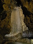
|
Grotte aux Fées | A | 46°08′24″N 7°23′13″E / 46.13994°N 7.38687°E | 6775 | ||
| Hérémence | 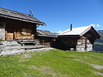
|
Alpage d'Essertse | B | 46°08′54″N 7°23′54″E / 46.14841°N 7.39826°E | 13925 | ||
| Hérémence | 
|
Maison bourgeoisiale | B | 46°10′47″N 7°24′18″E / 46.1798°N 7.40509°E | 6778 | ||
| Hérémence | 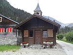
|
Pralong, chapelle St-Barthélemy (intérieur) | B | 46°06′44″N 7°23′51″E / 46.11229°N 7.39742°E | 6779 | ||
| Hérémence | 
|
Mâche/Mâchette | ISOS | 46°09′20″N 7°23′31″E / 46.15556°N 7.39191°E | |||
| Hérémence | 
|
barrage de la Grande-Dixence | A | 46°04′50″N 7°24′14″E / 46.080555555°N 7.403888888°E | 9047 | ||
| Hérémence | 
|
Hérémence | ISOS | 46°11′00″N 7°24′00″E / 46.183333333°N 7.4°E | |||
Inden
| Location | Upload | Photo | Object | Cat. | Coordinates | KGS-Nr | |
|---|---|---|---|---|---|---|---|
| Inden | 
|
Rumeling, Bogenbrücke über die Dala (1539, Ruffiner) | B | 46°20′05″N 7°37′29″E / 46.33473°N 7.62461°E | 6785 | ||
Isérables
| Location | Upload | Photo | Object | Cat. | Coordinates | KGS-Nr | |
|---|---|---|---|---|---|---|---|
| Isérables | 
|
Combe de Teur, groupe de raccards | B | 46°09′59″N 7°14′31″E / 46.16641°N 7.24184°E | 6786 | ||
| Isérables | 
|
Scierie du Vallon de la Fare | B | 46°08′54″N 7°15′44″E / 46.14836°N 7.2621°E | 6787 | ||
| Isérables | 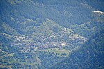
|
Isérables | ISOS | 46°09′52″N 7°14′36″E / 46.164466666°N 7.243383333°E | |||


