nimi ID
sijaitsee hallinnollisessa alueyksikössä sijainti koordinaatit kuva
Alvar Aallon oma talo ja arkkitehtitoimisto (kulttuurimaisema
Helsinki
. Vanha Munkkiniemi . 4665
60°11′48″N 24°52′35″E / 60.19673789°N 24.87643271°E / 60.19673789; 24.87643271
Askola (kunta Suomessa
Askola . . 4935
60°31′40″N 25°36′00″E / 60.52777777777778°N 25.6°E / 60.52777777777778; 25.6
Barönsalmi (salmi kylä
3975
. . Inkoo
59°58′34″N 23°52′41″E / 59.976°N 23.878°E / 59.976; 23.878
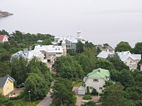
Brändö Villastad (Puutarhakaupunki
Helsinki
. Kulosaari Helsinki
60°10′59″N 25°00′36″E / 60.18293805555555°N 25.01000305555555°E / 60.18293805555555; 25.01000305555555 Upload an image of this heritage site
Dagmarkällanin lähde (kulttuurimaisema
Raasepori . Tammisaari . Raasepori
59°56′36″N 23°22′38″E / 59.94325°N 23.37717°E / 59.94325; 23.37717
Dragsvikin kasarmit (historiallinen sotilaskohde
1202
. Dragsvik . Raasepori
59°59′02″N 23°28′49″E / 59.983785533°N 23.480336791°E / 59.983785533; 23.480336791 Upload an image of this heritage site
Elias Lönnrotin Sammatti (kulttuurimaisema
1353
. . Lohja
Upload an image of this heritage site
Espoo (kaupunki kunta Suomessa
Espoon kartano Kauklahden rautatieasema Espoo Helsingin höyrylaivareittien kesähuvila-asutus . . 33Espoo
60°12′20″N 24°39′20″E / 60.20555555555555°N 24.655555555555555°E / 60.20555555555555; 24.655555555555555
Hangon Itäisen kylpyläpuiston huvila-alue (huvila-alue kaupunkimaisema )
Hanko
. . Hanko
59°49′27″N 22°58′47″E / 59.824047°N 22.979851°E / 59.824047; 22.979851
Hanko (pikkukaupunki kunta Suomessa
Hangon rautatieasema Hangon Länsisatama Hangon Keksin teollisuusrakennukset . . 2083Kudeneule Oy:n tehdasalue
59°49′25″N 22°58′05″E / 59.82361111111111°N 22.968055555555555°E / 59.82361111111111; 22.968055555555555
Hankoniemen sotahistorian kohteet (sotilastukikohta )
Hanko
. . Hanko
Upload an image of this heritage site
Helsingin Kauppatori rajaavine rakennuksineen (kulttuuriperintökohde
4631
. Kruununhaka Helsinki
Helsingin höyrylaivareittien kesähuvila-asutus (huvila-alue
Helsinki
. . Helsinki
Upload an image of this heritage site
Helsinki (pääkaupunki kunta Suomessa
1560Helsinki Malmin rautatieasema Salmisaaren teollisuusalue Katajanokan vanha osa Osuusliikkeiden ja teollisuuden Sörnäinen Tähtitorninmäen observatorio ja puisto Helsingin suomenkielinen työväenopisto Pirkkolan omakotialue ja rintamamiestalot Vallilan asuinalueet
. . Helsinki Torkkelinmäki Helsingin yliopiston keskustakampus Kannelmäen kirkko Vantaanjokisuun vesi- ja viemärilaitokset Östersundomin kartano, kappeli ja Björkuddenin huvila Taka-Töölön kerrostaloalue Käpylän puutaloalueet ja Käärmetalo Eläintarhan huvilat ja yleishyödylliset laitokset Herttoniemen ja Kumpulan siirtolapuutarhat Kansanpuistot Korkeasaari ja Seurasaari
60°10′15″N 24°56′15″E / 60.170833333333334°N 24.9375°E / 60.170833333333334; 24.9375
Hietaniemen hautausmaat (hautausmaa )
Helsinki
. Lapinlahti . Helsinki
Upload an image of this heritage site
Hilding Ekelundin arkkitehtuuri Karjaalla (kulttuurimaisema
Raasepori . . 4501
60°04′17″N 23°40′38″E / 60.071336967°N 23.677215564°E / 60.071336967; 23.677215564 Upload an image of this heritage site
Hinthaaran rautatieasema (rautatieasema )
Porvoo . Hinthaara
60°24′03″N 25°28′51″E / 60.4008°N 25.4808°E / 60.4008; 25.4808
Hyvinkään rautatieasemat (rautatieympäristö
Hyvinkää . . 3962
Upload an image of this heritage site
Inkoo (kunta Suomessa
Inkoo . . 4976
60°02′45″N 24°00′20″E / 60.045833333333334°N 24.005555555555556°E / 60.045833333333334; 24.005555555555556
Inkoon kirkko ja pappila (kirkkomaisema
Inkoo . . Inkoo
60°02′43″N 24°00′06″E / 60.0453°N 24.0017°E / 60.0453; 24.0017 Upload an image of this heritage site
Jakkarilan kartano (kartanoympäristö
129
. Jakari Porvoo
60°24′40″N 25°53′11″E / 60.411°N 25.886388888889°E / 60.411; 25.886388888889
Jokiniemi (Vantaan kaupunginosa
Jokiniemen koelaitos . . 1017
Järvenpää (kaupunki kunta Suomessa
1477
. . Järvenpää Tuusulan reservikomppania
60°28′20″N 25°05′20″E / 60.472222222222°N 25.088888888889°E / 60.472222222222; 25.088888888889
Järvenpään kirkko (kirkko )
4627
. . Järvenpää
60°28′03″N 25°05′22″E / 60.46757033°N 25.08953217°E / 60.46757033; 25.08953217 60°28′03″N 25°05′22″E / 60.4675147°N 25.0895383°E / 60.4675147; 25.0895383
Kabanovin tykkitie (historiallinen tie
3937
. . Siuntio
Upload an image of this heritage site
Kaisaniemen puisto ja kasvitieteellinen puutarha (kaupunkimaisema )
Helsinki
. Kluuvi
Upload an image of this heritage site
Kallio (Helsingin kaupunginosa
2
. . 1586
60°11′03″N 24°56′57″E / 60.184169444444°N 24.949169444444°E / 60.184169444444; 24.949169444444
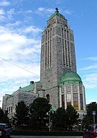
Kallion kirkko (kirkko )
Helsinki Kallio Castréninkatu Itäinen Papinkatu . Linjat . Helsinki
60°11′03″N 24°56′57″E / 60.184166666667°N 24.949166666667°E / 60.184166666667; 24.949166666667 60°11′03″N 24°56′58″E / 60.18415437°N 24.94935954°E / 60.18415437; 24.94935954 60°11′03″N 24°56′58″E / 60.184235°N 24.949349°E / 60.184235; 24.949349 60°11′03″N 24°56′58″E / 60.1842278°N 24.9493341°E / 60.1842278; 24.9493341
Kampinmalmi (Helsingin peruspiiri
Kampinmalmi . . 1561
60°09′55″N 24°56′08″E / 60.165297222222°N 24.935530555556°E / 60.165297222222; 24.935530555556
Kelan seisake (rautatieasema )
Siuntio . . Siuntio
60°06′47″N 24°19′28″E / 60.1131°N 24.3244°E / 60.1131; 24.3244 Upload an image of this heritage site
Keravan rautatieasema (rautatieasema ratapiha
Kerava
. . Kerava
60°24′12″N 25°06′20″E / 60.403333°N 25.105556°E / 60.403333; 25.105556
Keskus (Järvenpään kaupunginosa tilastollinen maantieteellinen alue
Keskus . . 4627
Upload an image of this heritage site
Kirkkonummi (kunta Suomessa
Oitbackan kartano Kirkkonummi . Länsi-Uusimaa Kirkkonummi Kallbådan ja Rönnskärin majakat
60°07′25″N 24°26′20″E / 60.12361111111111°N 24.43888888888889°E / 60.12361111111111; 24.43888888888889
Kirurginen sairaala (sairaala rakennus
11
Kasarmikatu Tähtitorninkatu . Ullanlinna
60°09′42″N 24°56′56″E / 60.161666944444°N 24.948833055556°E / 60.161666944444; 24.948833055556 60°09′42″N 24°56′57″E / 60.161689°N 24.949093°E / 60.161689; 24.949093 60°09′42″N 24°57′00″E / 60.161693°N 24.949899°E / 60.161693; 24.949899
Korson rautatieasema (rautatieasema ratapiha maanpäällinen asema
Vantaa
. . Vantaa
60°21′03″N 25°04′41″E / 60.350833°N 25.078056°E / 60.350833; 25.078056
Kärkelän kuparisulatto (historiallinen teollisuusympäristö
4985
. . Lohja
60°15′40″N 23°36′47″E / 60.261°N 23.613°E / 60.261; 23.613 Upload an image of this heritage site
Lapinjärvi (kunta Suomessa
Lapinjärvi . . Lapinjärven kirkonkylä
60°37′25″N 26°11′50″E / 60.62361111111111°N 26.197222222222223°E / 60.62361111111111; 26.197222222222223
Lohja (pikkukaupunki kunta Suomessa
4824Lohjan kirkko ympäristöineen Nummen kirkonkylä Karjalohjan kirkonkylä Myllymäen torppa Kirkniemen kartano Ojamon rautakaivos ja kartano
. . Lohja
60°15′00″N 24°04′00″E / 60.25°N 24.066666666666663°E / 60.25; 24.066666666666663
Loviisa (pikkukaupunki kunta Suomessa
Ahvenkoski Loviisan linnoitus Loviisa Forsbyn ruukki Loviisan Esplanadi Sarvilahden kartano ympäristöineen Sjögårdin kartano . . 1163Loviisa Tervikin kartano Malmgård Tjusterbyn kartano
60°27′25″N 26°13′30″E / 60.456944444444446°N 26.225°E / 60.456944444444446; 26.225
Loviisan alakaupunki (kaupunkimaisema )
Loviisa . . Loviisa
60°26′59″N 26°13′58″E / 60.449746354°N 26.232760689°E / 60.449746354; 26.232760689 Upload an image of this heritage site
Löparön kartano (kartanoympäristö
Sipoo . . 1545
Upload an image of this heritage site
Marieforsin ruukki ja Kellokosken sairaala (terveydenhuollon rakennus historiallinen teollisuusympäristö
903
. Kellokoski . Tuusula
Upload an image of this heritage site
Michelspiltomin rautatieseisake (rautatieympäristö rautatieasema asemarakennus
Loviisa . . 4240
60°36′56″N 26°01′49″E / 60.6154403°N 26.03021009°E / 60.6154403; 26.03021009 Upload an image of this heritage site
Myrskylä (kunta Suomessa
1521
. . Myrskylä
60°40′10″N 25°51′10″E / 60.66944444444445°N 25.852777777777774°E / 60.66944444444445; 25.852777777777774
Mäntsälä (kunta Suomessa
Saaren kartano Frugårdin kartano ja viljelymaisema . . 101Mäntsälä
60°38′10″N 25°19′10″E / 60.63611111111111°N 25.319444444444443°E / 60.63611111111111; 25.319444444444443
Nurmijärvi (kunta Suomessa
Nurmijärvi Aleksis Kiven Palojoki . . Rajamäen tehdasyhdyskunta, kirkko ja rautatieasema
60°27′45″N 24°48′25″E / 60.4625°N 24.806944444444444°E / 60.4625; 24.806944444444444
Pikkalan kartano (kartanoympäristö kartanon päärakennus
1339
. . Siuntio
60°05′50″N 24°18′07″E / 60.09714°N 24.30197°E / 60.09714; 24.30197
Porvoo (kunta Suomessa kaupunki
Porvoo Yliken kylä Drägsbyn kartano Kulloon kartano . . 2205Porvoo Porvoonjokilaakson kartano- ja kylämaisema Empire-Porvoon puutalokorttelit ja julkiset rakennukset
60°23′35″N 25°39′50″E / 60.39305555555555°N 25.663888888888888°E / 60.39305555555555; 25.663888888888888
Pääkaupunkiseudun I maailmansodan linnoitteet (kaupunkimaisema )
Helsinki . . Helsinki Espoo
Upload an image of this heritage site
Raasepori (kunta Suomessa pikkukaupunki
1203Raasepori Pohjan ruukkiympäristöt Lindön kartano Västankärrin kartano Hankoniemen sotahistorian kohteet Hagenin ja Ramsholmenin puistoalue
. . Raasepori Gullön kartano Tammisaaren vanha kaupunki ja satama Tammisaaren seminaari ja koulukorttelit Pohjankurun rautatieasema ja satama Pohjan kirkonmäki ympäristöineen
59°58′30″N 23°26′10″E / 59.975°N 23.43611111111111°E / 59.975; 23.43611111111111
Riilahden kartano (kartanon päärakennus kartano
Bromarv . Bromarv Bromarv Tenhola Tammisaari
59°57′26″N 23°03′34″E / 59.957222°N 23.059444°E / 59.957222; 23.059444
Senaatintori ympäristöineen (kaupunkimaisema )
Helsinki
. . Helsinki
Upload an image of this heritage site
Sipoo (kunta Suomessa
Nikkilän sairaala . . 1542Sipoo
60°22′37″N 25°15′43″E / 60.37694444444445°N 25.261944444444445°E / 60.37694444444445; 25.261944444444445
Siuntio (kunta Suomessa
1338Siuntio
. . Siuntio Suitian kartano ja Siuntion kirkko
60°08′15″N 24°13′40″E / 60.1375°N 24.227777777777774°E / 60.1375; 24.227777777777774
Skogbyn masuuni ja sahan alue (historiallinen teollisuusympäristö
Raasepori . Skogby
Upload an image of this heritage site
Struven ketju (meridiaanikaari rakennuskompleksi rakennelma
4255
. . Lapinjärvi
52°17′22″N 25°38′58″E / 52.28944444444444°N 25.649444444444445°E / 52.28944444444444; 25.649444444444445
Strömforsin ruukkiyhdyskunta (historiallinen teollisuusympäristö
918
. Ruotsinpyhtää Loviisa
60°31′23″N 26°28′16″E / 60.523°N 26.471°E / 60.523; 26.471 Upload an image of this heritage site
Suomen Pankki, Kansallisarkisto ja Säätytalo (kaupunkimaisema )
Helsinki
. . Helsinki
Upload an image of this heritage site
Suomenlinna (linnoitus merilinnoitus linnoitussaari )
Helsinki
. Suomenlinna . 1569
60°08′37″N 24°59′04″E / 60.143611111111°N 24.984444444444°E / 60.143611111111; 24.984444444444
Suontaan viljelysmaisema (maatalousympäristö
4838
. . Vihti
Upload an image of this heritage site
Suvilahti (historiallinen teollisuusympäristö
Helsinki
. Kalasatama
60°11′11″N 24°58′20″E / 60.186388888889°N 24.972222222222°E / 60.186388888889; 24.972222222222
Svartholman merilinnoitus (linna linnoitussaari )
1518
. . Loviisa
60°22′46″N 26°17′56″E / 60.3794°N 26.2989°E / 60.3794; 26.2989 60°22′46″N 26°17′59″E / 60.379401°N 26.299689°E / 60.379401; 26.299689
Tammisaaren rautatieasema-alue (rautatieympäristö
4009
. . Raasepori
Upload an image of this heritage site
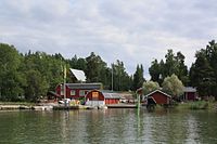
Tammisaaren ulkosaariston kalastajatilat (kalastajakylä
2103
. . Raasepori
Upload an image of this heritage site
Tammisaari (entinen kunta Suomessa
1208
. . Jussaari
59°58′30″N 23°26′10″E / 59.975°N 23.436111111111°E / 59.975; 23.436111111111
Tervikin kartano (kartanoympäristö
Pernaja . Pernaja Pernaja
60°27′30″N 25°56′51″E / 60.4584°N 25.9476°E / 60.4584; 25.9476
Tikkurilan rautatieasema (rautatieasema asemarakennus
Vantaa
. Jokiniemi Tikkurila
60°17′38″N 25°02′42″E / 60.293889°N 25.045°E / 60.293889; 25.045
Träskändan kartano (kartanon päärakennus
Espoo
. Järvenperä
60°14′13″N 24°42′32″E / 60.23694444°N 24.70888889°E / 60.23694444; 24.70888889
Tuomarinkylän kartano (kartanoympäristö kartanon päärakennus
55
Tuomarinkyläntie . Tuomarinkartano . 7
60°15′19″N 24°58′13″E / 60.255181°N 24.970324°E / 60.255181; 24.970324 60°15′19″N 24°58′14″E / 60.2552106°N 24.9704465°E / 60.2552106; 24.9704465
Tuusula (kunta Suomessa
Tuusula Tuusulan Rantatien kulttuurimaisema . . 4835Tuusula
60°24′10″N 25°01′45″E / 60.402777777778°N 25.029166666667°E / 60.402777777778; 25.029166666667
Tähtelä (kylä
Inkoo . . 4975
60°05′17″N 24°01′31″E / 60.08801°N 24.02534°E / 60.08801; 24.02534 Upload an image of this heritage site
Ullanlinnan peruspiiri (Helsingin peruspiiri
1553
. . Kaivopuisto
60°09′31″N 24°56′58″E / 60.1587145°N 24.949404°E / 60.1587145; 24.949404
Vanha Porvoo (kaupunkimaisema kunnanosa
1530
. . Porvoo
60°23′51″N 25°39′28″E / 60.39741°N 25.657818°E / 60.39741; 25.657818
Vanhankaupungin peruspiiri (Helsingin peruspiiri
Vanhankaupungin peruspiiri . . Vanhakaupunki
Upload an image of this heritage site
Vanjärvi (kylä) (kylä
Vihti . . 1511
60°28′00″N 24°15′00″E / 60.46666718°N 24.25°E / 60.46666718; 24.25 Upload an image of this heritage site
Vantaa (kaupunki kunta Suomessa
Helsingin pitäjän kirkonkylä Pääkaupunkiseudun I maailmansodan linnoitteet . . 1506
60°17′40″N 25°02′25″E / 60.29444444444445°N 25.040277777777774°E / 60.29444444444445; 25.040277777777774
Vihdin kirkonkylä (kirkonkylä taajama Suomessa
Vihti . . 4034
60°24′57″N 24°19′36″E / 60.41583333333333°N 24.326666666666668°E / 60.41583333333333; 24.326666666666668
Viikin tutkimustila (oppilaitos maatila
4998Viikki
. . Helsinki
60°13′20″N 25°01′00″E / 60.2223353°N 25.0167237°E / 60.2223353; 25.0167237 Upload an image of this heritage site
Vuorelan koulukoti (oppilaitos koulukoti koulurakennus
Vihti . . Vihti
60°20′46″N 24°16′15″E / 60.346050481°N 24.270850339°E / 60.346050481; 24.270850339 Upload an image of this heritage site
Östersundom (Helsingin kaupunginosa ihmisasutus Helsingin piirijaon osa-alue
Östersundomin kartano, kappeli ja Björkuddenin huvila . . 1544
60°15′30″N 25°11′38″E / 60.2584372196°N 25.1937630773°E / 60.2584372196; 25.1937630773


