Commons:Graphic Lab/Map workshop/Archive/2021
 | This is an archive of past discussions. Do not edit the contents of this page. If you wish to start a new discussion or revive an old one, please do so on the current talk page. |
my first map
-
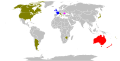
 Map of the world with contries and Britsh homelands in different colors

- Request
- Its my first svg file and my first map for commons. Pleas can someone take a look at this map (bevor I will uplaod similar maps for other years and themes) if it is 1. a correct or good svg file (created with inkscape, using the commons-blank-world-map as source), 2. the nessesary tags are set, 3. if you want, we can also provide hints on the design of the map and the legende. Thanks in advance. --TheRunnerUp (talk) 12:52, 8 January 2021 (UTC)
- Unabhängig von Quellcode usw.:
- Vergiss nicht, Inseln und Außengebiete mit einzufärben, z.B. bei Australien Tasmanien und Melville Island oder bei den USA Alaska und Hawaii. Ob man bei Frankreich auch zum Mutterland zählende Außengebiete mit einfärbt, sollte man zumindest überdenken, unabhängig davon, zu welchem Ergebnis man für sich kommt.
- Ich empfehle, die Farbpalette zu überdenken und sich von RGB-Grundtönen wie diesem unschönen Grün zu abschieden. Mischtöne sind für das Auge in der Regel angenehmer, weil natürlicher. Der Schwarzton ist zwar der stärkste Kontrast, der möglich ist, aber er hat keine Signalwirkung. Nur ein Land wird schwarz. Wenn es ein kleines Land wird (z.B. Belgien, aber auch schon hier mit England wird es sichtbar), ist der Gastgeber verhältnismäßig schwer zu finden. Gelb ist grundsätzlich keine gute Wahl, wenn eine gelbe Fläche an eine weiße stoßen wird, weil sich die Flächen dann nicht gut voneinander erkennen lassen. Sollte ein Inselstaat gelb werden, ist er für den Leser praktisch weg, ähnlich schon bei Südkorea, das an drei Seiten von Wasser umgeben ist. NNW 15:38, 9 January 2021 (UTC)
- Danke für die Tipps! Alaska und Tasmanien habe ich schon dazugefügt, bei Frankreich und Niederlande lasse ich die Überseegebiete jedenfalls weg (sonst schauts aus, als ob auch eine weitere Südamerikansiche Mannschaft teilgenommen hat). Grün und schwarz werde ich noch ändern; gelb lasse ich so, da kommen im laufe der Jahre immer mehr Länder dazu, sodass es eine unauffällige Farbe sein soll), aber ich werde alle grau abgrenzen, so wie ich es innhalb Europas (und bei einem anderen Versuch mit den Solomn Inseln) schon gemacht habe. --TheRunnerUp (talk) 17:21, 9 January 2021 (UTC)
- TheRunnerUp I have some more general thoughts for you. On my user page I have put some links which I find useful when doing graphic work here. In the 'tools' column you find links to W3C validator so that the code of the file is correct. In Inkscape use the Clean up document and then save it as optimized svg. Most often I have unchecked all boxes as that (for me) works best.
- I try as much as possible to make my graphic work here also function for people with color blind problems. Search for pallets to use, the fewer colors the easier. When it's complex work you have to use different patterns as well. If you export your work from Inkscape as a png file you can check in gimp how it will look for people with those problems: View/Display Filters.../Color Deficient Vision.
- In File information use Captions as that is searchable outside of commons, in any search engine. Look at what other people do, search and read. --Goran tek-en (talk) 17:50, 15 January 2021 (UTC)
- TheRunnerUp Also you should think about in which size you create your work. When we create graphic work we just don't do it for one specific usage, we make it available to the whole word and we can't know how it will be used. Often when used in a project within wikimedia it's used as thumbnail which when clicked on gives you the full image size. The map you have created is for me all to big, you can only view a small portion of it when looked at 100%. A common screen size is 1920*1080 or around. Most windows doesn't cover the full screen so maybe 800-1000 px in width is what you often view. Also when you have a very large drawing and a thumbnail is maybe 200 px wide it's really difficult to be able to see anything. It's always a problem with thumbnails because many editors wants the graphic work to be visible in detail which is almost impossible to achieve. As Inkscape is a svg tool we don't need to make the drawing so large in pixels as it enlarges with out any losses. Still, when you enlarge very much you will have other problems with relations between objects. So it's best if one can work on a size where the work is visible as you want it to be in 100% on a common screen and there I have found 600-800px high works pretty well mostly. Some times there are specific demands for any reason. --Goran tek-en (talk) 18:12, 15 January 2021 (UTC)
- Thanks for the hints. --TheRunnerUp (talk) 17:49, 26 January 2021 (UTC)
- TheRunnerUp Also you should think about in which size you create your work. When we create graphic work we just don't do it for one specific usage, we make it available to the whole word and we can't know how it will be used. Often when used in a project within wikimedia it's used as thumbnail which when clicked on gives you the full image size. The map you have created is for me all to big, you can only view a small portion of it when looked at 100%. A common screen size is 1920*1080 or around. Most windows doesn't cover the full screen so maybe 800-1000 px in width is what you often view. Also when you have a very large drawing and a thumbnail is maybe 200 px wide it's really difficult to be able to see anything. It's always a problem with thumbnails because many editors wants the graphic work to be visible in detail which is almost impossible to achieve. As Inkscape is a svg tool we don't need to make the drawing so large in pixels as it enlarges with out any losses. Still, when you enlarge very much you will have other problems with relations between objects. So it's best if one can work on a size where the work is visible as you want it to be in 100% on a common screen and there I have found 600-800px high works pretty well mostly. Some times there are specific demands for any reason. --Goran tek-en (talk) 18:12, 15 January 2021 (UTC)
- TheRunnerUp I have some more general thoughts for you. On my user page I have put some links which I find useful when doing graphic work here. In the 'tools' column you find links to W3C validator so that the code of the file is correct. In Inkscape use the Clean up document and then save it as optimized svg. Most often I have unchecked all boxes as that (for me) works best.
UploadWizzard - color "white"
-
 ok
ok -
 white areas are black at the version of 10:07, 15. Jan. 2021
_participating_nations.svg)
_results.svg)
Article(s): [[]]
- Request
- What is here the problem? I made an upload with UploadWizzard of the first map (created with inkscape, using the commons-blank-world-map as source) anc all is fine. I made an upload of the second map (only some colors - but not white - have been changed from grey to a color or from a color to grey) and all white areas become black (Version with time stamp 10:07, 15. Jan. 2021).
- As a first workaround I changed the color white from FFFFFF to FEFFFF (which looks nearly white but is not really white) to get a useable result at the moment, but this is not a good solution.
- What did I make wrong and how correct it? --TheRunnerUp (talk) 11:56, 15 January 2021 (UTC)
- Graphist opinion(s)
TheRunnerUp If you download that version with black and open it in a text editor (not an advanced writer) and turn on Line number. Start to mark from line 16 '<path id="ocean" class="oceanxx"' down thru line 20 'sodipodi:insensitive="true" />' and cut that out. Go down to line 222 which should end with '</style>'. Put your marker after that and make a new line and paste your content, Save as with new name. At this SVG checker you can check files. If it doesn't load click 'Commons SVG Checker is not loading? Click here!' Use the Upload file and first you can check the downloaded 'black' file, Execute SVG check... and it will show below. Now check the new 'white' one. For me it works.
Why that code peace has moved I don't know but the other file '1987' has that code peace in this position so something must have happened. --Goran tek-en (talk) 19:08, 15 January 2021 (UTC)
- Thank you for your hints. I will do these edits in the next days. But in general I think the problem is not my svg file, but the viewer in Wikimeida/wikipedia. When I open the file in inkscape th wiht background is ok, when I open it in firefox or edge it is ok ... only at commons on i.e. de-wikipedia it is shown incorrect. --TheRunnerUp (talk) 17:48, 26 January 2021 (UTC)
- TheRunnerUp There are many issues with rendering svg files on wikimedia but that is something we have to live with, check Help:SVG and other places for information. --Goran tek-en (talk) 12:41, 2 February 2021 (UTC)
- Thank you for your hints. I will do these edits in the next days. But in general I think the problem is not my svg file, but the viewer in Wikimeida/wikipedia. When I open the file in inkscape th wiht background is ok, when I open it in firefox or edge it is ok ... only at commons on i.e. de-wikipedia it is shown incorrect. --TheRunnerUp (talk) 17:48, 26 January 2021 (UTC)
![]() Done --Goran tek-en (talk) 15:57, 20 January 2021 (UTC)
Done --Goran tek-en (talk) 15:57, 20 January 2021 (UTC)
History of poll tax as a condition to voting
-
 Poll tax history

Article(s): en:Women's poll tax repeal movement
- Request
- This article was recently promoted to Featured Article and is scheduled to be presented on the main page for 8 March. I had requested help at the en.WP map workshop, but the request was archived without anyone taking it. One of the reviewers found the above map, but I'd like to have a derivative but separate image of the GIF, tailored to specifically address only poll taxes which applied as prerequisites to voting in the US. (In other words, leave the original GIF as it is, but create a new GIF based upon it.) A discussion of what is needed, along with sourcing, is here: en:Talk:Women's poll tax repeal movement#GIF
- Can the title be "History of poll tax as a condition to voting"?
- Can we add and remove parts of the GIF as indicated in the discussion?
- Can we change the colors as indicated in the discussion?
- Can you slow down the time increment so that people have the opportunity to read the text?
It would be fabulous if the GIF could be completed before it is scheduled to run on the main page. Thank you so much for any help. SusunW (talk) 13:41, 4 February 2021 (UTC)
- Graphist opinion(s)
Ghana, Benin, Burkina Faso - Locator (orthographic projection) svg
-
Description of first image
Article(s): Dagbani Wikimedians User Group
- Request
- Hi! I would like a Ghana, Benin, Burkina Faso Locator (orthographic projection) svg such as this. Thank you! --—M@sssly✉ 09:04, 6 March 2021 (UTC)
- Graphist opinion(s)
Masssly - ![]() Done – File:Ghana Benin Burkina Faso Locator (orthographic projection).svg
Done – File:Ghana Benin Burkina Faso Locator (orthographic projection).svg
- Thanks! —M@sssly✉ 17:13, 11 March 2021 (UTC)
Vellar River basin map
Article(s):
- en:Vellar River (Northern Tamil Nadu), although it may also have use for any of the tributary articles.
- Request
- Reposting a request from the Wikipedia map workshop here. A map depicting the drainage basin of the Vellar River. A map like this is the ideal thing. Names and courses of rivers, basin boundaries, water bodies, a small inset that contextualizes the basin, and district borders if possible. Be warned, the Vellar River system is larger and more complex than the example river system. I am still doing research to revamp the article, so don't worry about river/tributary names for now, as I'm still gathering the info. However, for reference maps that show courses, borders, and water bodies, here are sources 1 and 2 (p. 1 and 5). Thanks for any help, feel free to reach me on my talk page, or mention me here, with any questions. Starkenborgher (talk) 14:18, 5 March 2021 (UTC)
- Graphist opinion(s)
Starkenborgher You can close the request at the Wikipedia map workshop.
It would have helped if you used the "Make a new request" link at the top as it provides us with all the code we need. I added the code here below.
First we will have to decide on the overall area of the map so I will start with that and get back to you. --Goran tek-en (talk) 11:46, 6 March 2021 (UTC)
![]() Request taken by Goran tek-en (talk) 11:46, 6 March 2021 (UTC)
Request taken by Goran tek-en (talk) 11:46, 6 March 2021 (UTC)
| Extended content |
|---|
Goran tek-en Omitting the indent to free up space for new indents since its just us communicating. The basin borders in red look good, but there is the one spot where they are disconnected in kind of the bottom middle where the red line that reaches up to the main river and goes with one of the dashed lines should probably be moved left a little bit so the borders meet at the meeting place of the three rivers. I think you might have gotten the district borders a bit off and maybe used the roads which are in tan colors as district borders. No problem, the zoom and lines on that source I most recently gave can be hard to deal with. Figure 3 on page 4 of this source would probably be easier to use to interpret district borders. My mistake for not mentioning it earlier, I forgot. Lastly, if you could add lines for the tributaries of river 10 that come in from the left on Figure 6 of page 5 from that same source. Other than these things, the map looks great, and I'll be working on finishing up the river names. Thanks again. Starkenborgher (talk) 13:55, 9 March 2021 (UTC)
|
- Starkenborgher Draft-3, check it.
- I have just put out one name for you to see that if we put out all of them it will totally pack the map, it will be very hard to fit them. So to me we can either just put out the numbers and then have the names in a legend in the description section or it can be on the side of the map (included with the map). Or reduce the amount of names, or some names (most important) in the map by the rivers and the rest in legend.
- Do you want the different basins areas colored or just borders? --Goran tek-en (talk) 13:14, 11 March 2021 (UTC)
- Goran tek-en I think the best option is to name the rivers within the map in a legend on the side. Keeping the sub-basins as borders and not colored is fine. Removing the numbers for the rivers that I could not find names for would probably unclog the map to a degree and make it easier to understand. Additionally, if you could add numbers for the tributaries that were added to river 10, they all do have names, and to keep it concise I can provide them here. From top left to bottom right its 1. Chittar River 2. Manjini River 3. Ellar River and 4. Vadgarai River. Thanks.
Actually, if you could include the names for some rivers on the map too, that would be good. Just the Vellar, Manimuktha, Gomukhi, Anaivari, Vellar or Vasishta, Chinnar, and Swetha need to be labeled on the map, the others can be in a legend on the map with numbers.Starkenborgher (talk) 18:54, 11 March 2021 (UTC)- Starkenborgher Draft-4. --Goran tek-en (talk) 22:42, 11 March 2021 (UTC)
- Goran tek-en Thanks, you’ve been extremely helpful and the final product looks great. Just needs to be uploaded to commons, which I should be able to handle. Starkenborgher (talk) 20:04, 12 March 2021 (UTC)
- Starkenborgher Draft-4. --Goran tek-en (talk) 22:42, 11 March 2021 (UTC)
- Goran tek-en I think the best option is to name the rivers within the map in a legend on the side. Keeping the sub-basins as borders and not colored is fine. Removing the numbers for the rivers that I could not find names for would probably unclog the map to a degree and make it easier to understand. Additionally, if you could add numbers for the tributaries that were added to river 10, they all do have names, and to keep it concise I can provide them here. From top left to bottom right its 1. Chittar River 2. Manjini River 3. Ellar River and 4. Vadgarai River. Thanks.
- Starkenborgher Draft-3, check it.
Starkenborgher No you can't upload it because the draft is not the svg file, so stop.
I will need the following;
- Name of the file
- Description (/language)
- Captions/s (/language)
- Category/ies at commons
to be able to upload it at commons. If you don'y know about Captions read here.
Also it is up to the graphic worker to put out {{done}} then the requester puts out {{section resolved|1=~~~~}}. --Goran tek-en (talk) 20:48, 12 March 2021 (UTC)
- Goran tek-en Sorry. I'm not that experienced with commons, and I was just trying to be helpful. The name can be "Vellar River basin map". Description: A map of the river system and drainage basin of the Vellar River, in Tamil Nadu, India. Names of major tributaries are included in the map, and the legend provides names of more minor tributaries in the system, that correspond to numbers on the map. Caption: Map showing the basin of the Vellar River and its tributaries. Both in English, I guess. If it is going in as an SVG, which maybe it isn't, the one category I can think of is SVG maps of Tamil Nadu. Thanks again. Starkenborgher (talk) 18:49, 13 March 2021 (UTC)
- Starkenborgher I should have been more specific that the uploaded file will be in svg, it's just the drafts I show that are in png. Now you can find it here file:Vellar River basin map.svg. If you are happy with this please put the code
{{section resolved|1=~~~~}}on this request so it can be archived. This piece of code activates the automatic archiving here at graphic lab, thanks. Done --Goran tek-en (talk) 13:27, 14 March 2021 (UTC)
- Starkenborgher I should have been more specific that the uploaded file will be in svg, it's just the drafts I show that are in png. Now you can find it here file:Vellar River basin map.svg. If you are happy with this please put the code
Alte Fahrt (Müritz)
-
 Bolter Kanal und Alte Fahrt

Articles:
- Request
- Would somebody not be afraid of making a new map of these waters and canals? --Mehlauge (talk) 08:28, 15 February 2021 (UTC)
- Graphist opinion(s)
Mehlauge I will need your help on this so I will ping you later, ![]() Request taken by Goran tek-en (talk) 17:36, 29 March 2021 (UTC)
Request taken by Goran tek-en (talk) 17:36, 29 March 2021 (UTC)
- Great! I am not an expert but I live in Plau am See and good local friends will be eager to help. Thank you very much in advance.--Mehlauge (talk) 17:54, 29 March 2021 (UTC)
| Extended content |
|---|
@Goran tek-en: Please note

Thank you.--Mehlauge (talk) 16:24, 5 April 2021 (UTC)
|
- the Havelquellgebiet (Havel spring) is a science in its own right. We don't need details. Neustrelitz is useful.
- the Elde spring is bottom left.
- the pink marking of the Alte Fahrt is excellent
- how about one or two arrows bottom right: → Oder/Stettin and Oranienburg/Berlin ? That's what the canals, locks and lakes were all about.
--Mehlauge (talk) 18:06, 5 April 2021 (UTC)
- Mehlauge About 4. I have zero knowledge. What is it you want to mark out, where is/was it, why etc. --Goran tek-en (talk) 16:57, 7 April 2021 (UTC)
- @Goran tek-en: The geostrategic function of the Müritz–Havel–Oder waters was to link Mecklenburg with Berlin and Stettin. Still today Stettin is the most important harbour for Berlin, ahead of Hamburg!--Mehlauge (talk) 09:42, 11 April 2021 (UTC)
- Mehlauge Draft-6. --Goran tek-en (talk) 12:51, 11 April 2021 (UTC)
- Mehlauge Could you please give me feedback on Draft-6, so we can finish this, thanks. --Goran tek-en (talk) 13:47, 21 April 2021 (UTC)
- @Goran tek-en: Excuse me. I hoped to get an old map of the Alte Fahrt from the Landesarchiv Schwerin. Unfortunately it is not free. I think we can publish the drawing. Thank you very much.--Mehlauge (talk) 14:43, 21 April 2021 (UTC)
- Mehlauge Could you please give me feedback on Draft-6, so we can finish this, thanks. --Goran tek-en (talk) 13:47, 21 April 2021 (UTC)
- Mehlauge Draft-6. --Goran tek-en (talk) 12:51, 11 April 2021 (UTC)
- @Goran tek-en: The geostrategic function of the Müritz–Havel–Oder waters was to link Mecklenburg with Berlin and Stettin. Still today Stettin is the most important harbour for Berlin, ahead of Hamburg!--Mehlauge (talk) 09:42, 11 April 2021 (UTC)
Mehlauge I will need the following;
- Name of the file
- Description (/language)
- Captions/s (/language)
- Category/ies at commons
to be able to upload it at commons. If you don'y know about Captions read here.--Goran tek-en (talk) 17:38, 21 April 2021 (UTC)
- Name of the file: Canals Müritz–Mirow
- Description: English: This sketch shows the former Alte Müritz and the newer Müritz–Mirow canal. They link the Elde river and the Müritz with the water ways to the Oder (Stettin) and to Berlin.
- Captions/s: ? (might follow)
- Categories: Category:Maps of Landkreis Mecklenburgische Seenplatte, Category:Alte Fahrt (Müritz) --Mehlauge (talk) 09:20, 24 April 2021 (UTC)
- Mehlauge Now you can find it here file:Canals Müritz–Mirow.svg. If you are happy with this please put the code
{{section resolved|1=~~~~}}on this request so it can be archived, thanks. Done --Goran tek-en (talk) 13:21, 24 April 2021 (UTC)
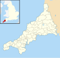
Duchy of Cornwall
-
 Misspelled key on a map

Article(s): en:Duchy of Cornwall
- Request
- Please correct the obvious misspelling on File:Duchy of Cornwall.svg. Thank you. --Celia Homeford (talk) 08:47, 27 April 2021 (UTC)
- Graphist opinion(s)
![]() Done Celia Homeford: I have uploaded a new version with the correction. Rcsprinter123 (talk) 00:55, 29 April 2021 (UTC)
Done Celia Homeford: I have uploaded a new version with the correction. Rcsprinter123 (talk) 00:55, 29 April 2021 (UTC)
Cornwall electoral divisions
-
 Cornish electoral division boundaries from 2013
 -
 Boundary map from 2021
.svg)

Article(s): en:List of electoral divisions and wards in Cornwall plus some pages in en:Category:Electoral divisions of Cornwall Council
- Request
- Old map of Cornish electoral divisions (see gallery) needs to be updated for the boundary changes in 2021. New boundaries can be found here. Let me know if there's anything else needed and I can try and find it. Thanks, Gazamp (talk) 11:38, 19 April 2021 (UTC)
- Update: Have managed to make a blank version of File:2021 Cornwall Council election.svg. If someone could help by adding Devon and a UK map similar to the 2013 version that'd be great. Thanks, Gazamp (talk) 13:45, 8 May 2021 (UTC)
- Managed to edit another map to make what I needed. Gazamp (talk) 17:31, 11 May 2021 (UTC)
- Graphist opinion(s)
Change Color Map

Article(s): en:Abortion law
- Request
- Change Thailand to blue per en:Abortion in Thailand --JMKTIN (talk) 08:20, 28 January 2021 (UTC)
- Graphist opinion(s)
- Resolved.
Tagging it as "Resolved" because at the time https://upload.wikimedia.org/wikipedia/commons/archive/a/a5/20210210060114%21Abortion_Laws.svg later changed to https://upload.wikimedia.org/wikipedia/commons/archive/a/a5/20210214010434%21Abortion_Laws.svg , so the request has been fulfilled. --Donald Trung 『徵國單』 (No Fake News 💬) (WikiProject Numismatics 💴) (Articles 📚) 20:25, 17 June 2021 (UTC)
- This section was archived on a request by: Donald Trung 『徵國單』 (No Fake News 💬) (WikiProject Numismatics 💴) (Articles 📚) 20:25, 17 June 2021 (UTC)
-
 Extradition map PH

Article(s): en:Extradition law in the Philippines
- Request
- Three countries mentioned in the Wiki article, India, Russia and the UK, are not colorized in this map. Requesting for someone to fill in those countries. Thank you in advance. Howhontanozaz (talk) 09:11, 18 February 2021 (UTC)
- Graphist opinion(s)
Howhontanozaz: ![]() Done – I hope it was right to fill these countries in red. Rcsprinter123 (talk) 18:41, 18 February 2021 (UTC)
Done – I hope it was right to fill these countries in red. Rcsprinter123 (talk) 18:41, 18 February 2021 (UTC)
No reactions since February 2021, and the original requestor didn't seem to mind the colour options. Tagging the section for archiving. --Donald Trung 『徵國單』 (No Fake News 💬) (WikiProject Numismatics 💴) (Articles 📚) 20:20, 17 June 2021 (UTC)
- This section was archived on a request by: Donald Trung 『徵國單』 (No Fake News 💬) (WikiProject Numismatics 💴) (Articles 📚) 20:20, 17 June 2021 (UTC)
Confirm which ones are lossless from the PNG original?
Article(s): (none speaking)
- Request
- I wanted to add this map, and I thought converting from the TIFF original would have the best color quality and overall quality. The TIFF master is here. I first used a web-based program to do #1, but I tried another PC-based program with #2, only to get what may be a loss of color. Are either lossless from the TIFF original or is there something I should do? Thanks --WhisperToMe (talk) 03:02, 8 March 2021 (UTC)
- Graphist opinion(s)
@WhisperToMe: I guess the most straight forward and less invasive method is to open and export in Gimp or similar. I have no idea what kind of tools/libraries the web based or pc based tools are using. I actually don't know 100% that Gimp is not doing anything without telling me but I don't think so. I have exported a png version which you can download from here. I hope this helps you. --Goran tek-en (talk) 16:38, 14 March 2021 (UTC)
- @Goran tek-en: Thank you so much for doing that! I wasn't using GIMP but I will try doing that from this time forward WhisperToMe (talk) 16:44, 14 March 2021 (UTC)
- @WhisperToMe: So you can close this now. Done --Goran tek-en (talk) 16:52, 14 March 2021 (UTC)
- @WhisperToMe: So you can close this now.
Adding the template below as the requestor used "the wrong template" that isn't read by the archiving bot. --Donald Trung 『徵國單』 (No Fake News 💬) (WikiProject Numismatics 💴) (Articles 📚) 20:19, 17 June 2021 (UTC)
- This section was archived on a request by: Donald Trung 『徵國單』 (No Fake News 💬) (WikiProject Numismatics 💴) (Articles 📚) 20:19, 17 June 2021 (UTC)
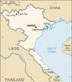
1993 Georgia map
-
 Map of conflicts in Georgia in 1993

- Request
- please change text from "Russian naval action in support of the Georgian defence" to "Evacuation of Georgian civilians by the Russian Navy" as sources report only evacuation and not any military help.
- Human Rights Watch report, en:Talk:Georgia_(country)#1993_conflict_map --Alaexis (talk) 05:54, 16 March 2021 (UTC)
- Graphist opinion(s)
![]() Done – version with new text is uploaded. Rcsprinter123 (talk) 21:03, 16 March 2021 (UTC)
Done – version with new text is uploaded. Rcsprinter123 (talk) 21:03, 16 March 2021 (UTC)
Tagging this section as "![]() Resolved" because as far as I can tell the request has been fulfilled by a Wikicartographer and is used. Furthermore, there have been no further replies and / or requests since March 2021. --Donald Trung 『徵國單』 (No Fake News 💬) (WikiProject Numismatics 💴) (Articles 📚) 20:39, 17 June 2021 (UTC)
Resolved" because as far as I can tell the request has been fulfilled by a Wikicartographer and is used. Furthermore, there have been no further replies and / or requests since March 2021. --Donald Trung 『徵國單』 (No Fake News 💬) (WikiProject Numismatics 💴) (Articles 📚) 20:39, 17 June 2021 (UTC)
- This section was archived on a request by: Donald Trung 『徵國單』 (No Fake News 💬) (WikiProject Numismatics 💴) (Articles 📚) 20:39, 17 June 2021 (UTC)
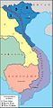
Map of the Nùng Autonomous Territory, French Indo-China
-
 The map on which the awesome Reddit map is based.
 -
 Its location in a modern map.
 -
 A concept map, I'm not really good at drawing up the borders using Microsoft Paint and this "base map" so I added the legends. The notes at the bottom aren't for copying to the "finished" map.
 -
 An approximation of the borders of the Hải Ninh Province.
 -
 Finished map.
.jpg)

.png)
_OpenStreetMap.png)

Article(s): en:Nùng Autonomous Territory
- Request
- I found this awesome map of the Nùng Autonomous Territory on Reddit. This map is a faithfully inspired version of a public domain map (in French) issued during the 1940's or early 1950's. The problem with the Reddit map is that its copyright © status is incompatible with Wikimedia Commons so I can't use it. If possible I would like for a WikiGraphist to create a map similar to "the Reddit map". --Donald Trung 『徵國單』 (No Fake News 💬) (WikiProject Numismatics 💴) (Articles 📚) 20:17, 26 April 2021 (UTC)
- Graphist opinion(s)
Donald Trung I can help you but a would need a link in OSM or similar to show me the location of this area. The article you linked to doesn't either have a location for this, should it not have that. Not everyone knows this. --always ping me-- Goran tek-en (talk) 17:52, 6 June 2021 (UTC)
- @Goran tek-en: , I added its location. --Donald Trung 『徵國單』 (No Fake News 💬) (WikiProject Numismatics 💴) (Articles 📚) 18:57, 6 June 2021 (UTC)
![]() Request taken by --always ping me-- Goran tek-en (talk) 16:00, 7 June 2021 (UTC)
Request taken by --always ping me-- Goran tek-en (talk) 16:00, 7 June 2021 (UTC)
| Extended content |
|---|
File name: "File:Map of the Nùng Autonomous Territory" File caption: A political map of the Nùng Autonomous Territory based on a map its government's official information book. File description: A political map of the Nùng Autonomous Territory based on a map its government's official information book. Categories: "Category:Maps of the Nùng Autonomous Territory". I will update this when I have time. --Donald Trung 『徵國單』 (No Fake News 💬) (WikiProject Numismatics 💴) (Articles 📚) 18:29, 8 June 2021 (UTC)
List of names
This is the Đình Lập Distict (in the current Lạng Sơn province).
Line break for reasons explained below@Goran tek-en: , I don't have a Vietnamese keyboard on this phone and couldn't find a list to import all these names from. You can just create the map without the diacritical marks for the cities (Just use the above for now) and I will ask another Wikicartographer to add the correct tones and accents. --Donald Trung 『徵國單』 (No Fake News 💬) (WikiProject Numismatics 💴) (Articles 📚) 11:15, 9 June 2021 (UTC)
|
- Donald Trung Thank you ever so much for the list of names, it helps me a lot.
- When maps are created here at commons we try to stick to Maps template-en so that a map created by someone is similar to what another graphic worker creates. So I try to stick to that regarding borders and so on.
- I will show you a draft here and before I continue I really need your help here. This draft is created from OSM with today's coastlines and borders. The two maps you provided are sketchy compared to OSM, also in other proportions so they are hard to work from and there are some really big differences. To me the borders of interprovincial and interdistrict must have changed since then. So I would need a good map with the borders or I have nothing to go from. Don't think about colors or stuff like that, right now we have to get the borders correct. Draft-2. --always ping me-- Goran tek-en (talk) 17:32, 11 June 2021 (UTC)
- @Goran tek-en: , yes, the borders of the Hải-Ninh Province / Quảng Ninh Province have changed a lot since the 1940's (when the original map was made), two districts belonging to the Hải-Ninh Province during the French Protectorate of Tonkin were transferred to the Lạng Sơn Province during the later years of the Democratic Republic of Vietnam (North Vietnam). I used the "colours" to indicate what wẵs where in the Reddit map. Nungmapist (or however the Reddit user was called, BNungcartography or Nungcartographer) based their map on the public domain one that is now on Wikimedia Commons. Unfortunately I don't really have access to any French or Vietnamese atlasses from the 1940's other than that map. Your borders are mostly right, but fail at the border with the Lạng Sơn province, I probably should have noted from the beginning that the Hải-Ninh Province consisted of more than just the modern-day Quảng Ninh Province. Wikipedia does lists all these administrative transfers... BUT... there are no visualisations to make it easier for us. I will look for more information and will come back to you once I found a better way to verbalise the administrative border changes. --Donald Trung 『徵國單』 (No Fake News 💬) (WikiProject Numismatics 💴) (Articles 📚) 19:06, 11 June 2021 (UTC)
- Donald Trung Thank you ever so much for the list of names, it helps me a lot.
| Extended content |
|---|
|
This was a bad idea, I should have used thebOpenStreetMapbsoftware. I thought that Google Maps could have been a good reference, but id you can't use it at all then it does not have much need here. --Donald Trung 『徵國單』 (No Fake News 💬) (WikiProject Numismatics 💴) (Articles 📚) 23:04, 11 June 2021 (UTC) Relevant Google Maps linksI'm going to use Google Maps because it actually shows administrative divisions quite well.
Error, edit not saved. - The text you wanted to publish was blocked by the spam filter. This is probably caused by a link to a forbidden external site. The following text is what triggered our spam filter:goo.gl/qXmVnU8WeNADKgfu5. If the url used is a url shortener/redirect, please use the full url in its place, for example use flickr.com rather than flic.kr. Where you are trying to upload an image found at Google, please read our page Commons:Licensing.", so I am going to add nowiki-tags.
--Donald Trung 『徵國單』 (No Fake News 💬) (WikiProject Numismatics 💴) (Articles 📚) 19:11, 11 June 2021 (UTC)
|
I will use OpenStreetMap. --Donald Trung 『徵國單』 (No Fake News 💬) (WikiProject Numismatics 💴) (Articles 📚) 23:04, 11 June 2021 (UTC)
- @Goran tek-en: , from what I can tell only the Đình Lập Distict (same name for its capital city) was moved to another province. The rest all largely coincide. The only actually wrong borders from your map are the northwestern ones. I will try to see what I can do with OpenStreetMap for the borders. --Donald Trung 『徵國單』 (No Fake News 💬) (WikiProject Numismatics 💴) (Articles 📚) 23:06, 11 June 2021 (UTC)
@Goran tek-en: , this district used to be a part of the Hải-Ninh Province during the 1940's until 1960's. --Donald Trung 『徵國單』 (No Fake News 💬) (WikiProject Numismatics 💴) (Articles 📚) 10:33, 12 June 2021 (UTC)
- Donald Trung Sorry I don't understand, I have zero knowledge. I need you to download my latest draft, mark the border which is wrong, make a screen print from OSM, in circle the correct border and show them to me. You really have to clear up some space at your drive so we can work together. Big disk' are not so expensive no so you can free up space. --always ping me-- Goran tek-en (talk) 14:29, 12 June 2021 (UTC)
@Goran tek-en: , I added a map above. I was such an idiot, I used the modern Quảng Ninh Province as a reference, but Between 1906 and 1963 Hải Ninh was a separate province from Quảng Yên, which explained why modern maps are useless. I made an approximation of the borders using the OpenStreetMap software above. I hope that this will be enough for you to work with. The red borders are the borders of the Hải Ninh Province and its Districts. I hope that you have enough information now to make a map of the Hải Ninh Province in Tonkin, French Indo-China. --Donald Trung 『徵國單』 (No Fake News 💬) (WikiProject Numismatics 💴) (Articles 📚) 07:24, 13 June 2021 (UTC)
- Donald Trung We agreed on the area the map should cover but to me it seems as it's to small?
- Check the different areas, don't think about the colors right now, Draft-3. --always ping me-- Goran tek-en (talk) 19:39, 13 June 2021 (UTC)
- @Goran tek-en: , yes, it is fine. Excuse me for not having the request in order when I filed it, it is the first time that I've worked with a map request and honestly I thought that someone would be able to "re-work the Reddit map", but your map looks fine, it just needs to be slightly zzoomed out. My issue is that I checked the English-language Wikipedia for the province which redirected it to Quảng Ninh Province so I just assumed that Hải-Ninh Province was renamed rather than merged, so I got the wrong area. As a final note, it is likely a good idea to exclude the scale from the original map. Also, probably use "Mãn" instead of "Miền" in the pie chart, as it was the contemporary term used by the Hải-Ninh Province government and is used in the literature. --Donald Trung 『徵國單』 (No Fake News 💬) (WikiProject Numismatics 💴) (Articles 📚) 19:50, 13 June 2021 (UTC)
- Donald Trung
- The colors are picked to work with many people with color deficiency.
- The reason I choose to make the pie chart in grey is because it could so easily be confused with the colors of the map.
- I miss two city names in the dark pink area and also one in the yellow area.
- In the pie chart I also miss some words.
- In the reddit map there is an island which is divided above Vinh Thuc island but I can't find any such island on the OSM map.
- The border between Bac Giang and Lang Son seems wrong to me.
- For most of the cities I had to guess there location so check them also.
- Regarding the reddit map, we can't "copy" a map which is not free, we can only use it as information. Besides, I think that map is bad. Of course it shows what you want but as an "illustration" (which is how I see maps) it's not nice. To me the coastline and rivers are important to get a feel of how the country might be.
- Draft-4. --always ping me-- Goran tek-en (talk) 20:28, 15 June 2021 (UTC)
- Donald Trung
Comments on Draft number 4
- @Goran tek-en: , first of all excuse me for the late reply as I didn't seem to get a notification 🔔 about the ping. I'm not really that concerned about the colours as I am sure that your vision of the colours are fine as Wikipedia must think of maximum accessibility. Regarding your comments and questions.
1. I understand your decision, I had no preference for any colours, if you would've chosen to make Hải Ninh a single colour I would have respected your decision.
2. I understand your reasoning, in the public domain map the inverse is true, the pie chart is coloured and the entire map is yellow.
3. Those are (will add them on my other phone with a Vietnamese keyboard). Lục Hồn (yellơw area), Bản Guốn (top dark pink), Bình Xá (bottơm dark pink).
4. You missed "Thổ" ("Thao" in Draft-4) and "Chinese Nung" = "Chinese Nùng". Also, you can make the words "Ethnic groups" on the top of the pie chart bold to make it stand out from the actual names of the ethnic groups.
5. Ghost Island (👻🏝), ignore it! The Redditor adopted it from the original 1940's/1950's Nùng Autonomous Territory government map, it does not exist in real life!!!
6. It is wrong! Bắc Giang extends further north taking the entirety of the river. The river that reaches Hải-Ninh Province's Đình Lập District. For reference, you can use the yellow line on "my map" above as a reference for its border with the river and the other province, rather than the contemporary borders in the Socialist Republic of Vietnam.
7. Most of these cities changed their names and neither the original map nor the Reddit map based on it provide accurate locations (literally the reason people make maps in the first (1st) place), I would advise just not putting any dots for those places, maybe they are even just names for regions. I really don't know as those maps are my only real reference and many places seem to have been renamed in the many decades that have passed.
8. I never meant for someone here to "just copy" that map, that would be a copyright © violation, also, the map is bad because it is just a computer-drawing of a hand-drawing from a person that didn't have much experience making maps. I see many errors in the original map that the Reddit map had to correct.
9. Looks really nice, more corrections coming up. Oh yeah, you can also add "Golf of Tonkin" to the large empty blue sea area. It would give a better indication of its location.
If you have any more questions I will answer them. --Donald Trung 『徵國單』 (No Fake News 💬) (WikiProject Numismatics 💴) (Articles 📚) 22:55, 15 June 2021 (UTC)
- Donald Trung
- 1. I don't understand this "if you would've chosen to make Hải Ninh a single colour I would have respected your decision" and I don't no which area Hải Ninh would be.
- 6. Is this border correct now?
- Draft-5. --always ping me-- Goran tek-en (talk) 18:26, 16 June 2021 (UTC)
- @Goran tek-en: , it looks awesome!!!
 Two (2) Minor corrections, I meant to write "Gulf of Tonkin" as "Golf" is Dutch like the Swedish "-golfen", my bad. And finally, perhaps it would be better to mark the three (3) other Vietnamese provinces in the map as "Lạng Sơn Province", "Bắc Giang Province", and "Quảng Yên Province" so they can't be confused for Districts by unfamiliar readers. Anyhow, after those minor changes the map would be ready to be uploaded to Wikimedia Commons. --Donald Trung 『徵國單』 (No Fake News 💬) (WikiProject Numismatics 💴) (Articles 📚) 18:50, 16 June 2021 (UTC)
- @Goran tek-en: , it looks awesome!!!
- File layout
File name: "File:Map of the Nùng Autonomous Territory.svg"
File caption:
A political map of the Nùng Autonomous Territory based on a map its government's official information book.
File description:
A political map of the Nùng Autonomous Territory based on a map its government's official information book.
Categories: "Category:Maps of the Nùng Autonomous Territory".
--Donald Trung 『徵國單』 (No Fake News 💬) (WikiProject Numismatics 💴) (Articles 📚) 18:59, 16 June 2021 (UTC)
- @Goran tek-en: ,
 Question, do you have enough information? --Donald Trung 『徵國單』 (No Fake News 💬) (WikiProject Numismatics 💴) (Articles 📚) 16:50, 17 June 2021 (UTC)
- Donald Trung Now you can find it here file:Map of the Nùng Autonomous Territory.svg. Will you delete the images you uploaded just to show me?
- If you are happy with this please put the code
{{section resolved|1=~~~~}}on this request so it can be archived, thanks. Done --always ping me-- Goran tek-en (talk) 17:31, 17 June 2021 (UTC)
- Donald Trung But are those three provinces not a part of Nùng Autonomous Territory? If they aren't they should not be colored in my opinion. --always ping me-- Goran tek-en (talk) 17:42, 17 June 2021 (UTC)
- @Goran tek-en: , personally I thought of requesting that the other provinces wouldn't be Coloured in, but I didn't want to burthen you with too much work (as their colours don't detract from the value of the image, but if you want you can make them beige or something). Anyhow, the concept images can be used for the historical record as I don't think that they fail to fulfill the educational value of what I attempted to express in many words above. Kind of like uploading screenshots of technical errors with Wikimedia to showcase them when reporting on them. The Nùng Autonomous Territory only consisted of the Province of Hải Ninh. I will add the image to Wikipedia's now. --Donald Trung 『徵國單』 (No Fake News 💬) (WikiProject Numismatics 💴) (Articles 📚) 17:52, 17 June 2021 (UTC)
- Donald Trung You have to ask me things like that because I didn't know until now that they were not a part of Nùng Autonomous Territory. It's not burden to me, it's important the stuff we make here is as good as possible. The map is better now, new version uploaded. As you decided to keep yours maps I added them as sources. --always ping me-- Goran tek-en (talk) 19:50, 17 June 2021 (UTC)
- Thanks you very much, the map actually looks a lot better with the other provinces being a different colour, as it is a map of Hải-Ninh Province and only Hải-Ninh Province (well, according to some sources also a "Monkay Province" or an "Independent city of Monkay", but I just used the official map provided by the Hải-Ninh Province government). Regarding the concept images, well, it is mostly for future people I deem "WikiHistorians" (usually just curious people that look through archives), oftentimes when I check 10 (ten) year old discussions on Wikimedia Commons I see many external links that go to websites that simply don't work anymore, concepts are being discussed that you simply cannot fully understand without the associated images and/or websites, but then nothing is accessible now, so you are essentially just getting "half the information" and are left "missing out" on the rest. In a way, that is something historians almost always face with researching the past, for example now I'm researching the old seal of the Viceroy of Tonkin and I actually managed to find a source that references it, but doesn't show it. The same with all those cities in Hải-Ninh Province that you just guessed their location, most of them changed names and most of Vietnam's archives aren't publicly available, so I can't verify that place A in 1948 is Place B in 2021. To me accuracy is the most important part of making content here, and if I can't be 100% (one-hundred percent) sure of something I will publish the information ℹ, but show others what I couldn't find so they have "a frame of reference" to work with while "continuing my research", someone in the future can always fix the cities on the map by adding locations, but we shouldn't speculate, because it is better to show less information ℹ than to show misinformation. By the way, I deliberately didn't ping, as this is a long read 📖 and the map has been created to my satisfaction.
 --Donald Trung 『徵國單』 (No Fake News 💬) (WikiProject Numismatics 💴) (Articles 📚) 20:12, 17 June 2021 (UTC)
- Donald Trung I uploaded a new version in which I changed colors for better visibility as not using colors for the three provinces freed up colors. And I agree with above. --always ping me-- Goran tek-en (talk) 18:17, 18 June 2021 (UTC)
- Thanks you very much, the map actually looks a lot better with the other provinces being a different colour, as it is a map of Hải-Ninh Province and only Hải-Ninh Province (well, according to some sources also a "Monkay Province" or an "Independent city of Monkay", but I just used the official map provided by the Hải-Ninh Province government). Regarding the concept images, well, it is mostly for future people I deem "WikiHistorians" (usually just curious people that look through archives), oftentimes when I check 10 (ten) year old discussions on Wikimedia Commons I see many external links that go to websites that simply don't work anymore, concepts are being discussed that you simply cannot fully understand without the associated images and/or websites, but then nothing is accessible now, so you are essentially just getting "half the information" and are left "missing out" on the rest. In a way, that is something historians almost always face with researching the past, for example now I'm researching the old seal of the Viceroy of Tonkin and I actually managed to find a source that references it, but doesn't show it. The same with all those cities in Hải-Ninh Province that you just guessed their location, most of them changed names and most of Vietnam's archives aren't publicly available, so I can't verify that place A in 1948 is Place B in 2021. To me accuracy is the most important part of making content here, and if I can't be 100% (one-hundred percent) sure of something I will publish the information ℹ, but show others what I couldn't find so they have "a frame of reference" to work with while "continuing my research", someone in the future can always fix the cities on the map by adding locations, but we shouldn't speculate, because it is better to show less information ℹ than to show misinformation. By the way, I deliberately didn't ping, as this is a long read 📖 and the map has been created to my satisfaction.
- Donald Trung You have to ask me things like that because I didn't know until now that they were not a part of Nùng Autonomous Territory. It's not burden to me, it's important the stuff we make here is as good as possible. The map is better now, new version uploaded. As you decided to keep yours maps I added them as sources. --always ping me-- Goran tek-en (talk) 19:50, 17 June 2021 (UTC)
- @Goran tek-en: , personally I thought of requesting that the other provinces wouldn't be Coloured in, but I didn't want to burthen you with too much work (as their colours don't detract from the value of the image, but if you want you can make them beige or something). Anyhow, the concept images can be used for the historical record as I don't think that they fail to fulfill the educational value of what I attempted to express in many words above. Kind of like uploading screenshots of technical errors with Wikimedia to showcase them when reporting on them. The Nùng Autonomous Territory only consisted of the Province of Hải Ninh. I will add the image to Wikipedia's now. --Donald Trung 『徵國單』 (No Fake News 💬) (WikiProject Numismatics 💴) (Articles 📚) 17:52, 17 June 2021 (UTC)
- Donald Trung But are those three provinces not a part of Nùng Autonomous Territory? If they aren't they should not be colored in my opinion. --always ping me-- Goran tek-en (talk) 17:42, 17 June 2021 (UTC)
- Donald Trung Now you can find it here file:Map of the Nùng Autonomous Territory.svg. Will you delete the images you uploaded just to show me?
- This section was archived on a request by: Donald Trung 『徵國單』 (No Fake News 💬) (WikiProject Numismatics 💴) (Articles 📚) 17:52, 17 June 2021 (UTC)
-
 Same-sex marriage in the USA

Article(s): already in multiple articles
- Request
- cleanup. Recently, image seems to be corrupted; only displays properly at full size (FF on Mint). I wasn't able to clean it up.
- --Kwamikagami (talk) 20:09, 14 June 2021 (UTC)
- Graphist opinion(s)
![]() Request taken by --always ping me-- Goran tek-en (talk) 11:49, 17 June 2021 (UTC) Kwamikagami I have fixed so the preview is working now but the whole file is constructed in a "not so easy to edit way".
Request taken by --always ping me-- Goran tek-en (talk) 11:49, 17 June 2021 (UTC) Kwamikagami I have fixed so the preview is working now but the whole file is constructed in a "not so easy to edit way".
You will have to check so all the correct content is visible.
![]() Done --always ping me-- Goran tek-en (talk) 11:49, 17 June 2021 (UTC)
Done --always ping me-- Goran tek-en (talk) 11:49, 17 June 2021 (UTC)
- @Goran tek-en: Thanks! It looks perfect, apart from the quibble that the tiny grey circle for the Lummi Nation off Puget Sound is missing. Everything else is looks identical. Kwamikagami (talk) 17:20, 17 June 2021 (UTC)
- Kwamikagami If you want me to fix it you have to tell me where I will find it. --always ping me-- Goran tek-en (talk) 17:45, 17 June 2021 (UTC)
- Goran tek-en It's the grey dot on the east coast of Puget Sound in Washington state. I fixed it myself, but Commons won't let me upload the fix, saying "the upload is an exact duplicate of an older version of" the file (not sure which older version, since it's different from the current one). Kwamikagami (talk) 18:03, 17 June 2021 (UTC)
- Kwamikagami I was able to upload a new version and I hope I got it right. --always ping me-- Goran tek-en (talk) 18:14, 17 June 2021 (UTC)
- @Goran tek-en: That's it!
- Thanks, Goran. Kwamikagami (talk) 18:44, 17 June 2021 (UTC)
- Kwamikagami I was able to upload a new version and I hope I got it right. --always ping me-- Goran tek-en (talk) 18:14, 17 June 2021 (UTC)
- Goran tek-en It's the grey dot on the east coast of Puget Sound in Washington state. I fixed it myself, but Commons won't let me upload the fix, saying "the upload is an exact duplicate of an older version of" the file (not sure which older version, since it's different from the current one). Kwamikagami (talk) 18:03, 17 June 2021 (UTC)
- Kwamikagami If you want me to fix it you have to tell me where I will find it. --always ping me-- Goran tek-en (talk) 17:45, 17 June 2021 (UTC)
Huaynaputina tephra fallout map
Article(s): en:Huaynaputina
- Request
- A map showing the tephra fallout from Huaynaputina.
- Is it possible to make a freely licenced tephra fallout map from Huaynaputina? Like Figure 1 here and Figures 2 and 6 here --Jo-Jo Eumerus (talk) 09:13, 24 May 2021 (UTC)
- Graphist opinion(s)
Jo-Jo Eumerus I can't see any figures/images on those links. --always ping me--Goran tek-en (talk) 15:14, 28 May 2021 (UTC)
- @Goran tek-en: [1] and [2]?
- Jo-Jo Eumerus I didn't get a ping, maybe because you didn't sign your post. I'm sorry to be troublesome but I have zero knowledge of this and all of your links includes many pages and images etc. It would help us graphic workers if you could link to exactly the images you mean and only to them. And if there is information that explains the images so we have a chanche to understand them. You have the knowledge about this subject not we the graphic workers. --always ping me-- Goran tek-en (talk) 17:36, 6 June 2021 (UTC)
- @Goran tek-en: Um, the images in the links are labelled Figure 1 and so... Jo-Jo Eumerus (talk) 06:48, 7 June 2021 (UTC)
- Jo-Jo Eumerus To me it's your responsibility to gather all the needed information so we (graphic workers) can access it in an easy way. If you don't understand or do that part I can't help you with this request. --always ping me-- Goran tek-en (talk) 08:51, 7 June 2021 (UTC)
- @Goran tek-en: It's this one and this one from the first and this one and this one from the second. All are copyrighted. Jo-Jo Eumerus (talk) 09:00, 7 June 2021 (UTC)
- @Goran tek-en: Um, the images in the links are labelled Figure 1 and so... Jo-Jo Eumerus (talk) 06:48, 7 June 2021 (UTC)
- Jo-Jo Eumerus I didn't get a ping, maybe because you didn't sign your post. I'm sorry to be troublesome but I have zero knowledge of this and all of your links includes many pages and images etc. It would help us graphic workers if you could link to exactly the images you mean and only to them. And if there is information that explains the images so we have a chanche to understand them. You have the knowledge about this subject not we the graphic workers. --always ping me-- Goran tek-en (talk) 17:36, 6 June 2021 (UTC)
- @Goran tek-en: [1] and [2]?
![]() Request taken by --always ping me-- Goran tek-en (talk) 17:12, 7 June 2021 (UTC)
Request taken by --always ping me-- Goran tek-en (talk) 17:12, 7 June 2021 (UTC)
| Extended content |
|---|
|
Jo-Jo Eumerus Thanks, they all show comparison with 1600 do you want that? --always ping me-- Goran tek-en (talk) 17:12, 7 June 2021 (UTC)
Jo-Jo Eumerus Draft-2. --always ping me-- Goran tek-en (talk) 20:07, 16 June 2021 (UTC)
|
- Jo-Jo Eumerus Draft-3.
- If this draft is fine I will need the following;
- Name of the file
- Description (/language)
- Captions/s (/language)
- Category/ies at commons
- to be able to upload it at commons. If you don'y know about Captions read here.
- I have also been thinking of adding topography. This results in a much heavier (Mb) file and takes some work but I will start looking at it. --always ping me-- Goran tek-en (talk) 18:32, 18 June 2021 (UTC)
- @Goran tek-en: Almost OK, the violet outlines around Quelccaya and Sajama still seem misleading to me though. Jo-Jo Eumerus (talk) 20:11, 18 June 2021 (UTC)
- Jo-Jo Eumerus But if they are not there you will have nothing to visually show the position or spread, just the text. --always ping me-- Goran tek-en (talk) 16:32, 20 June 2021 (UTC)
- @Goran tek-en: That's the thing - we only have ice cores from them. That does not mean we can extrapolate the spread. It has to be only text for these two. Jo-Jo Eumerus (talk) 10:32, 21 June 2021 (UTC)
- Jo-Jo Eumerus Those two areas were roughly taken from fig.1, just the same as the area labelled "Violent storm, palm...", so why should that been kept?
- Draft-4 plain map.
- Draft-1 topographic map. --always ping me-- Goran tek-en (talk) 14:20, 21 June 2021 (UTC)
- @Goran tek-en: Yes, these are exactly what I was looking for! Jo-Jo Eumerus (talk) 15:04, 21 June 2021 (UTC)
- Jo-Jo Eumerus Those two areas were roughly taken from fig.1, just the same as the area labelled "Violent storm, palm...", so why should that been kept?
- @Goran tek-en: That's the thing - we only have ice cores from them. That does not mean we can extrapolate the spread. It has to be only text for these two. Jo-Jo Eumerus (talk) 10:32, 21 June 2021 (UTC)
Jo-Jo Eumerus I will need the following for each of the files;
- Name of the file
- Description (/language)
- Captions/s (/language)
- Category/ies at commons
to be able to upload them at commons. If you don'y know about Captions read here. --always ping me-- Goran tek-en (talk) 16:08, 21 June 2021 (UTC)
- @Goran tek-en: In order:
- "Huaynaputina tephra fallout" and "Huaynaputina tephra fallout-topographic" seem OK to me.
- "Tephra fallout map of Huaynaputina's 1600 eruption. Derived from [3] and [4]" seem OK to me.
- Honestly, I am not sure.
- Category:Ash distribution maps of historical eruptions and Category:Huaynaputina (volcano) for now.
- Jo-Jo Eumerus (talk) 17:02, 21 June 2021 (UTC)
Jo-Jo Eumerus Now you can find them here Huaynaputina tephra fallout, Huaynaputina tephra fallout-topographic. If you are happy with this please put the code {{section resolved|1=~~~~}} on this request so it can be archived, thanks. ![]() Done --always ping me-- Goran tek-en (talk) 17:57, 21 June 2021 (UTC)
@Goran tek-en: Thanks. Jo-Jo Eumerus (talk) 08:33, 22 June 2021 (UTC)
Done --always ping me-- Goran tek-en (talk) 17:57, 21 June 2021 (UTC)
@Goran tek-en: Thanks. Jo-Jo Eumerus (talk) 08:33, 22 June 2021 (UTC)
Minor tweaks at the "Map of the Nùng Autonomous Territory"
-
Some very minor requests.
-
Description of second image (if needed)
-
Description of third image (if needed; don't request too many at once, though)
Article(s): [[]] (Where it's already used).
- Request
- Hello @Goran tek-en: … I have two (2) minor requests for this map.
- (1) = at "ĐaiDực Động" in the green field it needs to be altered to read "Đai Dực Động". (A space needs to be added between Đai and Dực.).
- (2) = Please change "Mon Cay" into "Móng Cái".
--Donald Trung 『徵國單』 (No Fake News 💬) (WikiProject Numismatics 💴) (Articles 📚) 16:54, 25 June 2021 (UTC)
- Graphist opinion(s)
![]() Request taken by --always ping me-- Goran tek-en (talk) 18:03, 27 June 2021 (UTC)
Request taken by --always ping me-- Goran tek-en (talk) 18:03, 27 June 2021 (UTC)
- Donald Trung New version uploaded, Done. --always ping me-- Goran tek-en (talk) 18:10, 27 June 2021 (UTC)
Heading text
-
Description of first image
-
Description of second image (if needed)
-
Description of third image (if needed; don't request too many at once, though)
Article(s): [[]]
- Request
- Details of your request go here… --68.1.148.153 06:15, 28 June 2021 (UTC)
- @68.1.148.153: , this seems like an empty request. --Donald Trung 『徵國單』 (No Fake News 💬) (WikiProject Numismatics 💴) (Articles 📚) 06:57, 28 June 2021 (UTC)
- Graphist opinion(s)
Thank you so much for adding those small improvements. ![]() --Donald Trung 『徵國單』 (No Fake News 💬) (WikiProject Numismatics 💴) (Articles 📚) 06:57, 28 June 2021 (UTC)
--Donald Trung 『徵國單』 (No Fake News 💬) (WikiProject Numismatics 💴) (Articles 📚) 06:57, 28 June 2021 (UTC)
- This section was archived on a request by: Donald Trung 『徵國單』 (No Fake News 💬) (WikiProject Numismatics 💴) (Articles 📚) 06:57, 28 June 2021 (UTC)
Beaufort, North Carolina
-

-
 Cleaned version


Article(s): en:Beaufort, North Carolina
- Request
- please remove bleedthrough from back --Kintetsubuffalo (talk) 02:52, 20 January 2021 (UTC)
- Graphist opinion(s)
-
- @Kintetsubuffalo: Done uploaded a cleaned version, let me know if we can close the issue
- Thank you!
- @Kintetsubuffalo:
Flag map of the world (20th century)
-
 1908 world map
 -
 1935 world map
.png)
.png)
Articles: en:List of countries by population in 1907 and en:List of countries by population in 1939
- Request
- I think that Alaska was a part of the U.S. as an incorporated territory, even if Alaska had its own flag before it became a state. NSassin,MjolnirPants, Alvin Lee and Illslidia, I think you should be the best at this because I found your usernames there. --Keyacom (talk) 19:18, 5 January 2021 (UTC)
- Graphist opinion(s)
Ifni War
Article(s): en:Ifni War
- Request
- There's currently no images in commons showing the lines of attack (Source1) or the territorial changes (Source2). Can someone please create the corresponding maps (preferebly SVG) based on these two sources? --Flaspec (talk) 01:08, 10 January 2021 (UTC)
- Graphist opinion(s)
Adding Disputed areas between recognized countries in a European blank map
-
 Location of European states without Kosovo, with the Golan heights disputed area removed, and Western Sahara with a solid line (requesting adjustment)
 -
 Compared to the file used in the Europe article that marks down disputed areas with neutrality (not requesting adjustment)
 -
 Compared to a file derived from this map (not requesting adjustment)

.svg)

Article(s): en:Wikipedia:Blank maps
- Request
- Add disputed areas either as a dashed line or a solid line to the Location_European_nation_states.svg file
- Adding the Golan Heights area currently controlled by Israel, Western Sahara line, disputed areas in the Caucasus region, and most importantly Kosovo. PyroFloe (talk) 00:43, 11 January 2021 (UTC)
- Graphist opinion(s)
jason industries inc
-
Description of first image
-
Description of second image (if needed)
-
Description of third image (if needed; don't request too many at once, though)
Article(s): [[]]
- Request
- Details of your request go here… --184.103.117.46 18:24, 23 July 2021 (UTC)
- Graphist opinion(s)
 Not a WikiCartographer (kind of), from what I could find about "Jason Industries, Inc." the isn't anything map-related about it. The fact that this IP address is from Phoenix, Arizona, United Statez and that the company is also based in the United States of America it's safe to assume that this isn't an actual map request and I'm tagging it for archiving. If the ABOVE IP Address wishes to file a proper request they can do so. But I don't see any value in keeping this with the active map requests. --Donald Trung 『徵國單』 (No Fake News 💬) (WikiProject Numismatics 💴) (Articles 📚) 18:35, 23 July 2021 (UTC)
- This section was archived on a request by: Donald Trung 『徵國單』 (No Fake News 💬) (WikiProject Numismatics 💴) (Articles 📚) 18:35, 23 July 2021 (UTC)
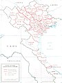
Map of the administrative divisions of the Democratic Republic of Vietnam (North Vietnam)
-
 Former French Indo-China with the Northwestern Autonomous Region, Việt Bắc Autonomous Region, and the Lào-Hà-Yên Autonomous Region.
 -
 This map from the Central Intelligence Agency (CIA) of the United States might be a good "basis" for generating this map on.
 -
 Done.
Done.


Article(s): en:North Vietnam, in the future also for en:Northwestern Autonomous Region, en:Việt Bắc Autonomous Region, and en:Lào-Hà-Yên Autonomous Region.
- Request
- I found this map of the provinces of North Vietnam. A third Autonomous Zone (or "Autonomous Region") exists as can be seen on this Wikimedia Commons map, a second version could be created which includes the Lào-Hà-Yên Autonomous Region which was created after the Northwestern Autonomous Region and the Việt Bắc Autonomous Region.
- If possible I would like to have a map created based on the one from GlobalSecurity.org and one which also incorporates the Lào-Hà-Yên Autonomous Region. --Donald Trung 『徵國單』 (No Fake News 💬) (WikiProject Numismatics 💴) (Articles 📚) 19:40, 26 April 2021 (UTC)
- Comment, the map with only the en:Northwestern Autonomous Region and en:Việt Bắc Autonomous Region should be called "File:Administrative divisions of North Vietnam (1956).svg" and the one with the en:Lào-Hà-Yên Autonomous Region should be entitled "File:Administrative divisions of North Vietnam (1957).svg". --Donald Trung 『徵國單』 (No Fake News 💬) (WikiProject Numismatics 💴) (Articles 📚) 20:16, 17 June 2021 (UTC)
- Graphist opinion(s)
- @Donald Trung: Partially done by the U.S. government here: File:North Vietnam Administrative Divisions.jpg. Zoozaz1 (talk) 21:08, 29 July 2021 (UTC)
- @Zoozaz1: , close enough really for what I want, I would say that the en:Lào-Hà-Yên Autonomous Region is too short-lived to actually be included and the map that you uploaded conveys the same message as the map that I found online, though while I would like there to be "a better Coloured version of the map", I think that this request is as " Resolved" as it's going to get. Thank you very much for finding and uploading that map. --Donald Trung 『徵國單』 (No Fake News 💬) (WikiProject Numismatics 💴) (Articles 📚) 21:57, 29 July 2021 (UTC)
- @Zoozaz1: , close enough really for what I want, I would say that the en:Lào-Hà-Yên Autonomous Region is too short-lived to actually be included and the map that you uploaded conveys the same message as the map that I found online, though while I would like there to be "a better Coloured version of the map", I think that this request is as "
- This section was archived on a request by: Donald Trung 『徵國單』 (No Fake News 💬) (WikiProject Numismatics 💴) (Articles 📚) 21:57, 29 July 2021 (UTC)
Fix text in SVG file

Article(s): en:Phnom Penh
- Request
- I made this map using ArcMap. However, the legend text cannot be viewed in commons. --SovanDara (talk) 05:12, 4 February 2021 (UTC)
- Graphist opinion(s)
I'm afraid the software has left a load of symbols which can't be read. If you list the names here for me, I can add them to the legend in the correct places. Rcsprinter123 (talk) 17:57, 4 February 2021 (UTC)
Hayden Bridge Map request
-
 Map of Hayden Bridge
,_Springfield,_Lane_County,_OR_HAER_ORE,20-SPRIF,2-_(sheet_1_of_4).png)
Article(s): en:Hayden Bridge (Springfield, Oregon)
- Request
- Please remove everything from the image except for the map portions, and make the map portions efficiently fit together within the image. Thanks! --Tyrone Madera (talk) 23:17, 22 July 2021 (UTC)
- Graphist opinion(s)
- @Tyrone Madera: I was able to crop it and color over all of the text with white, but I wasn't able to move the maps around. Zoozaz1 (talk) 23:41, 29 July 2021 (UTC)

- @Zoozaz1: Thank you for cropping the picture and removing the text!
,_Springfield,_Lane_County,_OR_HAER_ORE,20-SPRIF,2-_(sheet_1_of_4)_LI_(maps).png)
- If anyone could move the main map to take up the left half of the image and move the three bottom maps to be placed in a vertical arrangement on the right side of the image, I would very much appreciate it. Thanks again, Tyrone Madera (talk) 16:59, 5 August 2021 (UTC)
- @Tyrone Madera and Zoozaz1:
- Done, layout as requested (legend: small images reordered) En rouge (talk) 15:07, 6 August 2021 (UTC)
- @En rouge: Thank you! Tyrone Madera (talk) 18:12, 6 August 2021 (UTC)
- @Tyrone Madera: so, I put the banner hereunder (& thanks for the added information in the image page). En rouge (talk) 12:03, 7 August 2021 (UTC)
- @En rouge: Thank you! Tyrone Madera (talk) 18:12, 6 August 2021 (UTC)
- If anyone could move the main map to take up the left half of the image and move the three bottom maps to be placed in a vertical arrangement on the right side of the image, I would very much appreciate it. Thanks again, Tyrone Madera (talk) 16:59, 5 August 2021 (UTC)
SVG
-
 British Somaliland map

Article(s): en:British Somaliland
- Request
- Could someone please create SVG file of British Somaliland map
- Many Thanks… --Siirski (talk) 21:31, 30 May 2021 (UTC)
- Graphist opinion(s)
Siirski Is this still an open request as I can see something similar on your talk page? If not you should mark this as "resolved". If it's still active and I can help you but I need your help and information, ping me, thanks. --always ping me-- Goran tek-en (talk) 15:47, 21 August 2021 (UTC)
Neighborhoods in the city of Jaguari
-
 Localização da cidade

Article(s): pt:Jaguari
- Request
- Map of neighborhoods in the city of Jaguari. There are none here. Reference map: https://inundacoesjaguarirs.wordpress.com/jaguari/#jp-carousel-283 --Lord4522 (talk) 12:48, 20 July 2021 (UTC)
- Graphist opinion(s)
Lord4522 I can help you but first I want to get in contact with you and know you will be here because I'm pretty sure I have questions and you are the one with the knowledge, ping me, thanks. --always ping me-- Goran tek-en (talk) 15:32, 21 August 2021 (UTC)
- Lord4522 You can't write on my talk page and not signing and assume I will now what you are talking about. Please keep all discussions about this request here where your request is. I also prefer if you translate to English as that is what we try to use here. I will start working on this but I will ask you here and you have to reply here, thanks. --always ping me-- Goran tek-en (talk) 19:55, 21 August 2021 (UTC)
![]() Request taken by --always ping me-- Goran tek-en (talk) 19:55, 21 August 2021 (UTC)
Request taken by --always ping me-- Goran tek-en (talk) 19:55, 21 August 2021 (UTC)
Lord4522 So now I need your help to understand this.
- This area is the overall area of Jaguari which corresponds to the red in this file.
- A smaller area also called Jaguari but the shape doesn't correspond to your sources. Not to be used?
- City of Jaguari.
- How does the shape on the left side at this link correspond/fit to any or several of the images I show here?
- At this link, is the shape to the left the same as the small white area in the green area to the right?
- If so I need to know how to place the left side map in the right position on my maps above? thanks for your help --always ping me-- Goran tek-en (talk) 14:27, 22 August 2021 (UTC)
- Goran tek-en Hey man. I can send you a KMZ (Google Earth) file with the necessary information to make it easier if you want. explaining your maps: the first map shows the area of the municipality. the second shows the 1st district of the city.
- Here in Brazil the municipalities are divided like this: first the municipality is divided into districts, large areas. then it has an urban area, which is the area where the city is located, the urban center. then, the urban area is divided into neighborhoods.
- Your third map shows an image of the urban area, with no divisions, just the streets, and the fourth shows the neighborhoods, but this map of the neighborhoods is not very close to the real one, so I prefer to send the KMZ file, which would be more close to reality.
- Lord4522 (talk) 20:33, 22 August 2021 (UTC)
- Lord4522 Yes please send the KMZ file, thanks. --always ping me-- Goran tek-en (talk) 09:23, 23 August 2021 (UTC)
- Goran tek-en Here he is. Any questions or problems call me. KMZ file
- Lord4522 (talk) 25:19, 23 August 2021 (UTC)
- Lord4522 Thanks for the KMZ, it helps but I still have some questions.
- On the link you provided I can't find any information regarding copyright for those images. Can you give information regarding the copyright status as that tells me what I can do, copy or just use it as information, I need to know and see that information. If there is no such information we can ask the people there and then send it to VRT, I can do that but I want you to check first.
- How big area do you want the map to cover, can you draw a rectangle on a print screen from OSM?
- What do want included in the map, roads, railway, houses what, tell me?
- The areas in your link is not to be found on OSM so if the image is copyrighted I will have to draw just from looking at that image so it will not be that accurate.
- Sorry about all the questions but I have zero knowledge about this and want to do a so good work I can. --always ping me-- Goran tek-en (talk) 18:39, 24 August 2021 (UTC)
- Lord4522 Thanks for the KMZ, it helps but I still have some questions.
- Goran tek-en Okay. Those images I sent were make by students at a university in my state. That's all I know, but I didn't expect you to use them definitly, it was just a reference. Some them are inaccurate and this is the problem, that's why I sent the KMZ file, I expected know if you can do any work with this file. I was hoping you would add the rivers (Jaguari and Jaguarizinho),the stream and the (Sanga do Curtume) and the railroad, as they make the boundaries, it would be interesting. So I wanted if possible you could make a general map with the city limits, districts and urban area, and another map with the neighborhoods, in PNG preferably.
- Lord4522 (talk) 25:19, 23 August 2021 (UTC)
- Lord4522 For some strange reasons your ping doesn't work. Your username is read so you have no user page here but do you have one somewhere else, could it be some settings there?
- I didn't find all the things you wanted added so just tell me what more to add or edit.
- The colors right now is not the final ones, just so you can see the different parts.
- The drafts are PNGs but the original file I work in is SVG and that I will upload but there are automatically generated PNGs in different sizes.
- The information on those drafts can be visible or not as you need it.
- The lines in green on my drafts, what are they as I can't find them on any other map?
- I have been able to locate five neighborhoods, is that correct?
- Do you want the district line on top or below roads, railways etc?
- Without neighborhoods-1.
- With neighborhoods-1. --always ping me-- Goran tek-en (talk) 12:04, 25 August 2021 (UTC)
- Lord4522 For some strange reasons your ping doesn't work. Your username is read so you have no user page here but do you have one somewhere else, could it be some settings there?
- Goran_tek-en Okay, I created my page. Before, I only had it on the Brazilian WIKI.
- You probably won't find much on the internet, as there really isn't a lot about my city. That's why I sent the KMZ file to help.
- Yes, you found 5 neighborhoods, but 4 are still missing.
- I think it's better to put divisions above everything else.
- Lord4522 (talk) 16:07, 25 August 2021 (UTC)
- Lord4522 I'm sorry but now you are confusing me.
- This request is about neighborhoods of Jaguari but now you talk about districts which to my understanding is covering a much larger area so the KMZ file you sent me doesn't depict that at all. I really have to know what you want, remember I have zero knowledge of this area and I can't read what you thinking or taking for granted. If you want both Districts and Neighborhoods I think we have to create two different maps or one much bigger map in pixels size with both parts in it, this we can decide later on.
- So what do you want, Districts and/or Neighborhoods? --always ping me-- Goran tek-en (talk) 08:34, 26 August 2021 (UTC)
- Goran_tek-en ok, sorry for the confusion. forget the districts, i only want the neighborhoods.
- Lord4522 (talk) 22:10, 26 August 2021 (UTC)
- Lord4522 It's so strange, your ping is still not working.
Here are four drafts showing the same content but in different ways, I can't see which is best so you say, or some other way.To me both Neighborhood and Urban area transparent makes it hard to really see what is what. I will see if I can come up with something else but it's difficult when you want to see stuff which are overlapping each other. Give me feedback and I will see what else i can do. --always ping me-- Goran tek-en (talk) 19:26, 27 August 2021 (UTC)- Lord4522 Now I think I got a solution to above, Complete draft-3. --always ping me-- Goran tek-en (talk) 10:22, 28 August 2021 (UTC)
- Lord4522 It's so strange, your ping is still not working.
- Lord4522 I'm sorry but now you are confusing me.
- Lord4522 Yes please send the KMZ file, thanks. --always ping me-- Goran tek-en (talk) 09:23, 23 August 2021 (UTC)
- Goran tek-en Yes, that's basically it, thanks :::Lord4522 (talk) 19:37, 29 August 2021 (UTC)
- Lord4522 I will need the following;
- Name of the file
- Description (/language)
- Captions/s (/language)
- Category/ies at commons
- to be able to upload it at commons. If you don'y know about Captions read here. --always ping me-- Goran tek-en (talk) 13:18, 30 August 2021 (UTC)
- Name: Bairros de Jaguari
- Description: Post the image I write a description later
- Language: Portuguese
- Category: Maps
- Lord4522 I will need the following;
Lord4522 I have changed the category and added. The Map category is a Main category and files should preferably be put in appropriate subcategories. Now you can find it here Bairros de Jaguari. If you are happy with this please put the code "{{section re.solved|1=~~~~}}" (without the ".") on this request so it can be archived, thanks. ![]() Done --please ping me-- Goran tek-en (talk) 13:39, 31 August 2021 (UTC)
Done --please ping me-- Goran tek-en (talk) 13:39, 31 August 2021 (UTC)
Change "ISTANBUL" to "CONSTANTINOPLE (ISTANBUL)" on English language and French language Armenian Genocide maps
-
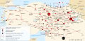 English SVG
 -
 French SVG


Article(s): various
- Request
- The maps already give the Ottoman-era French/English names for other cities (Adrianople and Smyrna) with their post-1930s French/English names (Edirne and Izmir) in parenthenses. However the Ottoman Empire-era name for Istanbul in French and English, Constantinople, is not given. The name Constantinople should be added. While those cities were known by Turkish names in Turkish (Konstantiniyye and Istanbul in Turkish for the Ottoman capital), it was only in the 1930s that the Turkish names were adopted in French and English, with the US State Department changing to using Istanbul in 1930. (the conventions in Turkish differ so I am not including that version in this request) --WhisperToMe (talk) 21:28, 8 March 2021 (UTC)
- Graphist opinion(s)
- Done 4nn1l2 (talk) 22:06, 8 March 2021 (UTC)
- Thank you so much! @4nn1l2: , there's two other things I forgot... Elazig was known at the time as Mamuret ül-Aziz and Trabzon was known as Trebizond (Trébizonde in French). Whenever it's convenient, if you wish to apply those changes too you may WhisperToMe (talk) 22:52, 8 March 2021 (UTC)
United Nations regional groups
-
 Map of countries by UN regional group

Article(s): en:United Nations Regional Groups
- Request
- The United States is not formally a member of the Western Europe and Others Group (WEOG). Rather, they are an observer and are counted alongside WEOG solely for electoral purposes. (This is a unique case; no other UN member state holds observer status in a regional group.) Given that this map is used on the English and French Wikipedias (and I presume elsewhere) to display group membership, not merely who is counted how for electoral purposes, could the United States be given a lighter shade of that gold-ish colour to reflect that they are an observer? Thanks, 207.161.86.162 22:03, 9 March 2021 (UTC)
- Graphist opinion(s)
Map of Mexico and the USA in 1800 Vs. 1900
-
 Concept map, the colours are just used because of Microsoft Paint, I suggest using different colours.
 -
 Viceroyalty of the New Spain 1800 (without Philippines).
 -
 Another map of the borders for reference, 1794.
 -
 The borders of Mexico have remained unchanged since 1900.
 -
 Done.
Done. -
 Done.
Done. -
 Done.
Done. -
 Done.
Done.
.png)
.png)
.svg)
.svg)


_01.svg)
_02.svg)
Article(s): en:Mexico–United States relations, after discussion.
- Request
- Hello fellow Wikimedia Commonists… I would like to request the creation of a map of New Spain / Mexico in 1800 and 1900 in relation with the United States, the map I used for the concept has a number of errors so I propose using the borders found at "File:Viceroyalty of the New Spain 1800 (without Philippines).png" as the basis for the borders of the Viceroyalty of the New Spain in the year 1800. In my preferred version the Philippine archipelago is included in a way similar to the concept image as it was a part of the Viceroyalty of New Spain in 1800 and the United States of America in 1900.
- In the concept map I used a number of colours that were "friendly to Microsoft Paint", but this wouldn't be preferable for an SVG map. --Donald Trung 『徵國單』 (No Fake News 💬) (WikiProject Numismatics 💴) (Articles 📚) 16:23, 19 August 2021 (UTC)
- Graphist opinion(s)
![]() Request taken by --always ping me-- Goran tek-en (talk) 16:31, 21 August 2021 (UTC)
Request taken by --always ping me-- Goran tek-en (talk) 16:31, 21 August 2021 (UTC)
1800 Map
| Extended content |
|---|
|
Donald Trung As always I have questions.
I will adapt and change what is needed. --always ping me-- Goran tek-en (talk) 17:31, 21 August 2021 (UTC)
@Goran tek-en: , I always assume that there is no such thing as "common knowledge", as often people use weird jargon or odd terms around me so I always try to explain things as simple as possible. Anyhow, above I listed a couple of maps, "File:Viceroyalty of the New Spain 1800 (without Philippines).png" (Viceroyalty of the New Spain 1800 (without Philippines).) shows what the United States of America 🇺🇸 is, as your map still includes the countries north of New Spain (British North America) as the United States of America 🇺🇸. The 1800 map linked here actually shows what that country was. I also see that your draft still includes an internal border in New Spain (specifically for Louisiana) which isn't necessary as it compares national borders. I hope that this map will make it clear, otherwise look at the concept map I provided here which shows the approximate borders. --Donald Trung 『徵國單』 (No Fake News 💬) (WikiProject Numismatics 💴) (Articles 📚) 22:47, 26 August 2021 (UTC)
|
1900 Map
| Extended content |
|---|
|
Donald Trung I'm sorry but it turned out one of the maps contained some really bad code so I had to start all over. So now I'm working on 1900 but I have some questions there. If you look at this image and where I have added red lines next to borders. Do you have any god map with those borders that I can use? --please ping me-- Goran tek-en (talk) 18:42, 4 September 2021 (UTC)
Donald Trung Now I have drafts which is done to the best I can with all the different sources showing different things. Check everything. I have guessed concerning islands so they need extra check. Those are the pure 1800 and 1900 maps, once they are OK we will see if I can add them to one.
Donald Trung As I said before, you are confusing me, now again. It's impossible for me to know what you think I can only go by what you tell me here. I asked this before: In your concept map for 1900 you have both areas from 1800 and 1900, is it supposed to be like that or do you want a pure 1900 map? I also wrote that after we have a pure approved map of 1800 and 1900 we can try to combine them in any way you want. So I will continue to get those pure maps approved by you and then we discuss the combined option. --please ping me-- Goran tek-en (talk) 14:39, 7 September 2021 (UTC)
Donald Trung I have made edits to all of the drafts I show you here so check everything.
|
Donald Trung So now we have those four drafts. If they are approved by you I would need the usual info for each be able to upload them: Name of the file, Description (/language), Captions/s (/language), Category/ies at commons
- 1800 pure
- 1900 pure
- Mixed concept map Here I have changed the southern border.
- Your concept layout Is the southern border fine at the lower map here? --please ping me-- Goran tek-en (talk) 16:31, 22 September 2021 (UTC)
- @Goran tek-en: , except for the southern border here these all look perfect, better than what I envisioned even. I have filled in the file layouts (including titles) below. Thank you so much for all your trouble and time, I really appreciate it. --Donald Trung 『徵國單』 (No Fake News 💬) (WikiProject Numismatics 💴) (Articles 📚) 03:13, 23 September 2021 (UTC)
File information
- "Title" fields.
Territories of the Viceroyalty of New Spain in 1800 that were a part of the United States of America in 1900 and leftover Mexico.svg
- Viceroyalty of New Spain and the United States of America
19001800.svg = 1800 pure. I guess it should be 1800 --please ping me-- Goran tek-en (talk) 11:25, 23 September 2021 (UTC)
- Former territories of New Spain lost to the USA by 1900.svg = *1900 pure.
- Territorial evolution of Mexico and the USA (1800–1900) 01.svg = Donnie's concept layout.
- Territorial evolution of Mexico and the USA (1800–1900) 02.svg = Mixed concept map.
- "File description" and "File caption" fields.
A map showing the territories of the Viceroyalty of New Spain in 1800 that were gradually annexed by the United States of America over the course of a century and what parts of New Spain were the Republic of Mexico only a century later.
- "Categories" field.
- "Category:SVG maps of the history of Mexico" & "Category:SVG territorial growth maps of the United States".
It's weird, I still haven't been able to come up with a good file name, I want to call it the "Partition of Mexico (1800-1900)", but that would be "a newly invented name" and I don't know how else to describe this phenomenon. --Donald Trung 『徵國單』 (No Fake News 💬) (WikiProject Numismatics 💴) (Articles 📚) 14:02, 17 September 2021 (UTC)
- Donald Trung I did change the name for "pure 1800" per above.
- I have added wikidata both in the Description part and in Structered data, please check so it's correct.
- Now you can find it here file:Viceroyalty of New Spain and the United States of America 1800.svg, file:Former territories of New Spain lost to the USA by 1900.svg, file:Territorial evolution of Mexico and the USA (1800–1900) 01.svg, file:Territorial evolution of Mexico and the USA (1800–1900) 02.svg. If you are happy with this please put the code
"{{section re.solved|1=~~~~}}"(without the ".") on this request so it can be archived, thanks. Done --please ping me-- Goran tek-en (talk) 15:18, 23 September 2021 (UTC)
- Donald Trung I did change the name for "pure 1800" per above.
- Thank you very much for all the trouble, these maps all look wonderful. --Donald Trung 『徵國單』 (No Fake News 💬) (WikiProject Numismatics 💴) (Articles 📚) 12:18, 24 September 2021 (UTC)
- @Goran tek-en: , one minor thing I didn't notice until close inspection was that the middle "Other countries" one (the blue one) is "USA" in 1800 but "Other countries" in 1900, this should be "USA" in both periods. Excuse me for not finding it before. --Donald Trung 『徵國單』 (No Fake News 💬) (WikiProject Numismatics 💴) (Articles 📚) 12:29, 24 September 2021 (UTC)
- Donald Trung Two maps updated. --please ping me-- Goran tek-en (talk) 16:38, 24 September 2021 (UTC)
- This section was archived on a request by: Donald Trung 『徵國單』 (No Fake News 💬) (WikiProject Numismatics 💴) (Articles 📚) 12:18, 24 September 2021 (UTC)
World maps
-
 CIA World Factbook Political World Map February 2021
 -
 CIA World Factbook Physical World Map February 2021
Article(s): en:Geography, en:List of political and geographic borders, en:Lists of countries and territories, en:Region, en:Robinson projection, en:Social science, en:World, en:World Suicide Prevention Day, en:Country, en:World map
- Request
- Western Sahara
- Details of your request go here… I would like these two images to show the border of Western Sahara like in this images: File:Map of the world by the US Gov as of 2016 no legend.svg and File:CIA WorldFactBook-Political world.pdf. I changed the images from the ones I mentioned here to the new ones on the English Wikipedia. Another editor reverted my changes to the images due the new map not being neutral. If you look into this for me, that would be helpful. --Interstellarity (talk) 19:36, 29 March 2021 (UTC)
- Graphist opinion(s)
- @Interstellarity: It does not make sense to edit borders on this map, since it is purposely the US (through CIA) vision of the world. And this is well stated both in the title and in the description. For them Western Sahara doesn't exist as country, and the map shows it. I would just close the request. Sette-quattro (talk) 15:16, 31 March 2021 (UTC)
- @Sette-quattro: For an up-to-date, neutral world map, what would be the best file to use on Commons or a file that could be uploaded to Commons? I don't think using the factbook's maps is neutral since this is the US's view of the world. Interstellarity (talk) 19:32, 31 March 2021 (UTC)
- @Interstellarity: I don't think there is such a thing as a "neutral map". You will always make someone angry. Western Sahara, Crimea, Kashmir, Somaliland to make some examples. I'd rather go with a map highlighting all the disputed areas. The most similar thing is the Natural Earth project, which anyways adopt the "on the ground" policy (territories are assigned to whom controls them) and therefore shows Western Sahara mainly as part of Morocco. If you want i can produce a world map out of that data. Sette-quattro (talk) 20:03, 31 March 2021 (UTC)
- @Sette-quattro: Sure, that's fine. Interstellarity (talk) 21:18, 31 March 2021 (UTC)
- @Sette-quattro: How long will it be until the image is complete? I waited 48 hours and no image was published. Did I not wait long enough or does the image take a long time to make? Interstellarity (talk) 21:26, 2 April 2021 (UTC)
- @Interstellarity: I do this in the spare time, as volunteer, so i cannot guarantee any delivery date. When i have some time i work on it. Best! Sette-quattro (talk) 08:28, 3 April 2021 (UTC)
- Agree that there's no such thing as a neutral map, but in this case I don't think there's a need to reinvent the wheel. File:BlankMap-World.svg has the flexibility to be edited in a number of ways. Might take less volunteer time to just edit that rather than create something new. It for example already has shapes for the two portions of Western Sahara. Chipmunkdavis (talk) 14:47, 12 April 2021 (UTC)
- I just want to echo the above comment, I don't think we need another world map. There are already world maps based on Natural Earth sitting on Commons (File:Worldmap_location_NED_50m.svg, File:Hoelzelnaturalearth.png) though I think File:BlankMap-World.svg is an improvement on those and has a lot of options on how to show disputed areas. Kmusser (talk) 17:08, 12 April 2021 (UTC)
- @Interstellarity: I do this in the spare time, as volunteer, so i cannot guarantee any delivery date. When i have some time i work on it. Best! Sette-quattro (talk) 08:28, 3 April 2021 (UTC)
- @Sette-quattro: How long will it be until the image is complete? I waited 48 hours and no image was published. Did I not wait long enough or does the image take a long time to make? Interstellarity (talk) 21:26, 2 April 2021 (UTC)
Paphos
Article(s): en:Paphos
- Request
- Please correct the swapped letter of Paphos in Cyprus… --Kintetsubuffalo (talk) 02:04, 2 October 2021 (UTC)
- Graphist opinion(s)
@Kintetsubuffalo: It's more than swapped letters. Map: Pahpus, Your spelling: Paphos. Is your spelling correct? --please ping me-- Goran tek-en (talk) 13:46, 2 October 2021 (UTC)
- @Goran tek-en: The English article consistently uses "o", the Greek matches. Thanks for asking!Kintetsubuffalo (talk) 19:22, 2 October 2021 (UTC)
- The map evidently uses contemporary Latin names, not modern or ‘native’ ones: Londinium, Massilia, & Vindobona for London, Marseilles, & Wien/Vienna. I don’t know for certain how Romans spelled the name of the place in Cyprus, but I note that Corinthus shows the -us ending where transliterated Greek would have -os, making me consider the former the more likely.—Odysseus1479 (talk) 19:47, 2 October 2021 (UTC)
![]() Request taken by --please ping me-- Goran tek-en (talk) 21:31, 2 October 2021 (UTC)
Request taken by --please ping me-- Goran tek-en (talk) 21:31, 2 October 2021 (UTC)
@Kintetsubuffalo: New version uploaded. ![]() Done --please ping me-- Goran tek-en (talk) 21:31, 2 October 2021 (UTC)
Done --please ping me-- Goran tek-en (talk) 21:31, 2 October 2021 (UTC)
- It's great, thank you!Kintetsubuffalo (talk) 22:15, 3 October 2021 (UTC)
- @Kintetsubuffalo: , @Goran tek-en: I agree with Odysseus1479; the map is Latin, not English. I suggest changing it to "Paphus" to match the language of the rest of the map. The map is labelled in Latin, and "Paphos" is the English spelling. Other Anglo-Greek spellings presently spelled with an "-os" that should be Latinized are "Cnossus" and "Chersonnesus". GPinkerton (talk) 18:28, 5 October 2021 (UTC)
- @Kintetsubuffalo: , @Odysseus1479: , @GPinkerton: I'm a graphic worker and mostly I have zero knowledge of the subject a map or illustration is depicting or the edits on them. So I'm always depending on that the requester knows what he/she is asking for. Often I ask for a source to verify what is asked for but in this case I guess it's a matter of opinion. So if the majority think this edit was wrong please just revert to the previous version, it's out of my knowledge. --please ping me-- Goran tek-en (talk) 21:43, 5 October 2021 (UTC)
- @Goran tek-en: Well the previous version is certainly wrong, so reverting to "Pahpus" would be no improvement. For consistency, it should be "Paphus", "Cnossus", and "Chersonesus". GPinkerton (talk) 21:56, 5 October 2021 (UTC)
- "Chesinos" (river by the Baltic Sea) should also be changed to "Chesinus". GPinkerton (talk) 22:10, 5 October 2021 (UTC)
- @GPinkerton: New version uploaded. Done --please ping me-- Goran tek-en (talk) 09:52, 6 October 2021 (UTC)
- @Goran tek-en: Cool! Can you please fix the same issues with the derivatives. I don't know how the Japanese and Chinese maps have been translated, but if they were translated from the map in hand there are very likely issues there arising from "Pahpus".GPinkerton (talk) 16:13, 6 October 2021 (UTC)
- @Goran tek-en: Cool! Can you please fix the same issues with the derivatives. I don't know how the Japanese and Chinese maps have been translated, but if they were translated from the map in hand there are very likely issues there arising from "Pahpus".GPinkerton (talk) 16:13, 6 October 2021 (UTC)
- @GPinkerton: New version uploaded.
- @Kintetsubuffalo: , @Odysseus1479: , @GPinkerton: I'm a graphic worker and mostly I have zero knowledge of the subject a map or illustration is depicting or the edits on them. So I'm always depending on that the requester knows what he/she is asking for. Often I ask for a source to verify what is asked for but in this case I guess it's a matter of opinion. So if the majority think this edit was wrong please just revert to the previous version, it's out of my knowledge. --please ping me-- Goran tek-en (talk) 21:43, 5 October 2021 (UTC)
- @Kintetsubuffalo: , @Goran tek-en: I agree with Odysseus1479; the map is Latin, not English. I suggest changing it to "Paphus" to match the language of the rest of the map. The map is labelled in Latin, and "Paphos" is the English spelling. Other Anglo-Greek spellings presently spelled with an "-os" that should be Latinized are "Cnossus" and "Chersonnesus". GPinkerton (talk) 18:28, 5 October 2021 (UTC)


@GPinkerton: If you want me to do that I will need your help but you can do it yourself. Download each file, open it with a simple text editor (which doesn't use formatting), search and change, save it and upload it. The files are on the heavy side so depending of your computer opening a file might some time, just wait. --please ping me-- Goran tek-en (talk) 17:06, 6 October 2021 (UTC)
- @GPinkerton: I just saw there are both SVG and PNG files. The description above is for SVG. PNG is a totally different thing and not so easy to do.
.svg Map of World rail gauges needs small correction
-
 colour-coded map showing usage of different rail gauges around the world

Article(s): List of track gauges
- This is an example- The file is used very widely
- Request
- The map shows blue (for standard gauge) in the North of Ireland. It should be the same green as for the Republic of Ireland as Northern Irish railways use the 1600mm 'Irish' gauge, not 'standard' gauge used in the rest of the UK. File:Rail gauge world.png does not have this error, although the .png versions of the .svg file are also wrong.
- Graphist opinion(s)
I checked and it's green so already corrected.
![]() Done:This section was archived on a request by: --please ping me-- Goran tek-en (talk) 15:30, 21 October 2021 (UTC)
Done:This section was archived on a request by: --please ping me-- Goran tek-en (talk) 15:30, 21 October 2021 (UTC)
World Time Zones Map.png
-
 World Time Zones Map.png

- Request
Please fix the artifacts around the word "SOUTH SUDAN" and the border of that country.--Mike Rohsopht (talk) 07:13, 9 September 2021 (UTC)
The country names "Macedonia" and "Swaziland" also need to be changed.
CIA website has a vector version [5], however it is not updated (South Sudan, Volgograd etc.) and need some modifications (Crimea, Eucla etc.).--Mike Rohsopht (talk) 12:06, 27 September 2021 (UTC)
- Graphist opinion(s)
@Mike Rohsopht: Is this Time zones of the world-UTC more correct? --please ping me-- Goran tek-en (talk) 18:04, 26 September 2021 (UTC)
- @Goran tek-en: No. South Sudan is now UTC+2.--Mike Rohsopht (talk) 09:20, 27 September 2021 (UTC)
- @Mike Rohsopht: I can update that map Time zones of the world-UTC, please show me some source for this, thanks. --please ping me-- Goran tek-en (talk) 13:10, 27 September 2021 (UTC)
- @Mike Rohsopht: I have updated South Sudan in Time zones of the world-UTC, anything else that needs to be corrected there. --please ping me-- Goran tek-en (talk) 14:01, 2 October 2021 (UTC)
- @Goran tek-en: Canary Islands, Madeira Islands should be +0, Norfolk Island should be +11[6], Broken Hill (County of Yancowinna) should be +9:30 [7]--Mike Rohsopht (talk) 16:07, 3 October 2021 (UTC)
- @Mike Rohsopht: I have updated South Sudan in Time zones of the world-UTC, anything else that needs to be corrected there. --please ping me-- Goran tek-en (talk) 14:01, 2 October 2021 (UTC)
- @Mike Rohsopht: I can update that map Time zones of the world-UTC, please show me some source for this, thanks. --please ping me-- Goran tek-en (talk) 13:10, 27 September 2021 (UTC)
- @Goran tek-en: No. South Sudan is now UTC+2.--Mike Rohsopht (talk) 09:20, 27 September 2021 (UTC)
@Mike Rohsopht: Here are my thoughts about this, please reply, thanks.
- Canary islands is +1 according to that link, but they have Daylight Saving Time (DST).
- Maderia islands seems to have two time zones, one used +1 and one not used +0, DST.
- Norfolk island is also complicated. They also have used and not used but in the text below they say it's using +11 and they have DST. I don't really know which to use.
- Broken Hill (County of Yancowinna) is even more complicated and how can you be able to place it on that map exactly. --please ping me-- Goran tek-en (talk) 17:56, 4 October 2021 (UTC)
- @Goran tek-en: The map should show standard time (winter time) only but not DST. Just like in UK, they are currently observing British summer time (UTC+1) but the standard time is UTC+0. You may refer to these articles en:Time in Spain, en:Time in Portugal, en:Time in Australia. A map for Yancowinna File:Yancowinna NSW.PNG.--Mike Rohsopht (talk) 10:53, 6 October 2021 (UTC)
- @Mike Rohsopht: Check this draft before I upload it, thanks. --please ping me-- Goran tek-en (talk) 11:40, 6 October 2021 (UTC)
- @Goran tek-en: Standard time of most part of Chile is -4, see en:Time in Chile. The standard time of the south-east part of Australia (NSW, TAS, VIC, ACT, JBT) is +10 not +11.--Mike Rohsopht (talk) 06:19, 7 October 2021 (UTC)
- @Mike Rohsopht: This is really complicated, wow. I lived for some years in Töreboda Sweden and that was our 0 time zone when we started to get trains between Stockholm and Gothenburg. We had seven time zones for that trip with Töreboda 0, strange to imaging that today.
- UTC-4. --please ping me-- Goran tek-en (talk) 17:04, 7 October 2021 (UTC)
- @Mike Rohsopht: I was probably nor clear enough, new draft-4 --please ping me-- Goran tek-en (talk) 18:32, 10 October 2021 (UTC)
- @Mike Rohsopht: This is really complicated, wow. I lived for some years in Töreboda Sweden and that was our 0 time zone when we started to get trains between Stockholm and Gothenburg. We had seven time zones for that trip with Töreboda 0, strange to imaging that today.
- @Goran tek-en: It seems OK.--Mike Rohsopht (talk) 08:57, 12 October 2021 (UTC)
- @Goran tek-en: Standard time of most part of Chile is -4, see en:Time in Chile. The standard time of the south-east part of Australia (NSW, TAS, VIC, ACT, JBT) is +10 not +11.--Mike Rohsopht (talk) 06:19, 7 October 2021 (UTC)
- @Mike Rohsopht: Check this draft before I upload it, thanks. --please ping me-- Goran tek-en (talk) 11:40, 6 October 2021 (UTC)
@Mike Rohsopht: New version uploaded. ![]() Done --please ping me-- Goran tek-en (talk) 11:37, 12 October 2021 (UTC)
Done --please ping me-- Goran tek-en (talk) 11:37, 12 October 2021 (UTC)
To my knowledge this is completed.
- This section was archived on a request by: --please ping me-- Goran tek-en (talk) 15:22, 21 October 2021 (UTC)
Eritrea on Grey–green orthographic projections maps
| Maps by view |
|---|
|
.svg)
.svg)
.svg)
.svg)
.svg)
.svg)

.svg)
.svg)
.svg)

.svg)
.svg)
.svg)
.svg)
.svg)
.svg)
.svg)
.svg)
.svg)
.svg)
.svg)
.svg)
.png)
_(orthographic_projection).png)
Article(s): Various
- Request
- A number of the Grey–green orthographic projections maps appear to have been generated without Eritrea. I've collected them above, sorted by viewpoint. Presumably the same fix can apply across each viewpoint. It's particularly noticeable for groups 1 and 2, and somewhat for 3 and a couple in the miscellaneous group. For the others the fix is not as important, but included for completeness. I'm hoping that for those familiar with orthographic maps this might be an easy fix, as South Sudan seems to have been possible for many of them. --Chipmunkdavis (talk) 12:27, 21 June 2021 (UTC)
- Graphist opinion(s)
Barbados and the Commonwealth
-
 Location of Barbados
 -
![Commonwealth realms, republics and other monarchies [OK]](https://upload.wikimedia.org/wikipedia/commons/thumb/8/8b/Commonwealth_realms_republics_and_monarchies.svg/120px-Commonwealth_realms_republics_and_monarchies.svg.png) Commonwealth realms, republics and other monarchies
Commonwealth realms, republics and other monarchies
-
![Commonwealth republics [OK]](https://upload.wikimedia.org/wikipedia/commons/thumb/1/1a/Commonwealth_republics.svg/120px-Commonwealth_republics.svg.png) Commonwealth republics
Commonwealth republics

![Commonwealth realms, republics and other monarchies [OK]](/wiki/File:Commonwealth_realms_republics_and_monarchies.svg)
![Commonwealth republics [OK]](/wiki/File:Commonwealth_republics.svg)
Article(s): Any articles these maps already feature on.
- Request
- Could someone please alter both of the above maps of the Commonwealth so that Barbados (which ceased to be a Commonwealth realm on 30 November 2021) is marked as a Commonwealth republic on both. Thanks. Snow Lion Fenian (talk) 18:08, 2 December 2021 (UTC)
- Graphist opinion(s)
![]() Request taken by Floogan (talk) 02:08, 21 December 2021 (UTC)
Request taken by Floogan (talk) 02:08, 21 December 2021 (UTC)
inset map needs to be replaced by a free map
-
The settlement area of the Pite Saamis, with an inset showing the location within Scandinavia
Article(s): en:Pite Sami, de:Dumpokjauratj (Wohnplatz), ca:Sami de Pite, sv:Pitesamiska, zh:皮特薩米語
- Request
- The file https://commons.wikimedia.org/wiki/has a copyrighted inset map. The file should be edited such that the copyrighted part is removed and replaced by a free map of Scandinavia with the relevant region marked.
- The file is used on Wikipedia instances in 5 different languages. The "real" map was created by Joshua Wilbur, author of the book which contains the map. Wilbur released it under CC-BY, but he was not aware of the problem with the inset. I can facilitate contact with Wilbur if required. --Jasy jatere (talk) 10:38, 14 January 2021 (UTC)
- Graphist opinion(s)
Jasy jatere Your link above is bad in some way so there is nothing to view. --Goran tek-en (talk) 16:43, 14 March 2021 (UTC)
- @Goran tek-en: , the map was deleted and no archive exists (or maybe it does). Perhaps @Jasy jatere: can upload the map to Imgur or Google Drive and share it here. --Donald Trung 『徵國單』 (No Fake News 💬) (WikiProject Numismatics 💴) (Articles 📚) 23:02, 7 July 2021 (UTC)
Guardafui Channel
-
 png version of Guardafui Channel incl. adjacent contiguous zone (not accurate to scale)
 -
 Guardafui Channel incl. adjacent contiguous zone, with place names
 -
png version of Guardafui Channel incl. adjacent 1000m depth


Article(s): war:Canal Guardafui
- Request
- Could someone please recreate or redo, similar or otherwise, the above png file into an SVG file map? The name of the proposed file can be any variation of "Guardafui Channel with adjacent contiguous zone (not accurate to scale)", its description that its depicts the Guardafui strait or Guardafui Channel between Socotra and Puntland, and its category the same as the above linked png file made by myself. Please do likewise with the 2nd image, with placenames. --Rcbbtjjhj (talk) 15:53, 30 December 2021 (UTC)
- Graphist opinion(s)
- There is already a well done SVG image (https://commons.wikimedia.org/wiki/File:Guardafui_Channel_map.svg). Why it is not suitable? --Sette-quattro (talk) 20:03, 1 January 2022 (UTC)
- That image does not shade the entry-points for the strait. Rcbbtjjhj (talk) 06:31, 2 January 2022 (UTC)
- @Rcbbtjjhj: which are the entry-points for the canal? do you have a source shapefile/official map showing it? --Sette-quattro (talk) 08:21, 3 January 2022 (UTC)
- @Sette-quattro: I meant to add the contiguous zones adjacent to Guardafui channel, however I didn't have a coordinate tab on my mapmaker to measure exact distance. Although contiguous zones typically are marked at 24 miles, being accurate to scale isn't crucial as the map is meant for visual simplification. Nonetheless, I realize I overshaded the southern parts, however you are at liberty to reverse my oversealous shading. References that contiguous zones reach out at 24 miles are widespread on google. In summary, the map illustrates a contiguous zone juxtaposed upon the channel. My reason for the contiguous zone running along Puntland's coast is part arbitrary and part that its the immediately recognizable canton in that area. Rcbbtjjhj (talk) 20:52, 3 January 2022 (UTC)
- @Rcbbtjjhj: which are the entry-points for the canal? do you have a source shapefile/official map showing it? --Sette-quattro (talk) 08:21, 3 January 2022 (UTC)
- That image does not shade the entry-points for the strait. Rcbbtjjhj (talk) 06:31, 2 January 2022 (UTC)
- Could someone please make an svg map of the Guardafui Channel amalgamated with the seafloor depth of 1000m as shown here [8]; with the depicted seafloor depth extending along the borders of Puntland's coast. Rcbbtjjhj (talk) 07:44, 5 January 2022 (UTC)
Former administrative units of Pakistan
-
 the whole map
 -
 suggested style

_(claims_hatched).svg)
Article(s): en:Former administrative units of Pakistan
- Request
- Please vectorize the whole map of Pakistan and to select on her one by one administrative unit (red or dark green).
units are:
-

-

-

-
-

-

-

-

-

-
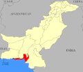
-

-

-
 w:Phulra very small
 -
 w:Amb (princely state) very small
 -
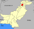
-

-

-

-
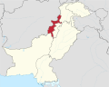
-

-
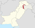
-
w:Baltistan district farthest east
-

-
Gwadar Enclave (purchased from Sultanate of Oman in 1958)


_map.gif)
_map.gif)


.svg)
.svg)
- Details of your request go here… --213.192.68.53 13:03, 1 August 2021 (UTC)
- Graphist opinion(s)
List of metro systems

Article(s): en:List of metro systems
- Request
- Please put Serbia under yellow as the Belgrade Metro started construction… --2603:8081:1604:88DE:742F:4DEE:6D7E:9969 05:47, 23 November 2021 (UTC)
- Graphist opinion(s)
![]() Done – New image version uploaded. Rcsprinter123 (talk) 21:23, 24 November 2021 (UTC)
Done – New image version uploaded. Rcsprinter123 (talk) 21:23, 24 November 2021 (UTC)
Tagging for archiving, as the request seems to be fulfilled. --Donald Trung 『徵國單』 (No Fake News 💬) (WikiProject Numismatics 💴) (Articles 📚) 10:44, 29 January 2022 (UTC)
- This section was archived on a request by: Donald Trung 『徵國單』 (No Fake News 💬) (WikiProject Numismatics 💴) (Articles 📚) 10:44, 29 January 2022 (UTC)
Need a correction on a map
Article(s): File:HotspotHighway.jpg
- Request
- Raratonga should be Rarotonga and Rurutu should be Arago.
- Per en:Arago hotspot that is nowadays the more common term, it seems. The Raratonga thing is just a plain typo fix. --Jo-Jo Eumerus (talk) 08:52, 5 July 2021 (UTC)
- Graphist opinion(s)
- Pinging @Scooteristi:
- - Jo-Jo Eumerus, perhaps the initial uploader can be of any help. Moreover, Scooteristi can upload an .svg version of the file? En rouge (talk) 13:03, 6 August 2021 (UTC)
Hanoi location map.svg
-
 Location map of Hanoi, Vietnam

Article(s): vi:Bản mẫu:Vị trí các di tích quốc gia đặc biệt tại Việt Nam
- Request
- Svg map editors needed
- Hi all! This svg map coordinates seemed to be incorrect. Can anyone please fix it? Thanks a lot! Hari caaru (talk) 00:54, 11 August 2021 (UTC)
- Graphist opinion(s)
-
- A bit difficult with only boundaries and no rivers but I would take
- N: 21.427139
- W: 105.154942
- S: 20.523778
- E: 106.132608
- Regards, NNW 16:40, 12 August 2021 (UTC)
Covid-19 Vaccination Map of UK.png
-
 Existing map by home nation only, showing April's data

Article(s): w:COVID-19 vaccination in the United Kingdom & its equivalents
- Request
- New map of COVID-19 vaccination in the United Kingdom
- Make a new map of covid-19 vaccinations in the UK by local authority area, rather than by home nation only, and with updated data (https://coronavirus.data.gov.uk/details/vaccinations here). The current map is now months old and doesn't show more than four data points. The new map ought to look something like the ones on the British Government websites: here, but with the metric of cumulative "People who have received 2nd dose vaccinations" from the government website rather than "percentage of adults vaccinated" used on the government's website interactive map. The data can be downloaded here. (The new map should use either the "Upper Tier Local Authority Data" (minimum detail) or the "Lower Tier Local Authority Data"; the "Middle layer Super Output Areas" (!) are probably unnecessarily small and the "regions" are unwieldy and have no administrative functions.) I assume an SVG file would be best for the purpose. GPinkerton (talk) 22:45, 12 August 2021 (UTC)
- Graphist opinion(s)
Afrin offensive (January–March 2018)
-
 Turkish military advancement in Afrin

Article(s): هجوم عفرين (يناير–مارس 2018)
- Request
- Can you please create an Arabic version of this gif file. The translation is as follows:
- Rajo = راجو
- Maabatli = معبطلي
- Afrin = عفرين
- Azaz = أعزاز
- Tell Rifat = تل رفعت
- Sawran = صوران
- Deir Jamal = دير جمال
- Mare' = مارع
- Nubl = نُبُّل
- Jindires = جنديرس
- Aleppo = حلب
- Darat Izza = دارة عزَّة
- Jalameh / Celemê = جلمة
- Qah = قاح
- Atmeh = أطمة
- Meidan Ekbis = ميدان أكبس
Thank you--باسم (talk) 20:30, 16 April 2021 (UTC)
- Graphist opinion(s)
باسم In that GIF there are 61 layers which each one containing those names with a changing background. So first you have to remove all of those names on all layers and restore the background. Then you have to add the translations. This is really really really a lot of work and the quality of image is not very good. So I'm not sure any one think it would be worth it. This is my reflection and I wanted you to know in case no one picks this request. --always ping me--Goran tek-en (talk) 12:48, 26 April 2021 (UTC)
- @Goran tek-en: thank you for clarifying this. If nobody was able to translate it then you can archive this request--باسم (talk) 17:24, 26 April 2021 (UTC)
- باسم I didn't say that, I only speak for myself. You can leave it open and see if someone picks it. --always ping me--Goran tek-en (talk) 18:18, 26 April 2021 (UTC)
- @باسم and Goran tek-en: hi, perhaps Pinging @Nate Hooper, the original uploader, can be of any help? En rouge (talk) 12:55, 6 August 2021 (UTC)
- Sorry, I'm not sure how to do that. I made this by editing each day in ms paint, it was someone else who originally made the map, where each layer, including the "name layer" were separate. Nate Hooper (talk) 01:57, 18 August 2021 (UTC)
- @باسم and Goran tek-en: hi, perhaps Pinging @Nate Hooper, the original uploader, can be of any help? En rouge (talk) 12:55, 6 August 2021 (UTC)
- باسم I didn't say that, I only speak for myself. You can leave it open and see if someone picks it. --always ping me--Goran tek-en (talk) 18:18, 26 April 2021 (UTC)
IKEA Map request
-
 Map of current and future IKEA loctions
 -
Description of second image (if needed)
-
Description of third image (if needed; don't request too many at once, though)
Article(s): List of countries with IKEA stores
- Request
- Update the map
- File:Map of IKEA stores.svg
Please update the map to include Ukraine, Mexico, and Slovenia in blue as they have opened IKEA stores as well as as add the Philippines, Chile, Brazil, Colombia, Peru, Luxembourg, New Zealand, Vietnam and Pakistan in yellow for future markets.- --Thenabster126 (talk) 01:05, 1 August 2021 (UTC)
- Graphist opinion(s)
![]() Done - Nancystodd (talk) 00:57, 19 August 2021 (UTC)
Done - Nancystodd (talk) 00:57, 19 August 2021 (UTC)
British territorial waters (Exclusive Economic Zone)
-
 Current .svg map of the British EEZ
 -
 Another .svg version
 -
 Another .png version

_in_the_World_(%2BAntarctica_claims).svg)

Article(s): potentially global usage; could supplant any of the maps above. Especially desirable for pages like British territorial waters and British overseas territories
- Request
- I'd like to request a more detailed world map of the British territorial waters and the territorial waters of the British overseas territories. The present maps don't have any labels and are quite small. It would be ideal if the territories themselves could be made (more) visible using a higher quality standard map. It would be really nice if there's a map for this purpose that shows the depth of the ocean as a relief map, and which has lines of latitude marked (to give an idea of the climate and environment). The territorial waters can be seen here: marineregions.org. My preference would be for a full-length Mercator projection (minimally cut off at the poles, to show the whole Antarctic territory and also because of the explicitly nautical purpose). Possibly there could be shading on the areas that are "territorial waters" and "contiguous zones", and the labels would be easily international-izable. Some of these are also "Marine Protected Areas" which could be useful information to incorporate, but not at all essential. I think this should probably be a relatively simple task for someone proficient in the usual cartographic software. Let me know if any more information is necessary; I look forward to seeing wikigraphists in action! GPinkerton (talk) 23:34, 23 June 2021 (UTC)
- Graphist opinion(s)
| Extended content |
|---|
|
GPinkerton I haven't got any answer yet and it might be it's not an active web page any more. So could you consider any format that is available to us as above? If not I will have to withdraw my "take" and you will have to find someone else with the necessary skills and software. --always ping me-- Goran tek-en (talk) 15:43, 21 August 2021 (UTC)
|
- Goran tek-en I think it will be easier for someone with map software skills to build a new map using the data than for you to do this by hand, yes. That way a basic world map could be made on which to base maps on many countries' maritime claims, protected areas, etc. Thanks for volunteering! GPinkerton (talk) 16:30, 21 August 2021 (UTC)
Population density maps of USA and of Europe using the same legend
-
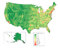 Population density map of USA (precision=county)
 -
 Population density map of EU (precision=state/province/department at least, the more detailed the better)
 -
Population density map of EU and other European countries, the more countries included the better, the more detailed the better...


Article(s): w:Americas
- Request
- I just came across this hypothesis, that the population density of the New World, after centuries of exponential growth, is still far lower than that of the Old World, especially Europe. It would be nice to have maps that use the same colour legend, so that they can be compared directly.
- The maps linked are just examples, not necessary to follow.
- It would be really cool to have a series of these maps of other countries as well, like India, China, Japan, Bangladesh, Indonesia, Southeast Asia... all these highly populated areas.
- I tried to look for existing files but I cant find much.--RZuo (talk) 10:38, 26 August 2021 (UTC)
- Graphist opinion(s)
SVG blank maps of the world centered in Asia
-
 Robinson projection centered in 162E
 -
 Winkel-Tripel projection centered in 150E

.svg)
Article(s): Various locator maps
- Request
- Hello, I have seen that we do not have any SVG maps centered on Asia in the Robinson and Winkel-Tripel projections, and I consider them necessary (preferably centered on the 90E meridian) to change the view for the locator maps for countries in the Far East, that look very strange such as this example here. The idea is to have them with the colors shown above (gray for Robinson and yellow-blue for Winkel) and preferably centered on the 90E meridian. Thank you. --Milenioscuro (talk) 18:21, 6 September 2021 (UTC)
- Graphist opinion(s)
Blank svg map of districts of Turkey
-
File:Turkey districts blank.svg
Article(s): en:Turkey_districts_blank.svg
- Request
- A blank svg map of Turkey on district level (similar to the [9]). The only district map of Turkey on Wikipedia is this[10], which is a png map.
- There is a SVG map of Turkey‘s provinces here: https://commons.wikimedia.org/wiki/File:SVG_map_centered_on_Turkey,_showing_her_provinces.svg It needs to be edited, but it’s complete and accurate, as far as I can judge it.
Balkanique (talk) 18:43, 9 October 2021 (UTC)
- Graphist opinion(s)
Request of SVG location map of South Vietnam (1955-1975)
-
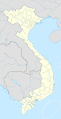 SVG location map of Vietnam
 -
 Source map
 -

-

-
 map approximation


.png)
Article(s): en:South Vietnam, vi:Việt Nam Cộng hoà, vi:Tỉnh (Việt Nam Cộng hoà),...
- Request
- Why don’t you vectorize a SVG location map of South Vietnam (1955-1975) --Baokhang48812002 (talk) 01:44, 13 October 2021 (UTC)
- Graphist opinion(s)
United Nations regional groups
-
Map of countries by UN regional group
Article(s): en:United Nations Regional Groups
- Request
- The United States is not formally a member of the Western Europe and Others Group (WEOG). Rather, they are an observer and are counted alongside WEOG solely for electoral purposes. (This is a unique case; no other UN member state holds observer status in a regional group.) Given that this map is used on the English and French Wikipedias (and I presume elsewhere) to display group membership, not merely who is counted how for electoral purposes, could the United States be given a lighter shade of that gold-ish colour to reflect that they are an observer? Thanks, 207.161.86.162 03:11, 22 October 2021 (UTC)
- Graphist opinion(s)
Ireland Border Maps
-
 Image of the Map of Ireland
 -
 Political Map of Ireland (Please convert to SVG)
 -
 New SVG blank map with flags
 -
 Additional pre-Brexit companion map


.svg)
Article(s): Various
- Request
- There’s no issue with the maps itself hence why it’s here but I just wondered if it was possible to add a flag of the UK in the Northern Ireland section and a Irish flag along with a EU flag for Southern Ireland in both of these maps to show that the Republic is a EU member given that the Irish Border is also now a EU frontier as well as the UK-border as currently this map only shows a border with nothing to indicate the current geo-political structure of the UK Irish border after Brexit. Also can the Political map be converted to SVG. Then these maps could be then used in other articles. (MOTORAL1987 (talk) 13:46, 28 October 2021 (UTC))
- Graphist opinion(s)
MOTORAL1987 I have made one SVG using an existing SVG map and added flags. It doesn't have labels, but they could be added if necessary, though I think the flags make it obvious enough. GPinkerton (talk) 17:04, 28 October 2021 (UTC)
- GPinkerton Thank you and sorry I haven’t replied until now this is a really good start and I do like it I think however labels should be added thou and also please can a flag of the Irish Republic also be added into the SVG and just maybe the flags should be made just slightly smaller otherwise it’s looking perfect. (MOTORAL1987 (talk) 12:22, 31 October 2021 (UTC))
- MOTORAL1987 I put the European flag only because I thought that was more relevant and because I didn't read the initial request properly (!) What labels are needed: country names (which? how many?, how abbreviated?), capital cities? Irish Sea? Great Britain? So far I left the labels out because that way it's universal and international; are they strictly necessary? GPinkerton (talk) 13:59, 31 October 2021 (UTC)
- Also, how should the two flags be arranged? Side by side, or one atop the other, or maybe with the Irish flag in the middle of the country and the European one closer the border? GPinkerton (talk) 14:05, 31 October 2021 (UTC)
- GPinkerton Thank you and sorry I haven’t replied until now this is a really good start and I do like it I think however labels should be added thou and also please can a flag of the Irish Republic also be added into the SVG and just maybe the flags should be made just slightly smaller otherwise it’s looking perfect. (MOTORAL1987 (talk) 12:22, 31 October 2021 (UTC))
I think the Irish and EU flags should be side by side in the centre of the map with the flags made slightly smaller so they are not overpowering to the map, oh don’t forget the labels I think Should be simply Northern Ireland with the UK in brackets under the UK flag and the Republic of Ireland with the EU in brackets in the southern section under the flags. Belfast and Dublin should also be in there with small labels and also the Irish Sea. Hope that makes sense. (MOTORAL1987 (talk) 14:17, 31 October 2021 (UTC))
- @MOTORAL1987: I have added labels and the Irish flag to the same file, although to tell the truth, I think the utility of the map is somewhat reduced thereby: the addition of labels makes the flags redundant, and the addition of flags makes the labels unnecessary, while the addition of either leads to the diminution of both (and hence to reduced readability overall). GPinkerton (talk) 15:52, 31 October 2021 (UTC)
- Can the flag sizes be slightly reduced slightly at all otherwise I think it’s generally perfect although I do think a thinker Irish border would also be welcome. Thanks so much (MOTORAL1987 (talk) 17:49, 31 October 2021 (UTC))
- @MOTORAL1987: I have reduced the flag sizes, though I have to say I think it's less attractive this way as the stripes and the stars are quite indistinct without putting the map in full screen. GPinkerton (talk) 18:38, 31 October 2021 (UTC)
- I also made a matching map that shows the pre-Brexit situation. GPinkerton (talk) 18:52, 31 October 2021 (UTC)
- @GPinkerton: Cheers I do think that works better thou, don’t worry I think it’s fine the last thing I think that just needs altering is underneath the Republic of Ireland can the text change from “(European Union) to (EU member state)” and could a third map be created which is the same as the other two but without any references to the EU please otherwise that is it. Thanks so much for doing that (MOTORAL1987 (talk) 19:44, 31 October 2021 (UTC))
- Can the flag sizes be slightly reduced slightly at all otherwise I think it’s generally perfect although I do think a thinker Irish border would also be welcome. Thanks so much (MOTORAL1987 (talk) 17:49, 31 October 2021 (UTC))
Mapa de la Ilha de Santo Aleixo
Holá, amigo. ¿Qué tal?
Soy edictor de Wikipédia y necesito de tu ayuda: ¿Podés actualizar los nombres del mapa de la Ilha de Santo Aleixo? (https://commons.wikimedia.org/wiki/File:Ilha_do_Aleixo.png)
Actualmente, el mapa no presenta los nombres de las dos playas: Praia dos Pernambucanos (Este) y Praia da Holanda (Sur), más allá de Enseada Espanha e França (Abajo de la playa ubicada en el Sur).
¡Muchas gracias, amigo!
¡Saludos!
Supermapp (talk) 19:52, 1 November 2021 (UTC)
1984 Summer Olympics medal map.png
-
 World map from 1985
 -
 Participating nations during the 1984 Summer Olympics
 -
 2012 Summer Olympics medal map
 -
 New map


Article(s): en:1984 Summer Olympics medal table
- Request
- I would like a colored map to be created showing medal results for each nation during the 1984 Summer Olympic using the blank map from 1985 as seen in the first image. The second image is a reference guide to the nations that did participates in the 1984 Summer Olympics. I also posted an example from the 2012 Summer Olympics showing medals results with countries in gold (for nations that won at least one gold medal), silver (nations that won at least one silver medal, but no gold medals), bronze (nations that ONLY won at least one bronze medal), blue (nations that won zero medals), and red (nations that did not participate in that year's Olympics). --Birdienest81 (talk) 11:16, 29 September 2021 (UTC)
- Graphist opinion(s)
- @Birdienest81: that blank map is configured for hand-coding with a text editor, and by the time I’d finished experimenting with it I had your map half done. But I have a couple of quibbles about the 2012 example. One is that colouring non-participants in red seems to draw more attention to them than to the medal achievements, counter to the ostensible purpose; I would like to colour them dark grey. Another is that IMO the circle-markers for small islands and other countries or quasi-colonies just create visual clutter unless they were participants. Who would have guessed the Vatican didn’t send a team? So my preference would be to show the dots for the BVI and Singapore, for example, but not those for the Channel Islands or Brunei. (Rather than basing participation on the 1984 example above I would go by the list at en:1984 Summer Olympics#Participating National Olympic Committees.) What are your thoughts?—Odysseus1479 (talk) 03:05, 23 October 2021 (UTC)
- @Odysseus1479: I think coloring the non-participating nations with dark grey is perfectly fine. Your suggestion on basing the participation of each nation by the aforementioned list you've mentioned works for me. You're free to make the map as how you see fit.
![]() Done. @Birdienest81: please check it over and let me know if there are any problems. I grouped non-participant colonies &c. with their parent countries, so for example Greenland is silver and St-Pierre-et-Miquelon is gold.—Odysseus1479 (talk) 08:36, 2 November 2021 (UTC)
Done. @Birdienest81: please check it over and let me know if there are any problems. I grouped non-participant colonies &c. with their parent countries, so for example Greenland is silver and St-Pierre-et-Miquelon is gold.—Odysseus1479 (talk) 08:36, 2 November 2021 (UTC)
- @Odysseus1479: Looks good. I wonder though if you could crop out the Antarctica continent and/or the outer board representing the shape of the globe so that it does look like the 2012 map. Otherwise, I placed the map onto the 1984 Summer Olympics medal table. Great work.
- --Birdienest81 (talk) 10:26, 2 November 2021 (UTC)
- @Birdienest81: I had the same idea earlier, and tried to crop it by hacking the code but got, shall we say, unexpected results. (Making the ocean & Antarctica disappear is easy; it’s getting rid of the extra space that I’m finding hard.) I might be able to figure out the coördinates with some more experimenting, though. It would be simple to crop in a graphic editor, but I’d rather leave that as a last resort because it will lose the CSS-editability. (Then again, the original would still be available from the file history.)—Odysseus1479 (talk) 03:24, 3 November 2021 (UTC) P.S. Never mind, figured it out, Done.—05:06, 3 November 2021 (UTC)
- @Odysseus1479: Looks good. I wonder though if you could crop out the Antarctica continent and/or the outer board representing the shape of the globe so that it does look like the 2012 map. Otherwise, I placed the map onto the 1984 Summer Olympics medal table. Great work.
1356 Poitiers campaign
-
Routes of the French and Anglo-Gascon armies through south-west France in 1356
-
Manoeuvres leading to the Battle of Poitiers
Article(s): en:Black Prince's chevauchée of 1356
- Request
- Two maps showing the movements of the French and Anglo-Gascon armies through south-west France in 1356 prior to the en:Battle of Poitiers. I will need to email through copies of the maps from my hard copy sources to whoever generously takes this on.
- Details
- The first map will be similar to File:Map of route of Black Prince chevauchée of 1355.svg or File:Map of the route of Edward III's chevauchée of 1346.svg. The second map will be simpler. Gog the Mild (talk) 22:19, 3 December 2021 (UTC)
- Graphist opinion(s)
Holocaust Denial Laws
-
 Description of first image
 -
Description of second image (if needed)
-
Description of third image (if needed; don't request too many at once, though)

Article(s): Legality of Holocaust denial
- Request
- Please add Bosnia & Herzegovina to the list as it recently criminalized all genocide denial. --2603:8081:1602:E41F:502B:1E46:3FC1:9898 20:15, 26 December 2021 (UTC)
- Graphist opinion(s)
Wikipedia:Village pump (technical) discussion on SVG maps
Looking for additional knowledgeable people in this SVG map discussion:
--Timeshifter (talk) 03:09, 31 December 2021 (UTC)
Rewritten map of South American tectonics
Article(s): en:Pali-Aike volcanic field
- Request
- I need someone to alter this map in accordance with the request here. To be clear, the line that separates the Scotia and South American plate is the Magallanes-Fagnano fault. --Jo-Jo Eumerus (talk) 17:01, 16 December 2021 (UTC)
- Graphist opinion(s)
- Hi @Jo-Jo Eumerus: it's not really clear what should be changed, could you provide a coincise description since i think moust of us are not experts of tectonic plates? Furthermore, Thee only geographical source I found is this one (an you can find here it as geojson) which has more plates than the currnt image on commons. It's the only sourece I found. If you have other ones, they are welcome. Best --Sette-quattro (talk) 09:07, 3 January 2022 (UTC)
- Greetings, Sette-quattro. What I need is:
- Crop the map so that it covers only the lowermost part of South America.
- Label the squiggly line between the Nazca and Antarctic plate as "Chile Rise"
- Label the vertical line between the South America and Nazca plate as "Peru-Chile Trench"
- Label the horizontal line between the South America and Scotia plate - specifically the part in South America - as the "Magallanes-Fagnano and Deseado faults"
- Does this help?Jo-Jo Eumerus (talk) 13:20, 3 January 2022 (UTC)
- Greetings, Sette-quattro. What I need is:
Rivers in China


Article(s): zh:中华人民共和国最长河流列表
- Request
- Please help re-upload (as a new file) the historical version of this map without those river names (i.e., please help upload this version).
- The existing version labels those rivers with their historical names, therefore I cannot use them to talk about rivers in the modern China. --173.75.31.249 19:10, 27 December 2021 (UTC)
- Graphist opinion(s)
- I can do a new version starting from geograhpical data. Do you have a source (a shapefile, a geojson) for the rivers? --Sette-quattro (talk) 21:11, 29 December 2021 (UTC)
- Sorry I don’t … I am not the original author of the map. —173.75.31.249 00:07, 30 December 2021 (UTC)
- Done @173.75.31.249: let me know if it's fine. --Sette-quattro (talk) 19:43, 1 January 2022 (UTC)
- Woohoo! One small icing on the cake: the map currently includes all the natural rivers in China, perhaps w:en:Grand Canal (China) can be included as well? The map looks totally awesome on its own; major rivers & their locations are all accurate. Mentioning this only because you named it "Rivers in China" instead of "Natural Rivers in China". --173.75.31.249 06:08, 2 January 2022 (UTC)
- Hi, i did not found any geograhpical data (shapefile) of the grand canal. furthermore, i'm not sure if it's a good idea to mix different data sources, but this is a decundary issue. One thing that we could do is to label the rivers in different languages, or at least to number them, what do you think? --Sette-quattro (talk) 08:20, 3 January 2022 (UTC)
- Labeling rivers sounds like a good idea to me. We can certainly keep this blank version, and have new files with river labels in different languages built on top of it. Yet this sounds like a large commitment; I don't mean to burden you too much. Please let me know how I may help. -- 173.75.31.249 02:10, 4 January 2022 (UTC)
- Hi, i did not found any geograhpical data (shapefile) of the grand canal. furthermore, i'm not sure if it's a good idea to mix different data sources, but this is a decundary issue. One thing that we could do is to label the rivers in different languages, or at least to number them, what do you think? --Sette-quattro (talk) 08:20, 3 January 2022 (UTC)
- Woohoo! One small icing on the cake: the map currently includes all the natural rivers in China, perhaps w:en:Grand Canal (China) can be included as well? The map looks totally awesome on its own; major rivers & their locations are all accurate. Mentioning this only because you named it "Rivers in China" instead of "Natural Rivers in China". --173.75.31.249 06:08, 2 January 2022 (UTC)
- Sorry I don’t … I am not the original author of the map. —173.75.31.249 00:07, 30 December 2021 (UTC)
Location Maps of Mid-Atlantic and Northeast United States
-
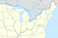 Existing map of the northeast United States
 -
 Existing map of the Mid-Atlantic United States
 -
 Cropped version of first map
 -
 Cropped (to Midatlantic states) version of the first map
 -
 Mid-Atlantic states (WGS84)
 -
 Northeastearn states (WGS84)


.svg)


Article(s): Various
- Request
- The existing location maps of the Mid-Atlantic and Northeast United States cover an area much more broad than what is usually considered part of both of those two areas. (see [11] and [12] for reference) This means that it is more likely that location maps that have multiple marks will be difficult to read due to overlap. (Yes, I know that a magnified version wouldn't solve all of the problems in this example, but it would still be useful more broadly.) Therefore, a version of the Northeast map above showing only roughly the area from central Ohio east and northern Virginia north and a version of the Mid-Atlantic map above showing only the area from eastern Massachusetts west, northern North Carolina north, and the Canadian border south would be helpful. –Noha307 (talk) 01:16, 25 October 2021 (UTC)
- Graphist opinion(s)
![]() Done Both. I didn't use the second, because it's a PNG, but the first was useable for both. MjolnirPants (talk) 15:25, 1 November 2021 (UTC)
Done Both. I didn't use the second, because it's a PNG, but the first was useable for both. MjolnirPants (talk) 15:25, 1 November 2021 (UTC)
- MPants at work, The map for Mid-Atlantic States has clipped Long Island from NYS. I recommend extending the right boundary to include that. Also, it would be helpful to get the extent in lat/long for each so they be can used in a {{Location}} template. Thanks for taking on Noha307 's request. - DutchTreat (talk) 10:30, 9 November 2021 (UTC)
- I've added back in Long Island. As for the geo coordinates, those are not embedded in the files, and not formally defined as far as I'm aware. I just looked at it in Google Earth and the mid-Atlantic region is roughly bound at [46.567394,-82.145506],[35.161925,-71.515667]. You can get the coordinates for the first map the same way (the current coordinates of the cursor are shown at the bottom right of the Google Earth viewport pane). MjolnirPants (talk) 13:40, 9 November 2021 (UTC)
- MPants at work Yes, thanks for doing this. I appreciate it.
- DutchTreat I considered doing the work myself, but not knowing how to add the location map functionality was one of the things that stopped me. (Another is my limited skill with vector editing programs.) After a bit of looking around, I came across an explanation of the process, so I'll try to take a whack at it when I get a chance. I might be able to add the {{Location}} template you mentioned at the same time, but I'm not sure how this would work with an image depicting an area more broad than just a single point as the template does not appear to be designed for that capability. –Noha307 (talk) 06:00, 11 November 2021 (UTC)
- Noha307 No worries. I will help you turn these into locator maps. Due to my schedule, I'll need a few days to complete. - DutchTreat (talk) 10:29, 11 November 2021 (UTC)
- DutchTreat Thanks! I appreciate the help! I didn't want to leave all the work up to you, so I tried creating modules and documentation pages for the maps (1, 2) based off of the example the image file was based on and I think I got most of it correct. However, what I'm stuck on is that I don't know how to obtain the exact coordinates for the edges of the maps. I was able to get the sample pushpins in the documentation close based on guess and check by slightly adjusting them and then using the page preview, but I'm sure it's slightly off. The USA Northeast map also uses some sort of calculation I am not familiar with to correct for the distortion of the map projection. –Noha307 (talk) 22:09, 14 November 2021 (UTC)
- Noha307 Good start! I agree the issue is with the projection needs to correct for a different Coordinate Reference System (CRS). Let me have a look to see if I can fix it. - DutchTreat (talk) 12:55, 21 November 2021 (UTC)
- DutchTreat Did you have any luck correcting the coordinates for the location maps? –Noha307 (talk) 01:03, 7 December 2021 (UTC)
- Noha307 Good start! I agree the issue is with the projection needs to correct for a different Coordinate Reference System (CRS). Let me have a look to see if I can fix it. - DutchTreat (talk) 12:55, 21 November 2021 (UTC)
- DutchTreat Thanks! I appreciate the help! I didn't want to leave all the work up to you, so I tried creating modules and documentation pages for the maps (1, 2) based off of the example the image file was based on and I think I got most of it correct. However, what I'm stuck on is that I don't know how to obtain the exact coordinates for the edges of the maps. I was able to get the sample pushpins in the documentation close based on guess and check by slightly adjusting them and then using the page preview, but I'm sure it's slightly off. The USA Northeast map also uses some sort of calculation I am not familiar with to correct for the distortion of the map projection. –Noha307 (talk) 22:09, 14 November 2021 (UTC)
- Noha307 No worries. I will help you turn these into locator maps. Due to my schedule, I'll need a few days to complete. - DutchTreat (talk) 10:29, 11 November 2021 (UTC)
- I've added back in Long Island. As for the geo coordinates, those are not embedded in the files, and not formally defined as far as I'm aware. I just looked at it in Google Earth and the mid-Atlantic region is roughly bound at [46.567394,-82.145506],[35.161925,-71.515667]. You can get the coordinates for the first map the same way (the current coordinates of the cursor are shown at the bottom right of the Google Earth viewport pane). MjolnirPants (talk) 13:40, 9 November 2021 (UTC)
Noha307 - Sorry, no progress in learning how to do the CRS transform formulas. I looked the ones for wikipedia:Module:Location_map/data/USA and wikipedia:Module:Location_map/data/USA_Northeast. There appears to be a basic substitution needed, but I'm not sure what that should be. - DutchTreat (talk) 12:11, 8 December 2021 (UTC)
- DutchTreat No problem, thanks for trying anyway. –Noha307 (talk) 04:33, 14 December 2021 (UTC)
- @Noha307: I received some background info from User:Sting. I am now thinking it would be best for me to re-draw the map with a equirectangular projection. - DutchTreat (talk) 21:00, 14 December 2021 (UTC)
- @Noha307: Completed two maps using a equirectangular projection Mid-Atlantic states and Northeastearn states. I updated your mod w:Module:Location map/data/USA Mid-Atlantic. I noticed that Dmm1169 on 15 December a new mod w:Module:Location map/data/USA Northeastern. I started a discussion on the talk page to determine which map file to use there. - DutchTreat (talk) 13:30, 16 December 2021 (UTC)
- The file w:Module:Location map/data/USA Northeastern was created for the module. Creating the module is simpler using a Mercator projection map where the borders can be defined by a simple lat/long. It does include [[Mid-Atlantic states so I'd be ok if it's renamed USA Mid-Atlantic and Northeast if that's better.-Dmm1169 (talk) 15:38, 16 December 2021 (UTC)
- @Dmm1169: I agree that a projection that is equirectangular is preferred. I also support two modules: one for Northeast (zoomed in from the current larger one starting in the midwest) like you created and a second module for the middle Atlantic states. My comment was on the module for USA Northweastern. I prefer the SVG map file. Hope that helps clarify my position. - DutchTreat (talk) 14:03, 18 December 2021 (UTC)
- DutchTreat, Dmm1169: I appreciate the help guys. Since I understand that pushpin location maps are somewhat falling out of favor anyway, I was going to suggest just dropping the effort due to the complications. Thanks for continuing on.
- I feel like USA Northeast should be renamed – the similarity of the name to USA Northeastern is already confusing me. However, I can't think of a better name as there doesn't seem to be any generally accepted term for the region of the United States it depicts. Any ideas? (Sorry Dutch, I like SpongeBob as much as the next guy, but I don't think "USA Northweastern" is going to work as a title.) The best I can come up with is "Midwest and Northeast".
- Also, should w:Module:Location map/data/USA Northeast (cropped) be deleted? If it is left up I am afraid people might try to use it without knowing it won't display locations accurately. –Noha307 (talk) 20:30, 20 December 2021 (UTC)
- @Dmm1169: I agree that a projection that is equirectangular is preferred. I also support two modules: one for Northeast (zoomed in from the current larger one starting in the midwest) like you created and a second module for the middle Atlantic states. My comment was on the module for USA Northweastern. I prefer the SVG map file. Hope that helps clarify my position. - DutchTreat (talk) 14:03, 18 December 2021 (UTC)
- The file w:Module:Location map/data/USA Northeastern was created for the module. Creating the module is simpler using a Mercator projection map where the borders can be defined by a simple lat/long. It does include [[Mid-Atlantic states so I'd be ok if it's renamed USA Mid-Atlantic and Northeast if that's better.-Dmm1169 (talk) 15:38, 16 December 2021 (UTC)
- @Noha307: Completed two maps using a equirectangular projection Mid-Atlantic states and Northeastearn states. I updated your mod w:Module:Location map/data/USA Mid-Atlantic. I noticed that Dmm1169 on 15 December a new mod w:Module:Location map/data/USA Northeastern. I started a discussion on the talk page to determine which map file to use there. - DutchTreat (talk) 13:30, 16 December 2021 (UTC)
- @Noha307: I received some background info from User:Sting. I am now thinking it would be best for me to re-draw the map with a equirectangular projection. - DutchTreat (talk) 21:00, 14 December 2021 (UTC)
Maps of USA Northeast # Map Next steps 1 USA Northeast Rename - "USA Midwest and Northeast"
I like Noha307's proposal.2 USA Northeastern Update - swap image from "USA Northeastern.png" to "USA Northeast location map.svg".
The SVG map I created has the following advantages. (a) Uses color coding to clearly define which states are in the region. (b) It uses a scaleable SVG format. (c) Zoomed in to provide better definition.
I'll let community consensus drive the result, since I created this map.3 USA Northeast (cropped) Delete not used as of 2021-12-22.
This map is not needed. Could cause confusion.4 USA Mid-Atlantic No changes
Sorry about the typo for "Northweastern", but glad it provided some unintended humor! - DutchTreat (talk) 11:46, 22 December 2021 (UTC)
- @DutchTreat Sorry it took so long, but the image file and associated template and documentation for USA Northeast has been renamed to USA Midwest and Northeast. I haven't had a chance to address the other ones. –Noha307 (talk) 01:30, 7 March 2022 (UTC)
Locator map of Kurdistan
-
 Kurdish inhabited areas, with countries boundaries
 -
 Kurdish inhabited areas, without boundaries
 -
 Detailed map, mercator projection

.svg)
.svg)
.svg)
.svg)
.svg)
.jpg)
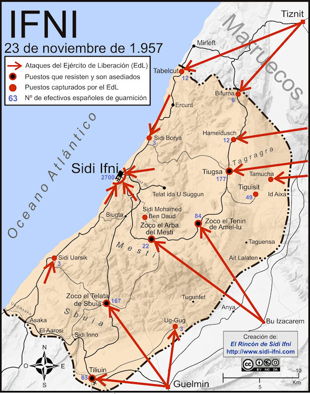
.svg&action=edit&redlink=1)
.svg&action=edit&redlink=1)
.svg)
.svg)
![[9]](https://commons.wikimedia.org/wiki/File:BlankMapTurkeyProvinces.png)
![[11]](https://en.wikipedia.org/wiki/File:The_Mid-Atlantic_States.png)
![[12]](https://en.wikipedia.org/wiki/File:Map_of_the_North_Eastern_United_States.svg)
Article: e.g. Kurds, Kurdistan
- Request
- Adapt Map 0.2 from The Cambridge History of the Kurds
- Make a standard grey-green location map for the same area as is marked on Map 0.2 on page xxviii of The Cambridge History of the Kurds (Bozarslan, Gunes, & Yadirgi, 2021). The "Map of Kurdish inhabited areas" should be laid over the typical grey-green orthographic projection centred on, say, Jazirat ibn ʿUmar (Turkish: Cizre). Versions with and without international borders would both be useful. GPinkerton (talk) 20:54, 5 October 2021 (UTC)
- Graphist opinion(s)
| Extended content |
|---|
This is important as it gives me information on how I/we can use it. --please ping me-- Goran tek-en (talk) 15:21, 21 October 2021 (UTC)
@GPinkerton: I really would need to know if you want me to withdraw my take so someone else can work on this, thanks. --please ping me-- Goran tek-en (talk) 19:08, 1 November 2021 (UTC)
|
.svg)
.svg)
.png)
.svg)
- Hi @GPinkerton: , what you are requesting is really complex. Orthographic maps are generated using existing shapefiles (the format to encode geographical locations).
Converting an image into a shapefile is quite complex. You could do it using QGIS, but it's not a simple task. to be honest I haven't seen other historical maps represented with orthogonal projection. Sette-quattro (talk) 12:40, 29 November 2021 (UTC)
- Hi @GPinkerton: , i've done it. It has been a really complex task but I learnt lots of stuff. All the metadata must be added. Let me know what do you think and in case mark it as done Sette-quattro (talk) 18:35, 16 December 2021 (UTC)
- @Sette-quattro: Hi thanks so much for doing this! I'm very impressed. Would it be possible to make a version without the white political borders? Additionally, it would also be great to have a flat map of the same area (did you make a new shapefile for the highlighted areas?) such a map would be good to have for the making the details of the region more visible. GPinkerton (talk) 01:55, 11 January 2022 (UTC)
- Sure, as soon as I have time. I don't know if there are established practices on how to share on commons shapefiles, i'd like to do so. I can upload a newer version without political boundaries.
- I can also produce a mercator projection (flat map) of the area. should I add or not political boundaries?
- Best --Sette-quattro (talk) 08:35, 11 January 2022 (UTC)
- @Sette-quattro: Political boundaries would be most useful, though a version without could also be helpful. If the borders are shown, then it would be good if they went over the top of the green area, so as to still be visible there. GPinkerton (talk) 16:48, 11 January 2022 (UTC)
- @GPinkerton: I only had time now to add the two versions you requested, please let me know if they are fine. in case mark the section as solved! BestSette-quattro (talk) 14:24, 6 May 2022 (UTC)
- @Sette-quattro: Political boundaries would be most useful, though a version without could also be helpful. If the borders are shown, then it would be good if they went over the top of the green area, so as to still be visible there. GPinkerton (talk) 16:48, 11 January 2022 (UTC)
- @Sette-quattro: Hi thanks so much for doing this! I'm very impressed. Would it be possible to make a version without the white political borders? Additionally, it would also be great to have a flat map of the same area (did you make a new shapefile for the highlighted areas?) such a map would be good to have for the making the details of the region more visible. GPinkerton (talk) 01:55, 11 January 2022 (UTC)
- Hi @GPinkerton: , i've done it. It has been a really complex task but I learnt lots of stuff. All the metadata must be added. Let me know what do you think and in case mark it as done Sette-quattro (talk) 18:35, 16 December 2021 (UTC)