Category:Road signs in Madison County, Florida
Jump to navigation
Jump to search
Counties of Florida: Alachua · Baker · Bay · Bradford · Brevard · Broward · Calhoun · Charlotte · Citrus · Clay · Collier · Columbia · Dixie · Duval · Escambia · Flagler · Franklin · Gadsden · Gilchrist · Glades · Hamilton · Hardee · Hendry · Hernando · Highlands · Hillsborough · Holmes · Indian River · Jackson · Jefferson · Lafayette · Lake · Lee · Leon · Levy · Liberty · Madison · Manatee · Marion · Martin · Miami-Dade · Monroe · Nassau · Okaloosa · Okeechobee · Orange · Osceola · Palm Beach · Pasco · Pinellas · Polk · Putnam · Santa Rosa · Sarasota · Seminole · St. Johns · St. Lucie · Sumter · Suwannee · Taylor · Union · Volusia · Wakulla · Walton · Washington
Media in category "Road signs in Madison County, Florida"
The following 80 files are in this category, out of 80 total.
-
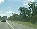
 CR53 NB Madison County border, Florida.jpg 5,184 × 3,456; 6.72 MB
-
 CR53 SB, Lafayette County border, Florida.jpg 5,036 × 3,456; 6.68 MB
-
 Day 23 (29187944105).jpg 2,400 × 1,600; 2.34 MB
-
 EB I-10 Madison Co Rest Area-02.jpg 2,774 × 2,195; 916 KB
-
 EB I-10 Madison Co Rest Area-03.jpg 4,608 × 3,456; 3.65 MB
-
 EB I-10 Madison Co Rest Area-04.jpg 3,622 × 1,733; 953 KB
-
 EB I-10 Madison Co Rest Area-05.jpg 3,330 × 2,052; 1.13 MB
-
 EB I-10 Madison Co Rest Area-06.jpg 4,608 × 3,456; 3.76 MB
-
 EB I-10 Madison Co Rest Area-08.jpg 4,608 × 3,456; 3.77 MB
-
 EB I-10 Madison Co Rest Area-09.jpg 4,608 × 3,456; 4 MB
-
 EB I-10 Madison Co Rest Area-10.jpg 4,608 × 3,456; 3.95 MB
-
 EB I-10 Madison Co Rest Area-17.jpg 4,608 × 3,456; 3.67 MB
-
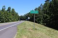
 EB I-10 Madison Co Rest Area; 1 Mile.jpg 4,608 × 3,456; 4.02 MB
-
 EB I-10 Madison Co Rest Area; Location Sign.jpg 4,608 × 3,456; 3.93 MB
-
 EB I-10 Madison Co Truck Weigh Station-01.jpg 4,608 × 3,456; 3.79 MB
-
 EB I-10 Madison Co Truck Weigh Station-02.jpg 4,608 × 3,456; 3.72 MB
-
 EB I-10 Madison Co Truck Weigh Station-04.jpg 4,608 × 3,456; 3.99 MB
-
 EB I-10 Madison Co Truck Weigh Station-05.jpg 4,608 × 3,456; 3.7 MB
-
 Ellaville border, US90WB.jpg 5,184 × 3,456; 6.87 MB
-
 Entering Jefferson County, US221NB, Florida.JPG 4,320 × 3,240; 4.52 MB
-
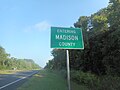
 Entering Madison County, US221SB, Florida.JPG 4,320 × 3,240; 4.55 MB
-
 Farm Road Recreation Facility sign.jpg 3,264 × 2,448; 2.61 MB
-
 FL 145 End, Madison.jpg 5,184 × 3,456; 6.74 MB
-
 FL6wEnd-US90ewRoad (29187941055).jpg 2,400 × 1,600; 2.47 MB
-
 Florida I10wb Jefferson County.jpg 5,184 × 3,456; 4.16 MB
-
 Florida State line, FL53 SB.JPG 5,152 × 3,864; 7.9 MB
-
 Florida State Line, GA 31 SB.JPG 4,320 × 3,240; 4.43 MB
-
 GA-FL state line Brooks-Madison north01.jpg 2,448 × 3,264; 2.02 MB
-
 GA-FL state line Brooks-Madison north02.jpg 3,264 × 2,448; 1.72 MB
-
 GA-FL state line Brooks-Madison south01.jpg 3,264 × 2,448; 1.21 MB
-
 GA-FL state line Brooks-Madison south02.jpg 3,264 × 2,448; 2.28 MB
-
 Georgia State Line, GA 31 NB.JPG 4,320 × 3,240; 4.53 MB
-
 Georgia State line, GA333 NB.JPG 5,152 × 3,864; 7.84 MB
-
 Georgia State Route 31 bridge Brooks County NB 01.JPG 4,608 × 3,456; 3.65 MB
-
 Georgia State Route 31 bridge Brooks County SB 07.JPG 4,608 × 3,456; 3.62 MB
-
 Greenville Baptist Church.JPG 4,320 × 3,240; 4.51 MB
-
 Greenville City Limit, US221NB.jpg 5,184 × 3,456; 9.57 MB
-
 Greenville city limit, US221SB.JPG 4,320 × 3,240; 4.4 MB
-
 Greenville city limit, US90WB.JPG 4,320 × 3,240; 4.46 MB
-
 Greenville FL US 90 east01.jpg 3,264 × 2,448; 1.45 MB
-
 Greenville FL US 90 west01.jpg 3,264 × 2,448; 1.62 MB
-
 Greenville welcome, US90EB.JPG 4,320 × 3,240; 4.48 MB
-
 Hanson Sign, Florida 145 NB.JPG 4,320 × 3,240; 4.46 MB
-
 Hanson Sign, Florida 145 SB.JPG 4,320 × 3,240; 4.58 MB
-
 Lafayette County border, NW County Rd 53 SB.jpg 5,184 × 3,456; 9.39 MB
-
 Lee city limit, CR255NB 2024.jpg 5,184 × 3,456; 5.05 MB
-
 Lee city limit, CR255NB.JPG 4,608 × 3,456; 4.69 MB
-
 Lee City limit, CR255SB.JPG 4,608 × 3,456; 5.21 MB
-
 Lee City limit, US90EB.JPG 4,608 × 3,456; 4.8 MB
-
 Lee city limit, US90WB.JPG 4,608 × 3,456; 5.65 MB
-
 Lee School Ave RR Crossing.JPG 4,608 × 3,456; 4.27 MB
-
 Lee welcome sign, US90EB.JPG 4,608 × 3,456; 5.9 MB
-
 Lee welcome sign, US90WB.JPG 4,608 × 3,456; 5.26 MB
-
 Lee, Florida (29205567185).jpg 2,400 × 1,600; 2.16 MB
-
 Looking North at US90 221 intersection, Greenville.JPG 4,320 × 3,240; 4.47 MB
-
 Looking SB at Broad St railroad crossing, Greenville.JPG 4,320 × 3,240; 4.55 MB
-
 Madison County Airport sign off of US90.JPG 4,608 × 3,456; 5.77 MB
-
 Madison County border, NW County Rd 53 NB.jpg 5,184 × 3,456; 10.01 MB
-
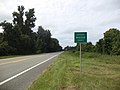
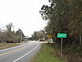
 Madison County border, US90WB.jpg 5,184 × 3,456; 8.18 MB
-
 Madison Sign, Fl53 SB.JPG 4,320 × 3,240; 4.44 MB
-
 Madison Sign, Florida 145 SB.JPG 4,320 × 3,240; 4.36 MB
-
 NB US 19-27 Enters Madison County, FL.jpg 3,648 × 2,736; 2.04 MB
-
 NB US 19-27 near Madison CR 150.jpg 3,648 × 2,736; 1.59 MB
-
 NB US 19-27 North of Madison CR 150.jpg 3,648 × 2,736; 2.08 MB
-
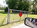
 No Gas Powered Boats sign at Farm Road Recreation Facility.jpg 2,659 × 1,871; 1.17 MB
-
 OldSuwaneeBridgeUS90-RoadClosed400FeetSign (29127146731).jpg 2,400 × 1,600; 3.66 MB
-
 Pinetta Sign, Fl145 NB.JPG 4,320 × 3,240; 4.49 MB
-
 Pinetta Sign, Fl145 SB.JPG 4,320 × 3,240; 4.5 MB
-
 S Range St Railroad Crossing, Madison.JPG 4,320 × 3,240; 4.49 MB
-
 SB US 19-27 Enters Madison Co @ Aucllia River Bridge.jpg 3,648 × 2,736; 2.08 MB
-
 Suwannee County border, US90EB.jpg 5,184 × 3,456; 8.76 MB
-
 Taylor County, CR14WB.JPG 4,608 × 3,456; 5 MB
-
 US221 SB at Interstate 10.jpg 5,184 × 3,456; 4.44 MB
-
 US221 SB Interstate 10 East West.jpg 5,184 × 3,456; 4.38 MB
-
 US90eFL53sSignsRoadMadison (29127144341).jpg 2,400 × 1,600; 2.17 MB
-
 US90eRoad-US221nSign-GreenvilleFL (29127142071).jpg 2,400 × 1,600; 2.11 MB
-
 US90eUS221sSignsRoad-GreenvilleFL (29205565125).jpg 2,400 × 1,600; 2.37 MB
-
 US90wRoad-FL53FL145signsMadison (29109727421).jpg 2,400 × 1,600; 1.91 MB
-
 Welcome to Madison, FL53 NB.JPG 4,320 × 3,240; 4.49 MB
-
 Welcome to Madison, US 90WB.JPG 4,320 × 3,240; 4.56 MB


.jpg)


.jpg)


.jpg)


.jpg)


.jpg)
.jpg)
.jpg)
.jpg)

