Category:Road signs in Baker County, Florida
Jump to navigation
Jump to search
Counties of Florida: Alachua · Baker · Bay · Bradford · Brevard · Broward · Calhoun · Charlotte · Citrus · Clay · Collier · Columbia · Dixie · Duval · Escambia · Flagler · Franklin · Gadsden · Gilchrist · Glades · Hamilton · Hardee · Hendry · Hernando · Highlands · Hillsborough · Holmes · Indian River · Jackson · Jefferson · Lafayette · Lake · Lee · Leon · Levy · Liberty · Madison · Manatee · Marion · Martin · Miami-Dade · Monroe · Nassau · Okaloosa · Okeechobee · Orange · Osceola · Palm Beach · Pasco · Pinellas · Polk · Putnam · Santa Rosa · Sarasota · Seminole · St. Johns · St. Lucie · Sumter · Suwannee · Taylor · Union · Volusia · Wakulla · Walton · Washington
Media in category "Road signs in Baker County, Florida"
The following 82 files are in this category, out of 82 total.
-
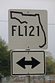 "FL121" Sign (31715707820).jpg 1,600 × 2,400; 1.59 MB
-
 American Inn, Macclenny.JPG 4,320 × 3,240; 4.38 MB
-
 Baker County 231, Osceola National Forest Recreation Area.jpg 5,184 × 3,456; 9.56 MB
-
 Baker County boundary FLSR2SB.JPG 5,152 × 3,864; 7.93 MB
-
 Baker County boundary FLSR2WB.JPG 5,152 × 3,864; 7.96 MB
-
 Baker County Health Department, Macclenny.JPG 4,320 × 3,240; 4.61 MB
-
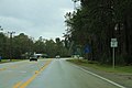
 Baker County limit, US90EB.jpg 5,184 × 3,456; 7.49 MB
-
 Baker County, US90WB.jpg 5,184 × 3,456; 8.38 MB
-
 Charlton County boundary GASR94EB.JPG 5,152 × 3,864; 7.87 MB
-
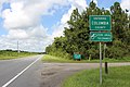
 Columbia County boundary FLSR2NB.JPG 5,152 × 3,864; 7.8 MB
-
 Columbia County limit, US90WB.jpg 5,184 × 3,456; 7.44 MB
-
 FL121sRoadSign-McClenneyAndInt10 (33835260511).jpg 2,400 × 1,600; 1.86 MB
-
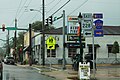 FL228eCR228wSigns-US90wRoadMcClenny (32091353945).jpg 2,400 × 1,600; 2.17 MB
-
 Florida I-10 Reststop.JPG 4,608 × 3,456; 4.45 MB
-
 Florida I10eb Baker County limit.JPG 4,320 × 3,240; 4.32 MB
-
 Florida I10eb County Rd 229 Overpass.JPG 4,320 × 3,240; 4.6 MB
-
 Florida I10eb Exit 324 1 mile.JPG 5,184 × 3,456; 3.79 MB
-
 Florida I10eb Exit 324.JPG 4,320 × 3,240; 4.47 MB
-
 Florida I10eb Exit 327 1 mile.jpg 5,184 × 3,456; 4.19 MB
-
 Florida I10eb Exit 327.JPG 5,184 × 3,456; 4.24 MB
-
 Florida I10eb Exit 333 1 mile.JPG 5,184 × 3,456; 4.41 MB
-
 Florida I10eb Exit 333.JPG 5,184 × 3,456; 4.42 MB
-
 Florida I10eb Exit 335 1 mile.jpg 5,184 × 3,456; 4.36 MB
-
 Florida I10eb Exit 335.JPG 5,184 × 3,456; 4.04 MB
-
 Florida I10eb Exit 336 .5 mile.jpg 5,184 × 3,456; 4.93 MB
-
 Florida I10eb Exit 336.JPG 5,184 × 3,456; 5.04 MB
-
 Florida I10eb Leaving Osceola National Forest.jpg 5,184 × 3,456; 4.44 MB
-
 Florida I10eb Nassau County line.JPG 5,184 × 3,456; 4.47 MB
-
 Florida I10eb Rest Area 20111 2 miles.jpg 5,184 × 3,456; 4.06 MB
-
 Florida I10eb Rest Area 20111 from I10.jpg 5,184 × 3,456; 4.43 MB
-
 Florida I10eb Rest Area 20111 Next Right.jpg 5,184 × 3,456; 4.57 MB
-
 Florida I10eb rest area 20121 exit.JPG 4,320 × 3,240; 4.35 MB
-
 Florida I10wb Columbia County line.JPG 4,320 × 3,240; 4.46 MB
-
 Florida I10wb Exit 324 1 mile.JPG 4,320 × 3,240; 4.45 MB
-
 Florida I10wb Exit 324.JPG 4,320 × 3,240; 4.44 MB
-
 Florida I10wb Exit 327 1 mile.JPG 4,320 × 3,240; 4.06 MB
-
 Florida I10wb Exit 327.JPG 4,320 × 3,240; 4.2 MB
-
 Florida I10wb Exit 333 1 mile.JPG 4,320 × 3,240; 4.42 MB
-
 Florida I10wb Exit 335 .75 mile.JPG 4,320 × 3,240; 4.39 MB
-
 Florida I10wb Exit 335.JPG 4,320 × 3,240; 4.02 MB
-
 Florida I10wb Exit 336 1 mile.JPG 4,320 × 3,240; 4.49 MB
-
 Florida I10wb Exit 336.JPG 4,320 × 3,240; 4.46 MB
-
 Florida Interstate 10wb Baker County line.JPG 4,320 × 3,240; 4.22 MB
-
 Glen St. Mary town limit sign US90 WB.JPG 4,320 × 3,240; 4.54 MB
-
 I-10 WB from FL121.JPG 4,320 × 3,240; 4.57 MB
-
 Macclenny City Limit FL121 NB.JPG 4,320 × 3,240; 4.5 MB
-
 Macclenny Pinnacle Tower; Distant Shot.jpg 3,648 × 2,736; 2.08 MB
-
 N End FL 121 @ Saint Mary's River Bridge.jpg 3,648 × 2,736; 2.06 MB
-
 Nassau County, US90EB.jpg 5,184 × 3,456; 6.8 MB
-
 NB FL 121 @ Baker CR 23C.jpg 3,648 × 2,736; 2.1 MB
-
 NB FL 121 @ Baker CR C-23A in MacClenny.jpg 3,648 × 2,736; 2.06 MB
-
 NB FL 121 @ Baker CRs 23B and 228.jpg 3,648 × 2,736; 2.04 MB
-
 NB FL 121 @ EB I-10 in Macclenny-1.jpg 3,648 × 2,736; 2.11 MB
-
 NB FL 121 @ EB I-10 in Macclenny-2.jpg 3,648 × 2,736; 2.12 MB
-
 NB FL 121 @ South Prong Saint Mary's River Bridge-02.jpg 3,648 × 2,736; 2.08 MB
-
 NB FL 121 @ South Prong Saint Mary's River Bridge-03.jpg 3,648 × 2,736; 2.08 MB
-
 NB FL 121 @ US 90 in MacClenny.jpg 3,648 × 2,736; 2.04 MB
-
 NB FL 121 in MacClenny; St George 17-Folkston 42.jpg 3,648 × 2,736; 2.1 MB
-
 NB FL 121 near NB Baker CR 125-01.jpg 3,648 × 2,736; 2.03 MB
-
 NB FL 121 near NB Baker CR 125-02.jpg 3,648 × 2,736; 2.07 MB
-
 NB FL 121 Truck Weigh Station; One Mile.jpg 3,648 × 2,736; 1.98 MB
-
 NB FL 121 Weigh Station; All Trucks Enter When Flashing.jpg 3,648 × 2,736; 2.09 MB
-
 NB FL 121; Agricultural Inspection Stations-01.jpg 3,648 × 2,736; 2.11 MB
-
 NB FL 121; Agricultural Inspection Stations-02.jpg 3,648 × 2,736; 2.06 MB
-
 NB FL 121; Agricultural Inspection Stations-03.jpg 3,648 × 2,736; 2.06 MB
-
 NB FL 121; Agricultural Inspection Stations-04.jpg 3,648 × 2,736; 2.12 MB
-
 NB FL 121; Agricultural Inspection Stations-05.jpg 3,648 × 2,736; 2.07 MB
-
 NB FL 121; Agricultural Inspection Stations-06.jpg 3,648 × 2,736; 2.06 MB
-
 NB FL 121; Baker County Weigh Station 1000 Feet.jpg 3,648 × 2,736; 2.07 MB
-
 NB FL 121; Baker County Weigh Station-01.jpg 3,648 × 2,736; 2.08 MB
-
 NB FL 121; Baker County Weigh Station-02.jpg 3,648 × 2,736; 2.04 MB
-
 NB FL 121; Baker County Weigh Station-03.jpg 3,648 × 2,736; 2.06 MB
-
 NB FL 121; Baker CR 23A @ EB I-10 Ramps.jpg 3,648 × 2,736; 2.06 MB
-
 NB FL 121; Jct Baker CRs 23B and 228.jpg 3,648 × 2,736; 2.05 MB
-
 NB FL 121; Jct US 90 in MacClenny.jpg 3,648 × 2,736; 2.11 MB
-
 NB Florida SR 121 Enters Manning.jpg 3,648 × 2,736; 2.05 MB
-
 O'Reilly Auto Parts, Macclenny.JPG 4,320 × 3,240; 4.36 MB
-
 OlusteeFL15.jpg 616 × 616; 114 KB
-
 WB I-10 Osceola NF Rest Area-1.jpg 5,152 × 3,864; 7.51 MB
-
 WB I-10 Osceola NF Rest Area-2.jpg 5,152 × 3,864; 7.42 MB
-
 WB I-10 Osceola NF Rest Area-3.jpg 5,152 × 3,864; 7.41 MB
-
 WB I-10 Osceola NF Rest Area-4.jpg 5,152 × 3,864; 7.48 MB
.jpg)


.jpg)
.jpg)


