Category:Road signs in Jefferson County, Florida
Jump to navigation
Jump to search
Counties of Florida: Alachua · Baker · Bay · Bradford · Brevard · Broward · Calhoun · Charlotte · Citrus · Clay · Collier · Columbia · Dixie · Duval · Escambia · Flagler · Franklin · Gadsden · Gilchrist · Glades · Hamilton · Hardee · Hendry · Hernando · Highlands · Hillsborough · Holmes · Indian River · Jackson · Jefferson · Lafayette · Lake · Lee · Leon · Levy · Liberty · Madison · Manatee · Marion · Martin · Miami-Dade · Monroe · Nassau · Okaloosa · Okeechobee · Orange · Osceola · Palm Beach · Pasco · Pinellas · Polk · Putnam · Santa Rosa · Sarasota · Seminole · St. Johns · St. Lucie · Sumter · Suwannee · Taylor · Union · Volusia · Wakulla · Walton · Washington
Media in category "Road signs in Jefferson County, Florida"
The following 75 files are in this category, out of 75 total.
-
 Ashville, US 221 SB.JPG 4,320 × 3,240; 4.55 MB
-
 Aucilla River US 98 bridge06.jpg 3,264 × 2,448; 2.47 MB
-
 Brooks County, Georgia state signs US 221 NB.JPG 4,320 × 3,240; 4.42 MB
-
 Drifton, US19SB Jefferson County.jpg 5,184 × 3,456; 5.8 MB
-
 EB I-10 Jeff Co Rest Area Gore Sign.jpg 4,608 × 3,456; 3.69 MB
-
 EB I-10 Jeff Co Rest Area; Move Over 4 Emergency Vehicles.jpg 4,608 × 3,456; 4 MB
-
 EB I-10 Jeff Co Rest Area; No Left Turn from Picnic Area Exit.jpg 4,608 × 3,456; 3.47 MB
-
 EB I-10 Jeff Co Rest Area; No Right Turn @ Picnic Area Exit.jpg 4,608 × 3,456; 3.73 MB
-
 EB I-10 Jeff Co Rest Area; Picnic Area Exit Gate.jpg 4,608 × 3,456; 3.83 MB
-
 EB I-10 Jeff Co Rest Area; Trucks vs Cars Parking.jpg 4,608 × 3,456; 3.97 MB
-
 EB I-10 Rest Area 30091; One Mile.jpg 727 × 969; 100 KB
-
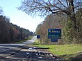
 Entering Jefferson County, US221NB, Florida.JPG 4,320 × 3,240; 4.52 MB
-
 Entering Madison County, US221SB, Florida.JPG 4,320 × 3,240; 4.55 MB
-
 Exit 217, I-10 WB.JPG 4,608 × 3,456; 5.13 MB
-
 Fla-Ga state line US 19 north01.jpg 3,264 × 2,448; 1.84 MB
-
 Fla-Ga state line US 19 south01.jpg 3,264 × 2,098; 2.12 MB
-
 Florida I10eb Exit 217.JPG 5,184 × 3,456; 5.79 MB
-
 Florida I10eb Exit 225 1 mile.JPG 4,608 × 3,456; 4.91 MB
-
 Florida I10eb Exit 225 offramp.JPG 4,608 × 3,456; 4.87 MB
-
 Florida I10eb Exit 225.JPG 4,608 × 3,456; 4.82 MB
-
 Florida I10eb Jefferson County border.JPG 4,608 × 3,456; 4.85 MB
-
 Florida I10wb distance road sign Tallahassee 22.jpg 5,184 × 3,456; 5.44 MB
-
 Florida I10wb Exit 209B 2024.jpg 5,184 × 3,456; 5.18 MB
-
 Florida I10wb exit 217 1 mile.jpg 5,184 × 3,456; 6.12 MB
-
 Florida I10wb Exit 217 1 mile.jpg 5,184 × 3,456; 4.85 MB
-
 Florida I10wb Exit 217 right.jpg 5,184 × 3,456; 5.98 MB
-
 Florida I10wb exit 217 upcoming.jpg 5,184 × 3,456; 6.48 MB
-
 Florida I10wb exit 225 1 mile.jpg 5,184 × 3,456; 4.31 MB
-
 Florida I10wb exit 233.jpg 5,184 × 3,456; 4.33 MB
-
 Florida I10wb Jefferson County.jpg 5,184 × 3,456; 4.16 MB
-
 Florida I10wb Leon County 2024.jpg 5,184 × 3,456; 4.67 MB
-
 Florida I10wb Leon County.jpg 5,184 × 3,456; 4.16 MB
-
 Florida I10wb rest area 30092 exit.jpg 5,184 × 3,456; 4.08 MB
-
 Florida State Sign, US 221 SB.JPG 4,320 × 3,240; 4.47 MB
-
 Int10wRoad-Exit233-CR257signNextRight (28565713004).jpg 2,400 × 1,600; 1.91 MB
-
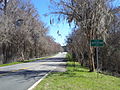
 Jefferson County border, I-10 EB.JPG 4,320 × 3,240; 4.44 MB
-
 Jefferson County border, US 90 EB before Monticello.JPG 4,320 × 3,240; 4.5 MB
-
 Jefferson County border, US 90 WB after Monticello.JPG 4,320 × 3,240; 4.52 MB
-
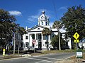
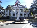
 Jefferson County Courthouse (North face) 1.JPG 4,320 × 3,240; 4.45 MB
-
 Jefferson County Courthouse (South face).JPG 4,320 × 3,240; 4.42 MB
-
 Jefferson County Courthouse (West face).JPG 4,320 × 3,240; 4.4 MB
-
 Jefferson County, Florida State signs US 221 SB.JPG 4,320 × 3,240; 4.48 MB
-
 Jefferson-Madison Aucilla River bridge southeast01.jpg 3,264 × 2,448; 1.72 MB
-
 Jefferson-Madison Aucilla River bridge southeast02.jpg 3,264 × 2,448; 1.34 MB
-
 Lake Miccosukee Rococo Ramp 1.JPG 4,320 × 3,240; 4.41 MB
-
 Leon County border, I-10 WB.JPG 5,184 × 3,456; 5.51 MB
-
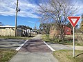 Monticello Bike Trail looking North from Dogwood St.JPG 4,320 × 3,240; 4.42 MB
-
 Monticello Bike Trail looking North from Pearl St.JPG 4,320 × 3,240; 4.54 MB
-
 Monticello City Limit, CR 146 WB.JPG 4,320 × 3,240; 4.54 MB
-
 Monticello city limit, US 19sb.JPG 4,320 × 3,240; 4.5 MB
-
 Monticello City Limit, US 90 WB.JPG 4,320 × 3,240; 4.52 MB
-
 Monticello Welcome, US 90 EB.JPG 4,320 × 3,240; 4.37 MB
-
 Monument in front of North face of Jefferson County Courthouse.JPG 4,320 × 3,240; 4.45 MB
-
 NB US 19 leaves US 27 in Capps, Florida.jpg 3,648 × 2,736; 2.08 MB
-
 NB US 19-27 2-Destination sign in Lamont, FL.jpg 3,648 × 2,736; 2.08 MB
-
 NB US 19-27 Enters Jefferson Co @ Aucllia River Bridge.jpg 3,648 × 2,736; 2.05 MB
-
 NB US 19-27; Florida Georgia Parkway Sign; Capps, FL.jpg 3,648 × 2,736; 2.07 MB
-
 NB US 19-27; Jefferson CR 257B to Aucilla, FL.jpg 3,648 × 2,736; 2.11 MB
-
 NB US 19-27; Jefferson CR 257B to I-10.jpg 3,648 × 2,736; 2.14 MB
-
 NB US 19-27; Pair of To I-10 Signs (1); Capps, FL.jpg 3,648 × 2,736; 2.12 MB
-
 NB US 19-27; Pair of To I-10 Signs (2); Capps, FL.jpg 3,648 × 2,736; 2.06 MB
-
 NB US 19-27; Pair of To I-10 Signs (3); Capps, FL.jpg 3,648 × 2,736; 2.07 MB
-
 NB US 19; 2-Destination sign in Capps, FL.jpg 3,648 × 2,736; 2.05 MB
-
 NB US 19; First Sign North of US 27 in Capps, FL.jpg 3,648 × 2,736; 2.06 MB
-
 NB US 27 near US 19 to Monticello, FL.jpg 3,648 × 2,736; 2.03 MB
-
 NB US 27; First Sign West of US 19.jpg 4,608 × 3,456; 3.76 MB
-
 NB US 27; Jct US 19; Capps, FL.jpg 3,648 × 2,736; 2.09 MB
-
 Pedestrian Crossing @ US 19-27 Split; Capps, FL.jpg 3,648 × 2,736; 2.04 MB
-
 Perkins Opera House (NW corner).JPG 4,320 × 3,240; 4.41 MB
-
 Perkins Opera House (West NorthWest face).JPG 4,320 × 3,240; 4.41 MB
-
 Pictographic Speed Limit Enforced (29205560985).jpg 2,400 × 1,600; 2.12 MB
-
 School Zone, FL57A US19SB T Intersection, Jefferson County.jpg 5,184 × 3,456; 4.95 MB
-
 US19SB at Interstate 10, Jefferson County.jpg 5,184 × 3,456; 5.08 MB
-
 US90eRoad-MonticelloFloridaHeritageSign (29171359956).jpg 2,400 × 1,600; 3.02 MB
-
 Wakulla County boundary US98 WB.jpg 5,184 × 3,456; 11.31 MB


.jpg)


_1.JPG)
.JPG)
.JPG)


;_Capps,_FL.jpg)
;_Capps,_FL.jpg)
;_Capps,_FL.jpg)


.JPG)
.JPG)
.jpg)


.jpg)
