Category:October 2008 in Kent
Jump to navigation
Jump to search
Deutsch: Bilder, die im Oktober 2008 in Kent aufgenommen worden sind. Bitte beachten Sie, dass dies weder das Datum des Uploads noch das Datum des Scannens eines Fotos ist.
English: Images/pictures taken in Kent during October 2008. Note this is not the date of the upload, nor the date a photo was scanned.
Español: Fotografías o imágenes tomadas en Kent durante octubre 2008. No es la fecha de subida ni escaneo, sino la fecha en que las fotografías o imágenes se crearon.
Esperanto: Bildoj faritaj en Kent en oktobro 2008. Tio ne estas la dato, kiam la bildoj estis alŝutitaj aŭ skanitaj.
Français : Photographies ou images prises en Kent durant octobre 2008. Ce n'est pas la date du téléchargement ou du scan.
Galego: Fotografías ou imaxes tomadas en Kent durante outubro 2008. Non é a data de subida nin escaneamento, senón a data na que se crearon as fotografías ou imaxes.
Italiano: Fotografie o immagini scattate a Kent nel ottobre 2008. Nota bene: la data non si riferisce né a quella di upload né a quella in cui la foto è stata digitalizzata.
Norsk bokmål: Bilder tatt i Kent i løpet av oktober 2008. Merk at dette ikke er datoen for opplasting, eller når et bilde har blitt skannet.
Norsk nynorsk: Bilete teke i Kent i løpet av oktober 2008. Merk at dette ikkje er datoen for opplasting, eller når eit bilete har vorte skanna.
Русский: Изображения, сделанные в Kent в течение октябрь 2008 (не дата загрузки изображения).
Українська: Зображення, зроблені в Kent протягом жовтень 2008. Зауважте, що це не дата завантаження чи дата сканування фотографії.
| October 2007 | ← | October 2008 | → | October 2009 | |||||||
| Jan | Feb | Mar | Apr | May | Jun | Jul | Aug | Sep | Oct | Nov | Dec |
| 76 | 112 | 141 | 111 | 89 | 104 | 99 | 61 | 206 | 166 | 277 | 205 |
|---|---|---|---|---|---|---|---|---|---|---|---|
Subcategories
This category has the following 3 subcategories, out of 3 total.
0
C
Media in category "October 2008 in Kent"
The following 163 files are in this category, out of 163 total.
-
 18 Dunstan Rd. - geograph.org.uk - 1024821.jpg 640 × 430; 65 KB
-
 Across Long Reach in the Swale - geograph.org.uk - 1118019.jpg 640 × 481; 56 KB
-
 The Albion Bar and Coffee Dock Cafe - geograph.org.uk - 1019312.jpg 481 × 640; 62 KB
-
 An Horologist^ - geograph.org.uk - 1024802.jpg 640 × 430; 62 KB
-

-
 Ashford Road, St Michaels, Kent - geograph.org.uk - 996154.jpg 640 × 427; 66 KB
-

-
 Avenue of Trees on Isle of Harty - geograph.org.uk - 1023402.jpg 640 × 481; 125 KB
-
 Bait diggers in South Oaze - geograph.org.uk - 1033237.jpg 640 × 481; 40 KB
-

-
 Baitdigger on Leysdown Mudflats - geograph.org.uk - 1023448.jpg 640 × 481; 86 KB
-
 Baitdigger on Sandwich Flats - geograph.org.uk - 1004254.jpg 640 × 481; 65 KB
-
 Baitdigger on Sheerness Mudflats - geograph.org.uk - 1019365.jpg 640 × 481; 77 KB
-
 Baldwin Road, Minster (Sheppey), Kent - geograph.org.uk - 996050.jpg 640 × 480; 50 KB
-
 Barton's point Canal - geograph.org.uk - 1019326.jpg 640 × 481; 54 KB
-
 Beaver Green - geograph.org.uk - 1017302.jpg 640 × 427; 56 KB
-
 Berth 7, Dover Docks - geograph.org.uk - 1029175.jpg 640 × 430; 47 KB
-
 Betts Bros garage on Holt Street - geograph.org.uk - 991889.jpg 640 × 480; 160 KB
-
 Bird Hide within Swale Nature Reserve - geograph.org.uk - 1023295.jpg 640 × 481; 108 KB
-
 Blue Bell Hill Village Sign - geograph.org.uk - 1033068.jpg 481 × 640; 58 KB
-
 Blue town anchor-by-David-Anstiss.jpg 640 × 481; 92 KB
-
 Boundary Earth bank - geograph.org.uk - 1019322.jpg 640 × 481; 94 KB
-

-
 Bridge the gap - geograph.org.uk - 1000491.jpg 640 × 480; 53 KB
-

-
 Castle in the Air - geograph.org.uk - 1038987.jpg 403 × 640; 37 KB
-
 Clan Line Leaving Faversham Station.jpg 2,048 × 1,536; 424 KB
-
 Clan Line leaving Faversham.jpg 1,291 × 2,048; 374 KB
-
 Coastal Park, Leysdown - geograph.org.uk - 996023.jpg 640 × 480; 39 KB
-
-
 Colemouth Creek and wreck at Low Tide - geograph.org.uk - 1015350.jpg 640 × 481; 104 KB
-
 Construction of House - geograph.org.uk - 1023406.jpg 640 × 481; 94 KB
-
 Cosmopolitan Leysdown - geograph.org.uk - 1000548.jpg 640 × 480; 59 KB
-
 Dartford Carnegie Library (2912659626).jpg 640 × 480; 49 KB
-
 Dead Man's Island and Channel Marker - geograph.org.uk - 997245.jpg 640 × 481; 57 KB
-

-

-
 Ditch and Earthbank Seawall - geograph.org.uk - 1023515.jpg 640 × 481; 69 KB
-
 Ditch and Seawall, Harty Marshes - geograph.org.uk - 1023522.jpg 640 × 481; 88 KB
-

-
 DIY Footbridge over ditch to Seawall - geograph.org.uk - 1023529.jpg 640 × 481; 117 KB
-
 Dover - panoramio.jpg 3,678 × 2,176; 3.17 MB
-
 Ducks at Leeds Castle - panoramio.jpg 2,272 × 1,704; 892 KB
-
 Dudley rd. - geograph.org.uk - 1024865.jpg 640 × 430; 67 KB
-

-
 Eastchurch Village Sign - geograph.org.uk - 1019387.jpg 481 × 640; 85 KB
-
 Elphinstone Point on Isle of Grain - geograph.org.uk - 1015371.jpg 640 × 481; 52 KB
-
 Festival Field Gate - geograph.org.uk - 1019316.jpg 481 × 640; 112 KB
-
 Field boundary, looking NE - geograph.org.uk - 1006273.jpg 640 × 480; 216 KB
-
 Field near Blaxland Farm - geograph.org.uk - 1008089.jpg 640 × 480; 210 KB
-
 Field near Maplehurst - geograph.org.uk - 1027134.jpg 640 × 480; 101 KB
-
-

-
 Flock of starlings - geograph.org.uk - 1023430.jpg 640 × 481; 56 KB
-
 Flock of starlings landing - geograph.org.uk - 1023439.jpg 640 × 481; 83 KB
-

-
 Folkestone Harbour Entrance - geograph.org.uk - 1023607.jpg 640 × 481; 37 KB
-

-
 Footpath across Prince's golf course - geograph.org.uk - 1003718.jpg 640 × 480; 152 KB
-
 Footpath along the sea wall - geograph.org.uk - 995510.jpg 640 × 480; 223 KB
-
 Footpath along the sea wall - geograph.org.uk - 995522.jpg 640 × 480; 204 KB
-
 Footpath heading SW. - geograph.org.uk - 1025037.jpg 640 × 430; 129 KB
-
-
-
 Footpath towards the sea - geograph.org.uk - 1003657.jpg 640 × 480; 168 KB
-

-
 Gate across farm track to Flete - geograph.org.uk - 1003255.jpg 640 × 480; 199 KB
-
-
 Groynes at Leysdown-on-Sea - geograph.org.uk - 1019431.jpg 640 × 481; 90 KB
-
 Groynes at Minster Coast - geograph.org.uk - 1019369.jpg 640 × 481; 124 KB
-
-
 H is for^ - geograph.org.uk - 1008493.jpg 640 × 480; 66 KB
-
-
 Harps Inn Public House - geograph.org.uk - 1019352.jpg 640 × 481; 65 KB
-

-
 Hay Bale Mountain - geograph.org.uk - 1023423.jpg 640 × 481; 104 KB
-

-

-
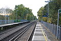 Leigh railway station looking towards Redhill in October 2008.jpg 640 × 430; 101 KB
-
 Leysdown Promenade - geograph.org.uk - 992973.jpg 480 × 640; 36 KB
-
 Leysdown Road, Leysdown - geograph.org.uk - 996031.jpg 640 × 480; 55 KB
-
 Leysdown-On-Mud - geograph.org.uk - 992980.jpg 640 × 480; 54 KB
-
 Leysdown-On-Mud - geograph.org.uk - 992993.jpg 640 × 480; 59 KB
-

-
 Life's a ditch........ - geograph.org.uk - 992941.jpg 640 × 480; 70 KB
-

-
 Looking out to sea from Foreness Point - geograph.org.uk - 1030480.jpg 640 × 480; 206 KB
-
 Margate Beach - geograph.org.uk - 1009831.jpg 395 × 640; 29 KB
-
 Margate Fire Station - geograph.org.uk - 994424.jpg 640 × 480; 67 KB
-
 Matts Hill Road, Hartlip, Sittingbourne - geograph.org.uk - 1008704.jpg 640 × 480; 111 KB
-
 Minster cliff top - geograph.org.uk - 997130.jpg 640 × 480; 51 KB
-
 Minster cliff top - geograph.org.uk - 997187.jpg 640 × 480; 52 KB
-
 Mudflats at Leysdown-on-Sea (1) - geograph.org.uk - 1019401.jpg 640 × 481; 65 KB
-
 Mudflats at Leysdown-on-Sea (2) - geograph.org.uk - 1019406.jpg 640 × 481; 50 KB
-
 Mudflats at Leysdown-on-Sea (3) - geograph.org.uk - 1019410.jpg 640 × 481; 77 KB
-
 Mudflats at Low Tide off Allhallows - geograph.org.uk - 1015245.jpg 640 × 481; 74 KB
-
 Mudflats of Allhallows at Low Tide - geograph.org.uk - 1015272.jpg 640 × 481; 60 KB
-
 Mudflats of Shellness - geograph.org.uk - 1023252.jpg 640 × 481; 138 KB
-
 Mudflats toward Allhallows at Low Tide - geograph.org.uk - 1015290.jpg 640 × 481; 105 KB
-

-
 New cars at Sheerness Docks - geograph.org.uk - 1019274.jpg 481 × 640; 61 KB
-
 Oare creek at low tide - geograph.org.uk - 998441.jpg 640 × 480; 44 KB
-
 Old Counter Wall, ditch and bank - geograph.org.uk - 1023270.jpg 640 × 481; 96 KB
-

-
 Pond within Tailness Marshes - geograph.org.uk - 997230.jpg 640 × 481; 60 KB
-
 Pylons across Oare Creek - geograph.org.uk - 998436.jpg 640 × 480; 35 KB
-
 QEQM Hospital, Margate - geograph.org.uk - 991371.jpg 640 × 480; 66 KB
-
 Queen's Road, Minster (Sheppey), Kent - geograph.org.uk - 993016.jpg 640 × 480; 46 KB
-
 River Darent Flood Barrier - geograph.org.uk - 1323565.jpg 640 × 480; 73 KB
-
 River Swale - geograph.org.uk - 1002318.jpg 640 × 480; 56 KB
-
 Rose and Crown Pub - geograph.org.uk - 1015222.jpg 640 × 481; 64 KB
-
 Saltings near Tailness Marshes - geograph.org.uk - 1101789.jpg 640 × 481; 76 KB
-
 Saltwork within Cattlefield - geograph.org.uk - 1023492.jpg 640 × 481; 78 KB
-
 Saltworks in Harty Marshes - geograph.org.uk - 1023372.jpg 640 × 481; 78 KB
-

-

-
 Sea Kale growing on the beach - geograph.org.uk - 995554.jpg 640 × 480; 261 KB
-
 Seaford Road Carpark and Picnic Area - geograph.org.uk - 1019357.jpg 640 × 481; 107 KB
-

-
 Shell Ness Marshes at lowtide - geograph.org.uk - 1023364.jpg 640 × 481; 90 KB
-
 Shellness Golf, Leysdown - geograph.org.uk - 997121.jpg 640 × 480; 54 KB
-
 Shellness Road, Leysdown - geograph.org.uk - 1000443.jpg 640 × 480; 58 KB
-
 Shellness Road, Leysdown - geograph.org.uk - 992968.jpg 640 × 480; 41 KB
-
 Shellness Road, Leysdown - geograph.org.uk - 997126.jpg 640 × 480; 56 KB
-
 Shellness Road, Sheppey - geograph.org.uk - 992939.jpg 640 × 480; 44 KB
-
 Shingle and Shell Spit - geograph.org.uk - 1023223.jpg 640 × 481; 80 KB
-
 Shoreline of Allhallows at Low Tide - geograph.org.uk - 1015249.jpg 640 × 481; 104 KB
-
 Sign on Coast Wall - geograph.org.uk - 1019435.jpg 640 × 481; 120 KB
-
 Sign on Footpath - geograph.org.uk - 1023592.jpg 640 × 481; 78 KB
-
 Sign on Footpath, near Mocketts Farm - geograph.org.uk - 1023499.jpg 640 × 481; 102 KB
-
 Sign on Wall near Anchor Monument - geograph.org.uk - 1019305.jpg 640 × 481; 109 KB
-

-

-

-
-

-
 St. Barnabas's Primary School. - geograph.org.uk - 1024840.jpg 640 × 430; 89 KB
-

-
 Steps up to Seaford Carpark - geograph.org.uk - 1019385.jpg 481 × 640; 111 KB
-
 Stone St., Tunbridge Wells - geograph.org.uk - 1024857.jpg 640 × 430; 67 KB
-
 Sunset over Swale Marshes - geograph.org.uk - 1023568.jpg 640 × 481; 28 KB
-
 Swale Station - geograph.org.uk - 1000088.jpg 640 × 480; 57 KB
-
 Swale with Coastal Marker Buoy - geograph.org.uk - 1033277.jpg 640 × 481; 59 KB
-
 The Barge public House - geograph.org.uk - 1013540.jpg 640 × 481; 86 KB
-
 The Bay View pub, Bay View, Kent, UK.jpg 640 × 481; 66 KB
-
 The Church of Christ. - geograph.org.uk - 1024847.jpg 640 × 430; 63 KB
-
 The Crown and Anchor Converted Pub - geograph.org.uk - 1019291.jpg 640 × 481; 59 KB
-
 The Guinea Butt - geograph.org.uk - 1025325.jpg 640 × 430; 62 KB
-
 The Halfway House Public House - geograph.org.uk - 1019344.jpg 481 × 640; 88 KB
-
 The last bits of land of Foreness Point - geograph.org.uk - 1030471.jpg 640 × 480; 181 KB
-
 The Lord Nelson Inn - geograph.org.uk - 1019300.jpg 481 × 640; 52 KB
-
 The mouth of Oare creek - geograph.org.uk - 998444.jpg 640 × 480; 59 KB
-
 The Nore Public House - geograph.org.uk - 1019330.jpg 640 × 481; 74 KB
-

-
 The Red Lion, Hernhill, Kent (2966291527).jpg 1,744 × 1,308; 426 KB
-
 The Wagon at Hale Public House - geograph.org.uk - 1015003.jpg 640 × 481; 72 KB
-

-
 Upnor Village Sign - geograph.org.uk - 1015149.jpg 481 × 640; 86 KB
-
 Waiting for the tide - geograph.org.uk - 998463.jpg 640 × 480; 45 KB
-

-
 Wrecks at Elmley Ferry - geograph.org.uk - 1016626.jpg 640 × 480; 101 KB
-

-


,_Kent_-_geograph.org.uk_-_996050.jpg)


.jpg)


_-_geograph.org.uk_-_1019401.jpg)
_-_geograph.org.uk_-_1019406.jpg)
_-_geograph.org.uk_-_1019410.jpg)


,_Kent_-_geograph.org.uk_-_993016.jpg)


.jpg)


.jpg)
