Category:December 2008 in Kent
Jump to navigation
Jump to search
Deutsch: Bilder, die im Dezember 2008 in Kent aufgenommen worden sind. Bitte beachten Sie, dass dies weder das Datum des Uploads noch das Datum des Scannens eines Fotos ist.
English: Images/pictures taken in Kent during December 2008. Note this is not the date of the upload, nor the date a photo was scanned.
Español: Fotografías o imágenes tomadas en Kent durante diciembre 2008. No es la fecha de subida ni escaneo, sino la fecha en que las fotografías o imágenes se crearon.
Esperanto: Bildoj faritaj en Kent en decembro 2008. Tio ne estas la dato, kiam la bildoj estis alŝutitaj aŭ skanitaj.
Français : Photographies ou images prises en Kent durant décembre 2008. Ce n'est pas la date du téléchargement ou du scan.
Galego: Fotografías ou imaxes tomadas en Kent durante decembro 2008. Non é a data de subida nin escaneamento, senón a data na que se crearon as fotografías ou imaxes.
Italiano: Fotografie o immagini scattate a Kent nel dicembre 2008. Nota bene: la data non si riferisce né a quella di upload né a quella in cui la foto è stata digitalizzata.
Norsk bokmål: Bilder tatt i Kent i løpet av desember 2008. Merk at dette ikke er datoen for opplasting, eller når et bilde har blitt skannet.
Norsk nynorsk: Bilete teke i Kent i løpet av desember 2008. Merk at dette ikkje er datoen for opplasting, eller når eit bilete har vorte skanna.
Русский: Изображения, сделанные в Kent в течение декабрь 2008 (не дата загрузки изображения).
Українська: Зображення, зроблені в Kent протягом грудень 2008. Зауважте, що це не дата завантаження чи дата сканування фотографії.
| December 2007 | ← | December 2008 | → | December 2009 | |||||||
| Jan | Feb | Mar | Apr | May | Jun | Jul | Aug | Sep | Oct | Nov | Dec |
| 76 | 112 | 141 | 111 | 89 | 104 | 99 | 61 | 206 | 166 | 277 | 205 |
|---|---|---|---|---|---|---|---|---|---|---|---|
Subcategories
This category has the following 4 subcategories, out of 4 total.
Media in category "December 2008 in Kent"
The following 200 files are in this category, out of 201 total.
(previous page) (next page)-
 101 steps, Rusthall Common. - geograph.org.uk - 1103859.jpg 430 × 640; 124 KB
-

-
 76 Mount Ephraim, Molyneux Place - geograph.org.uk - 1088012.jpg 640 × 430; 58 KB
-
 Abandoned railway - geograph.org.uk - 1084231.jpg 640 × 481; 70 KB
-
 Angel Lane - geograph.org.uk - 1096096.jpg 640 × 427; 68 KB
-

-
 Bird Cage Walk - geograph.org.uk - 1070690.jpg 640 × 430; 96 KB
-
 Bishops Court, Bishop's Down Rd - geograph.org.uk - 1103736.jpg 640 × 430; 87 KB
-
 Blatchington Rd - geograph.org.uk - 1070633.jpg 640 × 430; 104 KB
-

-

-
 Brighton Lake by Eridge Rd - geograph.org.uk - 1104302.jpg 640 × 430; 106 KB
-

-

-
 Clifton Rd - geograph.org.uk - 1104684.jpg 640 × 430; 60 KB
-
 Coach and Horses Passage - geograph.org.uk - 1104491.jpg 640 × 430; 48 KB
-
 Connaught Way - geograph.org.uk - 1103679.jpg 640 × 430; 84 KB
-

-
 Cooling Castle Gateway - geograph.org.uk - 1067812.jpg 640 × 481; 97 KB
-
 Corn Exchange, The Pantiles - geograph.org.uk - 1104497.jpg 640 × 430; 70 KB
-

-
 Culverden Park - geograph.org.uk - 1103668.jpg 640 × 430; 64 KB
-
 Darnet Fort - geograph.org.uk - 1076760.jpg 640 × 481; 56 KB
-
 Decapitated railway bridge - geograph.org.uk - 1070639.jpg 640 × 430; 85 KB
-

-

-
-
 Dynevor Rd - geograph.org.uk - 1104607.jpg 640 × 430; 61 KB
-
 Eastbound - geograph.org.uk - 1096075.jpg 640 × 427; 76 KB
-

-
 Entrance to Grove Hill Gardens - geograph.org.uk - 1070714.jpg 640 × 430; 86 KB
-
 Entrance to Hoo Marina - geograph.org.uk - 1076717.jpg 640 × 481; 94 KB
-

-
 Entrance to The Spa Hotel - geograph.org.uk - 1103765.jpg 640 × 430; 84 KB
-
 Entrance to Tunbridge Wells Golf Club - geograph.org.uk - 1609140.jpg 640 × 430; 143 KB
-

-
 Faversham Creek, Iron Wharf - geograph.org.uk - 1091709.jpg 640 × 480; 63 KB
-
 Field margin - geograph.org.uk - 1100274.jpg 640 × 480; 214 KB
-
 Field near Mathurst Farm - geograph.org.uk - 1082447.jpg 640 × 428; 125 KB
-
 Flat land, Dudley Rd - geograph.org.uk - 1088204.jpg 640 × 430; 73 KB
-

-
 Flats, St John's Rd - geograph.org.uk - 1087904.jpg 640 × 430; 98 KB
-
 Footbridge across Disused Canal - geograph.org.uk - 1095639.jpg 640 × 481; 94 KB
-

-
 Footbridge over A228 - geograph.org.uk - 1084295.jpg 640 × 481; 83 KB
-
 Footbridge over Railway - geograph.org.uk - 1067805.jpg 640 × 481; 100 KB
-

-
 Footpath across A228 Halling By-pass - geograph.org.uk - 1084205.jpg 640 × 481; 94 KB
-
 Footpath across Church Road - geograph.org.uk - 1112191.jpg 640 × 481; 87 KB
-
 Footpath across Hazel Street Road - geograph.org.uk - 1080377.jpg 640 × 481; 114 KB
-
 Footpath along the field boundary - geograph.org.uk - 1079698.jpg 640 × 430; 99 KB
-

-
 Footpath in Church Wood - geograph.org.uk - 1080354.jpg 640 × 481; 136 KB
-
 Footpath in the direction of Walmer - geograph.org.uk - 1097612.jpg 480 × 640; 227 KB
-
 Footpath junction in Wingate Wood - geograph.org.uk - 1083552.jpg 481 × 640; 130 KB
-
 Footpath junction near Cooling - geograph.org.uk - 1067809.jpg 640 × 481; 96 KB
-
 Footpath junction on Muggins Lane - geograph.org.uk - 1110638.jpg 640 × 481; 92 KB
-
 Footpath junction on North Downs Way - geograph.org.uk - 1088777.jpg 640 × 481; 74 KB
-
 Footpath near Sheldwich - geograph.org.uk - 1074341.jpg 640 × 456; 192 KB
-
 Footpath on Dully Road - geograph.org.uk - 1097163.jpg 640 × 481; 78 KB
-
 Footpath on Holywell Lane - geograph.org.uk - 1073504.jpg 640 × 481; 123 KB
-
 Footpath on Lodge Hill Lane - geograph.org.uk - 1073404.jpg 481 × 640; 73 KB
-
 Footpath on Meadow Crescent - geograph.org.uk - 1084211.jpg 640 × 481; 108 KB
-
 Footpath past Millfield House - geograph.org.uk - 1076578.jpg 640 × 481; 107 KB
-
 Footpath through Sweetcorn Crop - geograph.org.uk - 1076590.jpg 640 × 481; 112 KB
-
 Footpath to Cradles Road - geograph.org.uk - 1073744.jpg 640 × 481; 118 KB
-
 Footpath to Woodlands Road - geograph.org.uk - 1100388.jpg 480 × 640; 314 KB
-
 Footpath towards Pitt Wood - geograph.org.uk - 1100300.jpg 640 × 480; 247 KB
-
 Footpath towards the A258 - geograph.org.uk - 1097585.jpg 640 × 480; 258 KB
-
 Footpath up the Hill - geograph.org.uk - 1074993.jpg 481 × 640; 80 KB
-
 Footpath, Upper Cumberland Walk - geograph.org.uk - 1070580.jpg 640 × 430; 121 KB
-
 Gate Entrance to Cliffe Fort - geograph.org.uk - 1087777.jpg 481 × 640; 73 KB
-
 Gatehouse at Godinton Park - geograph.org.uk - 1076455.jpg 640 × 480; 115 KB
-
-
 Grosvenor Rd Bridge - geograph.org.uk - 1070390.jpg 640 × 430; 96 KB
-
 Grove Hill Tunnel - geograph.org.uk - 1104700.jpg 640 × 430; 101 KB
-
 Gun Battery Position on Sea Wall - geograph.org.uk - 1087754.jpg 640 × 481; 77 KB
-
 Halling Railway Station - geograph.org.uk - 1083625.jpg 640 × 481; 116 KB
-
 Halling railway station in 2008.jpg 640 × 481; 88 KB
-
 Hawkenbury United Reformed Church - geograph.org.uk - 1070487.jpg 640 × 430; 55 KB
-
 Hermes House - geograph.org.uk - 1087907.jpg 640 × 430; 77 KB
-
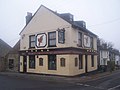
 High Brooms Tavern - geograph.org.uk - 1104664.jpg 640 × 430; 81 KB
-
 High Rocks Station - geograph.org.uk - 1104140.jpg 640 × 430; 97 KB
-
 High Street, Sevenoaks, Kent - geograph.org.uk - 1070315.jpg 640 × 480; 68 KB
-
 High Street, Sevenoaks, Kent - geograph.org.uk - 1117121.jpg 640 × 480; 81 KB
-
 Hilbert Woods Nature Reserve - geograph.org.uk - 1070374.jpg 640 × 430; 81 KB
-

-
 Houses on Cow Lane, Markbeech - geograph.org.uk - 1096518.jpg 640 × 427; 65 KB
-

-

-
 Kent and Sussex Hospital - geograph.org.uk - 1103663.jpg 640 × 430; 73 KB
-
 Kingsdown church on the cliff top - geograph.org.uk - 1097379.jpg 640 × 480; 160 KB
-
 Kingsdown church, Church Cliff - geograph.org.uk - 1097354.jpg 640 × 480; 177 KB
-
 Lake, Grosvenor Recreation Ground - geograph.org.uk - 1070383.jpg 640 × 430; 91 KB
-
 Lake, Grosvenor Recreation Ground - geograph.org.uk - 1070388.jpg 640 × 430; 101 KB
-
 Large houses, Byng Rd - geograph.org.uk - 1103691.jpg 640 × 430; 63 KB
-
 Linden Park cricket ground - geograph.org.uk - 1088036.jpg 640 × 430; 59 KB
-

-
 Little Bridge - geograph.org.uk - 1096062.jpg 640 × 427; 77 KB
-
 Lower Walk, The Pantiles - geograph.org.uk - 1104515.jpg 640 × 430; 78 KB
-
 Manor Park - geograph.org.uk - 1103743.jpg 640 × 430; 100 KB
-
 Mayo House, Mount Ephraim - geograph.org.uk - 1088005.jpg 640 × 430; 78 KB
-
 Medway Rd - geograph.org.uk - 1070396.jpg 640 × 430; 76 KB
-
 Middle Creek, Jetty and Darnet Fort - geograph.org.uk - 1076715.jpg 640 × 481; 90 KB
-
 Miles Garage, Mount Sion - geograph.org.uk - 1070664.jpg 640 × 430; 51 KB
-

-

-
 Mount Edgecumbe Hotel - geograph.org.uk - 1088022.jpg 640 × 430; 68 KB
-
 Muddy End to Footpath - geograph.org.uk - 1075872.jpg 640 × 481; 79 KB
-
 Nevill Terrace - geograph.org.uk - 1104312.jpg 640 × 430; 60 KB
-

-
 New Hythe Lane Bridge - geograph.org.uk - 1097357.jpg 640 × 481; 72 KB
-
 New Hythe Lane over M20 - geograph.org.uk - 1097410.jpg 481 × 640; 77 KB
-
 New Hythe Railway Station Footbridge - geograph.org.uk - 1097339.jpg 640 × 481; 76 KB
-

-
 Old chapel, Woodbury Park Cemetery - geograph.org.uk - 1103623.jpg 640 × 430; 83 KB
-
 Old fountain, Woodbury Park Cemetery. - geograph.org.uk - 1103633.jpg 640 × 430; 111 KB
-
 Panini on the Park - geograph.org.uk - 1070377.jpg 640 × 430; 55 KB
-
 Percy Terrace - geograph.org.uk - 1087940.jpg 640 × 430; 80 KB
-
 Phone Masts in Sheep Field - geograph.org.uk - 1075015.jpg 640 × 481; 67 KB
-
 Poona Rd - geograph.org.uk - 1070536.jpg 640 × 430; 99 KB
-
 Postbox, Byng Rd - geograph.org.uk - 1103686.jpg 640 × 430; 79 KB
-
 Postmens Entrance - geograph.org.uk - 1088157.jpg 640 × 430; 82 KB
-
 Railway Bridge over Broadwater Lane - geograph.org.uk - 1104291.jpg 640 × 430; 64 KB
-
 Railway Bridge, Broadwater Down - geograph.org.uk - 1104264.jpg 640 × 430; 85 KB
-
 Railway to Halling - geograph.org.uk - 1084228.jpg 481 × 640; 59 KB
-
 Remains of Abbot's Court Wharf - geograph.org.uk - 1076744.jpg 640 × 481; 88 KB
-
 Rotal Victoria House - geograph.org.uk - 1104478.jpg 640 × 430; 71 KB
-
 Roundabout on A228 Halling By-Pass - geograph.org.uk - 1084224.jpg 640 × 481; 79 KB
-
 Royal Chase - geograph.org.uk - 1103680.jpg 640 × 430; 92 KB
-

-

-
 Rusthall Farm, Tea Garden Lane - geograph.org.uk - 1103883.jpg 640 × 430; 64 KB
-
 Sainsbury's local, St John's Rd - geograph.org.uk - 1087964.jpg 640 × 430; 55 KB
-
 Scout Hut, Quarry Rd - geograph.org.uk - 1070400.jpg 640 × 430; 58 KB
-
 Sheep on Sea Wall - geograph.org.uk - 1076755.jpg 640 × 481; 76 KB
-
 Shopping Parade at Ramslye - geograph.org.uk - 1104249.jpg 640 × 430; 129 KB
-
 Shopping parade, High Brooms Rd - geograph.org.uk - 1104627.jpg 640 × 430; 77 KB
-
 Shopping Parade, Silverdale Rd - geograph.org.uk - 1072356.jpg 640 × 430; 85 KB
-

-
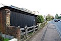
 SKLR bridge over Gas Road (south) - geograph.org.uk - 1073666.jpg 640 × 481; 68 KB
-
 SKLR over Gas Road, North - geograph.org.uk - 1073670.jpg 640 × 481; 91 KB
-
 Sladen Chambers - geograph.org.uk - 1071362.jpg 640 × 430; 73 KB
-
 St John's C of E Primary School - geograph.org.uk - 1070351.jpg 640 × 430; 96 KB
-

-
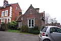
 St Paul's School House - geograph.org.uk - 1103836.jpg 640 × 430; 84 KB
-
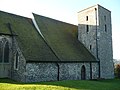 St. Nicholas' church, Harbledown - geograph.org.uk - 1075924.jpg 640 × 480; 79 KB
-
 Stepped Hedge on London Road - geograph.org.uk - 1073539.jpg 640 × 481; 99 KB
-
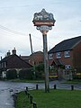 Stockbury Green and Village Sign - geograph.org.uk - 1074962.jpg 481 × 640; 56 KB
-
 Sussex Arms, Sussex Mews - geograph.org.uk - 1104504.jpg 640 × 430; 70 KB
-
 Tea Garden Lane - geograph.org.uk - 1103876.jpg 640 × 430; 118 KB
-
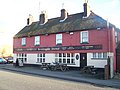
 The Barge Pub, Sittingbourne - geograph.org.uk - 1073655.jpg 640 × 481; 61 KB
-
 The Bedford - geograph.org.uk - 1088166.jpg 640 × 430; 77 KB
-
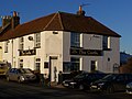
 The Black Pig Pub and Dining Room - geograph.org.uk - 1104574.jpg 640 × 430; 57 KB
-
 The Bricklayers Arms, New Hythe - geograph.org.uk - 1097380.jpg 640 × 481; 75 KB
-
 The Castle Pub, Oare - geograph.org.uk - 1080471.jpg 640 × 481; 59 KB
-
 The Cheesewring Rock, Rusthall Common - geograph.org.uk - 1103841.jpg 640 × 430; 130 KB
-

-
 The Eagle Pub, Maidstone - geograph.org.uk - 1087934.jpg 640 × 481; 46 KB
-
 The Foresters Arms Pub, Wouldham - geograph.org.uk - 1097250.jpg 640 × 481; 79 KB
-
 The Forum, Tunbridge Wells Common - geograph.org.uk - 1088140.jpg 640 × 430; 94 KB
-
 The Grapes Pub, Gravesend - geograph.org.uk - 1095757.jpg 481 × 640; 67 KB
-
 The Grove - geograph.org.uk - 1070677.jpg 640 × 430; 137 KB
-
 The Grove Bowling Club - geograph.org.uk - 1070700.jpg 640 × 430; 57 KB
-
 The Holly Bush Pub, Maidstone - geograph.org.uk - 1087992.jpg 640 × 481; 45 KB
-

-
 The Major York - geograph.org.uk - 1103751.jpg 640 × 430; 72 KB
-

-

-

-
 The Old Central Post Office - geograph.org.uk - 1088150.jpg 640 × 430; 76 KB
-
 The Pound, Grove Hill Rd - geograph.org.uk - 1070734.jpg 640 × 430; 68 KB
-
 The Rose Pub, Northfleet - geograph.org.uk - 1096026.jpg 640 × 481; 57 KB
-
 The Society Rooms Pub, Maidstone - geograph.org.uk - 1087976.jpg 640 × 481; 66 KB
-
 The Swan Hotel - geograph.org.uk - 1088121.jpg 640 × 430; 61 KB
-
 The Three Mariners Pub, Oare - geograph.org.uk - 1080474.jpg 640 × 481; 70 KB
-
 The White Rabbit Pub, Maidstone - geograph.org.uk - 1088024.jpg 640 × 481; 65 KB
-
 Toc H Hall, Little Mount Sion - geograph.org.uk - 1104556.jpg 640 × 430; 67 KB
-

-
 Tonbridge Castle - geograph.org.uk - 1095038.jpg 640 × 427; 51 KB
-

-
 Tunbridge Wells Fire Station - geograph.org.uk - 1070724.jpg 640 × 430; 59 KB
-
 Tunbridge Wells Registry Office - geograph.org.uk - 1070721.jpg 640 × 430; 101 KB
-
 Upper Cumberland Walk - geograph.org.uk - 1070628.jpg 640 × 430; 113 KB
-
 Victoria Cross Grove, Dunorlan Park (2) - geograph.org.uk - 1070468.jpg 640 × 430; 131 KB
-

-
 Victoria Cross Grove, Dunorlan Park - geograph.org.uk - 1070466.jpg 640 × 430; 128 KB
-
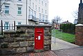 Victorian Postbox, Culverden Park. - geograph.org.uk - 1103650.jpg 640 × 430; 76 KB
-
 Walderslade Road, Walderslade - geograph.org.uk - 1083975.jpg 640 × 480; 59 KB
-
 Walderslade shops - geograph.org.uk - 1084000.jpg 640 × 480; 74 KB
-
 Wellington Rocks - geograph.org.uk - 1088060.jpg 640 × 430; 85 KB
-

-
 Wesleyan Chapel - geograph.org.uk - 1067843.jpg 640 × 481; 80 KB
-
 Woodbury Park Cemetery (2) - geograph.org.uk - 1087981.jpg 640 × 430; 97 KB
-
 Woodbury Park Cemetery - geograph.org.uk - 1087980.jpg 640 × 430; 112 KB
-
 Woodbury Park Cemetery - geograph.org.uk - 1103640.jpg 640 × 430; 94 KB
-
-
 Woodbury Park Rd. - geograph.org.uk - 1103610.jpg 640 × 430; 59 KB
-
 Woodbury Park Rd. - geograph.org.uk - 1103641.jpg 640 × 430; 75 KB
-
 Woodland Rd - geograph.org.uk - 1104597.jpg 640 × 430; 72 KB


.jpg)


_-_geograph.org.uk_-_1073666.jpg)


_-_geograph.org.uk_-_1070468.jpg)
_-_geograph.org.uk_-_1070473.jpg)


_-_geograph.org.uk_-_1087981.jpg)


