Category:October 2008 in the City of Canterbury
Jump to navigation
Jump to search
English: Images taken in the City of Canterbury in this month of 2008 (not the date of the upload).
| Jan | Feb | Mar | Apr | May | Jun | Jul | Aug | Sep | Oct | Nov | Dec | ||
| ← | 0 | 0 | 0 | 0 | 19 | 17 | 0 | 0 | 0 | 60 | 0 | 42 | → |
|---|
Media in category "October 2008 in the City of Canterbury"
The following 60 files are in this category, out of 60 total.
-

-

-
-

-

-
-

-

-
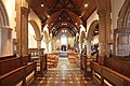
 All Saints Church, Whitstable, Kent - geograph.org.uk - 1010779.jpg 640 × 426; 92 KB
-
 All Saints Church, Whitstable, Kent - geograph.org.uk - 1010793.jpg 640 × 426; 77 KB
-
 All Saints Church, Whitstable, Kent - geograph.org.uk - 1010794.jpg 640 × 426; 113 KB
-
 All Saints Church, Whitstable, Kent - geograph.org.uk - 1010798.jpg 640 × 382; 63 KB
-
 All Saints Church, Whitstable, Kent - geograph.org.uk - 1010801.jpg 640 × 426; 110 KB
-

-

-
-

-

-
 Autumn hedgerow on lane to Brambles Farm - geograph.org.uk - 1005279.jpg 480 × 640; 279 KB
-
 Bales of straw at Blaxland Farm - geograph.org.uk - 1008046.jpg 640 × 480; 261 KB
-
 Blaxland Farm at the end of the lane - geograph.org.uk - 1008024.jpg 640 × 480; 238 KB
-
 Bridleway past Mayton Oast - geograph.org.uk - 1006810.jpg 480 × 640; 227 KB
-
 Ditch between fields - geograph.org.uk - 1005326.jpg 640 × 480; 249 KB
-

-
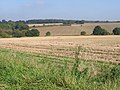
 Farmland, looking NE towards Calcott - geograph.org.uk - 1006758.jpg 640 × 480; 204 KB
-

-
 Lane from Brambles Farm - geograph.org.uk - 1006767.jpg 640 × 480; 215 KB
-
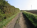
 Lane to Brambles Farm - geograph.org.uk - 1005268.jpg 640 × 480; 251 KB
-
 Lane to Brambles Farm - geograph.org.uk - 1005291.jpg 640 × 480; 272 KB
-
 Lane to Brambles Farm - geograph.org.uk - 1006752.jpg 640 × 480; 218 KB
-
-

-
 Looking N along lane to Blaxland Farm - geograph.org.uk - 1007978.jpg 640 × 480; 198 KB
-
 Looking N towards Calcott - geograph.org.uk - 1009308.jpg 640 × 480; 227 KB
-
 Looking NE along Mayton Lane - geograph.org.uk - 1007974.jpg 640 × 480; 182 KB
-
 Looking NW along footpath to Mayton Lane - geograph.org.uk - 1007970.jpg 640 × 480; 206 KB
-

-
 Looking W across fields near Mayton Farm - geograph.org.uk - 1005273.jpg 640 × 480; 235 KB
-
 Mayton Lane, looking NE - geograph.org.uk - 1005255.jpg 640 × 480; 177 KB
-
 Mayton Oast on Mayton Lane - geograph.org.uk - 1006783.jpg 640 × 480; 228 KB
-

-
 No passing places - geograph.org.uk - 1006763.jpg 640 × 480; 224 KB
-
 Peter Newman Factory Shop, Eddington - geograph.org.uk - 996380.jpg 640 × 480; 58 KB
-
 Pollarded trees on field boundary - geograph.org.uk - 1006841.jpg 640 × 480; 184 KB
-
 Preparing for autumn sowing - geograph.org.uk - 1005337.jpg 640 × 480; 220 KB
-
 River Wantsum on Wantsum Way path - geograph.org.uk - 1000065.jpg 481 × 640; 74 KB
-
 Road to Blaxland Farm and Greenacres - geograph.org.uk - 1005246.jpg 640 × 480; 168 KB
-
 Sheep grazing near Blaxland Farm - geograph.org.uk - 1008020.jpg 640 × 480; 195 KB
-
 Sheep sheltering from the sun - geograph.org.uk - 1008040.jpg 640 × 480; 246 KB
-
 Stream in the valley bottom - geograph.org.uk - 1005463.jpg 480 × 640; 286 KB
-
 The Punch Tavern on Herne Bay Road - geograph.org.uk - 1009331.jpg 640 × 480; 157 KB
-
 Twelve Foot Dyke, Reculver - geograph.org.uk - 1000077.jpg 640 × 481; 83 KB
-

-
 View along a line of power cables - geograph.org.uk - 1006774.jpg 640 × 480; 144 KB
-
 View along bridleway near Broad Oak - geograph.org.uk - 1005232.jpg 640 × 480; 213 KB
-

-
 View along lane to Blaxland Farm - geograph.org.uk - 1008017.jpg 640 × 480; 218 KB
-
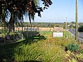
 View from Bishopstone Carpark - geograph.org.uk - 999911.jpg 640 × 481; 70 KB
-
 Wind farm out to sea off Herne Bay - geograph.org.uk - 1026401.jpg 640 × 480; 65 KB
-


