Category:Messtischblatt
Jump to navigation
Jump to search
german term of topographic map issued by a legal authority, usually scale of 1:25.000 _Deutschland_1_zu_25000,_1870-1943_Df_dk_0010001_000.jpg) | |||||
| Upload media | |||||
| Instance of |
| ||||
|---|---|---|---|---|---|
| |||||
English: Messtischblatt or Meßtischblatt (survey table sheet) describes a series of German language topographic ordinance land survey maps, with a scale of 1:25000. (Austria-Hungary used also other scales)
- Official German maps 1919-1945 can be downloaded at [1]
- See also: Category:Germany maps by U.S. Army Map Service
Subcategories
This category has the following 54 subcategories, out of 54 total.
*
- Meßtischblatt, Sekt. o.A. (2 F)
B
- Meßtischblatt, Sekt. Baruth (4 F)
- Meßtischblatt, Sekt. Bautzen (26 F)
G
- Meßtischblatt, Sekt. Görlitz (31 F)
H
- Meßtischblatt, Sekt. Hochkirch (17 F)
- Meßtischblatt, Sekt. Horka, 1886 (16 F)
J
K
L
- Meßtischblatt, Sekt. Löbau, 1884 (32 F)
M
- Meßtischblatt, Sekt. Mücka, 1887 (16 F)
N
O
P
- Meßtischblatt, Sekt. Penzig (7 F)
- Meßtischblatt, Sekt. Priebus (6 F)
R
- Meßtischblatt, Sekt. Reichenbach (34 F)
S
Pages in category "Messtischblatt"
The following 2 pages are in this category, out of 2 total.
Media in category "Messtischblatt"
The following 200 files are in this category, out of 295 total.
(previous page) (next page)-

-
 Adorf Messtischblatt Nr 2660 von 1900 Nachfolge Nr 4618.png 1,654 × 1,725; 4.52 MB
-
-
 Agronomische Bohrungen - Gülzow 1902.jpg 6,661 × 7,031; 11.27 MB
-
 Ahlten in Preussische Landesaufnahme vom 1896 Blatt 3625 Lehrte.jpg 4,372 × 3,353; 5.55 MB
-
 Anderten in Preussische Landesaufnahme vom 1896 Blatt 3625 Lehrte.jpg 3,981 × 2,214; 1.72 MB
-
 Messtischblatt 4211 Ascheberg 1894.jpg 8,279 × 7,881; 12.28 MB
-
 Babenhausen in Hessen Messtischblatt df dk 0010001 6019 1936.jpg 9,557 × 8,766; 16.27 MB
-
 Bahnstrecke voeklingen grube puettlingen 1882.JPG 1,614 × 1,245; 607 KB
-
 Balga Messtischblatt Nr 1485 1908 001.jpg 1,535 × 1,598; 1.23 MB
-
 Messtischblatt nr 4260 Beuthen (Lessendorf).jpg 900 × 600; 302 KB
-
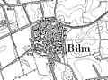 Bilm in Preussische Landesaufnahme vom 1896 Blatt 3625 Lehrte.jpg 1,977 × 1,473; 498 KB
-
 Messtischblatt 4509 Bochum 1899.jpg 1,654 × 1,774; 1,004 KB
-
 Messtischblatt 4509 Bochum 193x.jpg 10,336 × 7,960; 15.75 MB
-
 Messtischblatt 4107 Borken 1897.jpg 8,232 × 8,713; 13.42 MB
-
 Messtischblatt 4407 Bottrop 1907 Rechteck.jpg 7,318 × 7,054; 13.7 MB
-
 Messtischblatt 4407 Bottrop 1907.jpg 8,275 × 8,721; 14.84 MB
-
 Messtischblatt 4206 Bruenen 1897.jpg 8,223 × 8,692; 13.8 MB
-
 Messtischblatt 4110 Buldern 1897.jpg 8,204 × 8,687; 11.96 MB
-
 Messtischblatt 4406 Dinslaken 1906.jpg 1,654 × 1,766; 960 KB
-
 Messtischblatt 4307 Dorsten 1894 Rechteck.jpg 7,318 × 7,054; 12.33 MB
-
 Messtischblatt 4307 Dorsten 1894.jpg 8,247 × 8,702; 13.46 MB
-
 Messtischblatt 4410 Dortmund 1907.jpg 1,654 × 1,735; 976 KB
-
 Messtischblaetter 4309-4410 Altbuergermeisterei Castrop um 1910.jpg 10,793 × 8,016; 20.85 MB
-
 Messtischblaetter 4309-4410 Altbuergermeisterei Castrop um 1910.pdf 1,754 × 1,302; 15.49 MB
-
 Messtischblatt 4410 Dortmund 1913 Rechteck.jpg 7,318 × 7,054; 14.07 MB
-
 Messtischblatt 4306 Drevenack 1906.jpg 1,654 × 1,744; 959 KB
-
 Messtischblatt 4506 Duisburg 1907.jpg 8,268 × 8,687; 13.52 MB
-
 Messtischblatt 4109 Duelmen 1897.jpg 8,205 × 8,665; 13.64 MB
-

-
 Messtischblatt 4508 Essen 1894 (Eiberg).jpg 1,775 × 1,421; 653 KB
-
 Messtischblatt 4508 Essen 1894.jpg 7,261 × 7,427; 13.22 MB
-
 Messtischblatt 4508 Essen 1898.jpg 1,654 × 1,792; 954 KB
-
 Frankfurt am Main Messtischblatt df dk 0010001 5818 1906.jpg 8,382 × 8,778; 11.34 MB
-
 Messtischblatt 4408 Gelsenkirchen 1894.jpg 1,654 × 1,778; 962 KB
-
 Messtischblatt 4408 Gelsenkirchen 1907 Rechteck.jpg 7,318 × 7,054; 15.43 MB
-
 Geogreif Karte 1974 Neu Paleschken 1904.jpg 1,535 × 1,568; 2.02 MB
-
 Gloine Messtischblatt.jpg 1,039 × 448; 237 KB
-
 Messtischblatt 4108 Gr Reken 1897.jpg 8,257 × 8,706; 13.37 MB
-
 Großsteingrab Angersdorf Messtischblatt 283.png 868 × 607; 735 KB
-
 Messtischblatt 4209 Haltern 1895 Rechteck.jpg 7,318 × 7,054; 11.09 MB
-
 Messtischblatt 4209 Haltern 1895.jpg 8,394 × 8,879; 22.98 MB
-
 Messtischblatt 4413 Werl 1897 Ausschnitt Hilbeck Dorfkern.png 1,261 × 926; 1.78 MB
-
 Messtischblatt 4413 Werl 1897 Ausschnitt Hilbeck.png 2,668 × 2,764; 9.95 MB
-
 Messtischblatt 4609 Hattingen 193x.jpg 10,328 × 7,948; 16 MB
-
 Messtischblatt 4409 Herne 1906.jpg 1,654 × 1,791; 929 KB
-
 Messtischblatt 4409 Herne 1913 Rechteck.jpg 7,318 × 7,054; 13.91 MB
-
 Hillesheim Messtischblatt df dk 0010001 5706 1895.jpg 8,381 × 8,898; 14.43 MB
-
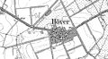 Höver in Preussische Landesaufnahme vom 1896 Blatt 3625 Lehrte.jpg 2,997 × 1,660; 765 KB
-
 Ilbenstadt Messtischblatt byu.edu id2412 5718 1955.jpg 11,244 × 8,622; 15.8 MB
-
 Ilten in Preussische Landesaufnahme vom 1896 Blatt 3625 Lehrte.jpg 2,704 × 1,914; 913 KB
-
 Messtischblatt 4411 Kamen 1907.jpg 1,654 × 1,763; 933 KB
-
 Messtischblatt 4511 Hoerde 1907.jpg 1,654 × 1,763; 1,008 KB
-
 Karte Landkreis Cammin in Pommern mit Gülzow.jpg 4,661 × 3,293; 14.67 MB
-
 Karte Landkreis Greifenberg in Pommern mit Karnitz.jpg 5,239 × 5,424; 3.02 MB
-
 Karte Landkreis Greifenberg in Pommern mit Treptow.jpg 5,384 × 5,315; 8.55 MB
-
 Karte Landkreis Usedom-Wollin, Landkreis Cammin in Pommern.jpg 4,661 × 3,293; 13.38 MB
-
 Karte Landkreis Vorpommern-Greifswald.jpg 1,550 × 1,604; 3.48 MB
-
 Karte Ostsee und Dievenow.jpg 4,661 × 3,293; 10.43 MB
-
 Karte Pommern - westlicher Teil 1918.jpg 1,435 × 1,275; 508 KB
-
 Karte Provinz Pommern.jpg 1,190 × 800; 234 KB
-
 Karte Regierungsbezirk Köslin.jpg 1,621 × 1,843; 4.23 MB
-
 Karte Regierungsbezirk Schneidemühl, Regierungsbezirk Stettin.jpg 1,673 × 1,851; 4.55 MB
-
 TK25 Sachsen Messtischblatt 49 Kötzschenbroda, Radebeul 1911.jpg 7,677 × 7,631; 14.83 MB
-
 Kreis Spremberg (Lausitz) Early 20th Century.png 4,062 × 2,048; 81 KB
-
 Lageplan-Bohrg.-u.-Schacht.jpg 1,200 × 1,065; 712 KB
-
 Lamsdorf1930's-Uebungsplatz&Lager 1870-1946.jpg 702 × 600; 255 KB
-
 Landkarte Soltau 1900 - Messtischblatt 3025 Ausschnitt.jpg 1,366 × 768; 761 KB
-
 Landkreis Cammin in Pommern mit Gülzow.jpg 4,661 × 3,293; 14.39 MB
-
 Landkreis Cammin in Pommern mit Pribbernow.jpg 4,661 × 3,293; 13.86 MB
-
 Lehrte in Preussische Landesaufnahme vom 1896 Blatt 3625 Lehrte.jpg 5,326 × 4,326; 4.57 MB
-
 Messtischblatt 4640 Leipzig von 1879 df dk 0000093.jpg 7,715 × 7,615; 14.55 MB
-
 Messtischblatt 4640 Leipzig von 1897 df dk 0000094.jpg 7,515 × 7,446; 10.39 MB
-
 Messtischblatt 4640 Leipzig von 1908 df dk 0000095.jpg 7,677 × 7,554; 13.47 MB
-
-
 TK25 Sachsen Äquidistantenkarte Montage Leipziger Gewässerknoten und Elsteraue 1880.jpg 7,440 × 10,680; 25.86 MB
-
 Messtischblatt 2176 Lubichow part.jpg 1,849 × 2,049; 1.21 MB
-
 Messtischblatt Lubichow 1908 part Forst Wirthy.jpg 2,511 × 2,310; 2.2 MB
-
 Messtischblatt 4210 Luedinghausen 1907 Rechteck.jpg 6,705 × 6,463; 10.1 MB
-
 Messtischblatt 4210 Luedinghausen 1907.jpg 7,279 × 7,634; 11.95 MB
-
 Messtischblatt 4311 Luenen 1907.jpg 8,305 × 8,713; 13.19 MB
-
 Hessen Meßtischblatt 5118 Marburg 1942.jpg 1,600 × 1,460; 1.01 MB
-
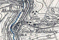
 Messtischblatt Marienberg (1927), Ausschnitt Grube Alexandria.jpg 548 × 418; 141 KB
-
 Messtischblatt 4308 Marl 1907 Rechteck.jpg 7,318 × 7,054; 11.17 MB
-
 Messtischblatt 4308 Marl 1907.jpg 8,427 × 8,862; 14.37 MB
-
 Dianaburg Darmstadt map pre1898.JPG 613 × 453; 308 KB
-
 Messel Messtischblatt df dk 0010001 6018 1914.jpg 7,255 × 6,751; 11.75 MB
-
 Messtischblaetter 25 Legende.png 1,375 × 719; 165 KB
-
 Messtischblatt 2056 - Stuchowo 1947.jpg 5,711 × 6,312; 13.34 MB
-
 Messtischblatt 4726 Grebendorf 1907Kopie.jpg 1,654 × 1,744; 1.5 MB
-
 Messtischblatt 5679 (ex 3309) Beuthen 1883 cropped.jpg 846 × 521; 279 KB
-
 Messtischblatt 5679 Beuthen 1943 cropped.jpg 4,052 × 2,331; 2.77 MB
-
 Messtischblatt 667 Dachau 1907.jpg 4,713 × 5,105; 8.28 MB
-
 Messtischblatt 668 Schleißheim 1911.jpg 4,625 × 4,716; 24.1 MB
-
 Messtischblatt 669 Ismaning 1911.jpg 4,638 × 4,878; 25.85 MB
-
 Messtischblatt 685 1886-1925 - Cammin.jpg 8,504 × 9,194; 12.18 MB
-
 Messtischblatt 688 - Greifenberg 1890-1929.jpg 5,760 × 6,287; 12.25 MB
-
 Messtischblatt 691 Pasing 1907.jpg 4,761 × 5,125; 8.14 MB
-
 Messtischblatt 693 Trudering 1907.jpg 4,714 × 5,149; 7.14 MB
-
 Messtischblatt 714 Grünwald 1907.jpg 4,702 × 5,206; 7.93 MB
-
 Messtischblatt 715 Hohenbrunn 1910.jpg 4,672 × 4,789; 21.05 MB
-
 Messtischblatt 772 Plenzeiger 1891-1929 - Gülzow.jpg 6,640 × 6,994; 14.83 MB
-
 Messtischbltauflp.png 480 × 360; 54 KB
-
 Meuchen Messtischblatt df dk 0010001 4739 1873.jpg 8,383 × 8,514; 9.01 MB
-
 Meßtischblatt 1546 Bergen auf Rügen 1936 Ausschnitt.jpg 1,007 × 519; 290 KB
-
 Meßtischblatt 1547 Lubkow 1925 Ausschnitt Thiessow.jpg 785 × 347; 260 KB
-
 Meßtischblatt 260 261 Sagard 1920 Ausschnitt Stubnitz.jpg 786 × 342; 282 KB
-
 Meßtischblatt 438 Richtenberg 1931 Ausschnitt.jpg 682 × 680; 295 KB
-
 Meßtischblatt 6206 Pfalzel 1939.jpg 10,232 × 9,498; 17.24 MB
-
 Meßtischblatt 6222 Nassig von 1881 Df dk 0010001 6222.jpg 1,600 × 1,562; 1.26 MB
-
 Meßtischblatt 6223 Wertheim von 1927 Df dk 0010001 6223.jpg 1,600 × 1,581; 1.15 MB
-
 Meßtischblatt 6224 Gerchsheim von 1928 Df dk 0010001 6224.jpg 1,600 × 1,535; 987 KB
-
 Meßtischblatt 6304 Wincheringen von 1939 Df dk 0010001 6304.jpg 1,600 × 1,589; 1.3 MB
-
 Meßtischblatt 6305 Saarburg (In Rheinland) von 1887 Df dk 0010001 6305.jpg 1,511 × 1,600; 1.05 MB
-
 Meßtischblatt 6306 Kell von 1887 Df dk 0010001 6306.jpg 1,511 × 1,600; 1.09 MB
-
 Meßtischblatt 6307 Hermeskeil von 1908 Df dk 0010001 6307.jpg 1,493 × 1,600; 1.13 MB
-
 Meßtischblatt 6308 Birkenfeld (West) von 1937 Df dk 0010001 6308.jpg 1,600 × 1,559; 1.4 MB
-
 Meßtischblatt 6309 Birkenfeld (Ost) von 1939 Df dk 0010001 6309.jpg 1,600 × 1,550; 1.39 MB
-
 Meßtischblatt 6310 Baumholder von 1936 Df dk 0010001 6310.jpg 1,600 × 1,597; 1.15 MB
-
 Meßtischblatt 6311 Lauterecken von 1938 Df dk 0010001 6311.jpg 1,497 × 1,600; 1.33 MB
-
 Meßtischblatt 6321 Rippberg von 1880 Df dk 0010001 6321.jpg 1,600 × 1,553; 1.3 MB
-
 Meßtischblatt 6322 Hardheim von 1935 Df dk 0010001 6322 1880a.jpg 1,600 × 1,542; 1.09 MB
-
 Meßtischblatt 6323 Tauberbischofsheim von 1928 Df dk 0010001 6323 1886a.jpg 1,600 × 1,595; 1.19 MB
-
 Meßtischblatt 6324 Grünsfeld von 1882 Df dk 0010001 6324 1882.jpg 1,600 × 1,560; 1.3 MB
-
 Meßtischblatt 6324 Grünsfeld von 1932 Df dk 0010001 6324 1882a.jpg 1,600 × 1,596; 1.19 MB
-
 Meßtischblatt 6325 Wittighausen von 1881 Df dk 0010001 6325.jpg 1,600 × 1,554; 853 KB
-
 Meßtischblatt 6420 Schlossau von 1880 Df dk 0010001 6420.jpg 1,600 × 1,571; 1.36 MB
-
 Meßtischblatt 6421 Buchen von 1882 Df dk 0010001 6421.jpg 1,600 × 1,571; 1.34 MB
-
 Meßtischblatt 6422 Walldürrn von 1880 Df dk 0010001 6422.jpg 1,600 × 1,569; 1.27 MB
-
 Meßtischblatt 6517 Ladenburg von 1881 Df dk 0010001 6517 1881.jpg 1,600 × 1,548; 1.13 MB
-
 Meßtischblatt 6519 Eberbach von 1880 Df dk 0010001 6519.jpg 1,600 × 1,563; 1.39 MB
-
 Meßtischblatt 6520 Zwingenberg von 1923 Df dk 0010001 6520.jpg 1,600 × 1,558; 1.24 MB
-
 Meßtischblatt 6521 Oberschefflenz von 1929 Df dk 0010001 6521.jpg 1,600 × 1,553; 1.22 MB
-
 Meßtischblatt 6522 Adelsheim von 1880 Df dk 0010001 6522.jpg 1,600 × 1,577; 1.31 MB
-
 Meßtischblatt 6617 Schwetzingen von 1877 Df dk 0010001 6617 1927.jpg 1,600 × 1,539; 1.24 MB
-
 Meßtischblatt 6618 Neckargemünd von 1878 Df dk 0010001 6618.jpg 1,600 × 1,578; 1.31 MB
-
 Meßtischblatt 6619 Epfenbach von 1880 Df dk 0010001 6619.jpg 1,600 × 1,532; 1.23 MB
-
 Meßtischblatt 6620 Mosbach von 1907 Df dk 0010001 6620.jpg 1,600 × 1,543; 1.13 MB
-
 Meßtischblatt 6621 Böttingerhof und Siglingen von 1904 Df dk 0010001 6621.jpg 1,600 × 1,499; 1.2 MB
-
 Meßtischblatt 6622 Sennfeld von 1880-1881 Df dk 0010001 6622.jpg 1,600 × 1,571; 1.29 MB
-
 Meßtischblatt 6623 Krautheim von 1882 Df dk 0010001 6623.jpg 1,600 × 1,565; 1.13 MB
-
 Meßtischblatt 6624 Dörzbach von 1939 Df dk 0010001 6624.jpg 1,590 × 1,600; 1.45 MB
-
 Meßtischblatt 6625 Schrozberg von 1939 Df dk 0010001 6625.jpg 1,600 × 1,581; 1.45 MB
-
 Meßtischblatt 6626 Gammesfeld von 1944 Df dk 0010001 6626.jpg 1,579 × 1,600; 1.42 MB
-
 Meßtischblatt 6716 Philippsburg von 1878 Df dk 0010001 6716.jpg 1,600 × 1,555; 946 KB
-
 Meßtischblatt 6717 Wiesental von 1877 Df dk 0010001 6717.jpg 1,600 × 1,567; 1.22 MB
-
 Meßtischblatt 6718 Wiesloch von 1877 Df dk 0010001 6718.jpg 1,600 × 1,556; 1.27 MB
-
 Meßtischblatt 6719 Sinsheim von 1877 Df dk 0010001 6719.jpg 1,600 × 1,569; 1.28 MB
-
 Meßtischblatt 6720 Gundelsheim von 1902 Df dk 0010001 6720.jpg 1,600 × 1,498; 1.13 MB
-
 Meßtischblatt 6721 Kochendorf von 1902 Df dk 0010001 6721.jpg 1,600 × 1,519; 1.11 MB
-
 Meßtischblatt 6722 Brettach von 1933 Df dk 0010001 6722.jpg 1,600 × 1,572; 1.3 MB
-
 Meßtischblatt 6723 Öhringen von 1933 Df dk 0010001 6723.jpg 1,600 × 1,566; 1.31 MB
-
 Meßtischblatt 6724 Künzelsau von 1932 Df dk 0010001 6724.jpg 1,600 × 1,570; 1.3 MB
-
 Meßtischblatt 6725 Gerabronn von 1938 Df dk 0010001 6725.jpg 1,600 × 1,577; 1.29 MB
-
 Meßtischblatt 6816 Graben von 1876 Df dk 0010001 6816.jpg 1,600 × 1,564; 990 KB
-
 Meßtischblatt 6817 Bruchsal von 1876 Df dk 0010001 6817.jpg 1,600 × 1,573; 1.22 MB
-
 Meßtischblatt 6818 Odenheim von 1876 Df dk 0010001 6818.jpg 1,600 × 1,560; 1.29 MB
-
 Meßtischblatt 6819 Niederhofen von 1902 Df dk 0010001 6819 1902.jpg 1,600 × 1,499; 1.1 MB
-
 Meßtischblatt 6820 Schwaigern von 1902 Df dk 0010001 6820.jpg 1,600 × 1,491; 1.16 MB
-
 Meßtischblatt 6821 Heilbronn von 1902 Df dk 0010001 6821.jpg 1,600 × 1,492; 1.17 MB
-
 Meßtischblatt 6822 Willsbach von 1932 Df dk 0010001 6822.jpg 1,600 × 1,574; 1.35 MB
-
 Meßtischblatt 6823 Pfedelbach von 1932 Df dk 0010001 6823.jpg 1,600 × 1,567; 1.38 MB
-
 Meßtischblatt 6824 Hall von 1930 Df dk 0010001 6824.jpg 1,600 × 1,576; 1.32 MB
-
 Meßtischblatt 6825 Ilshofen von 1937 Df dk 0010001 6825.jpg 1,600 × 1,567; 1.34 MB
-
 Meßtischblatt 6826 Crailsheim von 1938 Df dk 0010001 6826.jpg 1,600 × 1,568; 1.3 MB
-
 Meßtischblatt 6916 Carlsruhe von 1876 Df dk 0010001 6916.jpg 1,600 × 1,553; 1.2 MB
-
 Meßtischblatt 6917 Weingarten von 1876 Df dk 0010001 6917.jpg 1,600 × 1,560; 1.29 MB
-
 Meßtischblatt 6918 Knittlingen von 1904 Df dk 0010001 6918 1904.jpg 1,600 × 1,493; 1.19 MB
-
 Meßtischblatt 6918 Knittlingen von 1927 Df dk 0010001 6918 1927.jpg 1,600 × 1,566; 1.3 MB
-
 Meßtischblatt 6919 Güglingen von 1901 Df dk 0010001 6919.jpg 1,600 × 1,497; 1.08 MB
-
 Meßtischblatt 6919 Güglingen von 1901 Df dk 0010001 6919.png 8,672 × 8,112; 88.32 MB
-
 Meßtischblatt 6920 Lauffen von 1902 Df dk 0010001 6920.jpg 1,600 × 1,492; 1.13 MB
-
 Meßtischblatt 6921 Großbottwar von 1901 Df dk 0010001 6921.jpg 1,600 × 1,497; 1.12 MB
-
 Meßtischblatt 6922 Löwenstein von 1932 Df dk 0010001 6922.jpg 1,600 × 1,568; 1.3 MB
-
 Meßtischblatt 6923 Sulzbach an der Murr von 1931 Df dk 0010001 6923.jpg 1,600 × 1,579; 1.34 MB
-
 Meßtischblatt 6924 Gaildorf von 1930 Df dk 0010001 6924.jpg 1,600 × 1,576; 1.33 MB
-
 Meßtischblatt 6925 Obersontheim von 1936 Df dk 0010001 6925.jpg 1,600 × 1,574; 1.34 MB
-
 Meßtischblatt 6926 Jagstheim von 1936 Df dk 0010001 6926.jpg 1,600 × 1,567; 1.32 MB
-
 Meßtischblatt 7016 Ettlingen von 1876 Df dk 0010001 7016.jpg 1,600 × 1,557; 1.28 MB
-
 Meßtischblatt 7017 Königsbach von 1875 Df dk 0010001 7017.jpg 1,600 × 1,564; 1.32 MB
-
 Meßtischblatt 7018 Ötisheim von 1905 Df dk 0010001 7018.jpg 1,600 × 1,488; 1.13 MB
-
 Meßtischblatt 7019 Vaihingen an der Enz von 1901 Df dk 0010001 7019 1901.jpg 1,600 × 1,499; 1.15 MB
-
 Meßtischblatt 7019 Vaihingen an der Enz von 1937 Df dk 0010001 7019 1986.jpg 1,542 × 1,600; 1.33 MB
-
 Meßtischblatt 7020 Bietigheim von 1897 Df dk 0010001 7020.jpg 1,600 × 1,511; 1.07 MB
-
 Meßtischblatt 7021 Marbach von 1898 Df dk 0010001 7021.jpg 1,600 × 1,495; 1.09 MB
-
 Meßtischblatt 7022 Backnang von 1903, 2010 Df dk 0010001 7022.jpg 1,600 × 1,499; 1.14 MB
-
 Meßtischblatt 7023 Murrhardt von 1903, 2010 Df dk 0010001 7023.jpg 1,600 × 1,494; 1.2 MB
-
 Meßtischblatt 7024 Gschwend von 1904 Df dk 0010001 7024.jpg 1,600 × 1,490; 1.18 MB
-
 Meßtischblatt 7025 Untergröningen von 1935 Df dk 0010001 7025.jpg 1,600 × 1,574; 1.34 MB
-
 Meßtischblatt 7026 Ellwangen von 1935 Df dk 0010001 7026.jpg 1,600 × 1,565; 1.33 MB
-
 Meßtischblatt 7027 Zöbingen von 1935 Df dk 0010001 7027.jpg 1,600 × 1,572; 1.29 MB
-
 Meßtischblatt 7028 Unterschneidheim von 1944 Df dk 0010001 7028.jpg 1,589 × 1,600; 1.43 MB
-
 Meßtischblatt 7115 Rastatt von 1875 Df dk 0010001 7115.jpg 1,600 × 1,555; 1.18 MB
-
 Meßtischblatt 7116 Bernbach von 1905 Df dk 0010001 7116 1905.jpg 1,600 × 1,492; 1.17 MB
-
 Meßtischblatt 7116 Malsch von 1875 Df dk 0010001 7116 1875.jpg 1,600 × 1,559; 1.25 MB
-
 Meßtischblatt 7117 Neuenbürg von 1907 Df dk 0010001 7117.jpg 1,600 × 1,495; 1.26 MB
-
 Meßtischblatt 7118 Wurmberg von 1906 Df dk 0010001 7118.jpg 1,600 × 1,492; 1.19 MB
-
 Meßtischblatt 7119 Weissach von 1900 Df dk 0010001 7119 1900.jpg 1,600 × 1,491; 1.06 MB
-
 Meßtischblatt 7120 Leonberg von 1896 Df dk 0010001 7120 1896.jpg 1,600 × 1,485; 1.03 MB
-
 Meßtischblatt 7120 Leonberg von 1929 Df dk 0010001 7120 1929.jpg 1,600 × 1,572; 1.27 MB


.jpg)


.jpg)


_Early_20th_Century.png)


.png)


,_Ausschnitt_Grube_Alexandria.jpg)


_Beuthen_1883_cropped.jpg)


_von_1887_Df_dk_0010001_6305.jpg)


_von_1937_Df_dk_0010001_6308.jpg)
_von_1939_Df_dk_0010001_6309.jpg)


