Category:Survey drawings
Jump to navigation
Jump to search
scale map showing the divisions of a piece of land | |||||
| Upload media | |||||
| Instance of | |||||
|---|---|---|---|---|---|
| Subclass of | |||||
| Part of | |||||
| Said to be the same as | plat book | ||||
| |||||
Subcategories
This category has the following 14 subcategories, out of 14 total.
*
E
K
M
T
W
Media in category "Survey drawings"
The following 109 files are in this category, out of 109 total.
-
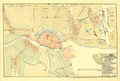
 1785 Land Ordinance Diagram.jpg 1,800 × 1,789; 1.12 MB
-
 1821 Survey Chicago 46a.jpg 2,753 × 3,331; 2.3 MB
-
 1821 Survey Chicago 46b.jpg 2,753 × 3,344; 2.23 MB
-
 1822 Survey Chicago 47b.jpg 2,768 × 3,330; 2.06 MB
-
 1831 Survey Chicago 47a.jpg 2,768 × 3,330; 2.09 MB
-
 1831 Survey Chicago 47c.jpg 2,768 × 3,330; 2.42 MB
-
 1870 Index Chart to GTS India-1.jpg 7,308 × 7,006; 25.55 MB
-
 1875 Survey T34 R5.JPG 3,862 × 4,177; 987 KB
-
 1951 Middletown Survey of Spring Lake in Berlin, New York (lower half).jpg 3,102 × 2,274; 3.72 MB
-
 1951 Middletown Survey of Spring Lake in Berlin, New York (upper half).jpg 2,940 × 2,319; 3.43 MB
-
 1951 Middletown survey of Spring Lake in Berlin, New York.jpg 2,172 × 2,844; 2.74 MB
-
 2015-tool-labs-survey-01-cohort-tool-labs-age.svg 1,023 × 489; 2 KB
-
 2015-tool-labs-survey-02-cohort-tool-developed.svg 1,023 × 489; 2 KB
-
 2015-tool-labs-survey-03-cohort-tools-maintained.svg 1,023 × 489; 2 KB
-
 2015-tool-labs-survey-04-cohort-hours.svg 1,023 × 489; 2 KB
-
 2015-tool-labs-survey-05-cohort-toolserver.svg 1,023 × 489; 1 KB
-
 2015-tool-labs-survey-06-local-dev-pcnt.svg 1,039 × 483; 6 KB
-
 2015-tool-labs-survey-07-source-cntrl.svg 1,023 × 489; 1 KB
-
 2015-tool-labs-survey-08-prog-lang.svg 1,039 × 483; 4 KB
-
 2015-tool-labs-survey-09-high-reliability.svg 1,039 × 483; 5 KB
-
 2015-tool-labs-survey-10-easy-to-write-and-run.svg 1,039 × 483; 6 KB
-
 2015-tool-labs-survey-11-support.svg 1,039 × 483; 6 KB
-
 2015-tool-labs-survey-12-information.svg 1,039 × 483; 6 KB
-
 2015-tool-labs-survey-13-documenation-discovery.svg 1,039 × 483; 5 KB
-
 2015-tool-labs-survey-14-toolserver-support.svg 1,039 × 483; 7 KB
-
 2015-tool-labs-survey-15-documentation-comprehensive.svg 1,039 × 483; 6 KB
-
 2015-tool-labs-survey-16-documentation-clear.svg 1,039 × 483; 6 KB
-
 2015-tool-labs-survey-17-usage-labsdb.svg 1,039 × 483; 6 KB
-
 2015-tool-labs-survey-18-usage-webservices.svg 1,039 × 483; 6 KB
-
 2015-tool-labs-survey-19-usage-cronjobs.svg 1,039 × 483; 6 KB
-
 2015-tool-labs-survey-20-usage-redis.svg 1,039 × 483; 6 KB
-
 2015-tool-labs-survey-21-usage-gridengine.svg 1,039 × 483; 6 KB
-
 2016-tool-labs-survey-01-cohort-tool-labs-age.svg 512 × 226; 2 KB
-
 2016-tool-labs-survey-02-cohort-tool-developed.svg 512 × 226; 3 KB
-
 2016-tool-labs-survey-03-cohotrt-tools-maintained.svg 512 × 226; 3 KB
-
 2016-tool-labs-survey-04-cohort-hours.svg 512 × 226; 3 KB
-
 2016-tool-labs-survey-05-cohort-toolserver.svg 512 × 226; 2 KB
-
 2016-tool-labs-survey-06-local-dev-perc.svg 512 × 226; 10 KB
-
 2016-tool-labs-survey-07-source-cntrl.svg 512 × 226; 2 KB
-
 2016-tool-labs-survey-08-high-reliability.svg 512 × 226; 8 KB
-
 2016-tool-labs-survey-09-easy-to-write-and-run.svg 512 × 226; 8 KB
-
 2016-tool-labs-survey-10-support.svg 512 × 226; 8 KB
-
 2016-tool-labs-survey-11-information.svg 512 × 226; 8 KB
-
 2016-tool-labs-survey-12-documentation-disc.svg 512 × 226; 8 KB
-
 2016-tool-labs-survey-13-toolserver-support.svg 512 × 226; 9 KB
-
 2016-tool-labs-survey-14-documenation-comp.svg 512 × 226; 8 KB
-
 2016-tool-labs-survey-15-documentation-clear.svg 512 × 226; 8 KB
-
 2016-tool-labs-survey-16-usage-labsdb.svg 512 × 226; 9 KB
-
 2016-tool-labs-survey-17-usages-webservices.svg 512 × 226; 9 KB
-
 2016-tool-labs-survey-18-usage-cronjobs.svg 512 × 226; 9 KB
-
 2016-tool-labs-survey-19-usage-redis.svg 512 × 226; 9 KB
-
 2016-tool-labs-survey-20-usage-gridengine.svg 512 × 226; 9 KB
-
 Buhnenwerer karte.jpg 283 × 187; 3 KB
-
 Bukowsko - mapa katastralna (1906).jpg 2,006 × 1,501; 1.14 MB
-
 Carte pont.JPG 822 × 588; 180 KB
-
 DE Büdingen Pferdsbach Karte 2 by Steschke.jpg 709 × 887; 173 KB
-
 Deutsche Grundkarte 5000.JPG 1,779 × 1,417; 503 KB
-
 Dooleys Ferry 1900 Supplemental Plat Survey.jpg 4,800 × 5,800; 4.02 MB
-
 Dooleys Ferry 1900 Supplemental Plat Survey.pdf 4,270 × 3,172; 7.88 MB
-
 Dudynce - mapa 1852.jpg 1,477 × 1,268; 342 KB
-
 Długie - mapa katastralna (1852).jpg 3,072 × 2,304; 551 KB
-
 Elizabethtown Plat Map.jpg 395 × 317; 96 KB
-
 Erle, Karte-1.jpg 1,419 × 915; 469 KB
-
 Flurkarte Mühldorf 1814.jpg 939 × 935; 295 KB
-
 Flurkarte.jpg 1,333 × 1,000; 1.43 MB
-
-

-
 Fotothek df tg 0000232 Geometrie ^ Vermessung.jpg 800 × 501; 171 KB
-
 Freudenbach neu.jpg 2,274 × 2,832; 831 KB
-
 Friesheim-Katasterkarte-1811.jpg 1,671 × 1,922; 467 KB
-
 GISELa- Detailkarte.jpg 2,604 × 1,845; 2.06 MB
-
 Gustav-Haestskau-Spandau-Extra-Moenia.jpg 302 × 204; 18 KB
-
 Gustav-Haestskau-Spandau-Extra-Moenia.png 302 × 204; 135 KB
-
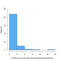 HoursPerWeek.png 480 × 480; 10 KB
-
 Huerth-Weilerhof-Anfang-1800.JPG 650 × 1,100; 656 KB
-
 Klagenfurt Annabichl Katasterplan Spittalmuehle.jpg 2,462 × 1,500; 548 KB
-

-
 Lechenich-Katasterkarte-1811-Stadt-Mühle-und-Stsdtgraben.jpg 736 × 569; 216 KB
-
 Marchmont Estate Atlas.JPG 2,886 × 1,730; 1.11 MB
-
 Monochromatic XPS survey scan.jpg 633 × 389; 41 KB
-
 Mound Site - Parcel Layout.png 1,275 × 1,650; 823 KB
-
 Nadolany (Nowoatniec) - mapa katastralna (1852).jpg 1,284 × 961; 264 KB
-
 Nowoatniec - mapa katastralna (1852).jpg 1,001 × 573; 200 KB
-
 Ottawahillsplatmap.gif 800 × 715; 140 KB
-
 Pielnia - mapa (1852).jpg 3,072 × 2,304; 7.13 MB
-
 Plat of Portland OR c1850s.png 1,200 × 1,418; 3.21 MB
-

-

-
-

-

-

-
-

-
-
 RS101 Christchurch.jpg 6,021 × 5,828; 9.92 MB
-
 Schätzungskarte.jpg 929 × 681; 201 KB
-
 Soulard land survey - Old Mines grant.jpg 1,220 × 1,931; 449 KB
-
 Spandau Extra Moenia 1728.jpg 3,649 × 2,396; 3.26 MB
-
 Spandau Intra Moenia 1728.jpg 2,744 × 1,993; 1.47 MB
-
 Spanish Land Grant Papers of John B. Gaudry page 8 of 53.png 991 × 1,557; 3.28 MB
-
 Stafford Property.jpg 730 × 1,171; 147 KB
-
-
 The Visit of Charles Fraser, map.png 2,799 × 2,321; 8.88 MB
-
 Traversing and Offsetting DP 79152.png 893 × 1,000; 109 KB
-
 Wetterstein Karte 1881.jpg 5,215 × 3,049; 817 KB
-
 Young Chippewayan 5830CLSRSK.png 782 × 1,302; 1.49 MB
-
 Zionplat2 (cropped to grid).jpg 459 × 478; 235 KB
-
 Zionplat2.jpg 650 × 851; 536 KB


.jpg)
.jpg)


.jpg)


.jpg)


.jpg)


_-_mapa_katastralna_(1852).jpg)
.jpg)

.jpg)

;_containing_a_description_of_the_soil_and_timber_of_the_townships_in_the_Ottawa_River_and_Georgian_Bay_Section_and_(20026904954).jpg)
;_containing_a_description_of_the_soil_and_timber_of_the_townships_in_the_Ottawa_River_and_Georgian_Bay_Section_and_(20028545343).jpg)
;_containing_a_description_of_the_soil_and_timber_of_the_townships_in_the_Ottawa_River_and_Georgian_Bay_Section_and_(20462750609).jpg)
;_containing_a_description_of_the_soil_and_timber_of_the_townships_in_the_Ottawa_River_and_Georgian_Bay_Section_and_(20462761019).jpg)
;_containing_a_description_of_the_soil_and_timber_of_the_townships_in_the_Ottawa_River_and_Georgian_Bay_Section_and_(20640295232).jpg)
;_containing_a_description_of_the_soil_and_timber_of_the_townships_in_the_Ottawa_River_and_Georgian_Bay_Section_and_(20640297232).jpg)
;_containing_a_description_of_the_soil_and_timber_of_the_townships_in_the_Ottawa_River_and_Georgian_Bay_Section_and_(20649468385).jpg)
;_containing_a_description_of_the_soil_and_timber_of_the_townships_in_the_Ottawa_River_and_Georgian_Bay_Section_and_(20656146751).jpg)
;_containing_a_description_of_the_soil_and_timber_of_the_townships_in_the_Ottawa_River_and_Georgian_Bay_Section_and_(20656153581).jpg)


.jpg)


.jpg)
