Category:Maps of the canton of Graubünden to 1982
Jump to navigation
Jump to search
Media in category "Maps of the canton of Graubünden to 1982"
The following 4 files are in this category, out of 4 total.
-
 Karte Gemeinden des Kantons Graubünden 1980.png 3,836 × 2,751; 2.18 MB
-
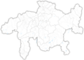 Karte Gemeinden des Kantons Graubünden 1982.png 3,836 × 2,751; 2.18 MB
-
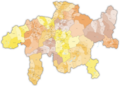 Karte Gemeinden des Kantons Graubünden farbig 1980.png 3,836 × 2,751; 2.44 MB
-
 Karte Gemeinden des Kantons Graubünden farbig 1982.png 3,836 × 2,751; 2.43 MB


