Category:Maps of Elkhart County, Indiana
Jump to navigation
Jump to search
Counties of Indiana: Adams · Allen · Bartholomew · Benton · Blackford · Boone · Brown · Carroll · Cass · Clark · Clay · Clinton · Crawford · Daviess · Dearborn · Decatur · DeKalb · Delaware · Dubois · Elkhart · Fayette · Floyd · Fountain · Franklin · Fulton · Gibson · Grant · Greene · Hamilton · Hancock · Harrison · Hendricks · Henry · Howard · Huntington · Jackson · Jasper · Jay · Jefferson · Jennings · Johnson · Knox · Kosciusko · LaGrange · Lake · LaPorte · Lawrence · Madison · Marion · Marshall · Martin · Miami · Monroe · Montgomery · Morgan · Newton · Noble · Ohio · Orange · Owen · Parke · Perry · Pike · Porter · Posey · Pulaski · Putnam · Randolph · Ripley · Rush · Scott · Shelby · Spencer · St. Joseph · Starke · Steuben · Sullivan · Switzerland · Tippecanoe · Tipton · Union · Vanderburgh · Vermillion · Vigo · Wabash · Warren · Warrick · Washington · Wayne · Wells · White · Whitley
Wikimedia category | |||||
| Upload media | |||||
| Instance of | |||||
|---|---|---|---|---|---|
| Category combines topics | |||||
| Elkhart County | |||||
county in Indiana, United States    | |||||
| Instance of | |||||
| Named after |
| ||||
| Location | Indiana | ||||
| Capital | |||||
| Inception |
| ||||
| Population |
| ||||
| Area |
| ||||
| official website | |||||
 | |||||
Subcategories
This category has the following 4 subcategories, out of 4 total.
Media in category "Maps of Elkhart County, Indiana"
The following 40 files are in this category, out of 40 total.
-

-
 Elkhart County IN.png 195 × 300; 6 KB
-

-

-

-

-

-

-

-
-

-

-
-

-

-

-

-

-

-

-
 Elkhart County, Indiana map.svg 650 × 550; 87 KB
-
 Elkhart IN.png 179 × 157; 1 KB
-
 Indiana (NLC).png 806 × 1,242; 47 KB
-
 Map highlighting Baugo Township, Elkhart County, Indiana.svg 512 × 512; 46 KB
-
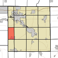
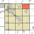
 Map highlighting Benton Township, Elkhart County, Indiana.svg 512 × 512; 46 KB
-
 Map highlighting Cleveland Township, Elkhart County, Indiana.svg 512 × 512; 46 KB
-
 Map highlighting Clinton Township, Elkhart County, Indiana.svg 512 × 512; 46 KB
-
 Map highlighting Concord Township, Elkhart County, Indiana.svg 512 × 512; 46 KB
-
 Map highlighting Elkhart Township, Elkhart County, Indiana.svg 512 × 512; 46 KB
-
 Map highlighting Harrison Township, Elkhart County, Indiana.svg 512 × 512; 46 KB
-
 Map highlighting Jackson Township, Elkhart County, Indiana.svg 512 × 512; 46 KB
-
 Map highlighting Jefferson Township, Elkhart County, Indiana.svg 512 × 512; 46 KB
-
 Map highlighting Locke Township, Elkhart County, Indiana.svg 512 × 512; 46 KB
-
 Map highlighting Middlebury Township, Elkhart County, Indiana.svg 512 × 512; 46 KB
-
 Map highlighting Olive Township, Elkhart County, Indiana.svg 512 × 512; 46 KB
-
 Map highlighting Osolo Township, Elkhart County, Indiana.svg 512 × 512; 46 KB
-
 Map highlighting Union Township, Elkhart County, Indiana.svg 512 × 512; 46 KB
-
 Map highlighting Washington Township, Elkhart County, Indiana.svg 512 × 512; 46 KB
-
 Map highlighting York Township, Elkhart County, Indiana.svg 512 × 512; 46 KB
-
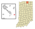
 Map of Indiana highlighting Elkhart County.svg 2,887 × 4,423; 56 KB


.png)


