Category:Maps of Blackford County, Indiana
Jump to navigation
Jump to search
Counties of Indiana: Adams · Allen · Bartholomew · Benton · Blackford · Boone · Brown · Carroll · Cass · Clark · Clay · Clinton · Crawford · Daviess · Dearborn · Decatur · DeKalb · Delaware · Dubois · Elkhart · Fayette · Floyd · Fountain · Franklin · Fulton · Gibson · Grant · Greene · Hamilton · Hancock · Harrison · Hendricks · Henry · Howard · Huntington · Jackson · Jasper · Jay · Jefferson · Jennings · Johnson · Knox · Kosciusko · LaGrange · Lake · LaPorte · Lawrence · Madison · Marion · Marshall · Martin · Miami · Monroe · Montgomery · Morgan · Newton · Noble · Ohio · Orange · Owen · Parke · Perry · Pike · Porter · Posey · Pulaski · Putnam · Randolph · Ripley · Rush · Scott · Shelby · Spencer · St. Joseph · Starke · Steuben · Sullivan · Switzerland · Tippecanoe · Tipton · Union · Vanderburgh · Vermillion · Vigo · Wabash · Warren · Warrick · Washington · Wayne · Wells · White · Whitley
Wikimedia category | |||||
| Upload media | |||||
| Instance of | |||||
|---|---|---|---|---|---|
| Category combines topics | |||||
| Blackford County | |||||
county in Indiana, United States   | |||||
| Instance of | |||||
| Named after | |||||
| Location | Indiana | ||||
| Capital | |||||
| Inception |
| ||||
| Population |
| ||||
| Area |
| ||||
| official website | |||||
 | |||||
Subcategories
This category has the following 3 subcategories, out of 3 total.
+
Media in category "Maps of Blackford County, Indiana"
The following 31 files are in this category, out of 31 total.
-
 Blackford and Jay.jpg 633 × 446; 78 KB
-
-
 Blackford County Indiana diagram V2.jpg 1,403 × 1,430; 190 KB
-
 Blackford County Indiana diagram V4.jpg 1,439 × 1,419; 197 KB
-
 Blackford County Indiana diagram.jpg 1,430 × 1,424; 200 KB
-

-

-

-
-
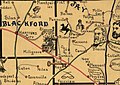
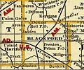
 Blackford County, Indiana map from 1876 atlas.jpg 1,242 × 1,704; 1.59 MB
-
 Blackford Hwy Map Indiana DOT.jpg 286 × 273; 30 KB
-
 Eaton-Dunkirk-Portland Indiana.png 1,279 × 558; 1.82 MB
-
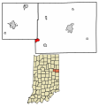
 Location map of Blackford County, Indiana.svg 768 × 768; 104 KB
-
 Map Blackford County 1887 Railway Mail Service.JPG 472 × 425; 70 KB
-
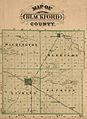
 Map Blackford County 1888.jpg 1,238 × 1,045; 145 KB
-

-
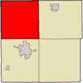
 Map highlighting Harrison Township, Blackford County, Indiana.svg 512 × 512; 17 KB
-
 Map highlighting Jackson Township, Blackford County, Indiana.png 400 × 400; 2 KB
-
 Map highlighting Jackson Township, Blackford County, Indiana.svg 512 × 512; 17 KB
-
 Map highlighting Licking Township, Blackford County, Indiana.png 400 × 400; 2 KB
-
 Map highlighting Licking Township, Blackford County, Indiana.svg 512 × 512; 17 KB
-
-
 Map highlighting Washington Township, Blackford County, Indiana.svg 512 × 512; 17 KB
-
 Map of Blackford County, Indiana.svg 768 × 768; 508 KB
-
 Map of Harrison Township, Blackford County, Indiana.svg 768 × 768; 295 KB
-
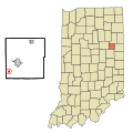
 Map of Indiana highlighting Blackford County.svg 2,887 × 4,423; 56 KB
-
 Map of Jackson Township, Blackford County, Indiana.svg 768 × 768; 357 KB
-
 Map of Licking Township, Blackford County, Indiana.svg 768 × 768; 523 KB
-
 Map of Washington Township, Blackford County, Indiana.svg 768 × 768; 231 KB
-
 Moraine Composite.jpg 1,551 × 815; 287 KB
-
 RR Map of Blackford County 1890s.jpg 275 × 258; 26 KB


