Category:Locator maps of counties of South Carolina
Jump to navigation
Jump to search

States of the United States: Alabama · Alaska · Arizona · Arkansas · California · Colorado · Connecticut · Delaware · Florida · Georgia · Hawaii · Idaho · Illinois · Indiana · Iowa · Kansas · Kentucky · Louisiana · Maine · Maryland · Massachusetts · Michigan · Minnesota · Mississippi · Missouri · Montana · Nebraska · Nevada · New Hampshire · New Jersey · New Mexico · New York · North Carolina · North Dakota · Ohio · Oklahoma · Oregon · Pennsylvania · Rhode Island · South Carolina · South Dakota · Tennessee · Texas · Utah · Vermont · Virginia · Washington · West Virginia · Wisconsin · Wyoming
| NO WIKIDATA ID FOUND! Search for Locator maps of counties of South Carolina on Wikidata | |
| Upload media |
English: Locator maps for counties in South Carolina.
Media in category "Locator maps of counties of South Carolina"
The following 46 files are in this category, out of 46 total.
-
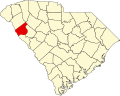 Map of South Carolina highlighting Abbeville County.svg 4,419 × 3,522; 103 KB
-
 Map of South Carolina highlighting Aiken County.svg 4,419 × 3,522; 103 KB
-
 Map of South Carolina highlighting Allendale County.svg 4,419 × 3,522; 103 KB
-
 Map of South Carolina highlighting Anderson County.svg 4,419 × 3,522; 103 KB
-
 Map of South Carolina highlighting Bamberg County.svg 4,419 × 3,522; 103 KB
-
 Map of South Carolina highlighting Barnwell County.svg 4,419 × 3,522; 103 KB
-
 Map of South Carolina highlighting Beaufort County.svg 4,419 × 3,522; 103 KB
-
 Map of South Carolina highlighting Berkeley County.svg 4,419 × 3,522; 103 KB
-
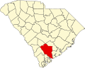
 Map of South Carolina highlighting Calhoun County.svg 4,419 × 3,522; 103 KB
-
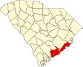 Map of South Carolina highlighting Charleston County.svg 4,419 × 3,522; 103 KB
-
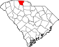 Map of South Carolina highlighting Cherokee County.svg 4,419 × 3,522; 103 KB
-
 Map of South Carolina highlighting Chester County.svg 4,419 × 3,522; 103 KB
-
 Map of South Carolina highlighting Chesterfield County.svg 4,419 × 3,522; 103 KB
-
 Map of South Carolina highlighting Clarendon County.svg 4,419 × 3,522; 103 KB
-
 Map of South Carolina highlighting Colleton County.svg 4,419 × 3,522; 103 KB
-
 Map of South Carolina highlighting Darlington County.svg 4,419 × 3,522; 103 KB
-
 Map of South Carolina highlighting Dillon County.svg 4,419 × 3,522; 103 KB
-
 Map of South Carolina highlighting Dorchester County.svg 4,419 × 3,522; 103 KB
-
 Map of South Carolina highlighting Edgefield County.svg 4,419 × 3,522; 103 KB
-
 Map of South Carolina highlighting Fairfield County.svg 4,419 × 3,522; 103 KB
-
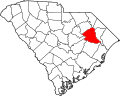 Map of South Carolina highlighting Florence County.svg 4,419 × 3,522; 103 KB
-
 Map of South Carolina highlighting Georgetown County.svg 4,419 × 3,522; 103 KB
-
 Map of South Carolina highlighting Greenville County.svg 4,419 × 3,522; 103 KB
-
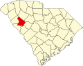 Map of South Carolina highlighting Greenwood County.svg 4,419 × 3,522; 103 KB
-
 Map of South Carolina highlighting Hampton County.svg 4,419 × 3,522; 103 KB
-
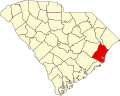
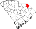
 Map of South Carolina highlighting Horry County.svg 4,419 × 3,522; 103 KB
-
 Map of South Carolina highlighting Jasper County.svg 4,419 × 3,522; 103 KB
-
 Map of South Carolina highlighting Kershaw County.svg 4,419 × 3,522; 103 KB
-
 Map of South Carolina highlighting Lancaster County.svg 4,419 × 3,522; 103 KB
-
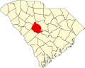
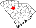
 Map of South Carolina highlighting Laurens County.svg 4,419 × 3,522; 103 KB
-
 Map of South Carolina highlighting Lee County.svg 4,419 × 3,522; 103 KB
-
 Map of South Carolina highlighting Lexington County.svg 4,419 × 3,522; 103 KB
-
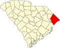
 Map of South Carolina highlighting Marion County.svg 4,419 × 3,522; 103 KB
-
 Map of South Carolina highlighting Marlboro County.svg 4,419 × 3,522; 103 KB
-
 Map of South Carolina highlighting McCormick County.svg 4,419 × 3,522; 103 KB
-
 Map of South Carolina highlighting Newberry County.svg 4,419 × 3,522; 103 KB
-
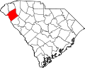
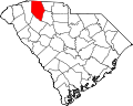
 Map of South Carolina highlighting Oconee County.svg 4,419 × 3,522; 103 KB
-
 Map of South Carolina highlighting Orangeburg County.svg 4,419 × 3,522; 103 KB
-
 Map of South Carolina highlighting Pickens County.svg 4,419 × 3,522; 103 KB
-
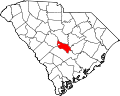
 Map of South Carolina highlighting Richland County.svg 4,419 × 3,522; 103 KB
-
 Map of South Carolina highlighting Saluda County.svg 4,419 × 3,522; 103 KB
-
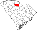
 Map of South Carolina highlighting Spartanburg County.svg 4,419 × 3,522; 103 KB
-
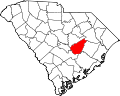
 Map of South Carolina highlighting Sumter County.svg 4,419 × 3,522; 103 KB
-
 Map of South Carolina highlighting Union County.svg 4,419 × 3,522; 103 KB
-
 Map of South Carolina highlighting Williamsburg County.svg 4,419 × 3,522; 103 KB
-
 Map of South Carolina highlighting York County.svg 4,419 × 3,522; 103 KB


