Category:Locator maps of counties of Kansas
Jump to navigation
Jump to search

States of the United States: Alabama · Alaska · Arizona · Arkansas · California · Colorado · Connecticut · Delaware · Florida · Georgia · Hawaii · Idaho · Illinois · Indiana · Iowa · Kansas · Kentucky · Louisiana · Maine · Maryland · Massachusetts · Michigan · Minnesota · Mississippi · Missouri · Montana · Nebraska · Nevada · New Hampshire · New Jersey · New Mexico · New York · North Carolina · North Dakota · Ohio · Oklahoma · Oregon · Pennsylvania · Rhode Island · South Carolina · South Dakota · Tennessee · Texas · Utah · Vermont · Virginia · Washington · West Virginia · Wisconsin · Wyoming
| NO WIKIDATA ID FOUND! Search for Locator maps of counties of Kansas on Wikidata | |
| Upload media |
English: Locator maps for counties in Kansas.
Subcategories
This category has only the following subcategory.
Media in category "Locator maps of counties of Kansas"
The following 109 files are in this category, out of 109 total.
-
 Location Map USA Kansas Ellsworth County.svg 953 × 598; 151 KB
-
 Map of Kansas highlighting Allen County.svg 6,607 × 3,388; 24 KB
-
 Map of Kansas highlighting Anderson County.svg 6,607 × 3,388; 24 KB
-
 Map of Kansas highlighting Atchison County.svg 6,607 × 3,388; 24 KB
-
 Map of Kansas highlighting Barber County.svg 6,607 × 3,388; 24 KB
-
 Map of Kansas highlighting Barton County.svg 6,607 × 3,388; 24 KB
-
 Map of Kansas highlighting Bourbon County.svg 6,607 × 3,388; 24 KB
-
 Map of Kansas highlighting Brown County.svg 6,607 × 3,388; 24 KB
-
 Map of Kansas highlighting Butler County.svg 6,607 × 3,388; 24 KB
-
 Map of Kansas highlighting Chase County.svg 6,607 × 3,388; 24 KB
-
 Map of Kansas highlighting Chautauqua County.svg 6,607 × 3,388; 24 KB
-
 Map of Kansas highlighting Cherokee County.svg 6,607 × 3,388; 24 KB
-
 Map of Kansas highlighting Cheyenne County.svg 6,607 × 3,388; 24 KB
-
 Map of Kansas highlighting Clark County.svg 6,607 × 3,388; 24 KB
-
 Map of Kansas highlighting Clay County.svg 6,607 × 3,388; 24 KB
-
 Map of Kansas highlighting Cloud County.svg 6,607 × 3,388; 24 KB
-
 Map of Kansas highlighting Coffey County.svg 6,607 × 3,388; 24 KB
-
 Map of Kansas highlighting Comanche County.svg 6,607 × 3,388; 24 KB
-
 Map of Kansas highlighting Cowley County.svg 6,607 × 3,388; 24 KB
-
 Map of Kansas highlighting Crawford County.svg 6,607 × 3,388; 24 KB
-
 Map of Kansas highlighting Decatur County.svg 6,607 × 3,388; 24 KB
-
 Map of Kansas highlighting Dickinson County.svg 6,607 × 3,388; 24 KB
-
 Map of Kansas highlighting Doniphan County.svg 6,607 × 3,388; 24 KB
-
 Map of Kansas highlighting Douglas County.svg 6,607 × 3,388; 24 KB
-
 Map of Kansas highlighting Edwards County.svg 6,607 × 3,388; 24 KB
-
 Map of Kansas highlighting Elk County.svg 6,607 × 3,388; 24 KB
-
 Map of Kansas highlighting Ellis County.svg 6,607 × 3,388; 24 KB
-
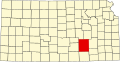
 Map of Kansas highlighting Ellsworth County.svg 6,607 × 3,388; 24 KB
-
 Map of Kansas highlighting Finney County.svg 6,607 × 3,388; 24 KB
-
 Map of Kansas highlighting Ford County.svg 6,607 × 3,388; 24 KB
-
 Map of Kansas highlighting Franklin County.svg 6,607 × 3,388; 24 KB
-
 Map of Kansas highlighting Geary County.svg 6,607 × 3,388; 24 KB
-
 Map of Kansas highlighting Gove County.svg 6,607 × 3,388; 24 KB
-
 Map of Kansas highlighting Graham County.svg 6,607 × 3,388; 24 KB
-
 Map of Kansas highlighting Grant County.svg 6,607 × 3,388; 24 KB
-
 Map of Kansas highlighting Gray County.svg 6,607 × 3,388; 24 KB
-
 Map of Kansas highlighting Greeley County.svg 6,607 × 3,388; 24 KB
-
 Map of Kansas highlighting Greenwood County.svg 6,607 × 3,388; 24 KB
-
 Map of Kansas highlighting Hamilton County.svg 6,607 × 3,388; 24 KB
-
 Map of Kansas highlighting Harper County.svg 6,607 × 3,388; 24 KB
-
 Map of Kansas highlighting Harvey County.svg 6,607 × 3,388; 24 KB
-
 Map of Kansas highlighting Haskell County.svg 6,607 × 3,388; 24 KB
-
 Map of Kansas highlighting Hodgeman County.svg 6,607 × 3,388; 24 KB
-
 Map of Kansas highlighting Jackson County.svg 6,607 × 3,388; 24 KB
-
 Map of Kansas highlighting Jefferson County.svg 6,607 × 3,388; 24 KB
-
 Map of Kansas highlighting Jewell County.svg 6,607 × 3,388; 24 KB
-
 Map of Kansas highlighting Johnson County.svg 6,607 × 3,388; 24 KB
-
 Map of Kansas highlighting Kearny County.svg 6,607 × 3,388; 24 KB
-
 Map of Kansas highlighting Kingman County.svg 6,607 × 3,388; 24 KB
-
 Map of Kansas highlighting Kiowa County.svg 6,607 × 3,388; 24 KB
-
 Map of Kansas highlighting Labette County.svg 6,607 × 3,388; 24 KB
-
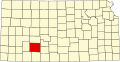
 Map of Kansas highlighting Lane County.svg 6,607 × 3,388; 24 KB
-
 Map of Kansas highlighting Leavenworth County.svg 6,607 × 3,388; 24 KB
-
 Map of Kansas highlighting Lincoln County.svg 6,607 × 3,388; 24 KB
-
 Map of Kansas highlighting Linn County.svg 6,607 × 3,388; 24 KB
-
 Map of Kansas highlighting Logan County.svg 6,607 × 3,388; 24 KB
-
 Map of Kansas highlighting Lyon County.svg 6,607 × 3,388; 24 KB
-
 Map of Kansas highlighting Marion County.svg 6,607 × 3,388; 24 KB
-
 Map of Kansas highlighting Marshall County.svg 6,607 × 3,388; 24 KB
-
 Map of Kansas highlighting McPherson County.svg 6,607 × 3,388; 24 KB
-
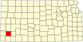
 Map of Kansas highlighting Meade County.svg 6,607 × 3,388; 24 KB
-
 Map of Kansas highlighting Miami County.svg 6,607 × 3,388; 24 KB
-
 Map of Kansas highlighting Mitchell County.svg 6,607 × 3,388; 24 KB
-
 Map of Kansas highlighting Montgomery County.svg 6,607 × 3,388; 24 KB
-
 Map of Kansas highlighting Morris County.svg 6,607 × 3,388; 24 KB
-
 Map of Kansas highlighting Morton County.svg 6,607 × 3,388; 24 KB
-
 Map of Kansas highlighting Nemaha County.svg 6,607 × 3,388; 24 KB
-
 Map of Kansas highlighting Neosho County.svg 6,607 × 3,388; 24 KB
-
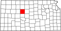
 Map of Kansas highlighting Ness County.svg 6,607 × 3,388; 24 KB
-
 Map of Kansas highlighting Norton County.svg 6,607 × 3,388; 24 KB
-
 Map of Kansas highlighting Osage County.svg 6,607 × 3,388; 24 KB
-
 Map of Kansas highlighting Osborne County.svg 6,607 × 3,388; 24 KB
-
 Map of Kansas highlighting Ottawa County.svg 6,607 × 3,388; 24 KB
-
 Map of Kansas highlighting Pawnee County.svg 6,607 × 3,388; 24 KB
-
 Map of Kansas highlighting Phillips County.svg 6,607 × 3,388; 24 KB
-
 Map of Kansas highlighting Pottawatomie County.svg 6,607 × 3,388; 24 KB
-
 Map of Kansas highlighting Pratt County.svg 6,607 × 3,388; 24 KB
-
 Map of Kansas highlighting Rawlins County.svg 6,607 × 3,388; 24 KB
-
 Map of Kansas highlighting Reno County.svg 6,607 × 3,388; 24 KB
-
 Map of Kansas highlighting Republic County.svg 6,607 × 3,388; 24 KB
-
 Map of Kansas highlighting Rice County.svg 6,607 × 3,388; 24 KB
-
 Map of Kansas highlighting Riley County.svg 6,607 × 3,388; 24 KB
-
 Map of Kansas highlighting Rooks County.svg 6,607 × 3,388; 24 KB
-
 Map of Kansas highlighting Rush County.svg 6,607 × 3,388; 24 KB
-
 Map of Kansas highlighting Russell County.svg 6,607 × 3,388; 24 KB
-
 Map of Kansas highlighting Saline County.svg 6,607 × 3,388; 24 KB
-
 Map of Kansas highlighting Scott County.svg 6,607 × 3,388; 24 KB
-
 Map of Kansas highlighting Sedgwick County.svg 6,607 × 3,388; 24 KB
-
 Map of Kansas highlighting Seward County.svg 6,607 × 3,388; 24 KB
-
 Map of Kansas highlighting Shawnee County.svg 6,607 × 3,388; 24 KB
-
 Map of Kansas highlighting Sheridan County.svg 6,607 × 3,388; 24 KB
-
 Map of Kansas highlighting Sherman County.svg 6,607 × 3,388; 24 KB
-
 Map of Kansas highlighting Smith County.svg 6,607 × 3,388; 24 KB
-
 Map of Kansas highlighting Stafford County.svg 6,607 × 3,388; 24 KB
-
 Map of Kansas highlighting Stanton County.svg 6,607 × 3,388; 24 KB
-
 Map of Kansas highlighting Stevens County.svg 6,607 × 3,388; 24 KB
-
 Map of Kansas highlighting Sumner County.svg 6,607 × 3,388; 24 KB
-
 Map of Kansas highlighting Thomas County.svg 6,607 × 3,388; 24 KB
-
 Map of Kansas highlighting Trego County.svg 6,607 × 3,388; 24 KB
-
 Map of Kansas highlighting Wabaunsee County.svg 6,607 × 3,388; 24 KB
-
 Map of Kansas highlighting Wallace County.svg 6,607 × 3,388; 24 KB
-
 Map of Kansas highlighting Washington County.svg 6,607 × 3,388; 24 KB
-
 Map of Kansas highlighting Wichita County.svg 6,607 × 3,388; 24 KB
-
 Map of Kansas highlighting Wilson County.svg 6,607 × 3,388; 24 KB
-
 Map of Kansas highlighting Woodson County.svg 6,607 × 3,388; 24 KB
-
 Map of Kansas highlighting Wyandotte County.svg 6,607 × 3,388; 24 KB
-
 Map of National Weather Service Wichita CWA.svg 6,607 × 3,388; 53 KB
-
 National Weather Service Dodge City, Kansas county warning area.svg 6,607 × 3,388; 29 KB
-
 National Weather Service Topeka, Kansas county warning area.svg 6,607 × 3,388; 28 KB


