Category:July 2009 in Lincolnshire
Jump to navigation
Jump to search
Deutsch: Bilder, die im Juli 2009 in Lincolnshire aufgenommen worden sind. Bitte beachten Sie, dass dies weder das Datum des Uploads noch das Datum des Scannens eines Fotos ist.
English: Images/pictures taken in Lincolnshire during July 2009. Note this is not the date of the upload, nor the date a photo was scanned.
Español: Fotografías o imágenes tomadas en Lincolnshire durante julio 2009. No es la fecha de subida ni escaneo, sino la fecha en que las fotografías o imágenes se crearon.
Esperanto: Bildoj faritaj en Lincolnshire en julio 2009. Tio ne estas la dato, kiam la bildoj estis alŝutitaj aŭ skanitaj.
Français : Photographies ou images prises en Lincolnshire durant juillet 2009. Ce n'est pas la date du téléchargement ou du scan.
Galego: Fotografías ou imaxes tomadas en Lincolnshire durante xullo 2009. Non é a data de subida nin escaneamento, senón a data na que se crearon as fotografías ou imaxes.
Italiano: Fotografie o immagini scattate a Lincolnshire nel luglio 2009. Nota bene: la data non si riferisce né a quella di upload né a quella in cui la foto è stata digitalizzata.
Norsk bokmål: Bilder tatt i Lincolnshire i løpet av juli 2009. Merk at dette ikke er datoen for opplasting, eller når et bilde har blitt skannet.
Norsk nynorsk: Bilete teke i Lincolnshire i løpet av juli 2009. Merk at dette ikkje er datoen for opplasting, eller når eit bilete har vorte skanna.
Русский: Изображения, сделанные в Lincolnshire в течение июль 2009 (не дата загрузки изображения).
Українська: Зображення, зроблені в Lincolnshire протягом липень 2009. Зауважте, що це не дата завантаження чи дата сканування фотографії.
| July 2008 | ← | July 2009 | → | July 2010 | |||||||
| Jan | Feb | Mar | Apr | May | Jun | Jul | Aug | Sep | Oct | Nov | Dec |
| 123 | 25 | 89 | 74 | 104 | 81 | 122 | 128 | 147 | 2 | 24 | 128 |
|---|---|---|---|---|---|---|---|---|---|---|---|
Subcategories
This category has the following 23 subcategories, out of 23 total.
R
- 2009 RAF Waddington Air Show (2 F)
Media in category "July 2009 in Lincolnshire"
The following 99 files are in this category, out of 99 total.
-
 Looking towards Barton Hill - geograph.org.uk - 1383999.jpg 640 × 425; 69 KB
-
 Misty View near Bonby - geograph.org.uk - 1383451.jpg 640 × 420; 92 KB
-

-
 Looking towards Turton's Covert - geograph.org.uk - 1395692.jpg 640 × 480; 103 KB
-
 Old Wood - geograph.org.uk - 1396542.jpg 640 × 426; 88 KB
-
 Copse on Elsham Wold - geograph.org.uk - 1401575.jpg 640 × 552; 121 KB
-
 St.Thomas's church nave - geograph.org.uk - 1386531.jpg 640 × 426; 70 KB
-
 St.Thomas's church nave - geograph.org.uk - 1386535.jpg 426 × 640; 64 KB
-
 St.Thomas's font - geograph.org.uk - 1386551.jpg 426 × 640; 62 KB
-
 32A Float, Winterton and Wind Farm - geograph.org.uk - 1392909.jpg 640 × 480; 115 KB
-
 The New River Ancholme at Ferriby Sluice - geograph.org.uk - 1392031.jpg 640 × 503; 104 KB
-

-
 New Grain Store near Spot Height 98m - geograph.org.uk - 1395714.jpg 640 × 480; 77 KB
-
 Silos at West Hann Farm - geograph.org.uk - 1397096.jpg 640 × 421; 74 KB
-
 Barrow Road Level Crossing, New Holland - geograph.org.uk - 1398414.jpg 640 × 480; 101 KB
-
 New Holland Bulk Services - geograph.org.uk - 1397045.jpg 640 × 480; 68 KB
-
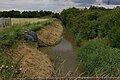 New Holland Main Drain - geograph.org.uk - 1398380.jpg 640 × 425; 104 KB
-
 Barrow Haven - Old Ferry Wharf - geograph.org.uk - 1399906.jpg 640 × 585; 139 KB
-
 Barrow Haven - Old Ferry Wharf - geograph.org.uk - 1399942.jpg 640 × 603; 93 KB
-

-
 Field Entry near Abbey Farm - geograph.org.uk - 1408008.jpg 640 × 428; 92 KB
-
 Crook Mill Road - geograph.org.uk - 1408026.jpg 640 × 428; 62 KB
-
 East Halton Beck - geograph.org.uk - 1407963.jpg 428 × 640; 110 KB
-
 Barrow Road, New Holland - geograph.org.uk - 1409528.jpg 640 × 400; 61 KB
-

-
 Top Road, North Killingholme - geograph.org.uk - 1408114.jpg 640 × 480; 112 KB
-
 Top Road, South Killingholme - geograph.org.uk - 1405343.jpg 640 × 480; 84 KB
-
 South Cloister Covert - geograph.org.uk - 1405398.jpg 640 × 428; 82 KB
-
 WintertonView.JPG 2,260 × 1,757; 1,000 KB
-
 Broughton Bridge - geograph.org.uk - 1427020.jpg 640 × 425; 77 KB
-
 Field Drain near Wressle - geograph.org.uk - 1410923.jpg 640 × 480; 106 KB
-
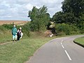
 Litter collection on roadside verge - geograph.org.uk - 1428899.jpg 640 × 480; 102 KB
-

-
 Looking towards Spring Wood - geograph.org.uk - 1424025.jpg 640 × 480; 82 KB
-
 Power Lines in Rowland Plantation - geograph.org.uk - 1424000.jpg 640 × 480; 109 KB
-

-
 Track to Spring Wood Lodge. - geograph.org.uk - 1424042.jpg 640 × 425; 79 KB
-
 Broughton Methodist Church - geograph.org.uk - 1413645.jpg 640 × 425; 74 KB
-
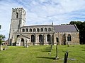 All Saints' church, Goxhill - geograph.org.uk - 1427977.jpg 640 × 480; 237 KB
-
 All Saints' church, Goxhill - geograph.org.uk - 1427981.jpg 640 × 480; 255 KB
-
 Pasture south of Ruard Road, Goxhill - geograph.org.uk - 1428001.jpg 640 × 480; 219 KB
-
 Scout Hut, New Holland - geograph.org.uk - 1428022.jpg 640 × 480; 227 KB
-
 Another patch of waste ground in Ulceby - geograph.org.uk - 1427831.jpg 640 × 480; 230 KB
-
 Patch of waste ground 2 - geograph.org.uk - 1427821.jpg 480 × 640; 240 KB
-
 By land and sea - geograph.org.uk - 1422902.jpg 640 × 426; 114 KB
-
 View from New Holland Signal Box - geograph.org.uk - 1398512.jpg 480 × 640; 106 KB
-
 ParkStreet.JPG 1,917 × 1,384; 516 KB
-
 Broughton Bridge - geograph.org.uk - 1428498.jpg 640 × 425; 95 KB
-
-

-
 Viking Way near Far Ings - geograph.org.uk - 1412019.jpg 640 × 425; 95 KB
-
 B1207 near Appleby - geograph.org.uk - 1418958.jpg 640 × 480; 91 KB
-
 B1207 near Broughton - geograph.org.uk - 1418877.jpg 640 × 480; 105 KB
-
 Field East of Common Plantation - geograph.org.uk - 1418928.jpg 640 × 480; 109 KB
-

-
 Track near Common Plantation - geograph.org.uk - 1418919.jpg 640 × 425; 82 KB
-
 Dog and Rat Public House, Broughton - geograph.org.uk - 1413635.jpg 640 × 480; 89 KB
-

-

-
 The Cider Centre, Brandy Wharf - geograph.org.uk - 1413384.jpg 640 × 480; 81 KB
-
 The New River Ancholme - geograph.org.uk - 1413392.jpg 640 × 480; 82 KB
-
 Traffic Lights, Brandy Wharf Bridge - geograph.org.uk - 1413374.jpg 640 × 480; 90 KB
-

-
 North Drove Drain - geograph.org.uk - 1429069.jpg 640 × 480; 190 KB
-
 Harvested rape field - geograph.org.uk - 1419622.jpg 640 × 480; 225 KB
-
 Advance of the Houses - geograph.org.uk - 1422600.jpg 640 × 425; 90 KB
-

-

-
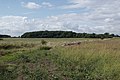
 Near Beacon Hill - geograph.org.uk - 1422617.jpg 640 × 425; 81 KB
-
 Road Liable to Flooding - geograph.org.uk - 1421338.jpg 640 × 425; 79 KB
-
 Frampton Roads - geograph.org.uk - 1422931.jpg 640 × 426; 62 KB
-
 After the Harvest near Horkstow - geograph.org.uk - 1421417.jpg 640 × 425; 100 KB
-
 Near Horkstow - geograph.org.uk - 1426987.jpg 640 × 432; 81 KB
-
 Pyronia tithonus - geograph.org.uk - 1422586.jpg 640 × 458; 104 KB
-
 Leadenham Heath - geograph.org.uk - 1422713.jpg 426 × 640; 81 KB
-
 Leadenham Heath transmitter mast - geograph.org.uk - 1422652.jpg 640 × 426; 60 KB
-
 Abandoned Farm Implement - geograph.org.uk - 1413690.jpg 640 × 480; 126 KB
-
 Anglo-Saxon tower - geograph.org.uk - 1400578.jpg 426 × 640; 102 KB
-
 B1210, Immingham - geograph.org.uk - 1391169.jpg 627 × 640; 98 KB
-
 Banks Street, Horncastle - geograph.org.uk - 1710022.jpg 640 × 480; 83 KB
-
 Banks Street, Horncastle - geograph.org.uk - 1710185.jpg 480 × 640; 121 KB
-
 Banks Street, Horncastle - geograph.org.uk - 1710226.jpg 640 × 480; 84 KB
-
 Banks Street, Horncastle - geograph.org.uk - 1723106.jpg 480 × 640; 77 KB
-
 Boston Road, Horncastle - geograph.org.uk - 1409954.jpg 640 × 480; 72 KB
-
 Bryant Close, Horncastle - geograph.org.uk - 1411854.jpg 640 × 480; 122 KB
-

-
 Consecration cross - geograph.org.uk - 1390131.jpg 426 × 640; 130 KB
-
 Defra Conservation walk - geograph.org.uk - 1226705.jpg 640 × 480; 91 KB
-
 East window - geograph.org.uk - 1390099.jpg 426 × 640; 64 KB
-
 Grass or beans for tea^ - geograph.org.uk - 1381074.jpg 640 × 480; 83 KB
-
 Humber Bridge From Air.jpg 2,032 × 1,524; 382 KB
-
 On a Clear day you can see for ever - geograph.org.uk - 1432403.jpg 640 × 391; 47 KB
-
 Public Bridleway along Boltgate Lane - geograph.org.uk - 1381071.jpg 640 × 480; 88 KB
-
-
 Public footpath to Eastholme - geograph.org.uk - 1381069.jpg 640 × 480; 57 KB
-
 Sandholme Lane - geograph.org.uk - 1421424.jpg 640 × 426; 72 KB
-
 Spring onion irrigation - geograph.org.uk - 1391329.jpg 640 × 426; 73 KB
-
 The King's Head, Bull Ring, Horncastle - geograph.org.uk - 1723179.jpg 640 × 480; 102 KB
-
 Going round the bend - geograph.org.uk - 1417413.jpg 640 × 480; 51 KB


_at_Gainsthorpe_-_geograph.org.uk_-_1419916.jpg)


