Category:July 2008 in Lincolnshire
Jump to navigation
Jump to search
Deutsch: Bilder, die im Juli 2008 in Lincolnshire aufgenommen worden sind. Bitte beachten Sie, dass dies weder das Datum des Uploads noch das Datum des Scannens eines Fotos ist.
English: Images/pictures taken in Lincolnshire during July 2008. Note this is not the date of the upload, nor the date a photo was scanned.
Español: Fotografías o imágenes tomadas en Lincolnshire durante julio 2008. No es la fecha de subida ni escaneo, sino la fecha en que las fotografías o imágenes se crearon.
Esperanto: Bildoj faritaj en Lincolnshire en julio 2008. Tio ne estas la dato, kiam la bildoj estis alŝutitaj aŭ skanitaj.
Français : Photographies ou images prises en Lincolnshire durant juillet 2008. Ce n'est pas la date du téléchargement ou du scan.
Galego: Fotografías ou imaxes tomadas en Lincolnshire durante xullo 2008. Non é a data de subida nin escaneamento, senón a data na que se crearon as fotografías ou imaxes.
Italiano: Fotografie o immagini scattate a Lincolnshire nel luglio 2008. Nota bene: la data non si riferisce né a quella di upload né a quella in cui la foto è stata digitalizzata.
Norsk bokmål: Bilder tatt i Lincolnshire i løpet av juli 2008. Merk at dette ikke er datoen for opplasting, eller når et bilde har blitt skannet.
Norsk nynorsk: Bilete teke i Lincolnshire i løpet av juli 2008. Merk at dette ikkje er datoen for opplasting, eller når eit bilete har vorte skanna.
Русский: Изображения, сделанные в Lincolnshire в течение июль 2008 (не дата загрузки изображения).
Українська: Зображення, зроблені в Lincolnshire протягом липень 2008. Зауважте, що це не дата завантаження чи дата сканування фотографії.
| July 2007 | ← | July 2008 | → | July 2009 | |||||||
| Jan | Feb | Mar | Apr | May | Jun | Jul | Aug | Sep | Oct | Nov | Dec |
| 154 | 47 | 36 | 59 | 41 | 98 | 99 | 119 | 81 | 146 | 141 | 22 |
|---|---|---|---|---|---|---|---|---|---|---|---|
Subcategories
This category has the following 15 subcategories, out of 15 total.
R
- 2008 RAF Waddington Air Show (5 F)
Media in category "July 2008 in Lincolnshire"
The following 84 files are in this category, out of 84 total.
-
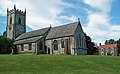 Barrow Church - geograph.org.uk - 867555.jpg 640 × 393; 244 KB
-
 Ferry Road Club, Scunthorpe - geograph.org.uk - 867341.jpg 640 × 462; 215 KB
-
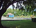 Sheffield Park, Scunthorpe - geograph.org.uk - 867349.jpg 640 × 490; 198 KB
-
 Baysgarth House - geograph.org.uk - 868582.jpg 640 × 511; 351 KB
-
 Tempus Fugit - geograph.org.uk - 868560.jpg 618 × 640; 183 KB
-
 Hall Meadow Road - geograph.org.uk - 869735.jpg 640 × 480; 56 KB
-
 Barrow Haven with a Gaggle of Swans - geograph.org.uk - 878257.jpg 640 × 427; 59 KB
-
 Beevor Street, Lincoln - geograph.org.uk - 3703842.jpg 640 × 426; 68 KB
-
 Bridge No.3, Lincoln (geograph 3697904).jpg 640 × 426; 81 KB
-
 Barton Shopping Centre - geograph.org.uk - 883224.jpg 640 × 480; 91 KB
-
 Linseed field near Castle Bytham, flowers.jpg 1,750 × 1,180; 162 KB
-
 Linseed field near Castle Bytham, footpath.jpg 1,750 × 1,313; 527 KB
-
 Linseed field near Castle Bytham, poppies.jpg 1,750 × 1,313; 521 KB
-
 Boatyard, Barton Waterside - geograph.org.uk - 889080.jpg 640 × 425; 118 KB
-

-
 Waterside House, Barton Upon Humber - geograph.org.uk - 888757.jpg 640 × 399; 87 KB
-
 Waterside Road, Barton Upon Humber - geograph.org.uk - 895674.jpg 640 × 425; 77 KB
-
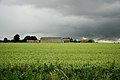 Storm brewing - geograph.org.uk - 879821.jpg 640 × 427; 60 KB
-
 Derelict car park - geograph.org.uk - 882803.jpg 640 × 480; 104 KB
-
 Thoresway Grange - geograph.org.uk - 1164397.jpg 640 × 480; 198 KB
-
 Folly Drain - geograph.org.uk - 1229856.jpg 640 × 480; 130 KB
-

-

-

-
 Ye Olde Bridge Inn - geograph.org.uk - 919763.jpg 640 × 480; 71 KB
-
 Alford Manor House - geograph.org.uk - 919746.jpg 640 × 480; 104 KB
-
 Humber Foreshore, Barton Waterside - geograph.org.uk - 894288.jpg 640 × 480; 83 KB
-
 The Reedbeds in July - geograph.org.uk - 894212.jpg 640 × 480; 127 KB
-
 The Remains of the Old Jetty - geograph.org.uk - 894276.jpg 640 × 489; 71 KB
-
 Village sign, west of Hagworthingham - geograph.org.uk - 919752.jpg 640 × 480; 63 KB
-
 Finkle Lane, Barton Upon Humber - geograph.org.uk - 895661.jpg 640 × 480; 90 KB
-
 Tetney Bus Shelter - geograph.org.uk - 901838.jpg 480 × 640; 89 KB
-
 The Village Friar, Tetney - geograph.org.uk - 897384.jpg 640 × 431; 75 KB
-
 Farm Buildings on Station Road - geograph.org.uk - 897938.jpg 640 × 480; 41 KB
-
 Ford at Kirkby Green - geograph.org.uk - 897627.jpg 640 × 480; 65 KB
-
 Maltkiln Lane, Barton Waterside - geograph.org.uk - 899564.jpg 640 × 427; 80 KB
-
 Site Clearance on Maltkiln Lane - geograph.org.uk - 899554.jpg 640 × 427; 110 KB
-
 Site Clearance on Maltkiln Lane - geograph.org.uk - 899560.jpg 640 × 427; 137 KB
-
 Thistledown Time - geograph.org.uk - 899616.jpg 640 × 427; 134 KB
-
 Route 64 - geograph.org.uk - 901809.jpg 640 × 427; 72 KB
-
 View within a view - geograph.org.uk - 901806.jpg 640 × 427; 66 KB
-
 Skegness Fun Fair - geograph.org.uk - 899807.jpg 640 × 480; 47 KB
-
 Eight Row - geograph.org.uk - 904775.jpg 640 × 427; 60 KB
-
 Middle Farm - geograph.org.uk - 904801.jpg 640 × 427; 75 KB
-
 River Glen - geograph.org.uk - 904710.jpg 640 × 427; 112 KB
-
 Eagle Road - geograph.org.uk - 903396.jpg 640 × 427; 113 KB
-
 Bridge No.3, Lincoln (geograph 3697877).jpg 640 × 426; 80 KB
-
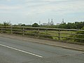 Bridge over the A180 - geograph.org.uk - 883277.jpg 640 × 480; 73 KB
-
 Bus stop and phone box - geograph.org.uk - 919754.jpg 640 × 480; 112 KB
-
 Greatford Bridge - geograph.org.uk - 904706.jpg 640 × 427; 108 KB
-
 Green Lane, Lincoln - geograph.org.uk - 875842.jpg 640 × 480; 87 KB
-
 Holton-le-Clay-Station-Cottage-by-David-Wright.jpg 640 × 480; 81 KB
-

-
 Lincoln Cathedral 01 crop.jpg 2,049 × 1,537; 554 KB
-
 Mind Your Head^ - geograph.org.uk - 877021.jpg 640 × 480; 138 KB
-
 Old crossing gate - geograph.org.uk - 901812.jpg 640 × 427; 85 KB
-
 Oldfleet Drain - geograph.org.uk - 883382.jpg 640 × 480; 128 KB
-
 P1020428-5thjuly2008.JPG 3,328 × 1,872; 1.43 MB
-
 Patience needed - geograph.org.uk - 882720.jpg 640 × 502; 108 KB
-
 Potato harvester - geograph.org.uk - 903402.jpg 640 × 427; 97 KB
-
 Railway at Blundell Park - geograph.org.uk - 882733.jpg 640 × 480; 109 KB
-
 Raking mown hay - geograph.org.uk - 868682.jpg 640 × 428; 124 KB
-
 River Glen - geograph.org.uk - 904694.jpg 640 × 427; 103 KB
-
 South arcade - geograph.org.uk - 896777.jpg 640 × 427; 71 KB
-
 St Nicholas' Church interior - geograph.org.uk - 1020315.jpg 475 × 634; 40 KB
-
 St.Mary's chancel - geograph.org.uk - 896804.jpg 640 × 427; 75 KB
-
 St.Mary's chancel arch - geograph.org.uk - 896795.jpg 427 × 640; 66 KB
-
 St.Mary's font - geograph.org.uk - 896812.jpg 427 × 640; 66 KB
-
 St.Mary's nave - geograph.org.uk - 896767.jpg 640 × 427; 67 KB
-
 St.Peter's nave - geograph.org.uk - 880114.jpg 427 × 640; 62 KB
-
-

-

-

-

-

-

-
 Suggitt's Lane Crossing - geograph.org.uk - 882736.jpg 480 × 640; 91 KB
-
 The Humber Bridge - geograph.org.uk - 870885.jpg 640 × 427; 76 KB
-
 The Humber Bridge - High Tide - geograph.org.uk - 871443.jpg 640 × 505; 82 KB
-
 The Humber Bridge - Low Tide - geograph.org.uk - 871440.jpg 640 × 480; 67 KB
-
 The Humber Bridge from north of Paull - geograph.org.uk - 869117.jpg 640 × 480; 47 KB
-
 The Public Footpath to Holton-le-Clay - geograph.org.uk - 902140.jpg 640 × 480; 107 KB
-
 Waiting for a bite - geograph.org.uk - 882703.jpg 640 × 480; 80 KB


.jpg)


.jpg)


