Category:August 2009 in Lincolnshire
Jump to navigation
Jump to search
Deutsch: Bilder, die im August 2009 in Lincolnshire aufgenommen worden sind. Bitte beachten Sie, dass dies weder das Datum des Uploads noch das Datum des Scannens eines Fotos ist.
English: Images/pictures taken in Lincolnshire during August 2009. Note this is not the date of the upload, nor the date a photo was scanned.
Español: Fotografías o imágenes tomadas en Lincolnshire durante agosto 2009. No es la fecha de subida ni escaneo, sino la fecha en que las fotografías o imágenes se crearon.
Esperanto: Bildoj faritaj en Lincolnshire en aŭgusto 2009. Tio ne estas la dato, kiam la bildoj estis alŝutitaj aŭ skanitaj.
Français : Photographies ou images prises en Lincolnshire durant août 2009. Ce n'est pas la date du téléchargement ou du scan.
Galego: Fotografías ou imaxes tomadas en Lincolnshire durante agosto 2009. Non é a data de subida nin escaneamento, senón a data na que se crearon as fotografías ou imaxes.
Italiano: Fotografie o immagini scattate a Lincolnshire nel agosto 2009. Nota bene: la data non si riferisce né a quella di upload né a quella in cui la foto è stata digitalizzata.
Norsk bokmål: Bilder tatt i Lincolnshire i løpet av august 2009. Merk at dette ikke er datoen for opplasting, eller når et bilde har blitt skannet.
Norsk nynorsk: Bilete teke i Lincolnshire i løpet av august 2009. Merk at dette ikkje er datoen for opplasting, eller når eit bilete har vorte skanna.
Русский: Изображения, сделанные в Lincolnshire в течение август 2009 (не дата загрузки изображения).
Українська: Зображення, зроблені в Lincolnshire протягом серпень 2009. Зауважте, що це не дата завантаження чи дата сканування фотографії.
| August 2008 | ← | August 2009 | → | August 2010 | |||||||
| Jan | Feb | Mar | Apr | May | Jun | Jul | Aug | Sep | Oct | Nov | Dec |
| 123 | 25 | 89 | 74 | 104 | 81 | 122 | 128 | 147 | 2 | 24 | 128 |
|---|---|---|---|---|---|---|---|---|---|---|---|
Subcategories
This category has the following 8 subcategories, out of 8 total.
0
Media in category "August 2009 in Lincolnshire"
The following 120 files are in this category, out of 120 total.
-

-
 Water Rail Way - geograph.org.uk - 1479352.jpg 640 × 480; 76 KB
-
 Down Hall, Barrow Upon Humber - geograph.org.uk - 1429677.jpg 640 × 518; 94 KB
-
 Looking towards Barrow Upon Humber - geograph.org.uk - 1429671.jpg 640 × 431; 85 KB
-
 Little Sale - geograph.org.uk - 1479337.jpg 640 × 426; 105 KB
-
 New Holland Bulk Storage - geograph.org.uk - 1429646.jpg 640 × 480; 74 KB
-
 Roe's Farm - geograph.org.uk - 1429692.jpg 640 × 421; 77 KB
-
 Rural Prospect near Bonby - geograph.org.uk - 1437042.jpg 640 × 425; 80 KB
-
 Wheat Fields near Barton Hill Farm - geograph.org.uk - 1432453.jpg 640 × 480; 97 KB
-
 Grazing on Frampton Marsh - geograph.org.uk - 1432540.jpg 640 × 480; 56 KB
-
 B1208 through Far Wood - geograph.org.uk - 1433486.jpg 640 × 480; 109 KB
-
 Marketplace, Barton Upon Humber - geograph.org.uk - 1435239.jpg 640 × 506; 87 KB
-
 Rural blight - geograph.org.uk - 1438900.jpg 640 × 426; 108 KB
-
 Footpath to Messingham - geograph.org.uk - 1438728.jpg 640 × 426; 99 KB
-
 Haven Fishing Ponds - geograph.org.uk - 1438769.jpg 640 × 426; 87 KB
-
 Farm Track to Barn - geograph.org.uk - 1444119.jpg 640 × 480; 87 KB
-
 Hall Top - geograph.org.uk - 1444087.jpg 640 × 480; 62 KB
-

-
 Gates at Baysgarth House - geograph.org.uk - 1444055.jpg 640 × 480; 126 KB
-
-
-
 Marketplace, Barton Upon Humber - geograph.org.uk - 1446949.jpg 640 × 450; 86 KB
-
 Hot afternoon down the lane - geograph.org.uk - 1451318.jpg 640 × 427; 116 KB
-
 Grassland - geograph.org.uk - 1451310.jpg 640 × 471; 78 KB
-
 Sibsey church east.JPG 2,444 × 1,833; 1.98 MB
-
 Sibsey Besant grave.JPG 2,444 × 1,833; 1.19 MB
-
 Oxmarsh Lane, New Holland - geograph.org.uk - 1430908.jpg 640 × 432; 69 KB
-
 The Railway towards New Holland - geograph.org.uk - 1438550.jpg 640 × 480; 109 KB
-
 Miscanthus Biomass Field near Bonby - geograph.org.uk - 1437023.jpg 640 × 425; 68 KB
-
 Dutch Barns at North Wold Farm - geograph.org.uk - 1432477.jpg 640 × 432; 61 KB
-
 Harvesting near Santon Wood - geograph.org.uk - 1433467.jpg 640 × 534; 136 KB
-
 Harvesting Oilseed Rape - geograph.org.uk - 1433309.jpg 640 × 425; 96 KB
-
 Church Lane - geograph.org.uk - 1433931.jpg 640 × 426; 106 KB
-
 High Street - geograph.org.uk - 1439222.jpg 640 × 426; 65 KB
-
 The Old Manor House - geograph.org.uk - 1438660.jpg 640 × 426; 96 KB
-
 ParkSt.JPG 2,592 × 1,944; 1.45 MB
-

-
 Permissive bridleway - geograph.org.uk - 1443869.jpg 640 × 426; 99 KB
-
 Bloxholm Lane - geograph.org.uk - 1444037.jpg 640 × 426; 72 KB
-
 Near Bonby - geograph.org.uk - 1450711.jpg 640 × 480; 75 KB
-
 Poultry Farm near Cleatham Hall Farm - geograph.org.uk - 1452442.jpg 640 × 480; 91 KB
-
 Carr Lane, Redbourne - geograph.org.uk - 1452479.jpg 640 × 480; 80 KB
-
 Footbridge over the River Welland - geograph.org.uk - 1464389.jpg 480 × 640; 114 KB
-
 Railway Bridge, Belvoir Road, Denton - geograph.org.uk - 1464834.jpg 640 × 480; 137 KB
-

-
 Trackbed of the Denton Branch - geograph.org.uk - 1464839.jpg 640 × 480; 181 KB
-
 Former ironstone quarry - geograph.org.uk - 1466482.jpg 640 × 480; 88 KB
-
 Former ironstone quarry - geograph.org.uk - 1466499.jpg 640 × 480; 66 KB
-
 Former ironstone quarry - geograph.org.uk - 1466530.jpg 640 × 480; 79 KB
-

-
-

-

-
-

-
 Harlaxton Spire - geograph.org.uk - 1470007.jpg 640 × 480; 85 KB
-
 Route of the Harlaxton ironstone railway - geograph.org.uk - 1466713.jpg 640 × 480; 134 KB
-

-
 Stile on the Denton-Harlaxton footpath - geograph.org.uk - 1470008.jpg 640 × 480; 132 KB
-

-

-

-
 Cultivating near Saxby All Saints - geograph.org.uk - 1462358.jpg 640 × 425; 68 KB
-
 Tidal Moorings at Ferriby Sluice - geograph.org.uk - 1469188.jpg 640 × 425; 67 KB
-
 Tidal Moorings at Ferriby Sluice - geograph.org.uk - 1469198.jpg 640 × 425; 65 KB
-
 Looking towards Winterton - geograph.org.uk - 1470370.jpg 640 × 425; 85 KB
-
 Ferry Road, Barrow Haven - geograph.org.uk - 1451940.jpg 640 × 480; 70 KB
-
 Hibaldstow Village Hall - geograph.org.uk - 1452512.jpg 640 × 480; 45 KB
-
 South Carr Road - geograph.org.uk - 1452486.jpg 640 × 480; 71 KB
-
 St Albans Close, Hibaldstow - geograph.org.uk - 1452492.jpg 640 × 480; 65 KB
-

-
 Lidgett Close, Scawby - geograph.org.uk - 1452528.jpg 640 × 480; 74 KB
-

-
 Looking towards South Cliff Farm - geograph.org.uk - 1455246.jpg 640 × 425; 98 KB
-

-
 The Old Humber Bank Path - geograph.org.uk - 1455262.jpg 640 × 425; 98 KB
-
 Near Field House Farm - geograph.org.uk - 1459881.jpg 640 × 480; 90 KB
-
 Harvesting near Barton Hill Farm - geograph.org.uk - 1456984.jpg 640 × 480; 72 KB
-
 Stubble Field near Barton Hill Farm - geograph.org.uk - 1456999.jpg 640 × 480; 86 KB
-
 A1077 Barton Upon Humber - geograph.org.uk - 1459854.jpg 640 × 480; 95 KB
-

-

-
 Stubble Field on Elsham Hill - geograph.org.uk - 1462371.jpg 640 × 425; 44 KB
-
 Maison natale de Margaret Thatcher, Grantham.JPG 2,592 × 1,214; 851 KB
-
 Plaque, maison natale de Margaret Thatcher.JPG 957 × 532; 520 KB
-
 Appleby Carrs - geograph.org.uk - 1466936.jpg 640 × 425; 70 KB
-
 Appleby Carrs - geograph.org.uk - 1467444.jpg 640 × 425; 75 KB
-
 Appleby Carrs - geograph.org.uk - 1467477.jpg 640 × 425; 109 KB
-
 Sir Rowland Winn's Drain - geograph.org.uk - 1466957.jpg 640 × 425; 130 KB
-
 AFRPS Appleby shed - 2009-08-08.jpg 2,592 × 3,872; 2.08 MB
-
 AFRPS Frodingham station - 2009-08-08.jpg 3,872 × 2,592; 3.48 MB
-
 Baler problem fixed - geograph.org.uk - 1467518.jpg 640 × 480; 196 KB
-
 Footbridge over Kirton Drain - geograph.org.uk - 1433938.jpg 640 × 426; 127 KB
-
 Fosdyke Bridge - geograph.org.uk - 1436003.jpg 640 × 426; 66 KB
-
 Fosdyke Bridge - geograph.org.uk - 1436287.jpg 640 × 426; 76 KB
-
 Giant's causeway - geograph.org.uk - 1432518.jpg 640 × 480; 98 KB
-
-

-
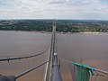 Humber bridge from the south tower - geograph.org.uk - 1463752.jpg 640 × 480; 87 KB
-
 Landing lights - geograph.org.uk - 1441229.jpg 640 × 426; 74 KB
-

-
 River Witham at The Haven - geograph.org.uk - 1430613.jpg 640 × 480; 139 KB
-
 Scunthorpe Banner.jpg 2,100 × 300; 273 KB
-
 St.Genewys' nave - geograph.org.uk - 1439344.jpg 426 × 640; 55 KB
-
 Stow park signal box and crossing - geograph.org.uk - 1431659.jpg 640 × 427; 74 KB
-
 The Humber Bridge - geograph.org.uk - 1460696.jpg 640 × 480; 64 KB
-
 The Jolly Fisherman - geograph.org.uk - 1455608.jpg 480 × 640; 76 KB
-

-
 The Ship Inn - geograph.org.uk - 1436547.jpg 640 × 426; 63 KB
-
 Towards the South Bank - geograph.org.uk - 1462057.jpg 640 × 480; 88 KB
-

-

-
 Balaclava Cottage - geograph.org.uk - 1433926.jpg 640 × 426; 67 KB
-
 Barge and passing yacht - geograph.org.uk - 1453452.jpg 640 × 480; 54 KB
-
 Burnham Lane - geograph.org.uk - 1440087.jpg 640 × 426; 69 KB
-
 Crossing gates across the road - geograph.org.uk - 1431695.jpg 640 × 396; 70 KB
-
 Drainside south - geograph.org.uk - 1434029.jpg 640 × 426; 87 KB
-
 Elms Farm polytunnels - geograph.org.uk - 1435542.jpg 640 × 426; 77 KB
-
 Former Vicarage gate - geograph.org.uk - 1439380.jpg 426 × 640; 115 KB
-
 High Point - geograph.org.uk - 1436971.jpg 426 × 640; 84 KB


_-_geograph.org.uk_-_1425127.jpg)


